ESA TPM Map Catalogue - Product List
back to previous node |
list of download URLs

Collection G2_Portugal_2021
GEOSAT-2 Portugal Coverage 2021 collection. More details here.
List of available products (latitude from 38.5731 to 38.6515 dg, longitude from -8.8325 to -8.68812 dg)..
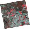
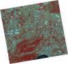
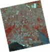
DE2_OPER_HRA_PSH_1C_20210721T111646_N38-723_W008-757_0001
Download Product | Product Info | Browse
Platform Short Name | GEOSAT |
Platform Serial Identifier | 2 |
Product Type | HRA_PSH_1C |
Start Date | 2021-07-21T11:16:46Z |
Stop Date | 2021-07-21T11:16:49Z |
Original Name | DE2_PSH_L1C_000000_20210721T111646_20210721T111649_DE2_38410_ECC3.zip |
Footprint | 38.6665466311 -8.64945852042 38.8056218193 -8.6823528854 38.7803531767 -8.86501088207 38.6412735555 -8.83159310808 38.6665466311 -8.64945852042 |
Orbit Direction | ASCENDING |
Scene Centre Longitude | W008 |
Scene Centre Latitude | N38 |
Cloud Cover Percentage | -1 |
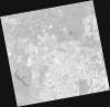
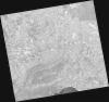
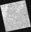
DE2_OPER_HRA_PM4_1C_20210721T111646_N38-723_W008-757_0001
Download Product | Product Info | Browse
Platform Short Name | GEOSAT |
Platform Serial Identifier | 2 |
Product Type | HRA_PM4_1C |
Start Date | 2021-07-21T11:16:46Z |
Stop Date | 2021-07-21T11:16:49Z |
Original Name | DE2_PM4_L1C_000000_20210721T111646_20210721T111649_DE2_38410_ECC3.zip |
Footprint | 38.6665466311 -8.64945852042 38.8056218193 -8.6823528854 38.7803531767 -8.86501088207 38.6412735555 -8.83159310808 38.6665466311 -8.64945852042 |
Orbit Direction | ASCENDING |
Scene Centre Longitude | W008 |
Scene Centre Latitude | N38 |
Cloud Cover Percentage | -1 |
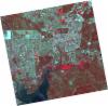
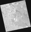
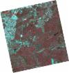
DE2_OPER_HRA_PSH_1C_20210721T111644_N38-597_W008-726_0001
Download Product | Product Info | Browse
Platform Short Name | GEOSAT |
Platform Serial Identifier | 2 |
Product Type | HRA_PSH_1C |
Start Date | 2021-07-21T11:16:44Z |
Stop Date | 2021-07-21T11:16:47Z |
Original Name | DE2_PSH_L1C_000000_20210721T111644_20210721T111647_DE2_38410_1B61.zip |
Footprint | 38.5401350541 -8.61948768356 38.6794180915 -8.65258607672 38.6541535843 -8.83459702769 38.5149203154 -8.80111533037 38.5401350541 -8.61948768356 |
Orbit Direction | ASCENDING |
Scene Centre Longitude | W008 |
Scene Centre Latitude | N38 |
Cloud Cover Percentage | -1 |
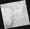
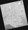
DE2_OPER_HRA_PM4_1C_20210721T111644_N38-597_W008-726_0001
Download Product | Product Info | Browse
Platform Short Name | GEOSAT |
Platform Serial Identifier | 2 |
Product Type | HRA_PM4_1C |
Start Date | 2021-07-21T11:16:44Z |
Stop Date | 2021-07-21T11:16:47Z |
Original Name | DE2_PM4_L1C_000000_20210721T111644_20210721T111647_DE2_38410_1B61.zip |
Footprint | 38.5401350541 -8.61948768356 38.6794180915 -8.65258607672 38.6541535843 -8.83459702769 38.5149203154 -8.80111533037 38.5401350541 -8.61948768356 |
Orbit Direction | ASCENDING |
Scene Centre Longitude | W008 |
Scene Centre Latitude | N38 |
Cloud Cover Percentage | -1 |
DE2_OPER_HRA_PSH_1C_20210715T112015_N38-581_W008-922_0001
Download Product | Product Info | Browse
Platform Short Name | GEOSAT |
Platform Serial Identifier | 2 |
Product Type | HRA_PSH_1C |
Start Date | 2021-07-15T11:20:15Z |
Stop Date | 2021-07-15T11:20:18Z |
Original Name | DE2_PSH_L1C_000000_20210715T112015_20210715T112018_DE2_38321_3718.zip |
Footprint | 38.5214241754 -8.80612197402 38.6665022829 -8.83957742465 38.6406044233 -9.03840713519 38.4954404081 -9.00509728008 38.5214241754 -8.80612197402 |
Orbit Direction | ASCENDING |
Scene Centre Longitude | W008 |
Scene Centre Latitude | N38 |
Cloud Cover Percentage | -1 |
DE2_OPER_HRA_PM4_1C_20210715T112015_N38-581_W008-922_0001
Download Product | Product Info | Browse
Platform Short Name | GEOSAT |
Platform Serial Identifier | 2 |
Product Type | HRA_PM4_1C |
Start Date | 2021-07-15T11:20:15Z |
Stop Date | 2021-07-15T11:20:18Z |
Original Name | DE2_PM4_L1C_000000_20210715T112015_20210715T112018_DE2_38321_3718.zip |
Footprint | 38.5214241754 -8.80612197402 38.6665022829 -8.83957742465 38.6406044233 -9.03840713519 38.4954404081 -9.00509728008 38.5214241754 -8.80612197402 |
Orbit Direction | ASCENDING |
Scene Centre Longitude | W008 |
Scene Centre Latitude | N38 |
Cloud Cover Percentage | -1 |
DE2_OPER_HRA_PM4_1C_20210607T111003_N38-680_W008-884_0001
Download Product | Product Info | Browse
Platform Short Name | GEOSAT |
Platform Serial Identifier | 2 |
Product Type | HRA_PM4_1C |
Start Date | 2021-06-07T11:10:03Z |
Stop Date | 2021-06-07T11:10:06Z |
Original Name | DE2_PM4_L1C_000000_20210607T111003_20210607T111006_DE2_37757_95AC.zip |
Footprint | 38.6301690027 -8.79382647584 38.7558307568 -8.82781976671 38.7314610227 -8.97534460978 38.6058075963 -8.94116526719 38.6301690027 -8.79382647584 |
Orbit Direction | ASCENDING |
Scene Centre Longitude | W008 |
Scene Centre Latitude | N38 |
Cloud Cover Percentage | -1 |
DE2_OPER_HRA_PSH_1C_20210607T111003_N38-680_W008-884_0001
Download Product | Product Info | Browse
Platform Short Name | GEOSAT |
Platform Serial Identifier | 2 |
Product Type | HRA_PSH_1C |
Start Date | 2021-06-07T11:10:03Z |
Stop Date | 2021-06-07T11:10:06Z |
Original Name | DE2_PSH_L1C_000000_20210607T111003_20210607T111006_DE2_37757_95AC.zip |
Footprint | 38.6301690027 -8.79382647584 38.7558307568 -8.82781976671 38.7314610227 -8.97534460978 38.6058075963 -8.94116526719 38.6301690027 -8.79382647584 |
Orbit Direction | ASCENDING |
Scene Centre Longitude | W008 |
Scene Centre Latitude | N38 |
Cloud Cover Percentage | -1 |
DE2_OPER_HRA_PM4_1C_20210607T111002_N38-566_W008-853_0001
Download Product | Product Info | Browse
Platform Short Name | GEOSAT |
Platform Serial Identifier | 2 |
Product Type | HRA_PM4_1C |
Start Date | 2021-06-07T11:10:02Z |
Stop Date | 2021-06-07T11:10:04Z |
Original Name | DE2_PM4_L1C_000000_20210607T111002_20210607T111004_DE2_37757_AA1B.zip |
Footprint | 38.5162281269 -8.76294863045 38.6417999411 -8.79701630219 38.6174548196 -8.94427443276 38.4919047228 -8.9099964177 38.5162281269 -8.76294863045 |
Orbit Direction | ASCENDING |
Scene Centre Longitude | W008 |
Scene Centre Latitude | N38 |
Cloud Cover Percentage | -1 |
DE2_OPER_HRA_PSH_1C_20210607T111002_N38-566_W008-853_0001
Download Product | Product Info | Browse
Platform Short Name | GEOSAT |
Platform Serial Identifier | 2 |
Product Type | HRA_PSH_1C |
Start Date | 2021-06-07T11:10:02Z |
Stop Date | 2021-06-07T11:10:04Z |
Original Name | DE2_PSH_L1C_000000_20210607T111002_20210607T111004_DE2_37757_AA1B.zip |
Footprint | 38.5162281269 -8.76294863045 38.6417999411 -8.79701630219 38.6174548196 -8.94427443276 38.4919047228 -8.9099964177 38.5162281269 -8.76294863045 |
Orbit Direction | ASCENDING |
Scene Centre Longitude | W008 |
Scene Centre Latitude | N38 |
Cloud Cover Percentage | -1 |
DE2_OPER_HRA_PM4_1C_20210507T111120_N38-610_W008-621_0001
Download Product | Product Info | Browse
Platform Short Name | GEOSAT |
Platform Serial Identifier | 2 |
Product Type | HRA_PM4_1C |
Start Date | 2021-05-07T11:11:20Z |
Stop Date | 2021-05-07T11:11:22Z |
Original Name | DE2_PM4_L1C_000000_20210507T111120_20210507T111122_DE2_37297_3F75.zip |
Footprint | 38.5594553588 -8.52924125218 38.68618066 -8.56300014208 38.6619012949 -8.71323785521 38.535183949 -8.6792602134 38.5594553588 -8.52924125218 |
Orbit Direction | ASCENDING |
Scene Centre Longitude | W008 |
Scene Centre Latitude | N38 |
Cloud Cover Percentage | -1 |
DE2_OPER_HRA_PSH_1C_20210507T111120_N38-610_W008-621_0001
Download Product | Product Info | Browse
Platform Short Name | GEOSAT |
Platform Serial Identifier | 2 |
Product Type | HRA_PSH_1C |
Start Date | 2021-05-07T11:11:20Z |
Stop Date | 2021-05-07T11:11:22Z |
Original Name | DE2_PSH_L1C_000000_20210507T111120_20210507T111122_DE2_37297_3F75.zip |
Footprint | 38.5594553588 -8.52924125218 38.68618066 -8.56300014208 38.6619012949 -8.71323785521 38.535183949 -8.6792602134 38.5594553588 -8.52924125218 |
Orbit Direction | ASCENDING |
Scene Centre Longitude | W008 |
Scene Centre Latitude | N38 |
Cloud Cover Percentage | -1 |