ESA TPM Map Catalogue - Product List
back to previous node |
list of download URLs

Collection G2_Portugal_2021
GEOSAT-2 Portugal Coverage 2021 collection. More details here.
List of available products (latitude from 38.5374 to 38.6158 dg, longitude from -8.255 to -8.11063 dg)..
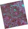
DE2_OPER_HRA_PSH_1C_20210921T111129_N38-627_W008-148_0001
Download Product | Product Info | Browse
Platform Short Name | GEOSAT |
Platform Serial Identifier | 2 |
Product Type | HRA_PSH_1C |
Start Date | 2021-09-21T11:11:29Z |
Stop Date | 2021-09-21T11:11:32Z |
Original Name | DE2_PSH_L1C_000000_20210921T111129_20210921T111132_DE2_39330_59DB.zip |
Footprint | 38.5709408775 -8.04305251266 38.708703823 -8.07665357621 38.683719174 -8.25404543653 38.5459164528 -8.220305417 38.5709408775 -8.04305251266 |
Orbit Direction | ASCENDING |
Scene Centre Longitude | W008 |
Scene Centre Latitude | N38 |
Cloud Cover Percentage | -1 |
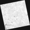
DE2_OPER_HRA_PM4_1C_20210921T111129_N38-627_W008-148_0001
Download Product | Product Info | Browse
Platform Short Name | GEOSAT |
Platform Serial Identifier | 2 |
Product Type | HRA_PM4_1C |
Start Date | 2021-09-21T11:11:29Z |
Stop Date | 2021-09-21T11:11:32Z |
Original Name | DE2_PM4_L1C_000000_20210921T111129_20210921T111132_DE2_39330_59DB.zip |
Footprint | 38.5709408775 -8.04305251266 38.708703823 -8.07665357621 38.683719174 -8.25404543653 38.5459164528 -8.220305417 38.5709408775 -8.04305251266 |
Orbit Direction | ASCENDING |
Scene Centre Longitude | W008 |
Scene Centre Latitude | N38 |
Cloud Cover Percentage | -1 |
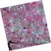
DE2_OPER_HRA_PSH_1C_20210921T111127_N38-502_W008-117_0001
Download Product | Product Info | Browse
Platform Short Name | GEOSAT |
Platform Serial Identifier | 2 |
Product Type | HRA_PSH_1C |
Start Date | 2021-09-21T11:11:27Z |
Stop Date | 2021-09-21T11:11:30Z |
Original Name | DE2_PSH_L1C_000000_20210921T111127_20210921T111130_DE2_39330_2CE9.zip |
Footprint | 38.4458706755 -8.01243446866 38.5836735187 -8.04625038636 38.5586781982 -8.22349883745 38.4208425899 -8.18956241588 38.4458706755 -8.01243446866 |
Orbit Direction | ASCENDING |
Scene Centre Longitude | W008 |
Scene Centre Latitude | N38 |
Cloud Cover Percentage | -1 |
DE2_OPER_HRA_PM4_1C_20210921T111127_N38-502_W008-117_0001
Download Product | Product Info | Browse
Platform Short Name | GEOSAT |
Platform Serial Identifier | 2 |
Product Type | HRA_PM4_1C |
Start Date | 2021-09-21T11:11:27Z |
Stop Date | 2021-09-21T11:11:30Z |
Original Name | DE2_PM4_L1C_000000_20210921T111127_20210921T111130_DE2_39330_2CE9.zip |
Footprint | 38.4458706755 -8.01243446866 38.5836735187 -8.04625038636 38.5586781982 -8.22349883745 38.4208425899 -8.18956241588 38.4458706755 -8.01243446866 |
Orbit Direction | ASCENDING |
Scene Centre Longitude | W008 |
Scene Centre Latitude | N38 |
Cloud Cover Percentage | -1 |
DE2_OPER_HRA_PM4_1C_20210331T111519_N38-599_W008-279_0001
Download Product | Product Info | Browse
Platform Short Name | GEOSAT |
Platform Serial Identifier | 2 |
Product Type | HRA_PM4_1C |
Start Date | 2021-03-31T11:15:19Z |
Stop Date | 2021-03-31T11:15:22Z |
Original Name | DE2_PM4_L1C_000000_20210331T111519_20210331T111522_DE2_36748_3B55.zip |
Footprint | 38.5451892709 -8.18014758477 38.678364469 -8.21354190411 38.6537117816 -8.37926822603 38.5205013544 -8.3459056106 38.5451892709 -8.18014758477 |
Orbit Direction | ASCENDING |
Scene Centre Longitude | W008 |
Scene Centre Latitude | N38 |
Cloud Cover Percentage | -1 |
DE2_OPER_HRA_PSH_1C_20210331T111519_N38-599_W008-279_0001
Download Product | Product Info | Browse
Platform Short Name | GEOSAT |
Platform Serial Identifier | 2 |
Product Type | HRA_PSH_1C |
Start Date | 2021-03-31T11:15:19Z |
Stop Date | 2021-03-31T11:15:22Z |
Original Name | DE2_PSH_L1C_000000_20210331T111519_20210331T111522_DE2_36748_3B55.zip |
Footprint | 38.5451892709 -8.18014758477 38.678364469 -8.21354190411 38.6537117816 -8.37926822603 38.5205013544 -8.3459056106 38.5451892709 -8.18014758477 |
Orbit Direction | ASCENDING |
Scene Centre Longitude | W008 |
Scene Centre Latitude | N38 |
Cloud Cover Percentage | -1 |
DE2_OPER_HRA_PM4_1C_20210331T111517_N38-478_W008-249_0001
Download Product | Product Info | Browse
Platform Short Name | GEOSAT |
Platform Serial Identifier | 2 |
Product Type | HRA_PM4_1C |
Start Date | 2021-03-31T11:15:17Z |
Stop Date | 2021-03-31T11:15:20Z |
Original Name | DE2_PM4_L1C_000000_20210331T111517_20210331T111520_DE2_36748_5B79.zip |
Footprint | 38.4243397935 -8.14988871941 38.5575205221 -8.18348507064 38.5328678729 -8.34911514917 38.3996894207 -8.31500136856 38.4243397935 -8.14988871941 |
Orbit Direction | ASCENDING |
Scene Centre Longitude | W008 |
Scene Centre Latitude | N38 |
Cloud Cover Percentage | -1 |
DE2_OPER_HRA_PSH_1C_20210331T111517_N38-478_W008-249_0001
Download Product | Product Info | Browse
Platform Short Name | GEOSAT |
Platform Serial Identifier | 2 |
Product Type | HRA_PSH_1C |
Start Date | 2021-03-31T11:15:17Z |
Stop Date | 2021-03-31T11:15:20Z |
Original Name | DE2_PSH_L1C_000000_20210331T111517_20210331T111520_DE2_36748_5B79.zip |
Footprint | 38.4243397935 -8.14988871941 38.5575205221 -8.18348507064 38.5328678729 -8.34911514917 38.3996894207 -8.31500136856 38.4243397935 -8.14988871941 |
Orbit Direction | ASCENDING |
Scene Centre Longitude | W008 |
Scene Centre Latitude | N38 |
Cloud Cover Percentage | -1 |