ESA TPM Map Catalogue - Product List
back to previous node |
list of download URLs
Collection G2_Portugal_2021
GEOSAT-2 Portugal Coverage 2021 collection. More details here.
List of available products (latitude from 38.459 to 38.5374 dg, longitude from -28.4562 to -28.3119 dg)..
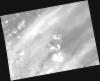
DE2_OPER_HRA_PM4_1C_20210606T123126_N38-554_W028-366_0001
Download Product | Product Info | Browse
Platform Short Name | GEOSAT |
Platform Serial Identifier | 2 |
Product Type | HRA_PM4_1C |
Start Date | 2021-06-06T12:31:26Z |
Stop Date | 2021-06-06T12:31:28Z |
Original Name | DE2_PM4_L1C_000000_20210606T123126_20210606T123128_DE2_37743_FA69.zip |
Footprint | 38.5212687393 -28.2760591399 38.6116234436 -28.299537753 38.587383167 -28.456552466 38.4966637627 -28.4357000962 38.5212687393 -28.2760591399 |
Orbit Direction | ASCENDING |
Scene Centre Longitude | W028 |
Scene Centre Latitude | N38 |
Cloud Cover Percentage | -1 |
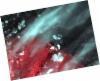
DE2_OPER_HRA_PSH_1C_20210606T123126_N38-554_W028-366_0001
Download Product | Product Info | Browse
Platform Short Name | GEOSAT |
Platform Serial Identifier | 2 |
Product Type | HRA_PSH_1C |
Start Date | 2021-06-06T12:31:26Z |
Stop Date | 2021-06-06T12:31:28Z |
Original Name | DE2_PSH_L1C_000000_20210606T123126_20210606T123128_DE2_37743_FA69.zip |
Footprint | 38.5212687393 -28.2760591399 38.6116234436 -28.299537753 38.587383167 -28.456552466 38.4966637627 -28.4357000962 38.5212687393 -28.2760591399 |
Orbit Direction | ASCENDING |
Scene Centre Longitude | W028 |
Scene Centre Latitude | N38 |
Cloud Cover Percentage | -1 |
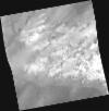
DE2_OPER_HRA_PM4_1C_20210606T123124_N38-456_W028-341_0001
Download Product | Product Info | Browse
Platform Short Name | GEOSAT |
Platform Serial Identifier | 2 |
Product Type | HRA_PM4_1C |
Start Date | 2021-06-06T12:31:24Z |
Stop Date | 2021-06-06T12:31:27Z |
Original Name | DE2_PM4_L1C_000000_20210606T123124_20210606T123127_DE2_37743_F892.zip |
Footprint | 38.4034433253 -28.2465420653 38.5333727974 -28.2792243341 38.5088114253 -28.4382551403 38.3792645476 -28.4022770905 38.4034433253 -28.2465420653 |
Orbit Direction | ASCENDING |
Scene Centre Longitude | W028 |
Scene Centre Latitude | N38 |
Cloud Cover Percentage | -1 |
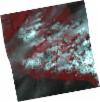
DE2_OPER_HRA_PSH_1C_20210606T123124_N38-456_W028-341_0001
Download Product | Product Info | Browse
Platform Short Name | GEOSAT |
Platform Serial Identifier | 2 |
Product Type | HRA_PSH_1C |
Start Date | 2021-06-06T12:31:24Z |
Stop Date | 2021-06-06T12:31:27Z |
Original Name | DE2_PSH_L1C_000000_20210606T123124_20210606T123127_DE2_37743_F892.zip |
Footprint | 38.4034433253 -28.2465420653 38.5333727974 -28.2792243341 38.5088114253 -28.4382551403 38.3792645476 -28.4022770905 38.4034433253 -28.2465420653 |
Orbit Direction | ASCENDING |
Scene Centre Longitude | W028 |
Scene Centre Latitude | N38 |
Cloud Cover Percentage | -1 |
DE2_OPER_HRA_PM4_1C_20210524T122242_N38-481_W028-490_0001
Download Product | Product Info | Browse
Platform Short Name | GEOSAT |
Platform Serial Identifier | 2 |
Product Type | HRA_PM4_1C |
Start Date | 2021-05-24T12:22:42Z |
Stop Date | 2021-05-24T12:22:45Z |
Original Name | DE2_PM4_L1C_000000_20210524T122242_20210524T122245_DE2_37550_C737.zip |
Footprint | 38.4329337977 -28.40187115 38.5559086904 -28.4379710534 38.530583885 -28.5785910812 38.4076283437 -28.5423531696 38.4329337977 -28.40187115 |
Orbit Direction | ASCENDING |
Scene Centre Longitude | W028 |
Scene Centre Latitude | N38 |
Cloud Cover Percentage | -1 |
DE2_OPER_HRA_PSH_1C_20210524T122242_N38-481_W028-490_0001
Download Product | Product Info | Browse
Platform Short Name | GEOSAT |
Platform Serial Identifier | 2 |
Product Type | HRA_PSH_1C |
Start Date | 2021-05-24T12:22:42Z |
Stop Date | 2021-05-24T12:22:45Z |
Original Name | DE2_PSH_L1C_000000_20210524T122242_20210524T122245_DE2_37550_C737.zip |
Footprint | 38.4329337977 -28.40187115 38.5559086904 -28.4379710534 38.530583885 -28.5785910812 38.4076283437 -28.5423531696 38.4329337977 -28.40187115 |
Orbit Direction | ASCENDING |
Scene Centre Longitude | W028 |
Scene Centre Latitude | N38 |
Cloud Cover Percentage | -1 |