ESA TPM Map Catalogue - Product List
back to previous node |
list of download URLs

Collection G2_Portugal_2021
GEOSAT-2 Portugal Coverage 2021 collection. More details here.
List of available products (latitude from 38.459 to 38.5374 dg, longitude from -8.54375 to -8.39938 dg)..
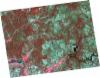
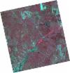
DE2_OPER_HRA_PSH_1C_20210922T112654_N38-470_W008-456_0001
Download Product | Product Info | Browse
Platform Short Name | GEOSAT |
Platform Serial Identifier | 2 |
Product Type | HRA_PSH_1C |
Start Date | 2021-09-22T11:26:54Z |
Stop Date | 2021-09-22T11:26:57Z |
Original Name | DE2_PSH_L1C_000000_20210922T112654_20210922T112657_DE2_39345_CB42.zip |
Footprint | 38.3961169804 -8.28829858626 38.5729214677 -8.32292484876 38.5438727273 -8.62365065501 38.3668999422 -8.58973834596 38.3961169804 -8.28829858626 |
Orbit Direction | ASCENDING |
Scene Centre Longitude | W008 |
Scene Centre Latitude | N38 |
Cloud Cover Percentage | -1 |
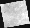
DE2_OPER_HRA_PM4_1C_20210922T112654_N38-470_W008-456_0001
Download Product | Product Info | Browse
Platform Short Name | GEOSAT |
Platform Serial Identifier | 2 |
Product Type | HRA_PM4_1C |
Start Date | 2021-09-22T11:26:54Z |
Stop Date | 2021-09-22T11:26:57Z |
Original Name | DE2_PM4_L1C_000000_20210922T112654_20210922T112657_DE2_39345_CB42.zip |
Footprint | 38.3961169804 -8.28829858626 38.5729214677 -8.32292484876 38.5438727273 -8.62365065501 38.3668999422 -8.58973834596 38.3961169804 -8.28829858626 |
Orbit Direction | ASCENDING |
Scene Centre Longitude | W008 |
Scene Centre Latitude | N38 |
Cloud Cover Percentage | -1 |
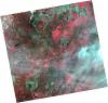
DE2_OPER_HRA_PSH_1C_20210827T111044_N38-603_W008-406_0001
Download Product | Product Info | Browse
Platform Short Name | GEOSAT |
Platform Serial Identifier | 2 |
Product Type | HRA_PSH_1C |
Start Date | 2021-08-27T11:10:44Z |
Stop Date | 2021-08-27T11:10:47Z |
Original Name | DE2_PSH_L1C_000000_20210827T111044_20210827T111047_DE2_38959_9BE7.zip |
Footprint | 38.5496703307 -8.30782267518 38.6822859354 -8.34059832958 38.6577248314 -8.50504915844 38.5252032246 -8.4712236513 38.5496703307 -8.30782267518 |
Orbit Direction | ASCENDING |
Scene Centre Longitude | W008 |
Scene Centre Latitude | N38 |
Cloud Cover Percentage | -1 |
DE2_OPER_HRA_PM4_1C_20210827T111044_N38-603_W008-406_0001
Download Product | Product Info | Browse
Platform Short Name | GEOSAT |
Platform Serial Identifier | 2 |
Product Type | HRA_PM4_1C |
Start Date | 2021-08-27T11:10:44Z |
Stop Date | 2021-08-27T11:10:47Z |
Original Name | DE2_PM4_L1C_000000_20210827T111044_20210827T111047_DE2_38959_9BE7.zip |
Footprint | 38.5496703307 -8.30782267518 38.6822859354 -8.34059832958 38.6577248314 -8.50504915844 38.5252032246 -8.4712236513 38.5496703307 -8.30782267518 |
Orbit Direction | ASCENDING |
Scene Centre Longitude | W008 |
Scene Centre Latitude | N38 |
Cloud Cover Percentage | -1 |
DE2_OPER_HRA_PM4_1C_20210507T111118_N38-495_W008-590_0001
Download Product | Product Info | Browse
Platform Short Name | GEOSAT |
Platform Serial Identifier | 2 |
Product Type | HRA_PM4_1C |
Start Date | 2021-05-07T11:11:18Z |
Stop Date | 2021-05-07T11:11:20Z |
Original Name | DE2_PM4_L1C_000000_20210507T111118_20210507T111120_DE2_37297_9C51.zip |
Footprint | 38.444396635 -8.49840498915 38.571187773 -8.53232440463 38.5469127566 -8.68243562613 38.420156382 -8.64821248707 38.444396635 -8.49840498915 |
Orbit Direction | ASCENDING |
Scene Centre Longitude | W008 |
Scene Centre Latitude | N38 |
Cloud Cover Percentage | -1 |
DE2_OPER_HRA_PSH_1C_20210507T111118_N38-495_W008-590_0001
Download Product | Product Info | Browse
Platform Short Name | GEOSAT |
Platform Serial Identifier | 2 |
Product Type | HRA_PSH_1C |
Start Date | 2021-05-07T11:11:18Z |
Stop Date | 2021-05-07T11:11:20Z |
Original Name | DE2_PSH_L1C_000000_20210507T111118_20210507T111120_DE2_37297_9C51.zip |
Footprint | 38.444396635 -8.49840498915 38.571187773 -8.53232440463 38.5469127566 -8.68243562613 38.420156382 -8.64821248707 38.444396635 -8.49840498915 |
Orbit Direction | ASCENDING |
Scene Centre Longitude | W008 |
Scene Centre Latitude | N38 |
Cloud Cover Percentage | -1 |
DE2_OPER_HRA_PM4_1C_20210319T112140_N38-603_W008-485_0001
Download Product | Product Info | Browse
Platform Short Name | GEOSAT |
Platform Serial Identifier | 2 |
Product Type | HRA_PM4_1C |
Start Date | 2021-03-19T11:21:40Z |
Stop Date | 2021-03-19T11:21:43Z |
Original Name | DE2_PM4_L1C_000000_20210319T112140_20210319T112143_DE2_36570_6A18.zip |
Footprint | 38.5444470197 -8.37157650172 38.688759973 -8.40468961216 38.6629689748 -8.60029575323 38.5187728426 -8.56595852643 38.5444470197 -8.37157650172 |
Orbit Direction | ASCENDING |
Scene Centre Longitude | W008 |
Scene Centre Latitude | N38 |
Cloud Cover Percentage | -1 |
DE2_OPER_HRA_PSH_1C_20210319T112140_N38-603_W008-485_0001
Download Product | Product Info | Browse
Platform Short Name | GEOSAT |
Platform Serial Identifier | 2 |
Product Type | HRA_PSH_1C |
Start Date | 2021-03-19T11:21:40Z |
Stop Date | 2021-03-19T11:21:43Z |
Original Name | DE2_PSH_L1C_000000_20210319T112140_20210319T112143_DE2_36570_6A18.zip |
Footprint | 38.5444470197 -8.37157650172 38.688759973 -8.40468961216 38.6629689748 -8.60029575323 38.5187728426 -8.56595852643 38.5444470197 -8.37157650172 |
Orbit Direction | ASCENDING |
Scene Centre Longitude | W008 |
Scene Centre Latitude | N38 |
Cloud Cover Percentage | -1 |