ESA TPM Map Catalogue - Product List
back to previous node |
list of download URLs
Collection G2_Portugal_2021
GEOSAT-2 Portugal Coverage 2021 collection. More details here.
List of available products (latitude from 38.459 to 38.5374 dg, longitude from -9.0425 to -8.89813 dg)..
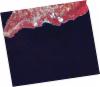
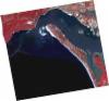
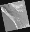
DE2_OPER_HRA_PSH_1C_20210803T112505_N38-397_W009-092_0001
Download Product | Product Info | Browse
Platform Short Name | GEOSAT |
Platform Serial Identifier | 2 |
Product Type | HRA_PSH_1C |
Start Date | 2021-08-03T11:25:05Z |
Stop Date | 2021-08-03T11:25:08Z |
Original Name | DE2_PSH_L1C_000000_20210803T112505_20210803T112508_DE2_38603_020B.zip |
Footprint | 38.3326034909 -8.95676453415 38.4898099823 -8.9931344006 38.4627434708 -9.22676937052 38.3052675706 -9.19250636704 38.3326034909 -8.95676453415 |
Orbit Direction | ASCENDING |
Scene Centre Longitude | W009 |
Scene Centre Latitude | N38 |
Cloud Cover Percentage | -1 |
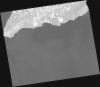
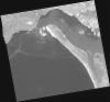
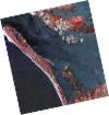
DE2_OPER_HRA_PM4_1C_20210803T112505_N38-397_W009-092_0001
Download Product | Product Info | Browse
Platform Short Name | GEOSAT |
Platform Serial Identifier | 2 |
Product Type | HRA_PM4_1C |
Start Date | 2021-08-03T11:25:05Z |
Stop Date | 2021-08-03T11:25:08Z |
Original Name | DE2_PM4_L1C_000000_20210803T112505_20210803T112508_DE2_38603_020B.zip |
Footprint | 38.3326034909 -8.95676453415 38.4898099823 -8.9931344006 38.4627434708 -9.22676937052 38.3052675706 -9.19250636704 38.3326034909 -8.95676453415 |
Orbit Direction | ASCENDING |
Scene Centre Longitude | W009 |
Scene Centre Latitude | N38 |
Cloud Cover Percentage | -1 |
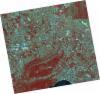
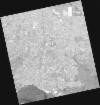
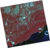
DE2_OPER_HRA_PSH_1C_20210715T112015_N38-581_W008-922_0001
Download Product | Product Info | Browse
Platform Short Name | GEOSAT |
Platform Serial Identifier | 2 |
Product Type | HRA_PSH_1C |
Start Date | 2021-07-15T11:20:15Z |
Stop Date | 2021-07-15T11:20:18Z |
Original Name | DE2_PSH_L1C_000000_20210715T112015_20210715T112018_DE2_38321_3718.zip |
Footprint | 38.5214241754 -8.80612197402 38.6665022829 -8.83957742465 38.6406044233 -9.03840713519 38.4954404081 -9.00509728008 38.5214241754 -8.80612197402 |
Orbit Direction | ASCENDING |
Scene Centre Longitude | W008 |
Scene Centre Latitude | N38 |
Cloud Cover Percentage | -1 |
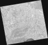
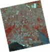
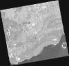
DE2_OPER_HRA_PM4_1C_20210715T112015_N38-581_W008-922_0001
Download Product | Product Info | Browse
Platform Short Name | GEOSAT |
Platform Serial Identifier | 2 |
Product Type | HRA_PM4_1C |
Start Date | 2021-07-15T11:20:15Z |
Stop Date | 2021-07-15T11:20:18Z |
Original Name | DE2_PM4_L1C_000000_20210715T112015_20210715T112018_DE2_38321_3718.zip |
Footprint | 38.5214241754 -8.80612197402 38.6665022829 -8.83957742465 38.6406044233 -9.03840713519 38.4954404081 -9.00509728008 38.5214241754 -8.80612197402 |
Orbit Direction | ASCENDING |
Scene Centre Longitude | W008 |
Scene Centre Latitude | N38 |
Cloud Cover Percentage | -1 |
DE2_OPER_HRA_PSH_1C_20210715T112013_N38-449_W008-892_0001
Download Product | Product Info | Browse
Platform Short Name | GEOSAT |
Platform Serial Identifier | 2 |
Product Type | HRA_PSH_1C |
Start Date | 2021-07-15T11:20:13Z |
Stop Date | 2021-07-15T11:20:16Z |
Original Name | DE2_PSH_L1C_000000_20210715T112013_20210715T112016_DE2_38321_A90D.zip |
Footprint | 38.3898110984 -8.77626972829 38.5348527052 -8.80919243889 38.5088231854 -9.00895199854 38.3638026106 -8.97394170723 38.3898110984 -8.77626972829 |
Orbit Direction | ASCENDING |
Scene Centre Longitude | W008 |
Scene Centre Latitude | N38 |
Cloud Cover Percentage | -1 |
DE2_OPER_HRA_PM4_1C_20210715T112013_N38-449_W008-892_0001
Download Product | Product Info | Browse
Platform Short Name | GEOSAT |
Platform Serial Identifier | 2 |
Product Type | HRA_PM4_1C |
Start Date | 2021-07-15T11:20:13Z |
Stop Date | 2021-07-15T11:20:16Z |
Original Name | DE2_PM4_L1C_000000_20210715T112013_20210715T112016_DE2_38321_A90D.zip |
Footprint | 38.3898110984 -8.77626972829 38.5348527052 -8.80919243889 38.5088231854 -9.00895199854 38.3638026106 -8.97394170723 38.3898110984 -8.77626972829 |
Orbit Direction | ASCENDING |
Scene Centre Longitude | W008 |
Scene Centre Latitude | N38 |
Cloud Cover Percentage | -1 |
DE2_OPER_HRA_PM4_1C_20210607T111002_N38-566_W008-853_0001
Download Product | Product Info | Browse
Platform Short Name | GEOSAT |
Platform Serial Identifier | 2 |
Product Type | HRA_PM4_1C |
Start Date | 2021-06-07T11:10:02Z |
Stop Date | 2021-06-07T11:10:04Z |
Original Name | DE2_PM4_L1C_000000_20210607T111002_20210607T111004_DE2_37757_AA1B.zip |
Footprint | 38.5162281269 -8.76294863045 38.6417999411 -8.79701630219 38.6174548196 -8.94427443276 38.4919047228 -8.9099964177 38.5162281269 -8.76294863045 |
Orbit Direction | ASCENDING |
Scene Centre Longitude | W008 |
Scene Centre Latitude | N38 |
Cloud Cover Percentage | -1 |
DE2_OPER_HRA_PSH_1C_20210607T111002_N38-566_W008-853_0001
Download Product | Product Info | Browse
Platform Short Name | GEOSAT |
Platform Serial Identifier | 2 |
Product Type | HRA_PSH_1C |
Start Date | 2021-06-07T11:10:02Z |
Stop Date | 2021-06-07T11:10:04Z |
Original Name | DE2_PSH_L1C_000000_20210607T111002_20210607T111004_DE2_37757_AA1B.zip |
Footprint | 38.5162281269 -8.76294863045 38.6417999411 -8.79701630219 38.6174548196 -8.94427443276 38.4919047228 -8.9099964177 38.5162281269 -8.76294863045 |
Orbit Direction | ASCENDING |
Scene Centre Longitude | W008 |
Scene Centre Latitude | N38 |
Cloud Cover Percentage | -1 |
DE2_OPER_HRA_PM4_1C_20210607T111000_N38-453_W008-822_0001
Download Product | Product Info | Browse
Platform Short Name | GEOSAT |
Platform Serial Identifier | 2 |
Product Type | HRA_PM4_1C |
Start Date | 2021-06-07T11:10:00Z |
Stop Date | 2021-06-07T11:10:02Z |
Original Name | DE2_PM4_L1C_000000_20210607T111000_20210607T111002_DE2_37757_C9B5.zip |
Footprint | 38.4024259853 -8.73219230954 38.5278736552 -8.7661456941 38.5034989685 -8.91316456024 38.3782282828 -8.87914808192 38.4024259853 -8.73219230954 |
Orbit Direction | ASCENDING |
Scene Centre Longitude | W008 |
Scene Centre Latitude | N38 |
Cloud Cover Percentage | -1 |
DE2_OPER_HRA_PSH_1C_20210607T111000_N38-453_W008-822_0001
Download Product | Product Info | Browse
Platform Short Name | GEOSAT |
Platform Serial Identifier | 2 |
Product Type | HRA_PSH_1C |
Start Date | 2021-06-07T11:10:00Z |
Stop Date | 2021-06-07T11:10:02Z |
Original Name | DE2_PSH_L1C_000000_20210607T111000_20210607T111002_DE2_37757_C9B5.zip |
Footprint | 38.4024259853 -8.73219230954 38.5278736552 -8.7661456941 38.5034989685 -8.91316456024 38.3782282828 -8.87914808192 38.4024259853 -8.73219230954 |
Orbit Direction | ASCENDING |
Scene Centre Longitude | W008 |
Scene Centre Latitude | N38 |
Cloud Cover Percentage | -1 |
DE2_OPER_HRA_PSH_1C_20210419T112110_N38-513_W009-010_0001
Download Product | Product Info | Browse
Platform Short Name | GEOSAT |
Platform Serial Identifier | 2 |
Product Type | HRA_PSH_1C |
Start Date | 2021-04-19T11:21:10Z |
Stop Date | 2021-04-19T11:21:13Z |
Original Name | DE2_PSH_L1C_000000_20210419T112110_20210419T112113_DE2_37030_58F0.zip |
Footprint | 38.4564466311 -8.90192591175 38.596071816 -8.93574729069 38.5707428071 -9.11972157779 38.4311162891 -9.08563446514 38.4564466311 -8.90192591175 |
Orbit Direction | ASCENDING |
Scene Centre Longitude | W009 |
Scene Centre Latitude | N38 |
Cloud Cover Percentage | -1 |
DE2_OPER_HRA_PM4_1C_20210419T112110_N38-513_W009-010_0001
Download Product | Product Info | Browse
Platform Short Name | GEOSAT |
Platform Serial Identifier | 2 |
Product Type | HRA_PM4_1C |
Start Date | 2021-04-19T11:21:10Z |
Stop Date | 2021-04-19T11:21:13Z |
Original Name | DE2_PM4_L1C_000000_20210419T112110_20210419T112113_DE2_37030_58F0.zip |
Footprint | 38.4564466311 -8.90192591175 38.596071816 -8.93574729069 38.5707428071 -9.11972157779 38.4311162891 -9.08563446514 38.4564466311 -8.90192591175 |
Orbit Direction | ASCENDING |
Scene Centre Longitude | W009 |
Scene Centre Latitude | N38 |
Cloud Cover Percentage | -1 |