ESA TPM Map Catalogue - Product List
back to previous node |
list of download URLs
Collection G2_Portugal_2021
GEOSAT-2 Portugal Coverage 2021 collection. More details here.
List of available products (latitude from 38.3806 to 38.459 dg, longitude from -7.61188 to -7.4675 dg)..
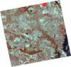
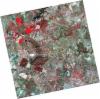
DE2_OPER_HRA_PSH_1C_20210727T111309_N38-520_W007-415_0001
Download Product | Product Info | Browse
Platform Short Name | GEOSAT |
Platform Serial Identifier | 2 |
Product Type | HRA_PSH_1C |
Start Date | 2021-07-27T11:13:09Z |
Stop Date | 2021-07-27T11:13:12Z |
Original Name | DE2_PSH_L1C_000000_20210727T111309_20210727T111312_DE2_38499_9512.zip |
Footprint | 38.4617561972 -7.30213412624 38.6048506893 -7.3354658246 38.5791048151 -7.5294629293 38.4360471838 -7.49549805802 38.4617561972 -7.30213412624 |
Orbit Direction | ASCENDING |
Scene Centre Longitude | W007 |
Scene Centre Latitude | N38 |
Cloud Cover Percentage | -1 |
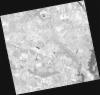
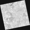
DE2_OPER_HRA_PM4_1C_20210727T111309_N38-520_W007-415_0001
Download Product | Product Info | Browse
Platform Short Name | GEOSAT |
Platform Serial Identifier | 2 |
Product Type | HRA_PM4_1C |
Start Date | 2021-07-27T11:13:09Z |
Stop Date | 2021-07-27T11:13:12Z |
Original Name | DE2_PM4_L1C_000000_20210727T111309_20210727T111312_DE2_38499_9512.zip |
Footprint | 38.4617561972 -7.30213412624 38.6048506893 -7.3354658246 38.5791048151 -7.5294629293 38.4360471838 -7.49549805802 38.4617561972 -7.30213412624 |
Orbit Direction | ASCENDING |
Scene Centre Longitude | W007 |
Scene Centre Latitude | N38 |
Cloud Cover Percentage | -1 |
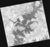
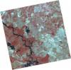
DE2_OPER_HRA_PM4_1C_20210727T111307_N38-390_W007-385_0001
Download Product | Product Info | Browse
Platform Short Name | GEOSAT |
Platform Serial Identifier | 2 |
Product Type | HRA_PM4_1C |
Start Date | 2021-07-27T11:13:07Z |
Stop Date | 2021-07-27T11:13:09Z |
Original Name | DE2_PM4_L1C_000000_20210727T111307_20210727T111309_DE2_38499_6E87.zip |
Footprint | 38.3319113109 -7.27206615819 38.4750245246 -7.30550253589 38.4493024216 -7.49878090655 38.3061648224 -7.46522221581 38.3319113109 -7.27206615819 |
Orbit Direction | ASCENDING |
Scene Centre Longitude | W007 |
Scene Centre Latitude | N38 |
Cloud Cover Percentage | -1 |
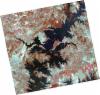
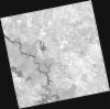
DE2_OPER_HRA_PSH_1C_20210727T111307_N38-390_W007-385_0001
Download Product | Product Info | Browse
Platform Short Name | GEOSAT |
Platform Serial Identifier | 2 |
Product Type | HRA_PSH_1C |
Start Date | 2021-07-27T11:13:07Z |
Stop Date | 2021-07-27T11:13:09Z |
Original Name | DE2_PSH_L1C_000000_20210727T111307_20210727T111309_DE2_38499_6E87.zip |
Footprint | 38.3319113109 -7.27206615819 38.4750245246 -7.30550253589 38.4493024216 -7.49878090655 38.3061648224 -7.46522221581 38.3319113109 -7.27206615819 |
Orbit Direction | ASCENDING |
Scene Centre Longitude | W007 |
Scene Centre Latitude | N38 |
Cloud Cover Percentage | -1 |
DE2_OPER_HRA_PSH_1C_20210702T111142_N38-488_W007-574_0001
Download Product | Product Info | Browse
Platform Short Name | GEOSAT |
Platform Serial Identifier | 2 |
Product Type | HRA_PSH_1C |
Start Date | 2021-07-02T11:11:42Z |
Stop Date | 2021-07-02T11:11:45Z |
Original Name | DE2_PSH_L1C_000000_20210702T111142_20210702T111145_DE2_38128_AA14.zip |
Footprint | 38.4325782563 -7.4697927672 38.5698847704 -7.50375563842 38.5449004403 -7.67915376984 38.4075160966 -7.64541041608 38.4325782563 -7.4697927672 |
Orbit Direction | ASCENDING |
Scene Centre Longitude | W007 |
Scene Centre Latitude | N38 |
Cloud Cover Percentage | -1 |
DE2_OPER_HRA_PM4_1C_20210702T111142_N38-488_W007-574_0001
Download Product | Product Info | Browse
Platform Short Name | GEOSAT |
Platform Serial Identifier | 2 |
Product Type | HRA_PM4_1C |
Start Date | 2021-07-02T11:11:42Z |
Stop Date | 2021-07-02T11:11:45Z |
Original Name | DE2_PM4_L1C_000000_20210702T111142_20210702T111145_DE2_38128_AA14.zip |
Footprint | 38.4325782563 -7.4697927672 38.5698847704 -7.50375563842 38.5449004403 -7.67915376984 38.4075160966 -7.64541041608 38.4325782563 -7.4697927672 |
Orbit Direction | ASCENDING |
Scene Centre Longitude | W007 |
Scene Centre Latitude | N38 |
Cloud Cover Percentage | -1 |
DE2_OPER_HRA_PSH_1C_20210702T111140_N38-364_W007-544_0001
Download Product | Product Info | Browse
Platform Short Name | GEOSAT |
Platform Serial Identifier | 2 |
Product Type | HRA_PSH_1C |
Start Date | 2021-07-02T11:11:40Z |
Stop Date | 2021-07-02T11:11:43Z |
Original Name | DE2_PSH_L1C_000000_20210702T111140_20210702T111143_DE2_38128_159C.zip |
Footprint | 38.307855808 -7.43971093816 38.445300114 -7.4730648186 38.420273016 -7.64860861731 38.2828378344 -7.61490633462 38.307855808 -7.43971093816 |
Orbit Direction | ASCENDING |
Scene Centre Longitude | W007 |
Scene Centre Latitude | N38 |
Cloud Cover Percentage | -1 |
DE2_OPER_HRA_PM4_1C_20210702T111140_N38-364_W007-544_0001
Download Product | Product Info | Browse
Platform Short Name | GEOSAT |
Platform Serial Identifier | 2 |
Product Type | HRA_PM4_1C |
Start Date | 2021-07-02T11:11:40Z |
Stop Date | 2021-07-02T11:11:43Z |
Original Name | DE2_PM4_L1C_000000_20210702T111140_20210702T111143_DE2_38128_159C.zip |
Footprint | 38.307855808 -7.43971093816 38.445300114 -7.4730648186 38.420273016 -7.64860861731 38.2828378344 -7.61490633462 38.307855808 -7.43971093816 |
Orbit Direction | ASCENDING |
Scene Centre Longitude | W007 |
Scene Centre Latitude | N38 |
Cloud Cover Percentage | -1 |