ESA TPM Map Catalogue - Product List
back to previous node |
list of download URLs


Collection G2_Portugal_2021
GEOSAT-2 Portugal Coverage 2021 collection. More details here.
List of available products (latitude from 38.3806 to 38.459 dg, longitude from -7.90062 to -7.75625 dg)..
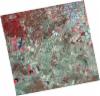
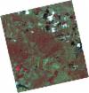
DE2_OPER_HRA_PSH_1C_20210626T111510_N38-498_W007-965_0001
Download Product | Product Info | Browse
Platform Short Name | GEOSAT |
Platform Serial Identifier | 2 |
Product Type | HRA_PSH_1C |
Start Date | 2021-06-26T11:15:10Z |
Stop Date | 2021-06-26T11:15:13Z |
Original Name | DE2_PSH_L1C_000000_20210626T111510_20210626T111513_DE2_38039_C7C7.zip |
Footprint | 38.441061167 -7.85597277453 38.5817708927 -7.88952036731 38.5562618407 -8.07599895634 38.4156483495 -8.04136761571 38.441061167 -7.85597277453 |
Orbit Direction | ASCENDING |
Scene Centre Longitude | W007 |
Scene Centre Latitude | N38 |
Cloud Cover Percentage | -1 |
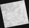
DE2_OPER_HRA_PM4_1C_20210626T111510_N38-498_W007-965_0001
Download Product | Product Info | Browse
Platform Short Name | GEOSAT |
Platform Serial Identifier | 2 |
Product Type | HRA_PM4_1C |
Start Date | 2021-06-26T11:15:10Z |
Stop Date | 2021-06-26T11:15:13Z |
Original Name | DE2_PM4_L1C_000000_20210626T111510_20210626T111513_DE2_38039_C7C7.zip |
Footprint | 38.441061167 -7.85597277453 38.5817708927 -7.88952036731 38.5562618407 -8.07599895634 38.4156483495 -8.04136761571 38.441061167 -7.85597277453 |
Orbit Direction | ASCENDING |
Scene Centre Longitude | W007 |
Scene Centre Latitude | N38 |
Cloud Cover Percentage | -1 |
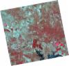
DE2_OPER_HRA_PSH_1C_20210626T111508_N38-371_W007-935_0001
Download Product | Product Info | Browse
Platform Short Name | GEOSAT |
Platform Serial Identifier | 2 |
Product Type | HRA_PSH_1C |
Start Date | 2021-06-26T11:15:08Z |
Stop Date | 2021-06-26T11:15:11Z |
Original Name | DE2_PSH_L1C_000000_20210626T111508_20210626T111511_DE2_38039_191E.zip |
Footprint | 38.3133353168 -7.82564123689 38.45412908 -7.85905841434 38.4286986349 -8.04452035327 38.2878933003 -8.01096868792 38.3133353168 -7.82564123689 |
Orbit Direction | ASCENDING |
Scene Centre Longitude | W007 |
Scene Centre Latitude | N38 |
Cloud Cover Percentage | -1 |
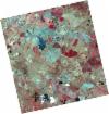
DE2_OPER_HRA_PM4_1C_20210626T111508_N38-371_W007-935_0001
Download Product | Product Info | Browse
Platform Short Name | GEOSAT |
Platform Serial Identifier | 2 |
Product Type | HRA_PM4_1C |
Start Date | 2021-06-26T11:15:08Z |
Stop Date | 2021-06-26T11:15:11Z |
Original Name | DE2_PM4_L1C_000000_20210626T111508_20210626T111511_DE2_38039_191E.zip |
Footprint | 38.3133353168 -7.82564123689 38.45412908 -7.85905841434 38.4286986349 -8.04452035327 38.2878933003 -8.01096868792 38.3133353168 -7.82564123689 |
Orbit Direction | ASCENDING |
Scene Centre Longitude | W007 |
Scene Centre Latitude | N38 |
Cloud Cover Percentage | -1 |
DE2_OPER_HRA_PM4_1C_20210613T110634_N38-492_W007-837_0001
Download Product | Product Info | Browse
Platform Short Name | GEOSAT |
Platform Serial Identifier | 2 |
Product Type | HRA_PM4_1C |
Start Date | 2021-06-13T11:06:34Z |
Stop Date | 2021-06-13T11:06:36Z |
Original Name | DE2_PM4_L1C_000000_20210613T110634_20210613T110636_DE2_37846_A561.zip |
Footprint | 38.4410013542 -7.74642136297 38.5678100055 -7.78046374909 38.5434353694 -7.92943075805 38.4166870287 -7.89524812872 38.4410013542 -7.74642136297 |
Orbit Direction | ASCENDING |
Scene Centre Longitude | W007 |
Scene Centre Latitude | N38 |
Cloud Cover Percentage | -1 |
DE2_OPER_HRA_PSH_1C_20210613T110634_N38-492_W007-837_0001
Download Product | Product Info | Browse
Platform Short Name | GEOSAT |
Platform Serial Identifier | 2 |
Product Type | HRA_PSH_1C |
Start Date | 2021-06-13T11:06:34Z |
Stop Date | 2021-06-13T11:06:36Z |
Original Name | DE2_PSH_L1C_000000_20210613T110634_20210613T110636_DE2_37846_A561.zip |
Footprint | 38.4410013542 -7.74642136297 38.5678100055 -7.78046374909 38.5434353694 -7.92943075805 38.4166870287 -7.89524812872 38.4410013542 -7.74642136297 |
Orbit Direction | ASCENDING |
Scene Centre Longitude | W007 |
Scene Centre Latitude | N38 |
Cloud Cover Percentage | -1 |
DE2_OPER_HRA_PSH_1C_20210613T110632_N38-377_W007-807_0001
Download Product | Product Info | Browse
Platform Short Name | GEOSAT |
Platform Serial Identifier | 2 |
Product Type | HRA_PSH_1C |
Start Date | 2021-06-13T11:06:32Z |
Stop Date | 2021-06-13T11:06:35Z |
Original Name | DE2_PSH_L1C_000000_20210613T110632_20210613T110635_DE2_37846_6224.zip |
Footprint | 38.3258610885 -7.71614648781 38.4527352058 -7.74963915965 38.4284231441 -7.8984031292 38.3016232477 -7.86420469182 38.3258610885 -7.71614648781 |
Orbit Direction | ASCENDING |
Scene Centre Longitude | W007 |
Scene Centre Latitude | N38 |
Cloud Cover Percentage | -1 |
DE2_OPER_HRA_PM4_1C_20210613T110632_N38-377_W007-807_0001
Download Product | Product Info | Browse
Platform Short Name | GEOSAT |
Platform Serial Identifier | 2 |
Product Type | HRA_PM4_1C |
Start Date | 2021-06-13T11:06:32Z |
Stop Date | 2021-06-13T11:06:35Z |
Original Name | DE2_PM4_L1C_000000_20210613T110632_20210613T110635_DE2_37846_6224.zip |
Footprint | 38.3258610885 -7.71614648781 38.4527352058 -7.74963915965 38.4284231441 -7.8984031292 38.3016232477 -7.86420469182 38.3258610885 -7.71614648781 |
Orbit Direction | ASCENDING |
Scene Centre Longitude | W007 |
Scene Centre Latitude | N38 |
Cloud Cover Percentage | -1 |
DE2_OPER_HRA_PSH_1C_20210525T110114_N38-424_W007-690_0001
Download Product | Product Info | Browse
Platform Short Name | GEOSAT |
Platform Serial Identifier | 2 |
Product Type | HRA_PSH_1C |
Start Date | 2021-05-25T11:01:14Z |
Stop Date | 2021-05-25T11:01:17Z |
Original Name | DE2_PSH_L1C_000000_20210525T110114_20210525T110117_DE2_37564_B57B.zip |
Footprint | 38.3753204894 -7.60250690699 38.4982327658 -7.63793348247 38.4732959456 -7.77851557303 38.3504011968 -7.74283527564 38.3753204894 -7.60250690699 |
Orbit Direction | ASCENDING |
Scene Centre Longitude | W007 |
Scene Centre Latitude | N38 |
Cloud Cover Percentage | -1 |
DE2_OPER_HRA_PM4_1C_20210525T110114_N38-424_W007-690_0001
Download Product | Product Info | Browse
Platform Short Name | GEOSAT |
Platform Serial Identifier | 2 |
Product Type | HRA_PM4_1C |
Start Date | 2021-05-25T11:01:14Z |
Stop Date | 2021-05-25T11:01:17Z |
Original Name | DE2_PM4_L1C_000000_20210525T110114_20210525T110117_DE2_37564_B57B.zip |
Footprint | 38.3753204894 -7.60250690699 38.4982327658 -7.63793348247 38.4732959456 -7.77851557303 38.3504011968 -7.74283527564 38.3753204894 -7.60250690699 |
Orbit Direction | ASCENDING |
Scene Centre Longitude | W007 |
Scene Centre Latitude | N38 |
Cloud Cover Percentage | -1 |