ESA TPM Map Catalogue - Product List
back to previous node |
list of download URLs

Collection G2_Portugal_2021
GEOSAT-2 Portugal Coverage 2021 collection. More details here.
List of available products (latitude from 38.3806 to 38.459 dg, longitude from -8.39938 to -8.255 dg)..
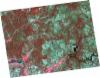
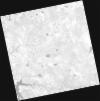
DE2_OPER_HRA_PSH_1C_20210922T112654_N38-470_W008-456_0001
Download Product | Product Info | Browse
Platform Short Name | GEOSAT |
Platform Serial Identifier | 2 |
Product Type | HRA_PSH_1C |
Start Date | 2021-09-22T11:26:54Z |
Stop Date | 2021-09-22T11:26:57Z |
Original Name | DE2_PSH_L1C_000000_20210922T112654_20210922T112657_DE2_39345_CB42.zip |
Footprint | 38.3961169804 -8.28829858626 38.5729214677 -8.32292484876 38.5438727273 -8.62365065501 38.3668999422 -8.58973834596 38.3961169804 -8.28829858626 |
Orbit Direction | ASCENDING |
Scene Centre Longitude | W008 |
Scene Centre Latitude | N38 |
Cloud Cover Percentage | -1 |
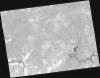
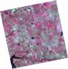
DE2_OPER_HRA_PM4_1C_20210922T112654_N38-470_W008-456_0001
Download Product | Product Info | Browse
Platform Short Name | GEOSAT |
Platform Serial Identifier | 2 |
Product Type | HRA_PM4_1C |
Start Date | 2021-09-22T11:26:54Z |
Stop Date | 2021-09-22T11:26:57Z |
Original Name | DE2_PM4_L1C_000000_20210922T112654_20210922T112657_DE2_39345_CB42.zip |
Footprint | 38.3961169804 -8.28829858626 38.5729214677 -8.32292484876 38.5438727273 -8.62365065501 38.3668999422 -8.58973834596 38.3961169804 -8.28829858626 |
Orbit Direction | ASCENDING |
Scene Centre Longitude | W008 |
Scene Centre Latitude | N38 |
Cloud Cover Percentage | -1 |
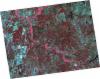
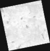
DE2_OPER_HRA_PSH_1C_20210922T112651_N38-309_W008-425_0001
Download Product | Product Info | Browse
Platform Short Name | GEOSAT |
Platform Serial Identifier | 2 |
Product Type | HRA_PSH_1C |
Start Date | 2021-09-22T11:26:51Z |
Stop Date | 2021-09-22T11:26:55Z |
Original Name | DE2_PSH_L1C_000000_20210922T112651_20210922T112655_DE2_39345_4236.zip |
Footprint | 38.2352228634 -8.25799900118 38.4124479103 -8.29180659736 38.3827947723 -8.59280866214 38.2059312288 -8.55917063758 38.2352228634 -8.25799900118 |
Orbit Direction | ASCENDING |
Scene Centre Longitude | W008 |
Scene Centre Latitude | N38 |
Cloud Cover Percentage | -1 |
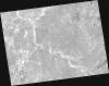
DE2_OPER_HRA_PM4_1C_20210922T112651_N38-309_W008-425_0001
Download Product | Product Info | Browse
Platform Short Name | GEOSAT |
Platform Serial Identifier | 2 |
Product Type | HRA_PM4_1C |
Start Date | 2021-09-22T11:26:51Z |
Stop Date | 2021-09-22T11:26:55Z |
Original Name | DE2_PM4_L1C_000000_20210922T112651_20210922T112655_DE2_39345_4236.zip |
Footprint | 38.2352228634 -8.25799900118 38.4124479103 -8.29180659736 38.3827947723 -8.59280866214 38.2059312288 -8.55917063758 38.2352228634 -8.25799900118 |
Orbit Direction | ASCENDING |
Scene Centre Longitude | W008 |
Scene Centre Latitude | N38 |
Cloud Cover Percentage | -1 |
DE2_OPER_HRA_PM4_1C_20210331T111517_N38-478_W008-249_0001
Download Product | Product Info | Browse
Platform Short Name | GEOSAT |
Platform Serial Identifier | 2 |
Product Type | HRA_PM4_1C |
Start Date | 2021-03-31T11:15:17Z |
Stop Date | 2021-03-31T11:15:20Z |
Original Name | DE2_PM4_L1C_000000_20210331T111517_20210331T111520_DE2_36748_5B79.zip |
Footprint | 38.4243397935 -8.14988871941 38.5575205221 -8.18348507064 38.5328678729 -8.34911514917 38.3996894207 -8.31500136856 38.4243397935 -8.14988871941 |
Orbit Direction | ASCENDING |
Scene Centre Longitude | W008 |
Scene Centre Latitude | N38 |
Cloud Cover Percentage | -1 |
DE2_OPER_HRA_PSH_1C_20210331T111517_N38-478_W008-249_0001
Download Product | Product Info | Browse
Platform Short Name | GEOSAT |
Platform Serial Identifier | 2 |
Product Type | HRA_PSH_1C |
Start Date | 2021-03-31T11:15:17Z |
Stop Date | 2021-03-31T11:15:20Z |
Original Name | DE2_PSH_L1C_000000_20210331T111517_20210331T111520_DE2_36748_5B79.zip |
Footprint | 38.4243397935 -8.14988871941 38.5575205221 -8.18348507064 38.5328678729 -8.34911514917 38.3996894207 -8.31500136856 38.4243397935 -8.14988871941 |
Orbit Direction | ASCENDING |
Scene Centre Longitude | W008 |
Scene Centre Latitude | N38 |
Cloud Cover Percentage | -1 |
DE2_OPER_HRA_PM4_1C_20210331T111515_N38-357_W008-218_0001
Download Product | Product Info | Browse
Platform Short Name | GEOSAT |
Platform Serial Identifier | 2 |
Product Type | HRA_PM4_1C |
Start Date | 2021-03-31T11:15:15Z |
Stop Date | 2021-03-31T11:15:18Z |
Original Name | DE2_PM4_L1C_000000_20210331T111515_20210331T111518_DE2_36748_0FD2.zip |
Footprint | 38.3031835243 -8.1196876405 38.4366569055 -8.15299258925 38.4120491341 -8.31802024386 38.278559031 -8.28454295563 38.3031835243 -8.1196876405 |
Orbit Direction | ASCENDING |
Scene Centre Longitude | W008 |
Scene Centre Latitude | N38 |
Cloud Cover Percentage | -1 |
DE2_OPER_HRA_PSH_1C_20210331T111515_N38-357_W008-218_0001
Download Product | Product Info | Browse
Platform Short Name | GEOSAT |
Platform Serial Identifier | 2 |
Product Type | HRA_PSH_1C |
Start Date | 2021-03-31T11:15:15Z |
Stop Date | 2021-03-31T11:15:18Z |
Original Name | DE2_PSH_L1C_000000_20210331T111515_20210331T111518_DE2_36748_0FD2.zip |
Footprint | 38.3031835243 -8.1196876405 38.4366569055 -8.15299258925 38.4120491341 -8.31802024386 38.278559031 -8.28454295563 38.3031835243 -8.1196876405 |
Orbit Direction | ASCENDING |
Scene Centre Longitude | W008 |
Scene Centre Latitude | N38 |
Cloud Cover Percentage | -1 |