ESA TPM Map Catalogue - Product List
back to previous node |
list of download URLs

Collection G2_Portugal_2021
GEOSAT-2 Portugal Coverage 2021 collection. More details here.
List of available products (latitude from 38.3806 to 38.459 dg, longitude from -8.8325 to -8.68812 dg)..
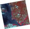
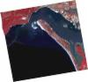
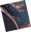
DE2_OPER_HRA_PSH_1C_20210721T111642_N38-470_W008-696_0001
Download Product | Product Info | Browse
Platform Short Name | GEOSAT |
Platform Serial Identifier | 2 |
Product Type | HRA_PSH_1C |
Start Date | 2021-07-21T11:16:42Z |
Stop Date | 2021-07-21T11:16:45Z |
Original Name | DE2_PSH_L1C_000000_20210721T111642_20210721T111645_DE2_38410_1AB4.zip |
Footprint | 38.4139205494 -8.58887123174 38.5530274832 -8.62250118558 38.5277812301 -8.80418613171 38.3886579444 -8.77065678949 38.4139205494 -8.58887123174 |
Orbit Direction | ASCENDING |
Scene Centre Longitude | W008 |
Scene Centre Latitude | N38 |
Cloud Cover Percentage | -1 |
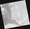
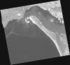
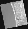
DE2_OPER_HRA_PM4_1C_20210721T111642_N38-470_W008-696_0001
Download Product | Product Info | Browse
Platform Short Name | GEOSAT |
Platform Serial Identifier | 2 |
Product Type | HRA_PM4_1C |
Start Date | 2021-07-21T11:16:42Z |
Stop Date | 2021-07-21T11:16:45Z |
Original Name | DE2_PM4_L1C_000000_20210721T111642_20210721T111645_DE2_38410_1AB4.zip |
Footprint | 38.4139205494 -8.58887123174 38.5530274832 -8.62250118558 38.5277812301 -8.80418613171 38.3886579444 -8.77065678949 38.4139205494 -8.58887123174 |
Orbit Direction | ASCENDING |
Scene Centre Longitude | W008 |
Scene Centre Latitude | N38 |
Cloud Cover Percentage | -1 |
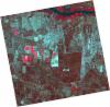
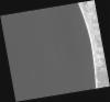
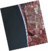
DE2_OPER_HRA_PSH_1C_20210721T111640_N38-344_W008-666_0001
Download Product | Product Info | Browse
Platform Short Name | GEOSAT |
Platform Serial Identifier | 2 |
Product Type | HRA_PSH_1C |
Start Date | 2021-07-21T11:16:40Z |
Stop Date | 2021-07-21T11:16:43Z |
Original Name | DE2_PSH_L1C_000000_20210721T111640_20210721T111643_DE2_38410_23E5.zip |
Footprint | 38.2875244369 -8.55948370088 38.4267816262 -8.59228683631 38.4015402301 -8.77374264435 38.2622982748 -8.74068901536 38.2875244369 -8.55948370088 |
Orbit Direction | ASCENDING |
Scene Centre Longitude | W008 |
Scene Centre Latitude | N38 |
Cloud Cover Percentage | -1 |
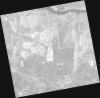
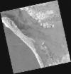
DE2_OPER_HRA_PM4_1C_20210721T111640_N38-344_W008-666_0001
Download Product | Product Info | Browse
Platform Short Name | GEOSAT |
Platform Serial Identifier | 2 |
Product Type | HRA_PM4_1C |
Start Date | 2021-07-21T11:16:40Z |
Stop Date | 2021-07-21T11:16:43Z |
Original Name | DE2_PM4_L1C_000000_20210721T111640_20210721T111643_DE2_38410_23E5.zip |
Footprint | 38.2875244369 -8.55948370088 38.4267816262 -8.59228683631 38.4015402301 -8.77374264435 38.2622982748 -8.74068901536 38.2875244369 -8.55948370088 |
Orbit Direction | ASCENDING |
Scene Centre Longitude | W008 |
Scene Centre Latitude | N38 |
Cloud Cover Percentage | -1 |
DE2_OPER_HRA_PSH_1C_20210715T112013_N38-449_W008-892_0001
Download Product | Product Info | Browse
Platform Short Name | GEOSAT |
Platform Serial Identifier | 2 |
Product Type | HRA_PSH_1C |
Start Date | 2021-07-15T11:20:13Z |
Stop Date | 2021-07-15T11:20:16Z |
Original Name | DE2_PSH_L1C_000000_20210715T112013_20210715T112016_DE2_38321_A90D.zip |
Footprint | 38.3898110984 -8.77626972829 38.5348527052 -8.80919243889 38.5088231854 -9.00895199854 38.3638026106 -8.97394170723 38.3898110984 -8.77626972829 |
Orbit Direction | ASCENDING |
Scene Centre Longitude | W008 |
Scene Centre Latitude | N38 |
Cloud Cover Percentage | -1 |
DE2_OPER_HRA_PM4_1C_20210715T112013_N38-449_W008-892_0001
Download Product | Product Info | Browse
Platform Short Name | GEOSAT |
Platform Serial Identifier | 2 |
Product Type | HRA_PM4_1C |
Start Date | 2021-07-15T11:20:13Z |
Stop Date | 2021-07-15T11:20:16Z |
Original Name | DE2_PM4_L1C_000000_20210715T112013_20210715T112016_DE2_38321_A90D.zip |
Footprint | 38.3898110984 -8.77626972829 38.5348527052 -8.80919243889 38.5088231854 -9.00895199854 38.3638026106 -8.97394170723 38.3898110984 -8.77626972829 |
Orbit Direction | ASCENDING |
Scene Centre Longitude | W008 |
Scene Centre Latitude | N38 |
Cloud Cover Percentage | -1 |
DE2_OPER_HRA_PSH_1C_20210715T112011_N38-318_W008-862_0001
Download Product | Product Info | Browse
Platform Short Name | GEOSAT |
Platform Serial Identifier | 2 |
Product Type | HRA_PSH_1C |
Start Date | 2021-07-15T11:20:11Z |
Stop Date | 2021-07-15T11:20:14Z |
Original Name | DE2_PSH_L1C_000000_20210715T112011_20210715T112014_DE2_38321_781B.zip |
Footprint | 38.2585592811 -8.74638591706 38.4034359352 -8.77892488731 38.3772679754 -8.9786079756 38.232803758 -8.94545187742 38.2585592811 -8.74638591706 |
Orbit Direction | ASCENDING |
Scene Centre Longitude | W008 |
Scene Centre Latitude | N38 |
Cloud Cover Percentage | -1 |
DE2_OPER_HRA_PM4_1C_20210715T112011_N38-318_W008-862_0001
Download Product | Product Info | Browse
Platform Short Name | GEOSAT |
Platform Serial Identifier | 2 |
Product Type | HRA_PM4_1C |
Start Date | 2021-07-15T11:20:11Z |
Stop Date | 2021-07-15T11:20:14Z |
Original Name | DE2_PM4_L1C_000000_20210715T112011_20210715T112014_DE2_38321_781B.zip |
Footprint | 38.2585592811 -8.74638591706 38.4034359352 -8.77892488731 38.3772679754 -8.9786079756 38.232803758 -8.94545187742 38.2585592811 -8.74638591706 |
Orbit Direction | ASCENDING |
Scene Centre Longitude | W008 |
Scene Centre Latitude | N38 |
Cloud Cover Percentage | -1 |
DE2_OPER_HRA_PM4_1C_20210607T111000_N38-453_W008-822_0001
Download Product | Product Info | Browse
Platform Short Name | GEOSAT |
Platform Serial Identifier | 2 |
Product Type | HRA_PM4_1C |
Start Date | 2021-06-07T11:10:00Z |
Stop Date | 2021-06-07T11:10:02Z |
Original Name | DE2_PM4_L1C_000000_20210607T111000_20210607T111002_DE2_37757_C9B5.zip |
Footprint | 38.4024259853 -8.73219230954 38.5278736552 -8.7661456941 38.5034989685 -8.91316456024 38.3782282828 -8.87914808192 38.4024259853 -8.73219230954 |
Orbit Direction | ASCENDING |
Scene Centre Longitude | W008 |
Scene Centre Latitude | N38 |
Cloud Cover Percentage | -1 |
DE2_OPER_HRA_PSH_1C_20210607T111000_N38-453_W008-822_0001
Download Product | Product Info | Browse
Platform Short Name | GEOSAT |
Platform Serial Identifier | 2 |
Product Type | HRA_PSH_1C |
Start Date | 2021-06-07T11:10:00Z |
Stop Date | 2021-06-07T11:10:02Z |
Original Name | DE2_PSH_L1C_000000_20210607T111000_20210607T111002_DE2_37757_C9B5.zip |
Footprint | 38.4024259853 -8.73219230954 38.5278736552 -8.7661456941 38.5034989685 -8.91316456024 38.3782282828 -8.87914808192 38.4024259853 -8.73219230954 |
Orbit Direction | ASCENDING |
Scene Centre Longitude | W008 |
Scene Centre Latitude | N38 |
Cloud Cover Percentage | -1 |
DE2_OPER_HRA_PM4_1C_20210607T110958_N38-339_W008-791_0001
Download Product | Product Info | Browse
Platform Short Name | GEOSAT |
Platform Serial Identifier | 2 |
Product Type | HRA_PM4_1C |
Start Date | 2021-06-07T11:09:58Z |
Stop Date | 2021-06-07T11:10:00Z |
Original Name | DE2_PM4_L1C_000000_20210607T110958_20210607T111000_DE2_37757_365C.zip |
Footprint | 38.2885322799 -8.70131721847 38.4140115958 -8.73532818306 38.389681336 -8.88201460472 38.264284057 -8.84778752672 38.2885322799 -8.70131721847 |
Orbit Direction | ASCENDING |
Scene Centre Longitude | W008 |
Scene Centre Latitude | N38 |
Cloud Cover Percentage | -1 |
DE2_OPER_HRA_PSH_1C_20210607T110958_N38-339_W008-791_0001
Download Product | Product Info | Browse
Platform Short Name | GEOSAT |
Platform Serial Identifier | 2 |
Product Type | HRA_PSH_1C |
Start Date | 2021-06-07T11:09:58Z |
Stop Date | 2021-06-07T11:10:00Z |
Original Name | DE2_PSH_L1C_000000_20210607T110958_20210607T111000_DE2_37757_365C.zip |
Footprint | 38.2885322799 -8.70131721847 38.4140115958 -8.73532818306 38.389681336 -8.88201460472 38.264284057 -8.84778752672 38.2885322799 -8.70131721847 |
Orbit Direction | ASCENDING |
Scene Centre Longitude | W008 |
Scene Centre Latitude | N38 |
Cloud Cover Percentage | -1 |