ESA TPM Map Catalogue - Product List
back to previous node |
list of download URLs

Collection G2_Portugal_2021
GEOSAT-2 Portugal Coverage 2021 collection. More details here.
List of available products (latitude from 38.3806 to 38.459 dg, longitude from -8.97687 to -8.8325 dg)..
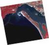
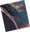
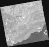
DE2_OPER_HRA_PSH_1C_20210715T112013_N38-449_W008-892_0001
Download Product | Product Info | Browse
Platform Short Name | GEOSAT |
Platform Serial Identifier | 2 |
Product Type | HRA_PSH_1C |
Start Date | 2021-07-15T11:20:13Z |
Stop Date | 2021-07-15T11:20:16Z |
Original Name | DE2_PSH_L1C_000000_20210715T112013_20210715T112016_DE2_38321_A90D.zip |
Footprint | 38.3898110984 -8.77626972829 38.5348527052 -8.80919243889 38.5088231854 -9.00895199854 38.3638026106 -8.97394170723 38.3898110984 -8.77626972829 |
Orbit Direction | ASCENDING |
Scene Centre Longitude | W008 |
Scene Centre Latitude | N38 |
Cloud Cover Percentage | -1 |
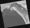
DE2_OPER_HRA_PM4_1C_20210715T112013_N38-449_W008-892_0001
Download Product | Product Info | Browse
Platform Short Name | GEOSAT |
Platform Serial Identifier | 2 |
Product Type | HRA_PM4_1C |
Start Date | 2021-07-15T11:20:13Z |
Stop Date | 2021-07-15T11:20:16Z |
Original Name | DE2_PM4_L1C_000000_20210715T112013_20210715T112016_DE2_38321_A90D.zip |
Footprint | 38.3898110984 -8.77626972829 38.5348527052 -8.80919243889 38.5088231854 -9.00895199854 38.3638026106 -8.97394170723 38.3898110984 -8.77626972829 |
Orbit Direction | ASCENDING |
Scene Centre Longitude | W008 |
Scene Centre Latitude | N38 |
Cloud Cover Percentage | -1 |
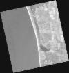
DE2_OPER_HRA_PSH_1C_20210715T112011_N38-318_W008-862_0001
Download Product | Product Info | Browse
Platform Short Name | GEOSAT |
Platform Serial Identifier | 2 |
Product Type | HRA_PSH_1C |
Start Date | 2021-07-15T11:20:11Z |
Stop Date | 2021-07-15T11:20:14Z |
Original Name | DE2_PSH_L1C_000000_20210715T112011_20210715T112014_DE2_38321_781B.zip |
Footprint | 38.2585592811 -8.74638591706 38.4034359352 -8.77892488731 38.3772679754 -8.9786079756 38.232803758 -8.94545187742 38.2585592811 -8.74638591706 |
Orbit Direction | ASCENDING |
Scene Centre Longitude | W008 |
Scene Centre Latitude | N38 |
Cloud Cover Percentage | -1 |
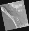
DE2_OPER_HRA_PM4_1C_20210715T112011_N38-318_W008-862_0001
Download Product | Product Info | Browse
Platform Short Name | GEOSAT |
Platform Serial Identifier | 2 |
Product Type | HRA_PM4_1C |
Start Date | 2021-07-15T11:20:11Z |
Stop Date | 2021-07-15T11:20:14Z |
Original Name | DE2_PM4_L1C_000000_20210715T112011_20210715T112014_DE2_38321_781B.zip |
Footprint | 38.2585592811 -8.74638591706 38.4034359352 -8.77892488731 38.3772679754 -8.9786079756 38.232803758 -8.94545187742 38.2585592811 -8.74638591706 |
Orbit Direction | ASCENDING |
Scene Centre Longitude | W008 |
Scene Centre Latitude | N38 |
Cloud Cover Percentage | -1 |
DE2_OPER_HRA_PM4_1C_20210607T111000_N38-453_W008-822_0001
Download Product | Product Info | Browse
Platform Short Name | GEOSAT |
Platform Serial Identifier | 2 |
Product Type | HRA_PM4_1C |
Start Date | 2021-06-07T11:10:00Z |
Stop Date | 2021-06-07T11:10:02Z |
Original Name | DE2_PM4_L1C_000000_20210607T111000_20210607T111002_DE2_37757_C9B5.zip |
Footprint | 38.4024259853 -8.73219230954 38.5278736552 -8.7661456941 38.5034989685 -8.91316456024 38.3782282828 -8.87914808192 38.4024259853 -8.73219230954 |
Orbit Direction | ASCENDING |
Scene Centre Longitude | W008 |
Scene Centre Latitude | N38 |
Cloud Cover Percentage | -1 |
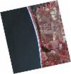
DE2_OPER_HRA_PSH_1C_20210607T111000_N38-453_W008-822_0001
Download Product | Product Info | Browse
Platform Short Name | GEOSAT |
Platform Serial Identifier | 2 |
Product Type | HRA_PSH_1C |
Start Date | 2021-06-07T11:10:00Z |
Stop Date | 2021-06-07T11:10:02Z |
Original Name | DE2_PSH_L1C_000000_20210607T111000_20210607T111002_DE2_37757_C9B5.zip |
Footprint | 38.4024259853 -8.73219230954 38.5278736552 -8.7661456941 38.5034989685 -8.91316456024 38.3782282828 -8.87914808192 38.4024259853 -8.73219230954 |
Orbit Direction | ASCENDING |
Scene Centre Longitude | W008 |
Scene Centre Latitude | N38 |
Cloud Cover Percentage | -1 |
DE2_OPER_HRA_PM4_1C_20210607T110958_N38-339_W008-791_0001
Download Product | Product Info | Browse
Platform Short Name | GEOSAT |
Platform Serial Identifier | 2 |
Product Type | HRA_PM4_1C |
Start Date | 2021-06-07T11:09:58Z |
Stop Date | 2021-06-07T11:10:00Z |
Original Name | DE2_PM4_L1C_000000_20210607T110958_20210607T111000_DE2_37757_365C.zip |
Footprint | 38.2885322799 -8.70131721847 38.4140115958 -8.73532818306 38.389681336 -8.88201460472 38.264284057 -8.84778752672 38.2885322799 -8.70131721847 |
Orbit Direction | ASCENDING |
Scene Centre Longitude | W008 |
Scene Centre Latitude | N38 |
Cloud Cover Percentage | -1 |
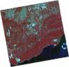
DE2_OPER_HRA_PSH_1C_20210607T110958_N38-339_W008-791_0001
Download Product | Product Info | Browse
Platform Short Name | GEOSAT |
Platform Serial Identifier | 2 |
Product Type | HRA_PSH_1C |
Start Date | 2021-06-07T11:09:58Z |
Stop Date | 2021-06-07T11:10:00Z |
Original Name | DE2_PSH_L1C_000000_20210607T110958_20210607T111000_DE2_37757_365C.zip |
Footprint | 38.2885322799 -8.70131721847 38.4140115958 -8.73532818306 38.389681336 -8.88201460472 38.264284057 -8.84778752672 38.2885322799 -8.70131721847 |
Orbit Direction | ASCENDING |
Scene Centre Longitude | W008 |
Scene Centre Latitude | N38 |
Cloud Cover Percentage | -1 |
DE2_OPER_HRA_PSH_1C_20210419T112110_N38-513_W009-010_0001
Download Product | Product Info | Browse
Platform Short Name | GEOSAT |
Platform Serial Identifier | 2 |
Product Type | HRA_PSH_1C |
Start Date | 2021-04-19T11:21:10Z |
Stop Date | 2021-04-19T11:21:13Z |
Original Name | DE2_PSH_L1C_000000_20210419T112110_20210419T112113_DE2_37030_58F0.zip |
Footprint | 38.4564466311 -8.90192591175 38.596071816 -8.93574729069 38.5707428071 -9.11972157779 38.4311162891 -9.08563446514 38.4564466311 -8.90192591175 |
Orbit Direction | ASCENDING |
Scene Centre Longitude | W009 |
Scene Centre Latitude | N38 |
Cloud Cover Percentage | -1 |
DE2_OPER_HRA_PM4_1C_20210419T112110_N38-513_W009-010_0001
Download Product | Product Info | Browse
Platform Short Name | GEOSAT |
Platform Serial Identifier | 2 |
Product Type | HRA_PM4_1C |
Start Date | 2021-04-19T11:21:10Z |
Stop Date | 2021-04-19T11:21:13Z |
Original Name | DE2_PM4_L1C_000000_20210419T112110_20210419T112113_DE2_37030_58F0.zip |
Footprint | 38.4564466311 -8.90192591175 38.596071816 -8.93574729069 38.5707428071 -9.11972157779 38.4311162891 -9.08563446514 38.4564466311 -8.90192591175 |
Orbit Direction | ASCENDING |
Scene Centre Longitude | W009 |
Scene Centre Latitude | N38 |
Cloud Cover Percentage | -1 |