ESA TPM Map Catalogue - Product List
back to previous node |
list of download URLs


Collection G2_Portugal_2021
GEOSAT-2 Portugal Coverage 2021 collection. More details here.
List of available products (latitude from 38.2237 to 38.3021 dg, longitude from -8.045 to -7.90062 dg)..
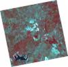
DE2_OPER_HRA_PSH_1C_20210921T111123_N38-251_W008-057_0001
Download Product | Product Info | Browse
Platform Short Name | GEOSAT |
Platform Serial Identifier | 2 |
Product Type | HRA_PSH_1C |
Start Date | 2021-09-21T11:11:23Z |
Stop Date | 2021-09-21T11:11:26Z |
Original Name | DE2_PSH_L1C_000000_20210921T111123_20210921T111126_DE2_39330_C29D.zip |
Footprint | 38.1954129184 -7.95234399996 38.3333833822 -7.9858172773 38.3084116999 -8.1626099366 38.1704198989 -8.12886434996 38.1954129184 -7.95234399996 |
Orbit Direction | ASCENDING |
Scene Centre Longitude | W008 |
Scene Centre Latitude | N38 |
Cloud Cover Percentage | -1 |
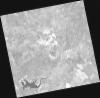
DE2_OPER_HRA_PM4_1C_20210921T111123_N38-251_W008-057_0001
Download Product | Product Info | Browse
Platform Short Name | GEOSAT |
Platform Serial Identifier | 2 |
Product Type | HRA_PM4_1C |
Start Date | 2021-09-21T11:11:23Z |
Stop Date | 2021-09-21T11:11:26Z |
Original Name | DE2_PM4_L1C_000000_20210921T111123_20210921T111126_DE2_39330_C29D.zip |
Footprint | 38.1954129184 -7.95234399996 38.3333833822 -7.9858172773 38.3084116999 -8.1626099366 38.1704198989 -8.12886434996 38.1954129184 -7.95234399996 |
Orbit Direction | ASCENDING |
Scene Centre Longitude | W008 |
Scene Centre Latitude | N38 |
Cloud Cover Percentage | -1 |
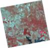
DE2_OPER_HRA_PSH_1C_20210626T111508_N38-371_W007-935_0001
Download Product | Product Info | Browse
Platform Short Name | GEOSAT |
Platform Serial Identifier | 2 |
Product Type | HRA_PSH_1C |
Start Date | 2021-06-26T11:15:08Z |
Stop Date | 2021-06-26T11:15:11Z |
Original Name | DE2_PSH_L1C_000000_20210626T111508_20210626T111511_DE2_38039_191E.zip |
Footprint | 38.3133353168 -7.82564123689 38.45412908 -7.85905841434 38.4286986349 -8.04452035327 38.2878933003 -8.01096868792 38.3133353168 -7.82564123689 |
Orbit Direction | ASCENDING |
Scene Centre Longitude | W007 |
Scene Centre Latitude | N38 |
Cloud Cover Percentage | -1 |
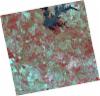
DE2_OPER_HRA_PM4_1C_20210626T111508_N38-371_W007-935_0001
Download Product | Product Info | Browse
Platform Short Name | GEOSAT |
Platform Serial Identifier | 2 |
Product Type | HRA_PM4_1C |
Start Date | 2021-06-26T11:15:08Z |
Stop Date | 2021-06-26T11:15:11Z |
Original Name | DE2_PM4_L1C_000000_20210626T111508_20210626T111511_DE2_38039_191E.zip |
Footprint | 38.3133353168 -7.82564123689 38.45412908 -7.85905841434 38.4286986349 -8.04452035327 38.2878933003 -8.01096868792 38.3133353168 -7.82564123689 |
Orbit Direction | ASCENDING |
Scene Centre Longitude | W007 |
Scene Centre Latitude | N38 |
Cloud Cover Percentage | -1 |
DE2_OPER_HRA_PSH_1C_20210626T111506_N38-243_W007-904_0001
Download Product | Product Info | Browse
Platform Short Name | GEOSAT |
Platform Serial Identifier | 2 |
Product Type | HRA_PSH_1C |
Start Date | 2021-06-26T11:15:06Z |
Stop Date | 2021-06-26T11:15:09Z |
Original Name | DE2_PSH_L1C_000000_20210626T111506_20210626T111509_DE2_38039_431D.zip |
Footprint | 38.1855652566 -7.79525679286 38.3263907049 -7.82872536047 38.300982924 -8.01385307039 38.1601246377 -7.98015787149 38.1855652566 -7.79525679286 |
Orbit Direction | ASCENDING |
Scene Centre Longitude | W007 |
Scene Centre Latitude | N38 |
Cloud Cover Percentage | -1 |
DE2_OPER_HRA_PM4_1C_20210626T111506_N38-243_W007-904_0001
Download Product | Product Info | Browse
Platform Short Name | GEOSAT |
Platform Serial Identifier | 2 |
Product Type | HRA_PM4_1C |
Start Date | 2021-06-26T11:15:06Z |
Stop Date | 2021-06-26T11:15:09Z |
Original Name | DE2_PM4_L1C_000000_20210626T111506_20210626T111509_DE2_38039_431D.zip |
Footprint | 38.1855652566 -7.79525679286 38.3263907049 -7.82872536047 38.300982924 -8.01385307039 38.1601246377 -7.98015787149 38.1855652566 -7.79525679286 |
Orbit Direction | ASCENDING |
Scene Centre Longitude | W007 |
Scene Centre Latitude | N38 |
Cloud Cover Percentage | -1 |