ESA TPM Map Catalogue - Product List
back to previous node |
list of download URLs
Collection G2_Portugal_2021
GEOSAT-2 Portugal Coverage 2021 collection. More details here.
List of available products (latitude from 38.2237 to 38.3021 dg, longitude from -8.68812 to -8.54375 dg)..
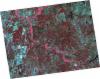
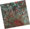
DE2_OPER_HRA_PSH_1C_20210922T112651_N38-309_W008-425_0001
Download Product | Product Info | Browse
Platform Short Name | GEOSAT |
Platform Serial Identifier | 2 |
Product Type | HRA_PSH_1C |
Start Date | 2021-09-22T11:26:51Z |
Stop Date | 2021-09-22T11:26:55Z |
Original Name | DE2_PSH_L1C_000000_20210922T112651_20210922T112655_DE2_39345_4236.zip |
Footprint | 38.2352228634 -8.25799900118 38.4124479103 -8.29180659736 38.3827947723 -8.59280866214 38.2059312288 -8.55917063758 38.2352228634 -8.25799900118 |
Orbit Direction | ASCENDING |
Scene Centre Longitude | W008 |
Scene Centre Latitude | N38 |
Cloud Cover Percentage | -1 |
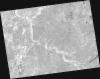
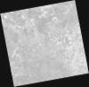
DE2_OPER_HRA_PM4_1C_20210922T112651_N38-309_W008-425_0001
Download Product | Product Info | Browse
Platform Short Name | GEOSAT |
Platform Serial Identifier | 2 |
Product Type | HRA_PM4_1C |
Start Date | 2021-09-22T11:26:51Z |
Stop Date | 2021-09-22T11:26:55Z |
Original Name | DE2_PM4_L1C_000000_20210922T112651_20210922T112655_DE2_39345_4236.zip |
Footprint | 38.2352228634 -8.25799900118 38.4124479103 -8.29180659736 38.3827947723 -8.59280866214 38.2059312288 -8.55917063758 38.2352228634 -8.25799900118 |
Orbit Direction | ASCENDING |
Scene Centre Longitude | W008 |
Scene Centre Latitude | N38 |
Cloud Cover Percentage | -1 |
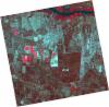
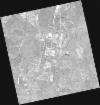
DE2_OPER_HRA_PSH_1C_20210721T111640_N38-344_W008-666_0001
Download Product | Product Info | Browse
Platform Short Name | GEOSAT |
Platform Serial Identifier | 2 |
Product Type | HRA_PSH_1C |
Start Date | 2021-07-21T11:16:40Z |
Stop Date | 2021-07-21T11:16:43Z |
Original Name | DE2_PSH_L1C_000000_20210721T111640_20210721T111643_DE2_38410_23E5.zip |
Footprint | 38.2875244369 -8.55948370088 38.4267816262 -8.59228683631 38.4015402301 -8.77374264435 38.2622982748 -8.74068901536 38.2875244369 -8.55948370088 |
Orbit Direction | ASCENDING |
Scene Centre Longitude | W008 |
Scene Centre Latitude | N38 |
Cloud Cover Percentage | -1 |
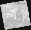
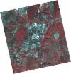
DE2_OPER_HRA_PM4_1C_20210721T111640_N38-344_W008-666_0001
Download Product | Product Info | Browse
Platform Short Name | GEOSAT |
Platform Serial Identifier | 2 |
Product Type | HRA_PM4_1C |
Start Date | 2021-07-21T11:16:40Z |
Stop Date | 2021-07-21T11:16:43Z |
Original Name | DE2_PM4_L1C_000000_20210721T111640_20210721T111643_DE2_38410_23E5.zip |
Footprint | 38.2875244369 -8.55948370088 38.4267816262 -8.59228683631 38.4015402301 -8.77374264435 38.2622982748 -8.74068901536 38.2875244369 -8.55948370088 |
Orbit Direction | ASCENDING |
Scene Centre Longitude | W008 |
Scene Centre Latitude | N38 |
Cloud Cover Percentage | -1 |
DE2_OPER_HRA_PSH_1C_20210721T111638_N38-218_W008-636_0001
Download Product | Product Info | Browse
Platform Short Name | GEOSAT |
Platform Serial Identifier | 2 |
Product Type | HRA_PSH_1C |
Start Date | 2021-07-21T11:16:38Z |
Stop Date | 2021-07-21T11:16:41Z |
Original Name | DE2_PSH_L1C_000000_20210721T111638_20210721T111641_DE2_38410_D7AA.zip |
Footprint | 38.1613671922 -8.52974909907 38.30041897 -8.56251077521 38.2751682215 -8.74383297295 38.1361445236 -8.71066021691 38.1613671922 -8.52974909907 |
Orbit Direction | ASCENDING |
Scene Centre Longitude | W008 |
Scene Centre Latitude | N38 |
Cloud Cover Percentage | -1 |
DE2_OPER_HRA_PM4_1C_20210721T111638_N38-218_W008-636_0001
Download Product | Product Info | Browse
Platform Short Name | GEOSAT |
Platform Serial Identifier | 2 |
Product Type | HRA_PM4_1C |
Start Date | 2021-07-21T11:16:38Z |
Stop Date | 2021-07-21T11:16:41Z |
Original Name | DE2_PM4_L1C_000000_20210721T111638_20210721T111641_DE2_38410_D7AA.zip |
Footprint | 38.1613671922 -8.52974909907 38.30041897 -8.56251077521 38.2751682215 -8.74383297295 38.1361445236 -8.71066021691 38.1613671922 -8.52974909907 |
Orbit Direction | ASCENDING |
Scene Centre Longitude | W008 |
Scene Centre Latitude | N38 |
Cloud Cover Percentage | -1 |
DE2_OPER_HRA_PM4_1C_20210507T111114_N38-265_W008-529_0001
Download Product | Product Info | Browse
Platform Short Name | GEOSAT |
Platform Serial Identifier | 2 |
Product Type | HRA_PM4_1C |
Start Date | 2021-05-07T11:11:14Z |
Stop Date | 2021-05-07T11:11:17Z |
Original Name | DE2_PM4_L1C_000000_20210507T111114_20210507T111117_DE2_37297_5141.zip |
Footprint | 38.2141710276 -8.43741388336 38.3409700128 -8.47118390902 38.3167493415 -8.62074389019 38.1899380088 -8.58692176228 38.2141710276 -8.43741388336 |
Orbit Direction | ASCENDING |
Scene Centre Longitude | W008 |
Scene Centre Latitude | N38 |
Cloud Cover Percentage | -1 |
DE2_OPER_HRA_PSH_1C_20210507T111114_N38-265_W008-529_0001
Download Product | Product Info | Browse
Platform Short Name | GEOSAT |
Platform Serial Identifier | 2 |
Product Type | HRA_PSH_1C |
Start Date | 2021-05-07T11:11:14Z |
Stop Date | 2021-05-07T11:11:17Z |
Original Name | DE2_PSH_L1C_000000_20210507T111114_20210507T111117_DE2_37297_5141.zip |
Footprint | 38.2141710276 -8.43741388336 38.3409700128 -8.47118390902 38.3167493415 -8.62074389019 38.1899380088 -8.58692176228 38.2141710276 -8.43741388336 |
Orbit Direction | ASCENDING |
Scene Centre Longitude | W008 |
Scene Centre Latitude | N38 |
Cloud Cover Percentage | -1 |