ESA TPM Map Catalogue - Product List
back to previous node |
list of download URLs


Collection G2_Portugal_2021
GEOSAT-2 Portugal Coverage 2021 collection. More details here.
List of available products (latitude from 38.2237 to 38.3021 dg, longitude from -8.97687 to -8.8325 dg)..
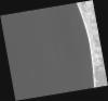
DE2_OPER_HRA_PSH_1C_20210715T112011_N38-318_W008-862_0001
Download Product | Product Info | Browse
Platform Short Name | GEOSAT |
Platform Serial Identifier | 2 |
Product Type | HRA_PSH_1C |
Start Date | 2021-07-15T11:20:11Z |
Stop Date | 2021-07-15T11:20:14Z |
Original Name | DE2_PSH_L1C_000000_20210715T112011_20210715T112014_DE2_38321_781B.zip |
Footprint | 38.2585592811 -8.74638591706 38.4034359352 -8.77892488731 38.3772679754 -8.9786079756 38.232803758 -8.94545187742 38.2585592811 -8.74638591706 |
Orbit Direction | ASCENDING |
Scene Centre Longitude | W008 |
Scene Centre Latitude | N38 |
Cloud Cover Percentage | -1 |
DE2_OPER_HRA_PM4_1C_20210715T112011_N38-318_W008-862_0001
Download Product | Product Info | Browse
Platform Short Name | GEOSAT |
Platform Serial Identifier | 2 |
Product Type | HRA_PM4_1C |
Start Date | 2021-07-15T11:20:11Z |
Stop Date | 2021-07-15T11:20:14Z |
Original Name | DE2_PM4_L1C_000000_20210715T112011_20210715T112014_DE2_38321_781B.zip |
Footprint | 38.2585592811 -8.74638591706 38.4034359352 -8.77892488731 38.3772679754 -8.9786079756 38.232803758 -8.94545187742 38.2585592811 -8.74638591706 |
Orbit Direction | ASCENDING |
Scene Centre Longitude | W008 |
Scene Centre Latitude | N38 |
Cloud Cover Percentage | -1 |
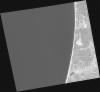
DE2_OPER_HRA_PSH_1C_20210715T112009_N38-186_W008-833_0001
Download Product | Product Info | Browse
Platform Short Name | GEOSAT |
Platform Serial Identifier | 2 |
Product Type | HRA_PSH_1C |
Start Date | 2021-07-15T11:20:09Z |
Stop Date | 2021-07-15T11:20:12Z |
Original Name | DE2_PSH_L1C_000000_20210715T112009_20210715T112012_DE2_38321_9B14.zip |
Footprint | 38.1270081223 -8.71721683469 38.2717539717 -8.74973538634 38.2475018021 -8.95262363348 38.1007923258 -8.91370317073 38.1270081223 -8.71721683469 |
Orbit Direction | ASCENDING |
Scene Centre Longitude | W008 |
Scene Centre Latitude | N38 |
Cloud Cover Percentage | -1 |
DE2_OPER_HRA_PM4_1C_20210715T112009_N38-186_W008-833_0001
Download Product | Product Info | Browse
Platform Short Name | GEOSAT |
Platform Serial Identifier | 2 |
Product Type | HRA_PM4_1C |
Start Date | 2021-07-15T11:20:09Z |
Stop Date | 2021-07-15T11:20:12Z |
Original Name | DE2_PM4_L1C_000000_20210715T112009_20210715T112012_DE2_38321_9B14.zip |
Footprint | 38.1270081223 -8.71721683469 38.2717539717 -8.74973538634 38.2475018021 -8.95262363348 38.1007923258 -8.91370317073 38.1270081223 -8.71721683469 |
Orbit Direction | ASCENDING |
Scene Centre Longitude | W008 |
Scene Centre Latitude | N38 |
Cloud Cover Percentage | -1 |
DE2_OPER_HRA_PM4_1C_20210607T110958_N38-339_W008-791_0001
Download Product | Product Info | Browse
Platform Short Name | GEOSAT |
Platform Serial Identifier | 2 |
Product Type | HRA_PM4_1C |
Start Date | 2021-06-07T11:09:58Z |
Stop Date | 2021-06-07T11:10:00Z |
Original Name | DE2_PM4_L1C_000000_20210607T110958_20210607T111000_DE2_37757_365C.zip |
Footprint | 38.2885322799 -8.70131721847 38.4140115958 -8.73532818306 38.389681336 -8.88201460472 38.264284057 -8.84778752672 38.2885322799 -8.70131721847 |
Orbit Direction | ASCENDING |
Scene Centre Longitude | W008 |
Scene Centre Latitude | N38 |
Cloud Cover Percentage | -1 |
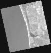
DE2_OPER_HRA_PSH_1C_20210607T110958_N38-339_W008-791_0001
Download Product | Product Info | Browse
Platform Short Name | GEOSAT |
Platform Serial Identifier | 2 |
Product Type | HRA_PSH_1C |
Start Date | 2021-06-07T11:09:58Z |
Stop Date | 2021-06-07T11:10:00Z |
Original Name | DE2_PSH_L1C_000000_20210607T110958_20210607T111000_DE2_37757_365C.zip |
Footprint | 38.2885322799 -8.70131721847 38.4140115958 -8.73532818306 38.389681336 -8.88201460472 38.264284057 -8.84778752672 38.2885322799 -8.70131721847 |
Orbit Direction | ASCENDING |
Scene Centre Longitude | W008 |
Scene Centre Latitude | N38 |
Cloud Cover Percentage | -1 |
DE2_OPER_HRA_PM4_1C_20210607T110956_N38-225_W008-760_0001
Download Product | Product Info | Browse
Platform Short Name | GEOSAT |
Platform Serial Identifier | 2 |
Product Type | HRA_PM4_1C |
Start Date | 2021-06-07T11:09:56Z |
Stop Date | 2021-06-07T11:09:58Z |
Original Name | DE2_PM4_L1C_000000_20210607T110956_20210607T110958_DE2_37757_BDAC.zip |
Footprint | 38.1746567491 -8.67091399574 38.3001866894 -8.70452029729 38.2759277132 -8.85093583285 38.1504178837 -8.81687496319 38.1746567491 -8.67091399574 |
Orbit Direction | ASCENDING |
Scene Centre Longitude | W008 |
Scene Centre Latitude | N38 |
Cloud Cover Percentage | -1 |
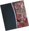
DE2_OPER_HRA_PSH_1C_20210607T110956_N38-225_W008-760_0001
Download Product | Product Info | Browse
Platform Short Name | GEOSAT |
Platform Serial Identifier | 2 |
Product Type | HRA_PSH_1C |
Start Date | 2021-06-07T11:09:56Z |
Stop Date | 2021-06-07T11:09:58Z |
Original Name | DE2_PSH_L1C_000000_20210607T110956_20210607T110958_DE2_37757_BDAC.zip |
Footprint | 38.1746567491 -8.67091399574 38.3001866894 -8.70452029729 38.2759277132 -8.85093583285 38.1504178837 -8.81687496319 38.1746567491 -8.67091399574 |
Orbit Direction | ASCENDING |
Scene Centre Longitude | W008 |
Scene Centre Latitude | N38 |
Cloud Cover Percentage | -1 |