ESA TPM Map Catalogue - Product List
back to previous node |
list of download URLs
Collection G2_Portugal_2021
GEOSAT-2 Portugal Coverage 2021 collection. More details here.
List of available products (latitude from 38.1453 to 38.2237 dg, longitude from -7.75625 to -7.61188 dg)..
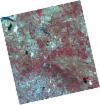
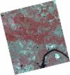
DE2_OPER_HRA_PSH_1C_20210613T110630_N38-262_W007-776_0001
Download Product | Product Info | Browse
Platform Short Name | GEOSAT |
Platform Serial Identifier | 2 |
Product Type | HRA_PSH_1C |
Start Date | 2021-06-13T11:06:30Z |
Stop Date | 2021-06-13T11:06:33Z |
Original Name | DE2_PSH_L1C_000000_20210613T110630_20210613T110633_DE2_37846_D948.zip |
Footprint | 38.2108266588 -7.6852921124 38.3376096194 -7.71938029136 38.3133933983 -7.86728098206 38.1866055825 -7.83334817144 38.2108266588 -7.6852921124 |
Orbit Direction | ASCENDING |
Scene Centre Longitude | W007 |
Scene Centre Latitude | N38 |
Cloud Cover Percentage | -1 |
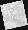
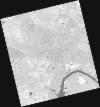
DE2_OPER_HRA_PM4_1C_20210613T110630_N38-262_W007-776_0001
Download Product | Product Info | Browse
Platform Short Name | GEOSAT |
Platform Serial Identifier | 2 |
Product Type | HRA_PM4_1C |
Start Date | 2021-06-13T11:06:30Z |
Stop Date | 2021-06-13T11:06:33Z |
Original Name | DE2_PM4_L1C_000000_20210613T110630_20210613T110633_DE2_37846_D948.zip |
Footprint | 38.2108266588 -7.6852921124 38.3376096194 -7.71938029136 38.3133933983 -7.86728098206 38.1866055825 -7.83334817144 38.2108266588 -7.6852921124 |
Orbit Direction | ASCENDING |
Scene Centre Longitude | W007 |
Scene Centre Latitude | N38 |
Cloud Cover Percentage | -1 |
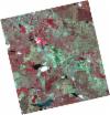
DE2_OPER_HRA_PSH_1C_20210613T110628_N38-147_W007-745_0001
Download Product | Product Info | Browse
Platform Short Name | GEOSAT |
Platform Serial Identifier | 2 |
Product Type | HRA_PSH_1C |
Start Date | 2021-06-13T11:06:28Z |
Stop Date | 2021-06-13T11:06:31Z |
Original Name | DE2_PSH_L1C_000000_20210613T110628_20210613T110631_DE2_37846_4F00.zip |
Footprint | 38.0959691944 -7.65420129969 38.222564005 -7.68864508844 38.1983117477 -7.83669020822 38.0716860043 -7.80245410288 38.0959691944 -7.65420129969 |
Orbit Direction | ASCENDING |
Scene Centre Longitude | W007 |
Scene Centre Latitude | N38 |
Cloud Cover Percentage | -1 |
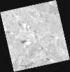
DE2_OPER_HRA_PM4_1C_20210613T110628_N38-147_W007-745_0001
Download Product | Product Info | Browse
Platform Short Name | GEOSAT |
Platform Serial Identifier | 2 |
Product Type | HRA_PM4_1C |
Start Date | 2021-06-13T11:06:28Z |
Stop Date | 2021-06-13T11:06:31Z |
Original Name | DE2_PM4_L1C_000000_20210613T110628_20210613T110631_DE2_37846_4F00.zip |
Footprint | 38.0959691944 -7.65420129969 38.222564005 -7.68864508844 38.1983117477 -7.83669020822 38.0716860043 -7.80245410288 38.0959691944 -7.65420129969 |
Orbit Direction | ASCENDING |
Scene Centre Longitude | W007 |
Scene Centre Latitude | N38 |
Cloud Cover Percentage | -1 |
DE2_OPER_HRA_PSH_1C_20210525T110111_N38-201_W007-626_0001
Download Product | Product Info | Browse
Platform Short Name | GEOSAT |
Platform Serial Identifier | 2 |
Product Type | HRA_PSH_1C |
Start Date | 2021-05-25T11:01:11Z |
Stop Date | 2021-05-25T11:01:13Z |
Original Name | DE2_PSH_L1C_000000_20210525T110111_20210525T110113_DE2_37564_8E44.zip |
Footprint | 38.151921594 -7.53888749766 38.2749765158 -7.57366944289 38.2500747063 -7.71382975848 38.1270296388 -7.67882186916 38.151921594 -7.53888749766 |
Orbit Direction | ASCENDING |
Scene Centre Longitude | W007 |
Scene Centre Latitude | N38 |
Cloud Cover Percentage | -1 |
DE2_OPER_HRA_PM4_1C_20210525T110111_N38-201_W007-626_0001
Download Product | Product Info | Browse
Platform Short Name | GEOSAT |
Platform Serial Identifier | 2 |
Product Type | HRA_PM4_1C |
Start Date | 2021-05-25T11:01:11Z |
Stop Date | 2021-05-25T11:01:13Z |
Original Name | DE2_PM4_L1C_000000_20210525T110111_20210525T110113_DE2_37564_8E44.zip |
Footprint | 38.151921594 -7.53888749766 38.2749765158 -7.57366944289 38.2500747063 -7.71382975848 38.1270296388 -7.67882186916 38.151921594 -7.53888749766 |
Orbit Direction | ASCENDING |
Scene Centre Longitude | W007 |
Scene Centre Latitude | N38 |
Cloud Cover Percentage | -1 |