ESA TPM Map Catalogue - Product List
back to previous node |
list of download URLs

Collection G2_Portugal_2021
GEOSAT-2 Portugal Coverage 2021 collection. More details here.
List of available products (latitude from 38.1453 to 38.2237 dg, longitude from -8.39938 to -8.255 dg)..
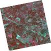
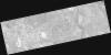
DE2_OPER_HRA_PSH_1C_20211211T110622_N38-179_W008-238_0001
Download Product | Product Info | Browse
Platform Short Name | GEOSAT |
Platform Serial Identifier | 2 |
Product Type | HRA_PSH_1C |
Start Date | 2021-12-11T11:06:22Z |
Stop Date | 2021-12-11T11:06:25Z |
Original Name | DE2_PSH_L1C_000000_20211211T110622_20211211T110625_DE2_40532_F585.zip |
Footprint | 38.1260406826 -8.14020785779 38.2582611988 -8.17346413343 38.2338268523 -8.33641582029 38.1015490526 -8.30309831373 38.1260406826 -8.14020785779 |
Orbit Direction | ASCENDING |
Scene Centre Longitude | W008 |
Scene Centre Latitude | N38 |
Cloud Cover Percentage | -1 |
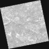
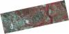
DE2_OPER_HRA_PM4_1C_20211211T110622_N38-179_W008-238_0001
Download Product | Product Info | Browse
Platform Short Name | GEOSAT |
Platform Serial Identifier | 2 |
Product Type | HRA_PM4_1C |
Start Date | 2021-12-11T11:06:22Z |
Stop Date | 2021-12-11T11:06:25Z |
Original Name | DE2_PM4_L1C_000000_20211211T110622_20211211T110625_DE2_40532_F585.zip |
Footprint | 38.1260406826 -8.14020785779 38.2582611988 -8.17346413343 38.2338268523 -8.33641582029 38.1015490526 -8.30309831373 38.1260406826 -8.14020785779 |
Orbit Direction | ASCENDING |
Scene Centre Longitude | W008 |
Scene Centre Latitude | N38 |
Cloud Cover Percentage | -1 |
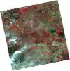
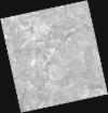
DE2_OPER_HRA_PSH_1C_20210827T111036_N38-121_W008-284_0001
Download Product | Product Info | Browse
Platform Short Name | GEOSAT |
Platform Serial Identifier | 2 |
Product Type | HRA_PSH_1C |
Start Date | 2021-08-27T11:10:36Z |
Stop Date | 2021-08-27T11:10:39Z |
Original Name | DE2_PSH_L1C_000000_20210827T111036_20210827T111039_DE2_38959_829B.zip |
Footprint | 38.0677607291 -8.18665889443 38.2006368703 -8.21962503706 38.176093048 -8.38309316881 38.0432784658 -8.34959264751 38.0677607291 -8.18665889443 |
Orbit Direction | ASCENDING |
Scene Centre Longitude | W008 |
Scene Centre Latitude | N38 |
Cloud Cover Percentage | -1 |
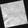
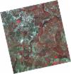
DE2_OPER_HRA_PM4_1C_20210827T111036_N38-121_W008-284_0001
Download Product | Product Info | Browse
Platform Short Name | GEOSAT |
Platform Serial Identifier | 2 |
Product Type | HRA_PM4_1C |
Start Date | 2021-08-27T11:10:36Z |
Stop Date | 2021-08-27T11:10:39Z |
Original Name | DE2_PM4_L1C_000000_20210827T111036_20210827T111039_DE2_38959_829B.zip |
Footprint | 38.0677607291 -8.18665889443 38.2006368703 -8.21962503706 38.176093048 -8.38309316881 38.0432784658 -8.34959264751 38.0677607291 -8.18665889443 |
Orbit Direction | ASCENDING |
Scene Centre Longitude | W008 |
Scene Centre Latitude | N38 |
Cloud Cover Percentage | -1 |
DE2_OPER_HRA_PM4_1C_20210708T110811_N38-219_W008-361_0001
Download Product | Product Info | Browse
Platform Short Name | GEOSAT |
Platform Serial Identifier | 2 |
Product Type | HRA_PM4_1C |
Start Date | 2021-07-08T11:08:11Z |
Stop Date | 2021-07-08T11:08:12Z |
Original Name | DE2_PM4_L1C_000000_20210708T110811_20210708T110812_DE2_38217_FF21.zip |
Footprint | 38.2126878674 -8.28198427491 38.249673237 -8.29176048607 38.225378957 -8.44043797008 38.1884181215 -8.43046086867 38.2126878674 -8.28198427491 |
Orbit Direction | ASCENDING |
Scene Centre Longitude | W008 |
Scene Centre Latitude | N38 |
Cloud Cover Percentage | -1 |
DE2_OPER_HRA_PSH_1C_20210708T110811_N38-219_W008-361_0001
Download Product | Product Info | Browse
Platform Short Name | GEOSAT |
Platform Serial Identifier | 2 |
Product Type | HRA_PSH_1C |
Start Date | 2021-07-08T11:08:11Z |
Stop Date | 2021-07-08T11:08:12Z |
Original Name | DE2_PSH_L1C_000000_20210708T110811_20210708T110812_DE2_38217_FF21.zip |
Footprint | 38.2126878674 -8.28198427491 38.249673237 -8.29176048607 38.225378957 -8.44043797008 38.1884181215 -8.43046086867 38.2126878674 -8.28198427491 |
Orbit Direction | ASCENDING |
Scene Centre Longitude | W008 |
Scene Centre Latitude | N38 |
Cloud Cover Percentage | -1 |
DE2_OPER_HRA_PM4_1C_20210708T110809_N38-148_W008-342_0001
Download Product | Product Info | Browse
Platform Short Name | GEOSAT |
Platform Serial Identifier | 2 |
Product Type | HRA_PM4_1C |
Start Date | 2021-07-08T11:08:09Z |
Stop Date | 2021-07-08T11:08:12Z |
Original Name | DE2_PM4_L1C_000000_20210708T110809_20210708T110812_DE2_38217_E748.zip |
Footprint | 38.0976758871 -8.25144572607 38.2244144013 -8.28516786231 38.200127098 -8.43361604032 38.0734418696 -8.39960439417 38.0976758871 -8.25144572607 |
Orbit Direction | ASCENDING |
Scene Centre Longitude | W008 |
Scene Centre Latitude | N38 |
Cloud Cover Percentage | -1 |
DE2_OPER_HRA_PSH_1C_20210708T110809_N38-148_W008-342_0001
Download Product | Product Info | Browse
Platform Short Name | GEOSAT |
Platform Serial Identifier | 2 |
Product Type | HRA_PSH_1C |
Start Date | 2021-07-08T11:08:09Z |
Stop Date | 2021-07-08T11:08:12Z |
Original Name | DE2_PSH_L1C_000000_20210708T110809_20210708T110812_DE2_38217_E748.zip |
Footprint | 38.0976758871 -8.25144572607 38.2244144013 -8.28516786231 38.200127098 -8.43361604032 38.0734418696 -8.39960439417 38.0976758871 -8.25144572607 |
Orbit Direction | ASCENDING |
Scene Centre Longitude | W008 |
Scene Centre Latitude | N38 |
Cloud Cover Percentage | -1 |
DE2_OPER_HRA_PM4_1C_20210331T111513_N38-236_W008-188_0001
Download Product | Product Info | Browse
Platform Short Name | GEOSAT |
Platform Serial Identifier | 2 |
Product Type | HRA_PM4_1C |
Start Date | 2021-03-31T11:15:13Z |
Stop Date | 2021-03-31T11:15:16Z |
Original Name | DE2_PM4_L1C_000000_20210331T111513_20210331T111516_DE2_36748_CBC6.zip |
Footprint | 38.1820782663 -8.08947960838 38.3155215847 -8.12274704038 38.2909137584 -8.28768921644 38.1574201887 -8.25432806411 38.1820782663 -8.08947960838 |
Orbit Direction | ASCENDING |
Scene Centre Longitude | W008 |
Scene Centre Latitude | N38 |
Cloud Cover Percentage | -1 |
DE2_OPER_HRA_PSH_1C_20210331T111513_N38-236_W008-188_0001
Download Product | Product Info | Browse
Platform Short Name | GEOSAT |
Platform Serial Identifier | 2 |
Product Type | HRA_PSH_1C |
Start Date | 2021-03-31T11:15:13Z |
Stop Date | 2021-03-31T11:15:16Z |
Original Name | DE2_PSH_L1C_000000_20210331T111513_20210331T111516_DE2_36748_CBC6.zip |
Footprint | 38.1820782663 -8.08947960838 38.3155215847 -8.12274704038 38.2909137584 -8.28768921644 38.1574201887 -8.25432806411 38.1820782663 -8.08947960838 |
Orbit Direction | ASCENDING |
Scene Centre Longitude | W008 |
Scene Centre Latitude | N38 |
Cloud Cover Percentage | -1 |