ESA TPM Map Catalogue - Product List
back to previous node |
list of download URLs
Collection G2_Portugal_2021
GEOSAT-2 Portugal Coverage 2021 collection. More details here.
List of available products (latitude from 38.1453 to 38.2237 dg, longitude from -8.54375 to -8.39938 dg)..
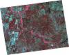
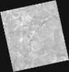
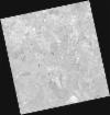
DE2_OPER_HRA_PSH_1C_20210922T112651_N38-309_W008-425_0001
Download Product | Product Info | Browse
Platform Short Name | GEOSAT |
Platform Serial Identifier | 2 |
Product Type | HRA_PSH_1C |
Start Date | 2021-09-22T11:26:51Z |
Stop Date | 2021-09-22T11:26:55Z |
Original Name | DE2_PSH_L1C_000000_20210922T112651_20210922T112655_DE2_39345_4236.zip |
Footprint | 38.2352228634 -8.25799900118 38.4124479103 -8.29180659736 38.3827947723 -8.59280866214 38.2059312288 -8.55917063758 38.2352228634 -8.25799900118 |
Orbit Direction | ASCENDING |
Scene Centre Longitude | W008 |
Scene Centre Latitude | N38 |
Cloud Cover Percentage | -1 |
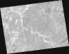
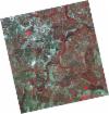
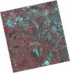
DE2_OPER_HRA_PM4_1C_20210922T112651_N38-309_W008-425_0001
Download Product | Product Info | Browse
Platform Short Name | GEOSAT |
Platform Serial Identifier | 2 |
Product Type | HRA_PM4_1C |
Start Date | 2021-09-22T11:26:51Z |
Stop Date | 2021-09-22T11:26:55Z |
Original Name | DE2_PM4_L1C_000000_20210922T112651_20210922T112655_DE2_39345_4236.zip |
Footprint | 38.2352228634 -8.25799900118 38.4124479103 -8.29180659736 38.3827947723 -8.59280866214 38.2059312288 -8.55917063758 38.2352228634 -8.25799900118 |
Orbit Direction | ASCENDING |
Scene Centre Longitude | W008 |
Scene Centre Latitude | N38 |
Cloud Cover Percentage | -1 |
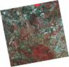
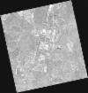
DE2_OPER_HRA_PSH_1C_20210721T111638_N38-218_W008-636_0001
Download Product | Product Info | Browse
Platform Short Name | GEOSAT |
Platform Serial Identifier | 2 |
Product Type | HRA_PSH_1C |
Start Date | 2021-07-21T11:16:38Z |
Stop Date | 2021-07-21T11:16:41Z |
Original Name | DE2_PSH_L1C_000000_20210721T111638_20210721T111641_DE2_38410_D7AA.zip |
Footprint | 38.1613671922 -8.52974909907 38.30041897 -8.56251077521 38.2751682215 -8.74383297295 38.1361445236 -8.71066021691 38.1613671922 -8.52974909907 |
Orbit Direction | ASCENDING |
Scene Centre Longitude | W008 |
Scene Centre Latitude | N38 |
Cloud Cover Percentage | -1 |
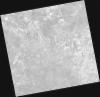
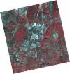
DE2_OPER_HRA_PM4_1C_20210721T111638_N38-218_W008-636_0001
Download Product | Product Info | Browse
Platform Short Name | GEOSAT |
Platform Serial Identifier | 2 |
Product Type | HRA_PM4_1C |
Start Date | 2021-07-21T11:16:38Z |
Stop Date | 2021-07-21T11:16:41Z |
Original Name | DE2_PM4_L1C_000000_20210721T111638_20210721T111641_DE2_38410_D7AA.zip |
Footprint | 38.1613671922 -8.52974909907 38.30041897 -8.56251077521 38.2751682215 -8.74383297295 38.1361445236 -8.71066021691 38.1613671922 -8.52974909907 |
Orbit Direction | ASCENDING |
Scene Centre Longitude | W008 |
Scene Centre Latitude | N38 |
Cloud Cover Percentage | -1 |
DE2_OPER_HRA_PSH_1C_20210721T111636_N38-092_W008-606_0001
Download Product | Product Info | Browse
Platform Short Name | GEOSAT |
Platform Serial Identifier | 2 |
Product Type | HRA_PSH_1C |
Start Date | 2021-07-21T11:16:36Z |
Stop Date | 2021-07-21T11:16:39Z |
Original Name | DE2_PSH_L1C_000000_20210721T111636_20210721T111639_DE2_38410_79A6.zip |
Footprint | 38.0351456004 -8.4999440573 38.1743103579 -8.53285124014 38.1490560248 -8.71377632119 38.0098470921 -8.68127211137 38.0351456004 -8.4999440573 |
Orbit Direction | ASCENDING |
Scene Centre Longitude | W008 |
Scene Centre Latitude | N38 |
Cloud Cover Percentage | -1 |
DE2_OPER_HRA_PM4_1C_20210721T111636_N38-092_W008-606_0001
Download Product | Product Info | Browse
Platform Short Name | GEOSAT |
Platform Serial Identifier | 2 |
Product Type | HRA_PM4_1C |
Start Date | 2021-07-21T11:16:36Z |
Stop Date | 2021-07-21T11:16:39Z |
Original Name | DE2_PM4_L1C_000000_20210721T111636_20210721T111639_DE2_38410_79A6.zip |
Footprint | 38.0351456004 -8.4999440573 38.1743103579 -8.53285124014 38.1490560248 -8.71377632119 38.0098470921 -8.68127211137 38.0351456004 -8.4999440573 |
Orbit Direction | ASCENDING |
Scene Centre Longitude | W008 |
Scene Centre Latitude | N38 |
Cloud Cover Percentage | -1 |
DE2_OPER_HRA_PM4_1C_20210708T110811_N38-219_W008-361_0001
Download Product | Product Info | Browse
Platform Short Name | GEOSAT |
Platform Serial Identifier | 2 |
Product Type | HRA_PM4_1C |
Start Date | 2021-07-08T11:08:11Z |
Stop Date | 2021-07-08T11:08:12Z |
Original Name | DE2_PM4_L1C_000000_20210708T110811_20210708T110812_DE2_38217_FF21.zip |
Footprint | 38.2126878674 -8.28198427491 38.249673237 -8.29176048607 38.225378957 -8.44043797008 38.1884181215 -8.43046086867 38.2126878674 -8.28198427491 |
Orbit Direction | ASCENDING |
Scene Centre Longitude | W008 |
Scene Centre Latitude | N38 |
Cloud Cover Percentage | -1 |
DE2_OPER_HRA_PSH_1C_20210708T110811_N38-219_W008-361_0001
Download Product | Product Info | Browse
Platform Short Name | GEOSAT |
Platform Serial Identifier | 2 |
Product Type | HRA_PSH_1C |
Start Date | 2021-07-08T11:08:11Z |
Stop Date | 2021-07-08T11:08:12Z |
Original Name | DE2_PSH_L1C_000000_20210708T110811_20210708T110812_DE2_38217_FF21.zip |
Footprint | 38.2126878674 -8.28198427491 38.249673237 -8.29176048607 38.225378957 -8.44043797008 38.1884181215 -8.43046086867 38.2126878674 -8.28198427491 |
Orbit Direction | ASCENDING |
Scene Centre Longitude | W008 |
Scene Centre Latitude | N38 |
Cloud Cover Percentage | -1 |
DE2_OPER_HRA_PM4_1C_20210708T110809_N38-148_W008-342_0001
Download Product | Product Info | Browse
Platform Short Name | GEOSAT |
Platform Serial Identifier | 2 |
Product Type | HRA_PM4_1C |
Start Date | 2021-07-08T11:08:09Z |
Stop Date | 2021-07-08T11:08:12Z |
Original Name | DE2_PM4_L1C_000000_20210708T110809_20210708T110812_DE2_38217_E748.zip |
Footprint | 38.0976758871 -8.25144572607 38.2244144013 -8.28516786231 38.200127098 -8.43361604032 38.0734418696 -8.39960439417 38.0976758871 -8.25144572607 |
Orbit Direction | ASCENDING |
Scene Centre Longitude | W008 |
Scene Centre Latitude | N38 |
Cloud Cover Percentage | -1 |
DE2_OPER_HRA_PSH_1C_20210708T110809_N38-148_W008-342_0001
Download Product | Product Info | Browse
Platform Short Name | GEOSAT |
Platform Serial Identifier | 2 |
Product Type | HRA_PSH_1C |
Start Date | 2021-07-08T11:08:09Z |
Stop Date | 2021-07-08T11:08:12Z |
Original Name | DE2_PSH_L1C_000000_20210708T110809_20210708T110812_DE2_38217_E748.zip |
Footprint | 38.0976758871 -8.25144572607 38.2244144013 -8.28516786231 38.200127098 -8.43361604032 38.0734418696 -8.39960439417 38.0976758871 -8.25144572607 |
Orbit Direction | ASCENDING |
Scene Centre Longitude | W008 |
Scene Centre Latitude | N38 |
Cloud Cover Percentage | -1 |
DE2_OPER_HRA_PM4_1C_20210507T111114_N38-265_W008-529_0001
Download Product | Product Info | Browse
Platform Short Name | GEOSAT |
Platform Serial Identifier | 2 |
Product Type | HRA_PM4_1C |
Start Date | 2021-05-07T11:11:14Z |
Stop Date | 2021-05-07T11:11:17Z |
Original Name | DE2_PM4_L1C_000000_20210507T111114_20210507T111117_DE2_37297_5141.zip |
Footprint | 38.2141710276 -8.43741388336 38.3409700128 -8.47118390902 38.3167493415 -8.62074389019 38.1899380088 -8.58692176228 38.2141710276 -8.43741388336 |
Orbit Direction | ASCENDING |
Scene Centre Longitude | W008 |
Scene Centre Latitude | N38 |
Cloud Cover Percentage | -1 |
DE2_OPER_HRA_PSH_1C_20210507T111114_N38-265_W008-529_0001
Download Product | Product Info | Browse
Platform Short Name | GEOSAT |
Platform Serial Identifier | 2 |
Product Type | HRA_PSH_1C |
Start Date | 2021-05-07T11:11:14Z |
Stop Date | 2021-05-07T11:11:17Z |
Original Name | DE2_PSH_L1C_000000_20210507T111114_20210507T111117_DE2_37297_5141.zip |
Footprint | 38.2141710276 -8.43741388336 38.3409700128 -8.47118390902 38.3167493415 -8.62074389019 38.1899380088 -8.58692176228 38.2141710276 -8.43741388336 |
Orbit Direction | ASCENDING |
Scene Centre Longitude | W008 |
Scene Centre Latitude | N38 |
Cloud Cover Percentage | -1 |
DE2_OPER_HRA_PM4_1C_20210507T111112_N38-150_W008-498_0001
Download Product | Product Info | Browse
Platform Short Name | GEOSAT |
Platform Serial Identifier | 2 |
Product Type | HRA_PM4_1C |
Start Date | 2021-05-07T11:11:12Z |
Stop Date | 2021-05-07T11:11:15Z |
Original Name | DE2_PM4_L1C_000000_20210507T111112_20210507T111115_DE2_37297_4F8C.zip |
Footprint | 38.0992318467 -8.40675827714 38.2259470474 -8.44050216738 38.2017033152 -8.58997326779 38.0749498613 -8.55652047692 38.0992318467 -8.40675827714 |
Orbit Direction | ASCENDING |
Scene Centre Longitude | W008 |
Scene Centre Latitude | N38 |
Cloud Cover Percentage | -1 |
DE2_OPER_HRA_PSH_1C_20210507T111112_N38-150_W008-498_0001
Download Product | Product Info | Browse
Platform Short Name | GEOSAT |
Platform Serial Identifier | 2 |
Product Type | HRA_PSH_1C |
Start Date | 2021-05-07T11:11:12Z |
Stop Date | 2021-05-07T11:11:15Z |
Original Name | DE2_PSH_L1C_000000_20210507T111112_20210507T111115_DE2_37297_4F8C.zip |
Footprint | 38.0992318467 -8.40675827714 38.2259470474 -8.44050216738 38.2017033152 -8.58997326779 38.0749498613 -8.55652047692 38.0992318467 -8.40675827714 |
Orbit Direction | ASCENDING |
Scene Centre Longitude | W008 |
Scene Centre Latitude | N38 |
Cloud Cover Percentage | -1 |