ESA TPM Map Catalogue - Product List
back to previous node |
list of download URLs


Collection G2_Portugal_2021
GEOSAT-2 Portugal Coverage 2021 collection. More details here.
List of available products (latitude from 38.1096 to 38.1881 dg, longitude from -7.4675 to -7.32313 dg)..
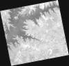
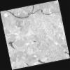
DE2_OPER_HRA_PSH_1C_20210727T111305_N38-260_W007-354_0001
Download Product | Product Info | Browse
Platform Short Name | GEOSAT |
Platform Serial Identifier | 2 |
Product Type | HRA_PSH_1C |
Start Date | 2021-07-27T11:13:05Z |
Stop Date | 2021-07-27T11:13:07Z |
Original Name | DE2_PSH_L1C_000000_20210727T111305_20210727T111307_DE2_38499_5EA9.zip |
Footprint | 38.2019167676 -7.24210881497 38.3451788739 -7.27531238326 38.3194448462 -7.468253723 38.1762949323 -7.43407010326 38.2019167676 -7.24210881497 |
Orbit Direction | ASCENDING |
Scene Centre Longitude | W007 |
Scene Centre Latitude | N38 |
Cloud Cover Percentage | -1 |
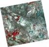
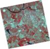
DE2_OPER_HRA_PM4_1C_20210727T111305_N38-260_W007-354_0001
Download Product | Product Info | Browse
Platform Short Name | GEOSAT |
Platform Serial Identifier | 2 |
Product Type | HRA_PM4_1C |
Start Date | 2021-07-27T11:13:05Z |
Stop Date | 2021-07-27T11:13:07Z |
Original Name | DE2_PM4_L1C_000000_20210727T111305_20210727T111307_DE2_38499_5EA9.zip |
Footprint | 38.2019167676 -7.24210881497 38.3451788739 -7.27531238326 38.3194448462 -7.468253723 38.1762949323 -7.43407010326 38.2019167676 -7.24210881497 |
Orbit Direction | ASCENDING |
Scene Centre Longitude | W007 |
Scene Centre Latitude | N38 |
Cloud Cover Percentage | -1 |
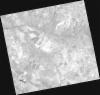
DE2_OPER_HRA_PSH_1C_20210727T111302_N38-130_W007-324_0001
Download Product | Product Info | Browse
Platform Short Name | GEOSAT |
Platform Serial Identifier | 2 |
Product Type | HRA_PSH_1C |
Start Date | 2021-07-27T11:13:02Z |
Stop Date | 2021-07-27T11:13:05Z |
Original Name | DE2_PSH_L1C_000000_20210727T111302_20210727T111305_DE2_38499_08EE.zip |
Footprint | 38.0719995337 -7.21206756788 38.2152096352 -7.24517276452 38.1895337521 -7.43748616457 38.0462891474 -7.40410039759 38.0719995337 -7.21206756788 |
Orbit Direction | ASCENDING |
Scene Centre Longitude | W007 |
Scene Centre Latitude | N38 |
Cloud Cover Percentage | -1 |
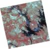
DE2_OPER_HRA_PM4_1C_20210727T111302_N38-130_W007-324_0001
Download Product | Product Info | Browse
Platform Short Name | GEOSAT |
Platform Serial Identifier | 2 |
Product Type | HRA_PM4_1C |
Start Date | 2021-07-27T11:13:02Z |
Stop Date | 2021-07-27T11:13:05Z |
Original Name | DE2_PM4_L1C_000000_20210727T111302_20210727T111305_DE2_38499_08EE.zip |
Footprint | 38.0719995337 -7.21206756788 38.2152096352 -7.24517276452 38.1895337521 -7.43748616457 38.0462891474 -7.40410039759 38.0719995337 -7.21206756788 |
Orbit Direction | ASCENDING |
Scene Centre Longitude | W007 |
Scene Centre Latitude | N38 |
Cloud Cover Percentage | -1 |
DE2_OPER_HRA_PSH_1C_20210702T111138_N38-239_W007-513_0001
Download Product | Product Info | Browse
Platform Short Name | GEOSAT |
Platform Serial Identifier | 2 |
Product Type | HRA_PSH_1C |
Start Date | 2021-07-02T11:11:38Z |
Stop Date | 2021-07-02T11:11:40Z |
Original Name | DE2_PSH_L1C_000000_20210702T111138_20210702T111140_DE2_38128_B985.zip |
Footprint | 38.1830796635 -7.40934915246 38.3205885196 -7.44270665462 38.2955502642 -7.61825815117 38.1580659545 -7.58416798315 38.1830796635 -7.40934915246 |
Orbit Direction | ASCENDING |
Scene Centre Longitude | W007 |
Scene Centre Latitude | N38 |
Cloud Cover Percentage | -1 |
DE2_OPER_HRA_PM4_1C_20210702T111138_N38-239_W007-513_0001
Download Product | Product Info | Browse
Platform Short Name | GEOSAT |
Platform Serial Identifier | 2 |
Product Type | HRA_PM4_1C |
Start Date | 2021-07-02T11:11:38Z |
Stop Date | 2021-07-02T11:11:40Z |
Original Name | DE2_PM4_L1C_000000_20210702T111138_20210702T111140_DE2_38128_B985.zip |
Footprint | 38.1830796635 -7.40934915246 38.3205885196 -7.44270665462 38.2955502642 -7.61825815117 38.1580659545 -7.58416798315 38.1830796635 -7.40934915246 |
Orbit Direction | ASCENDING |
Scene Centre Longitude | W007 |
Scene Centre Latitude | N38 |
Cloud Cover Percentage | -1 |
DE2_OPER_HRA_PM4_1C_20210702T111136_N38-114_W007-483_0001
Download Product | Product Info | Browse
Platform Short Name | GEOSAT |
Platform Serial Identifier | 2 |
Product Type | HRA_PM4_1C |
Start Date | 2021-07-02T11:11:36Z |
Stop Date | 2021-07-02T11:11:38Z |
Original Name | DE2_PM4_L1C_000000_20210702T111136_20210702T111138_DE2_38128_C326.zip |
Footprint | 38.0581625872 -7.37974474019 38.1957827588 -7.41258421295 38.1708551471 -7.58707126418 38.0332096926 -7.55395660035 38.0581625872 -7.37974474019 |
Orbit Direction | ASCENDING |
Scene Centre Longitude | W007 |
Scene Centre Latitude | N38 |
Cloud Cover Percentage | -1 |
DE2_OPER_HRA_PSH_1C_20210702T111136_N38-114_W007-483_0001
Download Product | Product Info | Browse
Platform Short Name | GEOSAT |
Platform Serial Identifier | 2 |
Product Type | HRA_PSH_1C |
Start Date | 2021-07-02T11:11:36Z |
Stop Date | 2021-07-02T11:11:38Z |
Original Name | DE2_PSH_L1C_000000_20210702T111136_20210702T111138_DE2_38128_C326.zip |
Footprint | 38.0581625872 -7.37974474019 38.1957827588 -7.41258421295 38.1708551471 -7.58707126418 38.0332096926 -7.55395660035 38.0581625872 -7.37974474019 |
Orbit Direction | ASCENDING |
Scene Centre Longitude | W007 |
Scene Centre Latitude | N38 |
Cloud Cover Percentage | -1 |