ESA TPM Map Catalogue - Product List
back to previous node |
list of download URLs

Collection G2_Portugal_2021
GEOSAT-2 Portugal Coverage 2021 collection. More details here.
List of available products (latitude from 38.1096 to 38.1881 dg, longitude from -8.8325 to -8.68812 dg)..
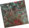
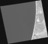
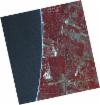
DE2_OPER_HRA_PSH_1C_20210721T111638_N38-218_W008-636_0001
Download Product | Product Info | Browse
Platform Short Name | GEOSAT |
Platform Serial Identifier | 2 |
Product Type | HRA_PSH_1C |
Start Date | 2021-07-21T11:16:38Z |
Stop Date | 2021-07-21T11:16:41Z |
Original Name | DE2_PSH_L1C_000000_20210721T111638_20210721T111641_DE2_38410_D7AA.zip |
Footprint | 38.1613671922 -8.52974909907 38.30041897 -8.56251077521 38.2751682215 -8.74383297295 38.1361445236 -8.71066021691 38.1613671922 -8.52974909907 |
Orbit Direction | ASCENDING |
Scene Centre Longitude | W008 |
Scene Centre Latitude | N38 |
Cloud Cover Percentage | -1 |
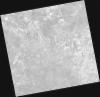
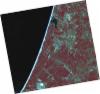
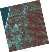
DE2_OPER_HRA_PM4_1C_20210721T111638_N38-218_W008-636_0001
Download Product | Product Info | Browse
Platform Short Name | GEOSAT |
Platform Serial Identifier | 2 |
Product Type | HRA_PM4_1C |
Start Date | 2021-07-21T11:16:38Z |
Stop Date | 2021-07-21T11:16:41Z |
Original Name | DE2_PM4_L1C_000000_20210721T111638_20210721T111641_DE2_38410_D7AA.zip |
Footprint | 38.1613671922 -8.52974909907 38.30041897 -8.56251077521 38.2751682215 -8.74383297295 38.1361445236 -8.71066021691 38.1613671922 -8.52974909907 |
Orbit Direction | ASCENDING |
Scene Centre Longitude | W008 |
Scene Centre Latitude | N38 |
Cloud Cover Percentage | -1 |
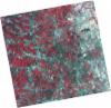
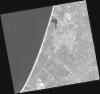
DE2_OPER_HRA_PSH_1C_20210721T111636_N38-092_W008-606_0001
Download Product | Product Info | Browse
Platform Short Name | GEOSAT |
Platform Serial Identifier | 2 |
Product Type | HRA_PSH_1C |
Start Date | 2021-07-21T11:16:36Z |
Stop Date | 2021-07-21T11:16:39Z |
Original Name | DE2_PSH_L1C_000000_20210721T111636_20210721T111639_DE2_38410_79A6.zip |
Footprint | 38.0351456004 -8.4999440573 38.1743103579 -8.53285124014 38.1490560248 -8.71377632119 38.0098470921 -8.68127211137 38.0351456004 -8.4999440573 |
Orbit Direction | ASCENDING |
Scene Centre Longitude | W008 |
Scene Centre Latitude | N38 |
Cloud Cover Percentage | -1 |
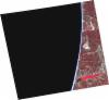
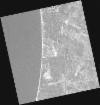
DE2_OPER_HRA_PM4_1C_20210721T111636_N38-092_W008-606_0001
Download Product | Product Info | Browse
Platform Short Name | GEOSAT |
Platform Serial Identifier | 2 |
Product Type | HRA_PM4_1C |
Start Date | 2021-07-21T11:16:36Z |
Stop Date | 2021-07-21T11:16:39Z |
Original Name | DE2_PM4_L1C_000000_20210721T111636_20210721T111639_DE2_38410_79A6.zip |
Footprint | 38.0351456004 -8.4999440573 38.1743103579 -8.53285124014 38.1490560248 -8.71377632119 38.0098470921 -8.68127211137 38.0351456004 -8.4999440573 |
Orbit Direction | ASCENDING |
Scene Centre Longitude | W008 |
Scene Centre Latitude | N38 |
Cloud Cover Percentage | -1 |
DE2_OPER_HRA_PSH_1C_20210715T112009_N38-186_W008-833_0001
Download Product | Product Info | Browse
Platform Short Name | GEOSAT |
Platform Serial Identifier | 2 |
Product Type | HRA_PSH_1C |
Start Date | 2021-07-15T11:20:09Z |
Stop Date | 2021-07-15T11:20:12Z |
Original Name | DE2_PSH_L1C_000000_20210715T112009_20210715T112012_DE2_38321_9B14.zip |
Footprint | 38.1270081223 -8.71721683469 38.2717539717 -8.74973538634 38.2475018021 -8.95262363348 38.1007923258 -8.91370317073 38.1270081223 -8.71721683469 |
Orbit Direction | ASCENDING |
Scene Centre Longitude | W008 |
Scene Centre Latitude | N38 |
Cloud Cover Percentage | -1 |
DE2_OPER_HRA_PM4_1C_20210715T112009_N38-186_W008-833_0001
Download Product | Product Info | Browse
Platform Short Name | GEOSAT |
Platform Serial Identifier | 2 |
Product Type | HRA_PM4_1C |
Start Date | 2021-07-15T11:20:09Z |
Stop Date | 2021-07-15T11:20:12Z |
Original Name | DE2_PM4_L1C_000000_20210715T112009_20210715T112012_DE2_38321_9B14.zip |
Footprint | 38.1270081223 -8.71721683469 38.2717539717 -8.74973538634 38.2475018021 -8.95262363348 38.1007923258 -8.91370317073 38.1270081223 -8.71721683469 |
Orbit Direction | ASCENDING |
Scene Centre Longitude | W008 |
Scene Centre Latitude | N38 |
Cloud Cover Percentage | -1 |
DE2_OPER_HRA_PSH_1C_20210715T112007_N38-055_W008-801_0001
Download Product | Product Info | Browse
Platform Short Name | GEOSAT |
Platform Serial Identifier | 2 |
Product Type | HRA_PSH_1C |
Start Date | 2021-07-15T11:20:07Z |
Stop Date | 2021-07-15T11:20:09Z |
Original Name | DE2_PSH_L1C_000000_20210715T112007_20210715T112009_DE2_38321_3519.zip |
Footprint | 37.9954672813 -8.6880738634 38.1403775024 -8.71965583011 38.1143201577 -8.91643363412 37.9698251805 -8.88322766718 37.9954672813 -8.6880738634 |
Orbit Direction | ASCENDING |
Scene Centre Longitude | W008 |
Scene Centre Latitude | N38 |
Cloud Cover Percentage | -1 |
DE2_OPER_HRA_PM4_1C_20210715T112007_N38-055_W008-801_0001
Download Product | Product Info | Browse
Platform Short Name | GEOSAT |
Platform Serial Identifier | 2 |
Product Type | HRA_PM4_1C |
Start Date | 2021-07-15T11:20:07Z |
Stop Date | 2021-07-15T11:20:09Z |
Original Name | DE2_PM4_L1C_000000_20210715T112007_20210715T112009_DE2_38321_3519.zip |
Footprint | 37.9954672813 -8.6880738634 38.1403775024 -8.71965583011 38.1143201577 -8.91643363412 37.9698251805 -8.88322766718 37.9954672813 -8.6880738634 |
Orbit Direction | ASCENDING |
Scene Centre Longitude | W008 |
Scene Centre Latitude | N38 |
Cloud Cover Percentage | -1 |
DE2_OPER_HRA_PM4_1C_20210607T110956_N38-225_W008-760_0001
Download Product | Product Info | Browse
Platform Short Name | GEOSAT |
Platform Serial Identifier | 2 |
Product Type | HRA_PM4_1C |
Start Date | 2021-06-07T11:09:56Z |
Stop Date | 2021-06-07T11:09:58Z |
Original Name | DE2_PM4_L1C_000000_20210607T110956_20210607T110958_DE2_37757_BDAC.zip |
Footprint | 38.1746567491 -8.67091399574 38.3001866894 -8.70452029729 38.2759277132 -8.85093583285 38.1504178837 -8.81687496319 38.1746567491 -8.67091399574 |
Orbit Direction | ASCENDING |
Scene Centre Longitude | W008 |
Scene Centre Latitude | N38 |
Cloud Cover Percentage | -1 |
DE2_OPER_HRA_PSH_1C_20210607T110956_N38-225_W008-760_0001
Download Product | Product Info | Browse
Platform Short Name | GEOSAT |
Platform Serial Identifier | 2 |
Product Type | HRA_PSH_1C |
Start Date | 2021-06-07T11:09:56Z |
Stop Date | 2021-06-07T11:09:58Z |
Original Name | DE2_PSH_L1C_000000_20210607T110956_20210607T110958_DE2_37757_BDAC.zip |
Footprint | 38.1746567491 -8.67091399574 38.3001866894 -8.70452029729 38.2759277132 -8.85093583285 38.1504178837 -8.81687496319 38.1746567491 -8.67091399574 |
Orbit Direction | ASCENDING |
Scene Centre Longitude | W008 |
Scene Centre Latitude | N38 |
Cloud Cover Percentage | -1 |
DE2_OPER_HRA_PSH_1C_20210607T110954_N38-111_W008-730_0001
Download Product | Product Info | Browse
Platform Short Name | GEOSAT |
Platform Serial Identifier | 2 |
Product Type | HRA_PSH_1C |
Start Date | 2021-06-07T11:09:54Z |
Stop Date | 2021-06-07T11:09:57Z |
Original Name | DE2_PSH_L1C_000000_20210607T110954_20210607T110957_DE2_37757_1B6C.zip |
Footprint | 38.0606428468 -8.64050205476 38.1862849674 -8.67404752514 38.1620693442 -8.82002205343 38.0364607025 -8.78616047861 38.0606428468 -8.64050205476 |
Orbit Direction | ASCENDING |
Scene Centre Longitude | W008 |
Scene Centre Latitude | N38 |
Cloud Cover Percentage | -1 |
DE2_OPER_HRA_PM4_1C_20210607T110954_N38-111_W008-730_0001
Download Product | Product Info | Browse
Platform Short Name | GEOSAT |
Platform Serial Identifier | 2 |
Product Type | HRA_PM4_1C |
Start Date | 2021-06-07T11:09:54Z |
Stop Date | 2021-06-07T11:09:57Z |
Original Name | DE2_PM4_L1C_000000_20210607T110954_20210607T110957_DE2_37757_1B6C.zip |
Footprint | 38.0606428468 -8.64050205476 38.1862849674 -8.67404752514 38.1620693442 -8.82002205343 38.0364607025 -8.78616047861 38.0606428468 -8.64050205476 |
Orbit Direction | ASCENDING |
Scene Centre Longitude | W008 |
Scene Centre Latitude | N38 |
Cloud Cover Percentage | -1 |