ESA TPM Map Catalogue - Product List
back to previous node |
list of download URLs
Collection G2_Portugal_2021
GEOSAT-2 Portugal Coverage 2021 collection. More details here.
List of available products (latitude from 38.0312 to 38.1096 dg, longitude from -7.90062 to -7.75625 dg)..
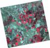
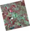
DE2_OPER_HRA_PSH_1C_20210626T111504_N38-115_W007-874_0001
Download Product | Product Info | Browse
Platform Short Name | GEOSAT |
Platform Serial Identifier | 2 |
Product Type | HRA_PSH_1C |
Start Date | 2021-06-26T11:15:04Z |
Stop Date | 2021-06-26T11:15:07Z |
Original Name | DE2_PSH_L1C_000000_20210626T111504_20210626T111507_DE2_38039_E838.zip |
Footprint | 38.0576861935 -7.76508540879 38.1985759038 -7.79849415164 38.1732023775 -7.98311798349 38.032275401 -7.94979241581 38.0576861935 -7.76508540879 |
Orbit Direction | ASCENDING |
Scene Centre Longitude | W007 |
Scene Centre Latitude | N38 |
Cloud Cover Percentage | -1 |
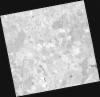
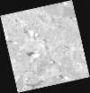
DE2_OPER_HRA_PM4_1C_20210626T111504_N38-115_W007-874_0001
Download Product | Product Info | Browse
Platform Short Name | GEOSAT |
Platform Serial Identifier | 2 |
Product Type | HRA_PM4_1C |
Start Date | 2021-06-26T11:15:04Z |
Stop Date | 2021-06-26T11:15:07Z |
Original Name | DE2_PM4_L1C_000000_20210626T111504_20210626T111507_DE2_38039_E838.zip |
Footprint | 38.0576861935 -7.76508540879 38.1985759038 -7.79849415164 38.1732023775 -7.98311798349 38.032275401 -7.94979241581 38.0576861935 -7.76508540879 |
Orbit Direction | ASCENDING |
Scene Centre Longitude | W007 |
Scene Centre Latitude | N38 |
Cloud Cover Percentage | -1 |
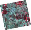
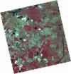
DE2_OPER_HRA_PSH_1C_20210626T111502_N37-987_W007-843_0001
Download Product | Product Info | Browse
Platform Short Name | GEOSAT |
Platform Serial Identifier | 2 |
Product Type | HRA_PSH_1C |
Start Date | 2021-06-26T11:15:02Z |
Stop Date | 2021-06-26T11:15:05Z |
Original Name | DE2_PSH_L1C_000000_20210626T111502_20210626T111505_DE2_38039_89AB.zip |
Footprint | 37.9299295227 -7.73462671074 38.0707692338 -7.76803755862 38.0453345957 -7.95283676686 37.9045025058 -7.91925310505 37.9299295227 -7.73462671074 |
Orbit Direction | ASCENDING |
Scene Centre Longitude | W007 |
Scene Centre Latitude | N37 |
Cloud Cover Percentage | -1 |
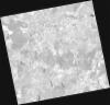
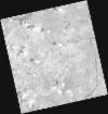
DE2_OPER_HRA_PM4_1C_20210626T111502_N37-987_W007-843_0001
Download Product | Product Info | Browse
Platform Short Name | GEOSAT |
Platform Serial Identifier | 2 |
Product Type | HRA_PM4_1C |
Start Date | 2021-06-26T11:15:02Z |
Stop Date | 2021-06-26T11:15:05Z |
Original Name | DE2_PM4_L1C_000000_20210626T111502_20210626T111505_DE2_38039_89AB.zip |
Footprint | 37.9299295227 -7.73462671074 38.0707692338 -7.76803755862 38.0453345957 -7.95283676686 37.9045025058 -7.91925310505 37.9299295227 -7.73462671074 |
Orbit Direction | ASCENDING |
Scene Centre Longitude | W007 |
Scene Centre Latitude | N37 |
Cloud Cover Percentage | -1 |
DE2_OPER_HRA_PSH_1C_20210613T110628_N38-147_W007-745_0001
Download Product | Product Info | Browse
Platform Short Name | GEOSAT |
Platform Serial Identifier | 2 |
Product Type | HRA_PSH_1C |
Start Date | 2021-06-13T11:06:28Z |
Stop Date | 2021-06-13T11:06:31Z |
Original Name | DE2_PSH_L1C_000000_20210613T110628_20210613T110631_DE2_37846_4F00.zip |
Footprint | 38.0959691944 -7.65420129969 38.222564005 -7.68864508844 38.1983117477 -7.83669020822 38.0716860043 -7.80245410288 38.0959691944 -7.65420129969 |
Orbit Direction | ASCENDING |
Scene Centre Longitude | W007 |
Scene Centre Latitude | N38 |
Cloud Cover Percentage | -1 |
DE2_OPER_HRA_PM4_1C_20210613T110628_N38-147_W007-745_0001
Download Product | Product Info | Browse
Platform Short Name | GEOSAT |
Platform Serial Identifier | 2 |
Product Type | HRA_PM4_1C |
Start Date | 2021-06-13T11:06:28Z |
Stop Date | 2021-06-13T11:06:31Z |
Original Name | DE2_PM4_L1C_000000_20210613T110628_20210613T110631_DE2_37846_4F00.zip |
Footprint | 38.0959691944 -7.65420129969 38.222564005 -7.68864508844 38.1983117477 -7.83669020822 38.0716860043 -7.80245410288 38.0959691944 -7.65420129969 |
Orbit Direction | ASCENDING |
Scene Centre Longitude | W007 |
Scene Centre Latitude | N38 |
Cloud Cover Percentage | -1 |
DE2_OPER_HRA_PSH_1C_20210613T110626_N38-032_W007-714_0001
Download Product | Product Info | Browse
Platform Short Name | GEOSAT |
Platform Serial Identifier | 2 |
Product Type | HRA_PSH_1C |
Start Date | 2021-06-13T11:06:26Z |
Stop Date | 2021-06-13T11:06:29Z |
Original Name | DE2_PSH_L1C_000000_20210613T110626_20210613T110629_DE2_37846_0534.zip |
Footprint | 37.9809150747 -7.62388070089 38.1077008031 -7.65755322883 38.0834248976 -7.80558922155 37.9566582325 -7.77183294189 37.9809150747 -7.62388070089 |
Orbit Direction | ASCENDING |
Scene Centre Longitude | W007 |
Scene Centre Latitude | N38 |
Cloud Cover Percentage | -1 |
DE2_OPER_HRA_PM4_1C_20210613T110626_N38-032_W007-714_0001
Download Product | Product Info | Browse
Platform Short Name | GEOSAT |
Platform Serial Identifier | 2 |
Product Type | HRA_PM4_1C |
Start Date | 2021-06-13T11:06:26Z |
Stop Date | 2021-06-13T11:06:29Z |
Original Name | DE2_PM4_L1C_000000_20210613T110626_20210613T110629_DE2_37846_0534.zip |
Footprint | 37.9809150747 -7.62388070089 38.1077008031 -7.65755322883 38.0834248976 -7.80558922155 37.9566582325 -7.77183294189 37.9809150747 -7.62388070089 |
Orbit Direction | ASCENDING |
Scene Centre Longitude | W007 |
Scene Centre Latitude | N38 |
Cloud Cover Percentage | -1 |