ESA TPM Map Catalogue - Product List
back to previous node |
list of download URLs

Collection G2_Portugal_2021
GEOSAT-2 Portugal Coverage 2021 collection. More details here.
List of available products (latitude from 38.0312 to 38.1096 dg, longitude from -8.18938 to -8.045 dg)..
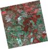
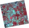
DE2_OPER_HRA_PSH_1C_20211211T110620_N38-059_W008-208_0001
Download Product | Product Info | Browse
Platform Short Name | GEOSAT |
Platform Serial Identifier | 2 |
Product Type | HRA_PSH_1C |
Start Date | 2021-12-11T11:06:20Z |
Stop Date | 2021-12-11T11:06:23Z |
Original Name | DE2_PSH_L1C_000000_20211211T110620_20211211T110623_DE2_40532_B6CB.zip |
Footprint | 38.0060298116 -8.11055803082 38.1382773984 -8.14329930994 38.1138149342 -8.30610452369 37.9816412032 -8.27278918994 38.0060298116 -8.11055803082 |
Orbit Direction | ASCENDING |
Scene Centre Longitude | W008 |
Scene Centre Latitude | N38 |
Cloud Cover Percentage | -1 |
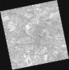
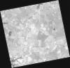
DE2_OPER_HRA_PM4_1C_20211211T110620_N38-059_W008-208_0001
Download Product | Product Info | Browse
Platform Short Name | GEOSAT |
Platform Serial Identifier | 2 |
Product Type | HRA_PM4_1C |
Start Date | 2021-12-11T11:06:20Z |
Stop Date | 2021-12-11T11:06:23Z |
Original Name | DE2_PM4_L1C_000000_20211211T110620_20211211T110623_DE2_40532_B6CB.zip |
Footprint | 38.0060298116 -8.11055803082 38.1382773984 -8.14329930994 38.1138149342 -8.30610452369 37.9816412032 -8.27278918994 38.0060298116 -8.11055803082 |
Orbit Direction | ASCENDING |
Scene Centre Longitude | W008 |
Scene Centre Latitude | N38 |
Cloud Cover Percentage | -1 |
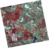
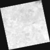
DE2_OPER_HRA_PSH_1C_20210921T111121_N38-126_W008-027_0001
Download Product | Product Info | Browse
Platform Short Name | GEOSAT |
Platform Serial Identifier | 2 |
Product Type | HRA_PSH_1C |
Start Date | 2021-09-21T11:11:21Z |
Stop Date | 2021-09-21T11:11:24Z |
Original Name | DE2_PSH_L1C_000000_20210921T111121_20210921T111124_DE2_39330_EEA5.zip |
Footprint | 38.0703333972 -7.92248628511 38.2082293338 -7.95549260828 38.183231563 -8.131983066 38.0453217161 -8.09891994375 38.0703333972 -7.92248628511 |
Orbit Direction | ASCENDING |
Scene Centre Longitude | W008 |
Scene Centre Latitude | N38 |
Cloud Cover Percentage | -1 |
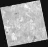
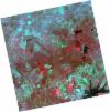
DE2_OPER_HRA_PM4_1C_20210921T111121_N38-126_W008-027_0001
Download Product | Product Info | Browse
Platform Short Name | GEOSAT |
Platform Serial Identifier | 2 |
Product Type | HRA_PM4_1C |
Start Date | 2021-09-21T11:11:21Z |
Stop Date | 2021-09-21T11:11:24Z |
Original Name | DE2_PM4_L1C_000000_20210921T111121_20210921T111124_DE2_39330_EEA5.zip |
Footprint | 38.0703333972 -7.92248628511 38.2082293338 -7.95549260828 38.183231563 -8.131983066 38.0453217161 -8.09891994375 38.0703333972 -7.92248628511 |
Orbit Direction | ASCENDING |
Scene Centre Longitude | W008 |
Scene Centre Latitude | N38 |
Cloud Cover Percentage | -1 |
DE2_OPER_HRA_PSH_1C_20210921T111119_N38-001_W007-997_0001
Download Product | Product Info | Browse
Platform Short Name | GEOSAT |
Platform Serial Identifier | 2 |
Product Type | HRA_PSH_1C |
Start Date | 2021-09-21T11:11:19Z |
Stop Date | 2021-09-21T11:11:22Z |
Original Name | DE2_PSH_L1C_000000_20210921T111119_20210921T111122_DE2_39330_35A8.zip |
Footprint | 37.9449873495 -7.89261808922 38.083136192 -7.92551383915 38.0581196868 -8.10188337699 37.9200205976 -8.06847831209 37.9449873495 -7.89261808922 |
Orbit Direction | ASCENDING |
Scene Centre Longitude | W007 |
Scene Centre Latitude | N38 |
Cloud Cover Percentage | -1 |
DE2_OPER_HRA_PM4_1C_20210921T111119_N38-001_W007-997_0001
Download Product | Product Info | Browse
Platform Short Name | GEOSAT |
Platform Serial Identifier | 2 |
Product Type | HRA_PM4_1C |
Start Date | 2021-09-21T11:11:19Z |
Stop Date | 2021-09-21T11:11:22Z |
Original Name | DE2_PM4_L1C_000000_20210921T111119_20210921T111122_DE2_39330_35A8.zip |
Footprint | 37.9449873495 -7.89261808922 38.083136192 -7.92551383915 38.0581196868 -8.10188337699 37.9200205976 -8.06847831209 37.9449873495 -7.89261808922 |
Orbit Direction | ASCENDING |
Scene Centre Longitude | W007 |
Scene Centre Latitude | N38 |
Cloud Cover Percentage | -1 |
DE2_OPER_HRA_PM4_1C_20210331T111511_N38-115_W008-158_0001
Download Product | Product Info | Browse
Platform Short Name | GEOSAT |
Platform Serial Identifier | 2 |
Product Type | HRA_PM4_1C |
Start Date | 2021-03-31T11:15:11Z |
Stop Date | 2021-03-31T11:15:14Z |
Original Name | DE2_PM4_L1C_000000_20210331T111511_20210331T111514_DE2_36748_09C2.zip |
Footprint | 38.0611614835 -8.05954455766 38.1944499739 -8.09239177702 38.1697949062 -8.25726720208 38.0365665508 -8.2237537389 38.0611614835 -8.05954455766 |
Orbit Direction | ASCENDING |
Scene Centre Longitude | W008 |
Scene Centre Latitude | N38 |
Cloud Cover Percentage | -1 |
DE2_OPER_HRA_PSH_1C_20210331T111511_N38-115_W008-158_0001
Download Product | Product Info | Browse
Platform Short Name | GEOSAT |
Platform Serial Identifier | 2 |
Product Type | HRA_PSH_1C |
Start Date | 2021-03-31T11:15:11Z |
Stop Date | 2021-03-31T11:15:14Z |
Original Name | DE2_PSH_L1C_000000_20210331T111511_20210331T111514_DE2_36748_09C2.zip |
Footprint | 38.0611614835 -8.05954455766 38.1944499739 -8.09239177702 38.1697949062 -8.25726720208 38.0365665508 -8.2237537389 38.0611614835 -8.05954455766 |
Orbit Direction | ASCENDING |
Scene Centre Longitude | W008 |
Scene Centre Latitude | N38 |
Cloud Cover Percentage | -1 |
DE2_OPER_HRA_PSH_1C_20210331T111509_N37-994_W008-128_0001
Download Product | Product Info | Browse
Platform Short Name | GEOSAT |
Platform Serial Identifier | 2 |
Product Type | HRA_PSH_1C |
Start Date | 2021-03-31T11:15:09Z |
Stop Date | 2021-03-31T11:15:12Z |
Original Name | DE2_PSH_L1C_000000_20210331T111509_20210331T111512_DE2_36748_3840.zip |
Footprint | 37.9403627263 -8.02950590415 38.0735406802 -8.06243009377 38.0489163241 -8.22686299396 37.9157475507 -8.19377085222 37.9403627263 -8.02950590415 |
Orbit Direction | ASCENDING |
Scene Centre Longitude | W008 |
Scene Centre Latitude | N37 |
Cloud Cover Percentage | -1 |
DE2_OPER_HRA_PM4_1C_20210331T111509_N37-994_W008-128_0001
Download Product | Product Info | Browse
Platform Short Name | GEOSAT |
Platform Serial Identifier | 2 |
Product Type | HRA_PM4_1C |
Start Date | 2021-03-31T11:15:09Z |
Stop Date | 2021-03-31T11:15:12Z |
Original Name | DE2_PM4_L1C_000000_20210331T111509_20210331T111512_DE2_36748_3840.zip |
Footprint | 37.9403627263 -8.02950590415 38.0735406802 -8.06243009377 38.0489163241 -8.22686299396 37.9157475507 -8.19377085222 37.9403627263 -8.02950590415 |
Orbit Direction | ASCENDING |
Scene Centre Longitude | W008 |
Scene Centre Latitude | N37 |
Cloud Cover Percentage | -1 |