ESA TPM Map Catalogue - Product List
back to previous node |
list of download URLs


Collection G2_Portugal_2021
GEOSAT-2 Portugal Coverage 2021 collection. More details here.
List of available products (latitude from 37.9528 to 38.0312 dg, longitude from -7.61188 to -7.4675 dg)..
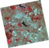
DE2_OPER_HRA_PSH_1C_20210702T111134_N37-989_W007-453_0001
Download Product | Product Info | Browse
Platform Short Name | GEOSAT |
Platform Serial Identifier | 2 |
Product Type | HRA_PSH_1C |
Start Date | 2021-07-02T11:11:34Z |
Stop Date | 2021-07-02T11:11:36Z |
Original Name | DE2_PSH_L1C_000000_20210702T111134_20210702T111136_DE2_38128_5746.zip |
Footprint | 37.9334937053 -7.34920368708 38.0709043564 -7.38277242409 38.045941078 -7.55703098613 37.908493206 -7.5237869322 37.9334937053 -7.34920368708 |
Orbit Direction | ASCENDING |
Scene Centre Longitude | W007 |
Scene Centre Latitude | N37 |
Cloud Cover Percentage | -1 |
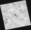
DE2_OPER_HRA_PM4_1C_20210702T111134_N37-989_W007-453_0001
Download Product | Product Info | Browse
Platform Short Name | GEOSAT |
Platform Serial Identifier | 2 |
Product Type | HRA_PM4_1C |
Start Date | 2021-07-02T11:11:34Z |
Stop Date | 2021-07-02T11:11:36Z |
Original Name | DE2_PM4_L1C_000000_20210702T111134_20210702T111136_DE2_38128_5746.zip |
Footprint | 37.9334937053 -7.34920368708 38.0709043564 -7.38277242409 38.045941078 -7.55703098613 37.908493206 -7.5237869322 37.9334937053 -7.34920368708 |
Orbit Direction | ASCENDING |
Scene Centre Longitude | W007 |
Scene Centre Latitude | N37 |
Cloud Cover Percentage | -1 |
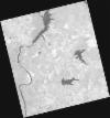
DE2_OPER_HRA_PSH_1C_20210525T110109_N38-089_W007-594_0001
Download Product | Product Info | Browse
Platform Short Name | GEOSAT |
Platform Serial Identifier | 2 |
Product Type | HRA_PSH_1C |
Start Date | 2021-05-25T11:01:09Z |
Stop Date | 2021-05-25T11:01:11Z |
Original Name | DE2_PSH_L1C_000000_20210525T110109_20210525T110111_DE2_37564_8405.zip |
Footprint | 38.0401496819 -7.5073278027 38.1633313995 -7.54220391608 38.1384492476 -7.68214184409 38.0153040205 -7.64701465806 38.0401496819 -7.5073278027 |
Orbit Direction | ASCENDING |
Scene Centre Longitude | W007 |
Scene Centre Latitude | N38 |
Cloud Cover Percentage | -1 |
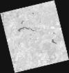
DE2_OPER_HRA_PM4_1C_20210525T110109_N38-089_W007-594_0001
Download Product | Product Info | Browse
Platform Short Name | GEOSAT |
Platform Serial Identifier | 2 |
Product Type | HRA_PM4_1C |
Start Date | 2021-05-25T11:01:09Z |
Stop Date | 2021-05-25T11:01:11Z |
Original Name | DE2_PM4_L1C_000000_20210525T110109_20210525T110111_DE2_37564_8405.zip |
Footprint | 38.0401496819 -7.5073278027 38.1633313995 -7.54220391608 38.1384492476 -7.68214184409 38.0153040205 -7.64701465806 38.0401496819 -7.5073278027 |
Orbit Direction | ASCENDING |
Scene Centre Longitude | W007 |
Scene Centre Latitude | N38 |
Cloud Cover Percentage | -1 |
DE2_OPER_HRA_PSH_1C_20210525T110107_N37-977_W007-562_0001
Download Product | Product Info | Browse
Platform Short Name | GEOSAT |
Platform Serial Identifier | 2 |
Product Type | HRA_PSH_1C |
Start Date | 2021-05-25T11:01:07Z |
Stop Date | 2021-05-25T11:01:10Z |
Original Name | DE2_PSH_L1C_000000_20210525T110107_20210525T110110_DE2_37564_B5D6.zip |
Footprint | 37.9284742784 -7.4756174757 38.0515529766 -7.51058366896 38.0266968353 -7.65026582331 37.9036345433 -7.61507603271 37.9284742784 -7.4756174757 |
Orbit Direction | ASCENDING |
Scene Centre Longitude | W007 |
Scene Centre Latitude | N37 |
Cloud Cover Percentage | -1 |
DE2_OPER_HRA_PM4_1C_20210525T110107_N37-977_W007-562_0001
Download Product | Product Info | Browse
Platform Short Name | GEOSAT |
Platform Serial Identifier | 2 |
Product Type | HRA_PM4_1C |
Start Date | 2021-05-25T11:01:07Z |
Stop Date | 2021-05-25T11:01:10Z |
Original Name | DE2_PM4_L1C_000000_20210525T110107_20210525T110110_DE2_37564_B5D6.zip |
Footprint | 37.9284742784 -7.4756174757 38.0515529766 -7.51058366896 38.0266968353 -7.65026582331 37.9036345433 -7.61507603271 37.9284742784 -7.4756174757 |
Orbit Direction | ASCENDING |
Scene Centre Longitude | W007 |
Scene Centre Latitude | N37 |
Cloud Cover Percentage | -1 |