ESA TPM Map Catalogue - Product List
back to previous node |
list of download URLs
Collection G2_Portugal_2021
GEOSAT-2 Portugal Coverage 2021 collection. More details here.
List of available products (latitude from 37.9528 to 38.0312 dg, longitude from -8.39938 to -8.255 dg)..
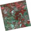
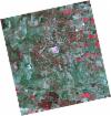
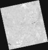
DE2_OPER_HRA_PSH_1C_20211211T110620_N38-059_W008-208_0001
Download Product | Product Info | Browse
Platform Short Name | GEOSAT |
Platform Serial Identifier | 2 |
Product Type | HRA_PSH_1C |
Start Date | 2021-12-11T11:06:20Z |
Stop Date | 2021-12-11T11:06:23Z |
Original Name | DE2_PSH_L1C_000000_20211211T110620_20211211T110623_DE2_40532_B6CB.zip |
Footprint | 38.0060298116 -8.11055803082 38.1382773984 -8.14329930994 38.1138149342 -8.30610452369 37.9816412032 -8.27278918994 38.0060298116 -8.11055803082 |
Orbit Direction | ASCENDING |
Scene Centre Longitude | W008 |
Scene Centre Latitude | N38 |
Cloud Cover Percentage | -1 |
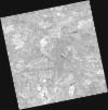
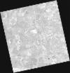
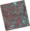
DE2_OPER_HRA_PM4_1C_20211211T110620_N38-059_W008-208_0001
Download Product | Product Info | Browse
Platform Short Name | GEOSAT |
Platform Serial Identifier | 2 |
Product Type | HRA_PM4_1C |
Start Date | 2021-12-11T11:06:20Z |
Stop Date | 2021-12-11T11:06:23Z |
Original Name | DE2_PM4_L1C_000000_20211211T110620_20211211T110623_DE2_40532_B6CB.zip |
Footprint | 38.0060298116 -8.11055803082 38.1382773984 -8.14329930994 38.1138149342 -8.30610452369 37.9816412032 -8.27278918994 38.0060298116 -8.11055803082 |
Orbit Direction | ASCENDING |
Scene Centre Longitude | W008 |
Scene Centre Latitude | N38 |
Cloud Cover Percentage | -1 |
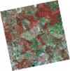
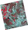
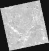
DE2_OPER_HRA_PSH_1C_20211211T110618_N37-940_W008-178_0001
Download Product | Product Info | Browse
Platform Short Name | GEOSAT |
Platform Serial Identifier | 2 |
Product Type | HRA_PSH_1C |
Start Date | 2021-12-11T11:06:18Z |
Stop Date | 2021-12-11T11:06:21Z |
Original Name | DE2_PSH_L1C_000000_20211211T110618_20211211T110621_DE2_40532_02B0.zip |
Footprint | 37.8861437091 -8.08077757977 38.0182927288 -8.11340887139 37.9938480183 -8.27592300448 37.8616395041 -8.24307942888 37.8861437091 -8.08077757977 |
Orbit Direction | ASCENDING |
Scene Centre Longitude | W008 |
Scene Centre Latitude | N37 |
Cloud Cover Percentage | -1 |
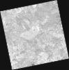
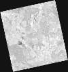
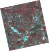
DE2_OPER_HRA_PM4_1C_20211211T110618_N37-940_W008-178_0001
Download Product | Product Info | Browse
Platform Short Name | GEOSAT |
Platform Serial Identifier | 2 |
Product Type | HRA_PM4_1C |
Start Date | 2021-12-11T11:06:18Z |
Stop Date | 2021-12-11T11:06:21Z |
Original Name | DE2_PM4_L1C_000000_20211211T110618_20211211T110621_DE2_40532_02B0.zip |
Footprint | 37.8861437091 -8.08077757977 38.0182927288 -8.11340887139 37.9938480183 -8.27592300448 37.8616395041 -8.24307942888 37.8861437091 -8.08077757977 |
Orbit Direction | ASCENDING |
Scene Centre Longitude | W008 |
Scene Centre Latitude | N37 |
Cloud Cover Percentage | -1 |
DE2_OPER_HRA_PSH_1C_20210708T110807_N38-033_W008-311_0001
Download Product | Product Info | Browse
Platform Short Name | GEOSAT |
Platform Serial Identifier | 2 |
Product Type | HRA_PSH_1C |
Start Date | 2021-07-08T11:08:07Z |
Stop Date | 2021-07-08T11:08:10Z |
Original Name | DE2_PSH_L1C_000000_20210708T110807_20210708T110810_DE2_38217_D92C.zip |
Footprint | 37.9824526569 -8.22110451762 38.1094098093 -8.25456831773 38.0851584948 -8.40273275979 37.9582336883 -8.36896351772 37.9824526569 -8.22110451762 |
Orbit Direction | ASCENDING |
Scene Centre Longitude | W008 |
Scene Centre Latitude | N38 |
Cloud Cover Percentage | -1 |
DE2_OPER_HRA_PM4_1C_20210708T110807_N38-033_W008-311_0001
Download Product | Product Info | Browse
Platform Short Name | GEOSAT |
Platform Serial Identifier | 2 |
Product Type | HRA_PM4_1C |
Start Date | 2021-07-08T11:08:07Z |
Stop Date | 2021-07-08T11:08:10Z |
Original Name | DE2_PM4_L1C_000000_20210708T110807_20210708T110810_DE2_38217_D92C.zip |
Footprint | 37.9824526569 -8.22110451762 38.1094098093 -8.25456831773 38.0851584948 -8.40273275979 37.9582336883 -8.36896351772 37.9824526569 -8.22110451762 |
Orbit Direction | ASCENDING |
Scene Centre Longitude | W008 |
Scene Centre Latitude | N38 |
Cloud Cover Percentage | -1 |
DE2_OPER_HRA_PSH_1C_20210708T110805_N37-918_W008-281_0001
Download Product | Product Info | Browse
Platform Short Name | GEOSAT |
Platform Serial Identifier | 2 |
Product Type | HRA_PSH_1C |
Start Date | 2021-07-08T11:08:05Z |
Stop Date | 2021-07-08T11:08:08Z |
Original Name | DE2_PSH_L1C_000000_20210708T110805_20210708T110808_DE2_38217_7A0E.zip |
Footprint | 37.8674111352 -8.19106615092 37.9941940992 -8.22419198324 37.9699716417 -8.37209925677 37.8431929938 -8.33861028056 37.8674111352 -8.19106615092 |
Orbit Direction | ASCENDING |
Scene Centre Longitude | W008 |
Scene Centre Latitude | N37 |
Cloud Cover Percentage | -1 |
DE2_OPER_HRA_PM4_1C_20210708T110805_N37-918_W008-281_0001
Download Product | Product Info | Browse
Platform Short Name | GEOSAT |
Platform Serial Identifier | 2 |
Product Type | HRA_PM4_1C |
Start Date | 2021-07-08T11:08:05Z |
Stop Date | 2021-07-08T11:08:08Z |
Original Name | DE2_PM4_L1C_000000_20210708T110805_20210708T110808_DE2_38217_7A0E.zip |
Footprint | 37.8674111352 -8.19106615092 37.9941940992 -8.22419198324 37.9699716417 -8.37209925677 37.8431929938 -8.33861028056 37.8674111352 -8.19106615092 |
Orbit Direction | ASCENDING |
Scene Centre Longitude | W008 |
Scene Centre Latitude | N37 |
Cloud Cover Percentage | -1 |
DE2_OPER_HRA_PM4_1C_20210507T111110_N38-035_W008-467_0001
Download Product | Product Info | Browse
Platform Short Name | GEOSAT |
Platform Serial Identifier | 2 |
Product Type | HRA_PM4_1C |
Start Date | 2021-05-07T11:11:10Z |
Stop Date | 2021-05-07T11:11:13Z |
Original Name | DE2_PM4_L1C_000000_20210507T111110_20210507T111113_DE2_37297_59B5.zip |
Footprint | 37.9840545569 -8.37641174566 38.1109822164 -8.40992278015 38.0867161936 -8.55957959084 37.9598075098 -8.52553046435 37.9840545569 -8.37641174566 |
Orbit Direction | ASCENDING |
Scene Centre Longitude | W008 |
Scene Centre Latitude | N38 |
Cloud Cover Percentage | -1 |
DE2_OPER_HRA_PSH_1C_20210507T111110_N38-035_W008-467_0001
Download Product | Product Info | Browse
Platform Short Name | GEOSAT |
Platform Serial Identifier | 2 |
Product Type | HRA_PSH_1C |
Start Date | 2021-05-07T11:11:10Z |
Stop Date | 2021-05-07T11:11:13Z |
Original Name | DE2_PSH_L1C_000000_20210507T111110_20210507T111113_DE2_37297_59B5.zip |
Footprint | 37.9840545569 -8.37641174566 38.1109822164 -8.40992278015 38.0867161936 -8.55957959084 37.9598075098 -8.52553046435 37.9840545569 -8.37641174566 |
Orbit Direction | ASCENDING |
Scene Centre Longitude | W008 |
Scene Centre Latitude | N38 |
Cloud Cover Percentage | -1 |
DE2_OPER_HRA_PSH_1C_20210507T111109_N37-920_W008-437_0001
Download Product | Product Info | Browse
Platform Short Name | GEOSAT |
Platform Serial Identifier | 2 |
Product Type | HRA_PSH_1C |
Start Date | 2021-05-07T11:11:09Z |
Stop Date | 2021-05-07T11:11:11Z |
Original Name | DE2_PSH_L1C_000000_20210507T111109_20210507T111111_DE2_37297_5E68.zip |
Footprint | 37.8688610912 -8.34612350314 37.9957920099 -8.37949846699 37.9715417364 -8.52875955268 37.8446765674 -8.49483969837 37.8688610912 -8.34612350314 |
Orbit Direction | ASCENDING |
Scene Centre Longitude | W008 |
Scene Centre Latitude | N37 |
Cloud Cover Percentage | -1 |
DE2_OPER_HRA_PM4_1C_20210507T111109_N37-920_W008-437_0001
Download Product | Product Info | Browse
Platform Short Name | GEOSAT |
Platform Serial Identifier | 2 |
Product Type | HRA_PM4_1C |
Start Date | 2021-05-07T11:11:09Z |
Stop Date | 2021-05-07T11:11:11Z |
Original Name | DE2_PM4_L1C_000000_20210507T111109_20210507T111111_DE2_37297_5E68.zip |
Footprint | 37.8688610912 -8.34612350314 37.9957920099 -8.37949846699 37.9715417364 -8.52875955268 37.8446765674 -8.49483969837 37.8688610912 -8.34612350314 |
Orbit Direction | ASCENDING |
Scene Centre Longitude | W008 |
Scene Centre Latitude | N37 |
Cloud Cover Percentage | -1 |