ESA TPM Map Catalogue - Product List
back to previous node |
list of download URLs

Collection G2_Portugal_2021
GEOSAT-2 Portugal Coverage 2021 collection. More details here.
List of available products (latitude from 37.9528 to 38.0312 dg, longitude from -8.68812 to -8.54375 dg)..
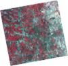
DE2_OPER_HRA_PSH_1C_20210721T111636_N38-092_W008-606_0001
Download Product | Product Info | Browse
Platform Short Name | GEOSAT |
Platform Serial Identifier | 2 |
Product Type | HRA_PSH_1C |
Start Date | 2021-07-21T11:16:36Z |
Stop Date | 2021-07-21T11:16:39Z |
Original Name | DE2_PSH_L1C_000000_20210721T111636_20210721T111639_DE2_38410_79A6.zip |
Footprint | 38.0351456004 -8.4999440573 38.1743103579 -8.53285124014 38.1490560248 -8.71377632119 38.0098470921 -8.68127211137 38.0351456004 -8.4999440573 |
Orbit Direction | ASCENDING |
Scene Centre Longitude | W008 |
Scene Centre Latitude | N38 |
Cloud Cover Percentage | -1 |
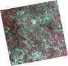
DE2_OPER_HRA_PM4_1C_20210721T111636_N38-092_W008-606_0001
Download Product | Product Info | Browse
Platform Short Name | GEOSAT |
Platform Serial Identifier | 2 |
Product Type | HRA_PM4_1C |
Start Date | 2021-07-21T11:16:36Z |
Stop Date | 2021-07-21T11:16:39Z |
Original Name | DE2_PM4_L1C_000000_20210721T111636_20210721T111639_DE2_38410_79A6.zip |
Footprint | 38.0351456004 -8.4999440573 38.1743103579 -8.53285124014 38.1490560248 -8.71377632119 38.0098470921 -8.68127211137 38.0351456004 -8.4999440573 |
Orbit Direction | ASCENDING |
Scene Centre Longitude | W008 |
Scene Centre Latitude | N38 |
Cloud Cover Percentage | -1 |
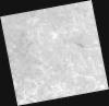
DE2_OPER_HRA_PSH_1C_20210721T111634_N37-965_W008-576_0001
Download Product | Product Info | Browse
Platform Short Name | GEOSAT |
Platform Serial Identifier | 2 |
Product Type | HRA_PSH_1C |
Start Date | 2021-07-21T11:16:34Z |
Stop Date | 2021-07-21T11:16:37Z |
Original Name | DE2_PSH_L1C_000000_20210721T111634_20210721T111637_DE2_38410_6775.zip |
Footprint | 37.9088231904 -8.46948014883 38.0480488048 -8.50294209141 38.0227257842 -8.6843694409 37.8835623871 -8.65038818103 37.9088231904 -8.46948014883 |
Orbit Direction | ASCENDING |
Scene Centre Longitude | W008 |
Scene Centre Latitude | N37 |
Cloud Cover Percentage | -1 |
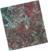
DE2_OPER_HRA_PM4_1C_20210721T111634_N37-965_W008-576_0001
Download Product | Product Info | Browse
Platform Short Name | GEOSAT |
Platform Serial Identifier | 2 |
Product Type | HRA_PM4_1C |
Start Date | 2021-07-21T11:16:34Z |
Stop Date | 2021-07-21T11:16:37Z |
Original Name | DE2_PM4_L1C_000000_20210721T111634_20210721T111637_DE2_38410_6775.zip |
Footprint | 37.9088231904 -8.46948014883 38.0480488048 -8.50294209141 38.0227257842 -8.6843694409 37.8835623871 -8.65038818103 37.9088231904 -8.46948014883 |
Orbit Direction | ASCENDING |
Scene Centre Longitude | W008 |
Scene Centre Latitude | N37 |
Cloud Cover Percentage | -1 |
DE2_OPER_HRA_PSH_1C_20210607T110952_N37-997_W008-699_0001
Download Product | Product Info | Browse
Platform Short Name | GEOSAT |
Platform Serial Identifier | 2 |
Product Type | HRA_PSH_1C |
Start Date | 2021-06-07T11:09:52Z |
Stop Date | 2021-06-07T11:09:55Z |
Original Name | DE2_PSH_L1C_000000_20210607T110952_20210607T110955_DE2_37757_75E6.zip |
Footprint | 37.9466788369 -8.60977294526 38.0722857553 -8.6436858144 38.0481063173 -8.78923807051 37.9224597051 -8.75549767705 37.9466788369 -8.60977294526 |
Orbit Direction | ASCENDING |
Scene Centre Longitude | W008 |
Scene Centre Latitude | N37 |
Cloud Cover Percentage | -1 |
DE2_OPER_HRA_PM4_1C_20210607T110952_N37-997_W008-699_0001
Download Product | Product Info | Browse
Platform Short Name | GEOSAT |
Platform Serial Identifier | 2 |
Product Type | HRA_PM4_1C |
Start Date | 2021-06-07T11:09:52Z |
Stop Date | 2021-06-07T11:09:55Z |
Original Name | DE2_PM4_L1C_000000_20210607T110952_20210607T110955_DE2_37757_75E6.zip |
Footprint | 37.9466788369 -8.60977294526 38.0722857553 -8.6436858144 38.0481063173 -8.78923807051 37.9224597051 -8.75549767705 37.9466788369 -8.60977294526 |
Orbit Direction | ASCENDING |
Scene Centre Longitude | W008 |
Scene Centre Latitude | N37 |
Cloud Cover Percentage | -1 |