ESA TPM Map Catalogue - Product List
back to previous node |
list of download URLs

Collection G2_Portugal_2021
GEOSAT-2 Portugal Coverage 2021 collection. More details here.
List of available products (latitude from 37.8744 to 37.9528 dg, longitude from -7.61188 to -7.4675 dg)..
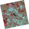
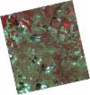
DE2_OPER_HRA_PSH_1C_20210702T111134_N37-989_W007-453_0001
Download Product | Product Info | Browse
Platform Short Name | GEOSAT |
Platform Serial Identifier | 2 |
Product Type | HRA_PSH_1C |
Start Date | 2021-07-02T11:11:34Z |
Stop Date | 2021-07-02T11:11:36Z |
Original Name | DE2_PSH_L1C_000000_20210702T111134_20210702T111136_DE2_38128_5746.zip |
Footprint | 37.9334937053 -7.34920368708 38.0709043564 -7.38277242409 38.045941078 -7.55703098613 37.908493206 -7.5237869322 37.9334937053 -7.34920368708 |
Orbit Direction | ASCENDING |
Scene Centre Longitude | W007 |
Scene Centre Latitude | N37 |
Cloud Cover Percentage | -1 |
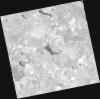
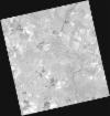
DE2_OPER_HRA_PM4_1C_20210702T111134_N37-989_W007-453_0001
Download Product | Product Info | Browse
Platform Short Name | GEOSAT |
Platform Serial Identifier | 2 |
Product Type | HRA_PM4_1C |
Start Date | 2021-07-02T11:11:34Z |
Stop Date | 2021-07-02T11:11:36Z |
Original Name | DE2_PM4_L1C_000000_20210702T111134_20210702T111136_DE2_38128_5746.zip |
Footprint | 37.9334937053 -7.34920368708 38.0709043564 -7.38277242409 38.045941078 -7.55703098613 37.908493206 -7.5237869322 37.9334937053 -7.34920368708 |
Orbit Direction | ASCENDING |
Scene Centre Longitude | W007 |
Scene Centre Latitude | N37 |
Cloud Cover Percentage | -1 |
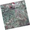
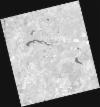
DE2_OPER_HRA_PSH_1C_20210702T111132_N37-865_W007-422_0001
Download Product | Product Info | Browse
Platform Short Name | GEOSAT |
Platform Serial Identifier | 2 |
Product Type | HRA_PSH_1C |
Start Date | 2021-07-02T11:11:32Z |
Stop Date | 2021-07-02T11:11:34Z |
Original Name | DE2_PSH_L1C_000000_20210702T111132_20210702T111134_DE2_38128_E90B.zip |
Footprint | 37.8090146654 -7.31889001951 37.9462326328 -7.35244372028 37.9212261759 -7.52691129764 37.7840294958 -7.49297455303 37.8090146654 -7.31889001951 |
Orbit Direction | ASCENDING |
Scene Centre Longitude | W007 |
Scene Centre Latitude | N37 |
Cloud Cover Percentage | -1 |
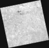
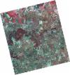
DE2_OPER_HRA_PM4_1C_20210702T111132_N37-865_W007-422_0001
Download Product | Product Info | Browse
Platform Short Name | GEOSAT |
Platform Serial Identifier | 2 |
Product Type | HRA_PM4_1C |
Start Date | 2021-07-02T11:11:32Z |
Stop Date | 2021-07-02T11:11:34Z |
Original Name | DE2_PM4_L1C_000000_20210702T111132_20210702T111134_DE2_38128_E90B.zip |
Footprint | 37.8090146654 -7.31889001951 37.9462326328 -7.35244372028 37.9212261759 -7.52691129764 37.7840294958 -7.49297455303 37.8090146654 -7.31889001951 |
Orbit Direction | ASCENDING |
Scene Centre Longitude | W007 |
Scene Centre Latitude | N37 |
Cloud Cover Percentage | -1 |
DE2_OPER_HRA_PSH_1C_20210613T110625_N37-917_W007-684_0001
Download Product | Product Info | Browse
Platform Short Name | GEOSAT |
Platform Serial Identifier | 2 |
Product Type | HRA_PSH_1C |
Start Date | 2021-06-13T11:06:25Z |
Stop Date | 2021-06-13T11:06:27Z |
Original Name | DE2_PSH_L1C_000000_20210613T110625_20210613T110627_DE2_37846_2E34.zip |
Footprint | 37.8658371358 -7.59347063734 37.9926649618 -7.62697506864 37.9684105392 -7.77486462384 37.8415999464 -7.74114089514 37.8658371358 -7.59347063734 |
Orbit Direction | ASCENDING |
Scene Centre Longitude | W007 |
Scene Centre Latitude | N37 |
Cloud Cover Percentage | -1 |
DE2_OPER_HRA_PM4_1C_20210613T110625_N37-917_W007-684_0001
Download Product | Product Info | Browse
Platform Short Name | GEOSAT |
Platform Serial Identifier | 2 |
Product Type | HRA_PM4_1C |
Start Date | 2021-06-13T11:06:25Z |
Stop Date | 2021-06-13T11:06:27Z |
Original Name | DE2_PM4_L1C_000000_20210613T110625_20210613T110627_DE2_37846_2E34.zip |
Footprint | 37.8658371358 -7.59347063734 37.9926649618 -7.62697506864 37.9684105392 -7.77486462384 37.8415999464 -7.74114089514 37.8658371358 -7.59347063734 |
Orbit Direction | ASCENDING |
Scene Centre Longitude | W007 |
Scene Centre Latitude | N37 |
Cloud Cover Percentage | -1 |
DE2_OPER_HRA_PSH_1C_20210525T110107_N37-977_W007-562_0001
Download Product | Product Info | Browse
Platform Short Name | GEOSAT |
Platform Serial Identifier | 2 |
Product Type | HRA_PSH_1C |
Start Date | 2021-05-25T11:01:07Z |
Stop Date | 2021-05-25T11:01:10Z |
Original Name | DE2_PSH_L1C_000000_20210525T110107_20210525T110110_DE2_37564_B5D6.zip |
Footprint | 37.9284742784 -7.4756174757 38.0515529766 -7.51058366896 38.0266968353 -7.65026582331 37.9036345433 -7.61507603271 37.9284742784 -7.4756174757 |
Orbit Direction | ASCENDING |
Scene Centre Longitude | W007 |
Scene Centre Latitude | N37 |
Cloud Cover Percentage | -1 |
DE2_OPER_HRA_PM4_1C_20210525T110107_N37-977_W007-562_0001
Download Product | Product Info | Browse
Platform Short Name | GEOSAT |
Platform Serial Identifier | 2 |
Product Type | HRA_PM4_1C |
Start Date | 2021-05-25T11:01:07Z |
Stop Date | 2021-05-25T11:01:10Z |
Original Name | DE2_PM4_L1C_000000_20210525T110107_20210525T110110_DE2_37564_B5D6.zip |
Footprint | 37.9284742784 -7.4756174757 38.0515529766 -7.51058366896 38.0266968353 -7.65026582331 37.9036345433 -7.61507603271 37.9284742784 -7.4756174757 |
Orbit Direction | ASCENDING |
Scene Centre Longitude | W007 |
Scene Centre Latitude | N37 |
Cloud Cover Percentage | -1 |
DE2_OPER_HRA_PSH_1C_20210525T110105_N37-865_W007-531_0001
Download Product | Product Info | Browse
Platform Short Name | GEOSAT |
Platform Serial Identifier | 2 |
Product Type | HRA_PSH_1C |
Start Date | 2021-05-25T11:01:05Z |
Stop Date | 2021-05-25T11:01:08Z |
Original Name | DE2_PSH_L1C_000000_20210525T110105_20210525T110108_DE2_37564_55DC.zip |
Footprint | 37.8167089267 -7.4439736573 37.939905261 -7.47884643024 37.9150624514 -7.61835133087 37.7918885571 -7.58322163842 37.8167089267 -7.4439736573 |
Orbit Direction | ASCENDING |
Scene Centre Longitude | W007 |
Scene Centre Latitude | N37 |
Cloud Cover Percentage | -1 |
DE2_OPER_HRA_PM4_1C_20210525T110105_N37-865_W007-531_0001
Download Product | Product Info | Browse
Platform Short Name | GEOSAT |
Platform Serial Identifier | 2 |
Product Type | HRA_PM4_1C |
Start Date | 2021-05-25T11:01:05Z |
Stop Date | 2021-05-25T11:01:08Z |
Original Name | DE2_PM4_L1C_000000_20210525T110105_20210525T110108_DE2_37564_55DC.zip |
Footprint | 37.8167089267 -7.4439736573 37.939905261 -7.47884643024 37.9150624514 -7.61835133087 37.7918885571 -7.58322163842 37.8167089267 -7.4439736573 |
Orbit Direction | ASCENDING |
Scene Centre Longitude | W007 |
Scene Centre Latitude | N37 |
Cloud Cover Percentage | -1 |