ESA TPM Map Catalogue - Product List
back to previous node |
list of download URLs
Collection G2_Portugal_2021
GEOSAT-2 Portugal Coverage 2021 collection. More details here.
List of available products (latitude from 37.8744 to 37.9528 dg, longitude from -8.045 to -7.90062 dg)..
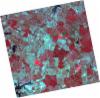
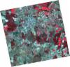
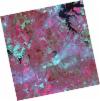
DE2_OPER_HRA_PSH_1C_20210921T111119_N38-001_W007-997_0001
Download Product | Product Info | Browse
Platform Short Name | GEOSAT |
Platform Serial Identifier | 2 |
Product Type | HRA_PSH_1C |
Start Date | 2021-09-21T11:11:19Z |
Stop Date | 2021-09-21T11:11:22Z |
Original Name | DE2_PSH_L1C_000000_20210921T111119_20210921T111122_DE2_39330_35A8.zip |
Footprint | 37.9449873495 -7.89261808922 38.083136192 -7.92551383915 38.0581196868 -8.10188337699 37.9200205976 -8.06847831209 37.9449873495 -7.89261808922 |
Orbit Direction | ASCENDING |
Scene Centre Longitude | W007 |
Scene Centre Latitude | N38 |
Cloud Cover Percentage | -1 |
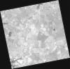
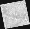
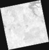
DE2_OPER_HRA_PM4_1C_20210921T111119_N38-001_W007-997_0001
Download Product | Product Info | Browse
Platform Short Name | GEOSAT |
Platform Serial Identifier | 2 |
Product Type | HRA_PM4_1C |
Start Date | 2021-09-21T11:11:19Z |
Stop Date | 2021-09-21T11:11:22Z |
Original Name | DE2_PM4_L1C_000000_20210921T111119_20210921T111122_DE2_39330_35A8.zip |
Footprint | 37.9449873495 -7.89261808922 38.083136192 -7.92551383915 38.0581196868 -8.10188337699 37.9200205976 -8.06847831209 37.9449873495 -7.89261808922 |
Orbit Direction | ASCENDING |
Scene Centre Longitude | W007 |
Scene Centre Latitude | N38 |
Cloud Cover Percentage | -1 |
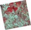
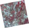
DE2_OPER_HRA_PSH_1C_20210921T111117_N37-876_W007-967_0001
Download Product | Product Info | Browse
Platform Short Name | GEOSAT |
Platform Serial Identifier | 2 |
Product Type | HRA_PSH_1C |
Start Date | 2021-09-21T11:11:17Z |
Stop Date | 2021-09-21T11:11:19Z |
Original Name | DE2_PSH_L1C_000000_20210921T111117_20210921T111119_DE2_39330_8B73.zip |
Footprint | 37.8196829738 -7.86245339711 37.9577647907 -7.89572157357 37.9327939853 -8.07162846241 37.7946337518 -8.03869024311 37.8196829738 -7.86245339711 |
Orbit Direction | ASCENDING |
Scene Centre Longitude | W007 |
Scene Centre Latitude | N37 |
Cloud Cover Percentage | -1 |
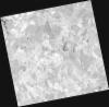
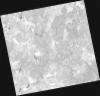
DE2_OPER_HRA_PM4_1C_20210921T111117_N37-876_W007-967_0001
Download Product | Product Info | Browse
Platform Short Name | GEOSAT |
Platform Serial Identifier | 2 |
Product Type | HRA_PM4_1C |
Start Date | 2021-09-21T11:11:17Z |
Stop Date | 2021-09-21T11:11:19Z |
Original Name | DE2_PM4_L1C_000000_20210921T111117_20210921T111119_DE2_39330_8B73.zip |
Footprint | 37.8196829738 -7.86245339711 37.9577647907 -7.89572157357 37.9327939853 -8.07162846241 37.7946337518 -8.03869024311 37.8196829738 -7.86245339711 |
Orbit Direction | ASCENDING |
Scene Centre Longitude | W007 |
Scene Centre Latitude | N37 |
Cloud Cover Percentage | -1 |
DE2_OPER_HRA_PSH_1C_20210626T111502_N37-987_W007-843_0001
Download Product | Product Info | Browse
Platform Short Name | GEOSAT |
Platform Serial Identifier | 2 |
Product Type | HRA_PSH_1C |
Start Date | 2021-06-26T11:15:02Z |
Stop Date | 2021-06-26T11:15:05Z |
Original Name | DE2_PSH_L1C_000000_20210626T111502_20210626T111505_DE2_38039_89AB.zip |
Footprint | 37.9299295227 -7.73462671074 38.0707692338 -7.76803755862 38.0453345957 -7.95283676686 37.9045025058 -7.91925310505 37.9299295227 -7.73462671074 |
Orbit Direction | ASCENDING |
Scene Centre Longitude | W007 |
Scene Centre Latitude | N37 |
Cloud Cover Percentage | -1 |
DE2_OPER_HRA_PM4_1C_20210626T111502_N37-987_W007-843_0001
Download Product | Product Info | Browse
Platform Short Name | GEOSAT |
Platform Serial Identifier | 2 |
Product Type | HRA_PM4_1C |
Start Date | 2021-06-26T11:15:02Z |
Stop Date | 2021-06-26T11:15:05Z |
Original Name | DE2_PM4_L1C_000000_20210626T111502_20210626T111505_DE2_38039_89AB.zip |
Footprint | 37.9299295227 -7.73462671074 38.0707692338 -7.76803755862 38.0453345957 -7.95283676686 37.9045025058 -7.91925310505 37.9299295227 -7.73462671074 |
Orbit Direction | ASCENDING |
Scene Centre Longitude | W007 |
Scene Centre Latitude | N37 |
Cloud Cover Percentage | -1 |
DE2_OPER_HRA_PSH_1C_20210626T111500_N37-859_W007-813_0001
Download Product | Product Info | Browse
Platform Short Name | GEOSAT |
Platform Serial Identifier | 2 |
Product Type | HRA_PSH_1C |
Start Date | 2021-06-26T11:15:00Z |
Stop Date | 2021-06-26T11:15:03Z |
Original Name | DE2_PSH_L1C_000000_20210626T111500_20210626T111503_DE2_38039_6DAA.zip |
Footprint | 37.8021665853 -7.70448870071 37.9429256738 -7.73821059136 37.9175300672 -7.92242428782 37.7767406183 -7.88878824829 37.8021665853 -7.70448870071 |
Orbit Direction | ASCENDING |
Scene Centre Longitude | W007 |
Scene Centre Latitude | N37 |
Cloud Cover Percentage | -1 |
DE2_OPER_HRA_PM4_1C_20210626T111500_N37-859_W007-813_0001
Download Product | Product Info | Browse
Platform Short Name | GEOSAT |
Platform Serial Identifier | 2 |
Product Type | HRA_PM4_1C |
Start Date | 2021-06-26T11:15:00Z |
Stop Date | 2021-06-26T11:15:03Z |
Original Name | DE2_PM4_L1C_000000_20210626T111500_20210626T111503_DE2_38039_6DAA.zip |
Footprint | 37.8021665853 -7.70448870071 37.9429256738 -7.73821059136 37.9175300672 -7.92242428782 37.7767406183 -7.88878824829 37.8021665853 -7.70448870071 |
Orbit Direction | ASCENDING |
Scene Centre Longitude | W007 |
Scene Centre Latitude | N37 |
Cloud Cover Percentage | -1 |
DE2_OPER_HRA_PSH_1C_20210331T111507_N37-873_W008-098_0001
Download Product | Product Info | Browse
Platform Short Name | GEOSAT |
Platform Serial Identifier | 2 |
Product Type | HRA_PSH_1C |
Start Date | 2021-03-31T11:15:07Z |
Stop Date | 2021-03-31T11:15:10Z |
Original Name | DE2_PSH_L1C_000000_20210331T111507_20210331T111510_DE2_36748_F177.zip |
Footprint | 37.8194901546 -7.99986044497 37.952697364 -8.03261316173 37.9281111332 -8.19677632112 37.7948273726 -8.16422425576 37.8194901546 -7.99986044497 |
Orbit Direction | ASCENDING |
Scene Centre Longitude | W008 |
Scene Centre Latitude | N37 |
Cloud Cover Percentage | -1 |
DE2_OPER_HRA_PM4_1C_20210331T111507_N37-873_W008-098_0001
Download Product | Product Info | Browse
Platform Short Name | GEOSAT |
Platform Serial Identifier | 2 |
Product Type | HRA_PM4_1C |
Start Date | 2021-03-31T11:15:07Z |
Stop Date | 2021-03-31T11:15:10Z |
Original Name | DE2_PM4_L1C_000000_20210331T111507_20210331T111510_DE2_36748_F177.zip |
Footprint | 37.8194901546 -7.99986044497 37.952697364 -8.03261316173 37.9281111332 -8.19677632112 37.7948273726 -8.16422425576 37.8194901546 -7.99986044497 |
Orbit Direction | ASCENDING |
Scene Centre Longitude | W008 |
Scene Centre Latitude | N37 |
Cloud Cover Percentage | -1 |