ESA TPM Map Catalogue - Product List
back to previous node |
list of download URLs
Collection G2_Portugal_2021
GEOSAT-2 Portugal Coverage 2021 collection. More details here.
List of available products (latitude from 37.8744 to 37.9528 dg, longitude from -8.18938 to -8.045 dg)..
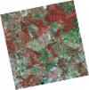
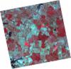
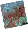
DE2_OPER_HRA_PSH_1C_20211211T110618_N37-940_W008-178_0001
Download Product | Product Info | Browse
Platform Short Name | GEOSAT |
Platform Serial Identifier | 2 |
Product Type | HRA_PSH_1C |
Start Date | 2021-12-11T11:06:18Z |
Stop Date | 2021-12-11T11:06:21Z |
Original Name | DE2_PSH_L1C_000000_20211211T110618_20211211T110621_DE2_40532_02B0.zip |
Footprint | 37.8861437091 -8.08077757977 38.0182927288 -8.11340887139 37.9938480183 -8.27592300448 37.8616395041 -8.24307942888 37.8861437091 -8.08077757977 |
Orbit Direction | ASCENDING |
Scene Centre Longitude | W008 |
Scene Centre Latitude | N37 |
Cloud Cover Percentage | -1 |
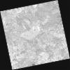
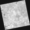
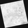
DE2_OPER_HRA_PM4_1C_20211211T110618_N37-940_W008-178_0001
Download Product | Product Info | Browse
Platform Short Name | GEOSAT |
Platform Serial Identifier | 2 |
Product Type | HRA_PM4_1C |
Start Date | 2021-12-11T11:06:18Z |
Stop Date | 2021-12-11T11:06:21Z |
Original Name | DE2_PM4_L1C_000000_20211211T110618_20211211T110621_DE2_40532_02B0.zip |
Footprint | 37.8861437091 -8.08077757977 38.0182927288 -8.11340887139 37.9938480183 -8.27592300448 37.8616395041 -8.24307942888 37.8861437091 -8.08077757977 |
Orbit Direction | ASCENDING |
Scene Centre Longitude | W008 |
Scene Centre Latitude | N37 |
Cloud Cover Percentage | -1 |
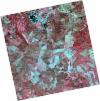
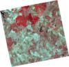
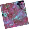
DE2_OPER_HRA_PSH_1C_20211211T110616_N37-820_W008-148_0001
Download Product | Product Info | Browse
Platform Short Name | GEOSAT |
Platform Serial Identifier | 2 |
Product Type | HRA_PSH_1C |
Start Date | 2021-12-11T11:06:16Z |
Stop Date | 2021-12-11T11:06:19Z |
Original Name | DE2_PSH_L1C_000000_20211211T110616_20211211T110619_DE2_40532_1405.zip |
Footprint | 37.7661881649 -8.05109900105 37.8984014445 -8.08371313883 37.8739474947 -8.24602345814 37.7417492896 -8.213265635 37.7661881649 -8.05109900105 |
Orbit Direction | ASCENDING |
Scene Centre Longitude | W008 |
Scene Centre Latitude | N37 |
Cloud Cover Percentage | -1 |
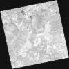
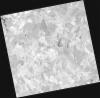
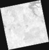
DE2_OPER_HRA_PM4_1C_20211211T110616_N37-820_W008-148_0001
Download Product | Product Info | Browse
Platform Short Name | GEOSAT |
Platform Serial Identifier | 2 |
Product Type | HRA_PM4_1C |
Start Date | 2021-12-11T11:06:16Z |
Stop Date | 2021-12-11T11:06:19Z |
Original Name | DE2_PM4_L1C_000000_20211211T110616_20211211T110619_DE2_40532_1405.zip |
Footprint | 37.7661881649 -8.05109900105 37.8984014445 -8.08371313883 37.8739474947 -8.24602345814 37.7417492896 -8.213265635 37.7661881649 -8.05109900105 |
Orbit Direction | ASCENDING |
Scene Centre Longitude | W008 |
Scene Centre Latitude | N37 |
Cloud Cover Percentage | -1 |
DE2_OPER_HRA_PSH_1C_20210921T111119_N38-001_W007-997_0001
Download Product | Product Info | Browse
Platform Short Name | GEOSAT |
Platform Serial Identifier | 2 |
Product Type | HRA_PSH_1C |
Start Date | 2021-09-21T11:11:19Z |
Stop Date | 2021-09-21T11:11:22Z |
Original Name | DE2_PSH_L1C_000000_20210921T111119_20210921T111122_DE2_39330_35A8.zip |
Footprint | 37.9449873495 -7.89261808922 38.083136192 -7.92551383915 38.0581196868 -8.10188337699 37.9200205976 -8.06847831209 37.9449873495 -7.89261808922 |
Orbit Direction | ASCENDING |
Scene Centre Longitude | W007 |
Scene Centre Latitude | N38 |
Cloud Cover Percentage | -1 |
DE2_OPER_HRA_PM4_1C_20210921T111119_N38-001_W007-997_0001
Download Product | Product Info | Browse
Platform Short Name | GEOSAT |
Platform Serial Identifier | 2 |
Product Type | HRA_PM4_1C |
Start Date | 2021-09-21T11:11:19Z |
Stop Date | 2021-09-21T11:11:22Z |
Original Name | DE2_PM4_L1C_000000_20210921T111119_20210921T111122_DE2_39330_35A8.zip |
Footprint | 37.9449873495 -7.89261808922 38.083136192 -7.92551383915 38.0581196868 -8.10188337699 37.9200205976 -8.06847831209 37.9449873495 -7.89261808922 |
Orbit Direction | ASCENDING |
Scene Centre Longitude | W007 |
Scene Centre Latitude | N38 |
Cloud Cover Percentage | -1 |
DE2_OPER_HRA_PSH_1C_20210921T111117_N37-876_W007-967_0001
Download Product | Product Info | Browse
Platform Short Name | GEOSAT |
Platform Serial Identifier | 2 |
Product Type | HRA_PSH_1C |
Start Date | 2021-09-21T11:11:17Z |
Stop Date | 2021-09-21T11:11:19Z |
Original Name | DE2_PSH_L1C_000000_20210921T111117_20210921T111119_DE2_39330_8B73.zip |
Footprint | 37.8196829738 -7.86245339711 37.9577647907 -7.89572157357 37.9327939853 -8.07162846241 37.7946337518 -8.03869024311 37.8196829738 -7.86245339711 |
Orbit Direction | ASCENDING |
Scene Centre Longitude | W007 |
Scene Centre Latitude | N37 |
Cloud Cover Percentage | -1 |
DE2_OPER_HRA_PM4_1C_20210921T111117_N37-876_W007-967_0001
Download Product | Product Info | Browse
Platform Short Name | GEOSAT |
Platform Serial Identifier | 2 |
Product Type | HRA_PM4_1C |
Start Date | 2021-09-21T11:11:17Z |
Stop Date | 2021-09-21T11:11:19Z |
Original Name | DE2_PM4_L1C_000000_20210921T111117_20210921T111119_DE2_39330_8B73.zip |
Footprint | 37.8196829738 -7.86245339711 37.9577647907 -7.89572157357 37.9327939853 -8.07162846241 37.7946337518 -8.03869024311 37.8196829738 -7.86245339711 |
Orbit Direction | ASCENDING |
Scene Centre Longitude | W007 |
Scene Centre Latitude | N37 |
Cloud Cover Percentage | -1 |
DE2_OPER_HRA_PSH_1C_20210331T111509_N37-994_W008-128_0001
Download Product | Product Info | Browse
Platform Short Name | GEOSAT |
Platform Serial Identifier | 2 |
Product Type | HRA_PSH_1C |
Start Date | 2021-03-31T11:15:09Z |
Stop Date | 2021-03-31T11:15:12Z |
Original Name | DE2_PSH_L1C_000000_20210331T111509_20210331T111512_DE2_36748_3840.zip |
Footprint | 37.9403627263 -8.02950590415 38.0735406802 -8.06243009377 38.0489163241 -8.22686299396 37.9157475507 -8.19377085222 37.9403627263 -8.02950590415 |
Orbit Direction | ASCENDING |
Scene Centre Longitude | W008 |
Scene Centre Latitude | N37 |
Cloud Cover Percentage | -1 |
DE2_OPER_HRA_PM4_1C_20210331T111509_N37-994_W008-128_0001
Download Product | Product Info | Browse
Platform Short Name | GEOSAT |
Platform Serial Identifier | 2 |
Product Type | HRA_PM4_1C |
Start Date | 2021-03-31T11:15:09Z |
Stop Date | 2021-03-31T11:15:12Z |
Original Name | DE2_PM4_L1C_000000_20210331T111509_20210331T111512_DE2_36748_3840.zip |
Footprint | 37.9403627263 -8.02950590415 38.0735406802 -8.06243009377 38.0489163241 -8.22686299396 37.9157475507 -8.19377085222 37.9403627263 -8.02950590415 |
Orbit Direction | ASCENDING |
Scene Centre Longitude | W008 |
Scene Centre Latitude | N37 |
Cloud Cover Percentage | -1 |
DE2_OPER_HRA_PSH_1C_20210331T111507_N37-873_W008-098_0001
Download Product | Product Info | Browse
Platform Short Name | GEOSAT |
Platform Serial Identifier | 2 |
Product Type | HRA_PSH_1C |
Start Date | 2021-03-31T11:15:07Z |
Stop Date | 2021-03-31T11:15:10Z |
Original Name | DE2_PSH_L1C_000000_20210331T111507_20210331T111510_DE2_36748_F177.zip |
Footprint | 37.8194901546 -7.99986044497 37.952697364 -8.03261316173 37.9281111332 -8.19677632112 37.7948273726 -8.16422425576 37.8194901546 -7.99986044497 |
Orbit Direction | ASCENDING |
Scene Centre Longitude | W008 |
Scene Centre Latitude | N37 |
Cloud Cover Percentage | -1 |
DE2_OPER_HRA_PM4_1C_20210331T111507_N37-873_W008-098_0001
Download Product | Product Info | Browse
Platform Short Name | GEOSAT |
Platform Serial Identifier | 2 |
Product Type | HRA_PM4_1C |
Start Date | 2021-03-31T11:15:07Z |
Stop Date | 2021-03-31T11:15:10Z |
Original Name | DE2_PM4_L1C_000000_20210331T111507_20210331T111510_DE2_36748_F177.zip |
Footprint | 37.8194901546 -7.99986044497 37.952697364 -8.03261316173 37.9281111332 -8.19677632112 37.7948273726 -8.16422425576 37.8194901546 -7.99986044497 |
Orbit Direction | ASCENDING |
Scene Centre Longitude | W008 |
Scene Centre Latitude | N37 |
Cloud Cover Percentage | -1 |