ESA TPM Map Catalogue - Product List
back to previous node |
list of download URLs
Collection G2_Portugal_2021
GEOSAT-2 Portugal Coverage 2021 collection. More details here.
List of available products (latitude from 37.8744 to 37.9528 dg, longitude from -8.68812 to -8.54375 dg)..
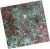
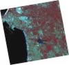
DE2_OPER_HRA_PSH_1C_20210721T111634_N37-965_W008-576_0001
Download Product | Product Info | Browse
Platform Short Name | GEOSAT |
Platform Serial Identifier | 2 |
Product Type | HRA_PSH_1C |
Start Date | 2021-07-21T11:16:34Z |
Stop Date | 2021-07-21T11:16:37Z |
Original Name | DE2_PSH_L1C_000000_20210721T111634_20210721T111637_DE2_38410_6775.zip |
Footprint | 37.9088231904 -8.46948014883 38.0480488048 -8.50294209141 38.0227257842 -8.6843694409 37.8835623871 -8.65038818103 37.9088231904 -8.46948014883 |
Orbit Direction | ASCENDING |
Scene Centre Longitude | W008 |
Scene Centre Latitude | N37 |
Cloud Cover Percentage | -1 |
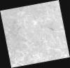
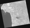
DE2_OPER_HRA_PM4_1C_20210721T111634_N37-965_W008-576_0001
Download Product | Product Info | Browse
Platform Short Name | GEOSAT |
Platform Serial Identifier | 2 |
Product Type | HRA_PM4_1C |
Start Date | 2021-07-21T11:16:34Z |
Stop Date | 2021-07-21T11:16:37Z |
Original Name | DE2_PM4_L1C_000000_20210721T111634_20210721T111637_DE2_38410_6775.zip |
Footprint | 37.9088231904 -8.46948014883 38.0480488048 -8.50294209141 38.0227257842 -8.6843694409 37.8835623871 -8.65038818103 37.9088231904 -8.46948014883 |
Orbit Direction | ASCENDING |
Scene Centre Longitude | W008 |
Scene Centre Latitude | N37 |
Cloud Cover Percentage | -1 |
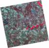
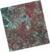
DE2_OPER_HRA_PSH_1C_20210721T111632_N37-839_W008-546_0001
Download Product | Product Info | Browse
Platform Short Name | GEOSAT |
Platform Serial Identifier | 2 |
Product Type | HRA_PSH_1C |
Start Date | 2021-07-21T11:16:32Z |
Stop Date | 2021-07-21T11:16:35Z |
Original Name | DE2_PSH_L1C_000000_20210721T111632_20210721T111635_DE2_38410_D0C4.zip |
Footprint | 37.7823977344 -8.43940806044 37.9217285569 -8.47273248526 37.8964426199 -8.65364558719 37.7571729147 -8.61965098587 37.7823977344 -8.43940806044 |
Orbit Direction | ASCENDING |
Scene Centre Longitude | W008 |
Scene Centre Latitude | N37 |
Cloud Cover Percentage | -1 |
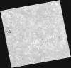
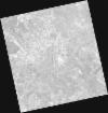
DE2_OPER_HRA_PM4_1C_20210721T111632_N37-839_W008-546_0001
Download Product | Product Info | Browse
Platform Short Name | GEOSAT |
Platform Serial Identifier | 2 |
Product Type | HRA_PM4_1C |
Start Date | 2021-07-21T11:16:32Z |
Stop Date | 2021-07-21T11:16:35Z |
Original Name | DE2_PM4_L1C_000000_20210721T111632_20210721T111635_DE2_38410_D0C4.zip |
Footprint | 37.7823977344 -8.43940806044 37.9217285569 -8.47273248526 37.8964426199 -8.65364558719 37.7571729147 -8.61965098587 37.7823977344 -8.43940806044 |
Orbit Direction | ASCENDING |
Scene Centre Longitude | W008 |
Scene Centre Latitude | N37 |
Cloud Cover Percentage | -1 |
DE2_OPER_HRA_PSH_1C_20210715T112004_N37-923_W008-771_0001
Download Product | Product Info | Browse
Platform Short Name | GEOSAT |
Platform Serial Identifier | 2 |
Product Type | HRA_PSH_1C |
Start Date | 2021-07-15T11:20:04Z |
Stop Date | 2021-07-15T11:20:07Z |
Original Name | DE2_PSH_L1C_000000_20210715T112004_20210715T112007_DE2_38321_2830.zip |
Footprint | 37.8641958831 -8.65738629027 38.0088931961 -8.69110969669 37.983219127 -8.88627246679 37.8384485381 -8.85281784299 37.8641958831 -8.65738629027 |
Orbit Direction | ASCENDING |
Scene Centre Longitude | W008 |
Scene Centre Latitude | N37 |
Cloud Cover Percentage | -1 |
DE2_OPER_HRA_PM4_1C_20210715T112004_N37-923_W008-771_0001
Download Product | Product Info | Browse
Platform Short Name | GEOSAT |
Platform Serial Identifier | 2 |
Product Type | HRA_PM4_1C |
Start Date | 2021-07-15T11:20:04Z |
Stop Date | 2021-07-15T11:20:07Z |
Original Name | DE2_PM4_L1C_000000_20210715T112004_20210715T112007_DE2_38321_2830.zip |
Footprint | 37.8641958831 -8.65738629027 38.0088931961 -8.69110969669 37.983219127 -8.88627246679 37.8384485381 -8.85281784299 37.8641958831 -8.65738629027 |
Orbit Direction | ASCENDING |
Scene Centre Longitude | W008 |
Scene Centre Latitude | N37 |
Cloud Cover Percentage | -1 |
DE2_OPER_HRA_PSH_1C_20210607T110952_N37-997_W008-699_0001
Download Product | Product Info | Browse
Platform Short Name | GEOSAT |
Platform Serial Identifier | 2 |
Product Type | HRA_PSH_1C |
Start Date | 2021-06-07T11:09:52Z |
Stop Date | 2021-06-07T11:09:55Z |
Original Name | DE2_PSH_L1C_000000_20210607T110952_20210607T110955_DE2_37757_75E6.zip |
Footprint | 37.9466788369 -8.60977294526 38.0722857553 -8.6436858144 38.0481063173 -8.78923807051 37.9224597051 -8.75549767705 37.9466788369 -8.60977294526 |
Orbit Direction | ASCENDING |
Scene Centre Longitude | W008 |
Scene Centre Latitude | N37 |
Cloud Cover Percentage | -1 |
DE2_OPER_HRA_PM4_1C_20210607T110952_N37-997_W008-699_0001
Download Product | Product Info | Browse
Platform Short Name | GEOSAT |
Platform Serial Identifier | 2 |
Product Type | HRA_PM4_1C |
Start Date | 2021-06-07T11:09:52Z |
Stop Date | 2021-06-07T11:09:55Z |
Original Name | DE2_PM4_L1C_000000_20210607T110952_20210607T110955_DE2_37757_75E6.zip |
Footprint | 37.9466788369 -8.60977294526 38.0722857553 -8.6436858144 38.0481063173 -8.78923807051 37.9224597051 -8.75549767705 37.9466788369 -8.60977294526 |
Orbit Direction | ASCENDING |
Scene Centre Longitude | W008 |
Scene Centre Latitude | N37 |
Cloud Cover Percentage | -1 |
DE2_OPER_HRA_PSH_1C_20210607T110950_N37-883_W008-669_0001
Download Product | Product Info | Browse
Platform Short Name | GEOSAT |
Platform Serial Identifier | 2 |
Product Type | HRA_PSH_1C |
Start Date | 2021-06-07T11:09:50Z |
Stop Date | 2021-06-07T11:09:53Z |
Original Name | DE2_PSH_L1C_000000_20210607T110950_20210607T110953_DE2_37757_F2FB.zip |
Footprint | 37.8325443655 -8.57954717416 37.9583560713 -8.612801753 37.9341198185 -8.75855717587 37.8082944332 -8.72538063078 37.8325443655 -8.57954717416 |
Orbit Direction | ASCENDING |
Scene Centre Longitude | W008 |
Scene Centre Latitude | N37 |
Cloud Cover Percentage | -1 |
DE2_OPER_HRA_PM4_1C_20210607T110950_N37-883_W008-669_0001
Download Product | Product Info | Browse
Platform Short Name | GEOSAT |
Platform Serial Identifier | 2 |
Product Type | HRA_PM4_1C |
Start Date | 2021-06-07T11:09:50Z |
Stop Date | 2021-06-07T11:09:53Z |
Original Name | DE2_PM4_L1C_000000_20210607T110950_20210607T110953_DE2_37757_F2FB.zip |
Footprint | 37.8325443655 -8.57954717416 37.9583560713 -8.612801753 37.9341198185 -8.75855717587 37.8082944332 -8.72538063078 37.8325443655 -8.57954717416 |
Orbit Direction | ASCENDING |
Scene Centre Longitude | W008 |
Scene Centre Latitude | N37 |
Cloud Cover Percentage | -1 |