ESA TPM Map Catalogue - Product List
back to previous node |
list of download URLs
Collection G2_Portugal_2021
GEOSAT-2 Portugal Coverage 2021 collection. More details here.
List of available products (latitude from 37.7959 to 37.8744 dg, longitude from -25.8137 to -25.6625 dg)..
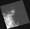
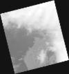
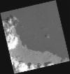
DE2_OPER_HRA_PM4_1C_20210930T115425_N37-899_W025-693_0001
Download Product | Product Info | Browse
Platform Short Name | GEOSAT |
Platform Serial Identifier | 2 |
Product Type | HRA_PM4_1C |
Start Date | 2021-09-30T11:54:25Z |
Stop Date | 2021-09-30T11:54:27Z |
Original Name | DE2_PM4_L1C_000000_20210930T115425_20210930T115427_DE2_39464_EC33.zip |
Footprint | 37.849064302 -25.5813950243 37.9854515984 -25.6344113248 37.95089811 -25.8051945953 37.8143051746 -25.7544874991 37.849064302 -25.5813950243 |
Orbit Direction | ASCENDING |
Scene Centre Longitude | W025 |
Scene Centre Latitude | N37 |
Cloud Cover Percentage | -1 |
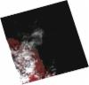
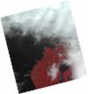
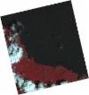
DE2_OPER_HRA_PSH_1C_20210930T115425_N37-899_W025-693_0001
Download Product | Product Info | Browse
Platform Short Name | GEOSAT |
Platform Serial Identifier | 2 |
Product Type | HRA_PSH_1C |
Start Date | 2021-09-30T11:54:25Z |
Stop Date | 2021-09-30T11:54:27Z |
Original Name | DE2_PSH_L1C_000000_20210930T115425_20210930T115427_DE2_39464_EC33.zip |
Footprint | 37.849064302 -25.5813950243 37.9854515984 -25.6344113248 37.95089811 -25.8051945953 37.8143051746 -25.7544874991 37.849064302 -25.5813950243 |
Orbit Direction | ASCENDING |
Scene Centre Longitude | W025 |
Scene Centre Latitude | N37 |
Cloud Cover Percentage | -1 |
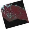
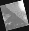
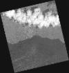
DE2_OPER_HRA_PSH_1C_20210930T115423_N37-776_W025-649_0001
Download Product | Product Info | Browse
Platform Short Name | GEOSAT |
Platform Serial Identifier | 2 |
Product Type | HRA_PSH_1C |
Start Date | 2021-09-30T11:54:23Z |
Stop Date | 2021-09-30T11:54:25Z |
Original Name | DE2_PSH_L1C_000000_20210930T115423_20210930T115425_DE2_39464_F70D.zip |
Footprint | 37.7255312966 -25.5383876762 37.862074831 -25.5852294883 37.8271125103 -25.7581497115 37.6891590841 -25.7160777513 37.7255312966 -25.5383876762 |
Orbit Direction | ASCENDING |
Scene Centre Longitude | W025 |
Scene Centre Latitude | N37 |
Cloud Cover Percentage | -1 |
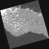
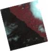
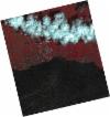
DE2_OPER_HRA_PM4_1C_20210930T115423_N37-776_W025-649_0001
Download Product | Product Info | Browse
Platform Short Name | GEOSAT |
Platform Serial Identifier | 2 |
Product Type | HRA_PM4_1C |
Start Date | 2021-09-30T11:54:23Z |
Stop Date | 2021-09-30T11:54:25Z |
Original Name | DE2_PM4_L1C_000000_20210930T115423_20210930T115425_DE2_39464_F70D.zip |
Footprint | 37.7255312966 -25.5383876762 37.862074831 -25.5852294883 37.8271125103 -25.7581497115 37.6891590841 -25.7160777513 37.7255312966 -25.5383876762 |
Orbit Direction | ASCENDING |
Scene Centre Longitude | W025 |
Scene Centre Latitude | N37 |
Cloud Cover Percentage | -1 |
DE2_OPER_HRA_PM4_1C_20210617T120853_N37-900_W025-823_0001
Download Product | Product Info | Browse
Platform Short Name | GEOSAT |
Platform Serial Identifier | 2 |
Product Type | HRA_PM4_1C |
Start Date | 2021-06-17T12:08:53Z |
Stop Date | 2021-06-17T12:08:56Z |
Original Name | DE2_PM4_L1C_000000_20210617T120853_20210617T120856_DE2_37906_25A7.zip |
Footprint | 37.8515381128 -25.7337429411 37.9756675679 -25.770739153 37.9487700288 -25.9126296338 37.8245460711 -25.8761413262 37.8515381128 -25.7337429411 |
Orbit Direction | ASCENDING |
Scene Centre Longitude | W025 |
Scene Centre Latitude | N37 |
Cloud Cover Percentage | -1 |
DE2_OPER_HRA_PSH_1C_20210617T120853_N37-900_W025-823_0001
Download Product | Product Info | Browse
Platform Short Name | GEOSAT |
Platform Serial Identifier | 2 |
Product Type | HRA_PSH_1C |
Start Date | 2021-06-17T12:08:53Z |
Stop Date | 2021-06-17T12:08:56Z |
Original Name | DE2_PSH_L1C_000000_20210617T120853_20210617T120856_DE2_37906_25A7.zip |
Footprint | 37.8515381128 -25.7337429411 37.9756675679 -25.770739153 37.9487700288 -25.9126296338 37.8245460711 -25.8761413262 37.8515381128 -25.7337429411 |
Orbit Direction | ASCENDING |
Scene Centre Longitude | W025 |
Scene Centre Latitude | N37 |
Cloud Cover Percentage | -1 |
DE2_OPER_HRA_PM4_1C_20210617T120851_N37-787_W025-789_0001
Download Product | Product Info | Browse
Platform Short Name | GEOSAT |
Platform Serial Identifier | 2 |
Product Type | HRA_PM4_1C |
Start Date | 2021-06-17T12:08:51Z |
Stop Date | 2021-06-17T12:08:54Z |
Original Name | DE2_PM4_L1C_000000_20210617T120851_20210617T120854_DE2_37906_8928.zip |
Footprint | 37.7388805988 -25.7004855016 37.8629631988 -25.7370431298 37.8359320582 -25.879284052 37.7118268016 -25.8423304634 37.7388805988 -25.7004855016 |
Orbit Direction | ASCENDING |
Scene Centre Longitude | W025 |
Scene Centre Latitude | N37 |
Cloud Cover Percentage | -1 |
DE2_OPER_HRA_PSH_1C_20210617T120851_N37-787_W025-789_0001
Download Product | Product Info | Browse
Platform Short Name | GEOSAT |
Platform Serial Identifier | 2 |
Product Type | HRA_PSH_1C |
Start Date | 2021-06-17T12:08:51Z |
Stop Date | 2021-06-17T12:08:54Z |
Original Name | DE2_PSH_L1C_000000_20210617T120851_20210617T120854_DE2_37906_8928.zip |
Footprint | 37.7388805988 -25.7004855016 37.8629631988 -25.7370431298 37.8359320582 -25.879284052 37.7118268016 -25.8423304634 37.7388805988 -25.7004855016 |
Orbit Direction | ASCENDING |
Scene Centre Longitude | W025 |
Scene Centre Latitude | N37 |
Cloud Cover Percentage | -1 |
DE2_OPER_HRA_PM4_1C_20210605T121541_N37-860_W025-659_0001
Download Product | Product Info | Browse
Platform Short Name | GEOSAT |
Platform Serial Identifier | 2 |
Product Type | HRA_PM4_1C |
Start Date | 2021-06-05T12:15:41Z |
Stop Date | 2021-06-05T12:15:44Z |
Original Name | DE2_PM4_L1C_000000_20210605T121541_20210605T121544_DE2_37728_FD2C.zip |
Footprint | 37.8107694758 -25.5716316505 37.9343748642 -25.6052739306 37.909985013 -25.7474841042 37.7862452476 -25.7134883377 37.8107694758 -25.5716316505 |
Orbit Direction | ASCENDING |
Scene Centre Longitude | W025 |
Scene Centre Latitude | N37 |
Cloud Cover Percentage | -1 |
DE2_OPER_HRA_PSH_1C_20210605T121541_N37-860_W025-659_0001
Download Product | Product Info | Browse
Platform Short Name | GEOSAT |
Platform Serial Identifier | 2 |
Product Type | HRA_PSH_1C |
Start Date | 2021-06-05T12:15:41Z |
Stop Date | 2021-06-05T12:15:44Z |
Original Name | DE2_PSH_L1C_000000_20210605T121541_20210605T121544_DE2_37728_FD2C.zip |
Footprint | 37.8107694758 -25.5716316505 37.9343748642 -25.6052739306 37.909985013 -25.7474841042 37.7862452476 -25.7134883377 37.8107694758 -25.5716316505 |
Orbit Direction | ASCENDING |
Scene Centre Longitude | W025 |
Scene Centre Latitude | N37 |
Cloud Cover Percentage | -1 |
DE2_OPER_HRA_PM4_1C_20210605T121539_N37-748_W025-628_0001
Download Product | Product Info | Browse
Platform Short Name | GEOSAT |
Platform Serial Identifier | 2 |
Product Type | HRA_PM4_1C |
Start Date | 2021-06-05T12:15:39Z |
Stop Date | 2021-06-05T12:15:42Z |
Original Name | DE2_PM4_L1C_000000_20210605T121539_20210605T121542_DE2_37728_7907.zip |
Footprint | 37.6984663569 -25.540561153 37.8222104179 -25.5747599784 37.7976635083 -25.7167232673 37.6740744806 -25.6820227486 37.6984663569 -25.540561153 |
Orbit Direction | ASCENDING |
Scene Centre Longitude | W025 |
Scene Centre Latitude | N37 |
Cloud Cover Percentage | -1 |
DE2_OPER_HRA_PSH_1C_20210605T121539_N37-748_W025-628_0001
Download Product | Product Info | Browse
Platform Short Name | GEOSAT |
Platform Serial Identifier | 2 |
Product Type | HRA_PSH_1C |
Start Date | 2021-06-05T12:15:39Z |
Stop Date | 2021-06-05T12:15:42Z |
Original Name | DE2_PSH_L1C_000000_20210605T121539_20210605T121542_DE2_37728_7907.zip |
Footprint | 37.6984663569 -25.540561153 37.8222104179 -25.5747599784 37.7976635083 -25.7167232673 37.6740744806 -25.6820227486 37.6984663569 -25.540561153 |
Orbit Direction | ASCENDING |
Scene Centre Longitude | W025 |
Scene Centre Latitude | N37 |
Cloud Cover Percentage | -1 |