ESA TPM Map Catalogue - Product List
back to previous node |
list of download URLs

Collection G2_Portugal_2021
GEOSAT-2 Portugal Coverage 2021 collection. More details here.
List of available products (latitude from 37.7959 to 37.8744 dg, longitude from -7.75625 to -7.61188 dg)..
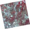
DE2_OPER_HRA_PSH_1C_20210626T111500_N37-859_W007-813_0001
Download Product | Product Info | Browse
Platform Short Name | GEOSAT |
Platform Serial Identifier | 2 |
Product Type | HRA_PSH_1C |
Start Date | 2021-06-26T11:15:00Z |
Stop Date | 2021-06-26T11:15:03Z |
Original Name | DE2_PSH_L1C_000000_20210626T111500_20210626T111503_DE2_38039_6DAA.zip |
Footprint | 37.8021665853 -7.70448870071 37.9429256738 -7.73821059136 37.9175300672 -7.92242428782 37.7767406183 -7.88878824829 37.8021665853 -7.70448870071 |
Orbit Direction | ASCENDING |
Scene Centre Longitude | W007 |
Scene Centre Latitude | N37 |
Cloud Cover Percentage | -1 |
DE2_OPER_HRA_PM4_1C_20210626T111500_N37-859_W007-813_0001
Download Product | Product Info | Browse
Platform Short Name | GEOSAT |
Platform Serial Identifier | 2 |
Product Type | HRA_PM4_1C |
Start Date | 2021-06-26T11:15:00Z |
Stop Date | 2021-06-26T11:15:03Z |
Original Name | DE2_PM4_L1C_000000_20210626T111500_20210626T111503_DE2_38039_6DAA.zip |
Footprint | 37.8021665853 -7.70448870071 37.9429256738 -7.73821059136 37.9175300672 -7.92242428782 37.7767406183 -7.88878824829 37.8021665853 -7.70448870071 |
Orbit Direction | ASCENDING |
Scene Centre Longitude | W007 |
Scene Centre Latitude | N37 |
Cloud Cover Percentage | -1 |
DE2_OPER_HRA_PSH_1C_20210626T111458_N37-732_W007-783_0001
Download Product | Product Info | Browse
Platform Short Name | GEOSAT |
Platform Serial Identifier | 2 |
Product Type | HRA_PSH_1C |
Start Date | 2021-06-26T11:14:58Z |
Stop Date | 2021-06-26T11:15:01Z |
Original Name | DE2_PSH_L1C_000000_20210626T111458_20210626T111501_DE2_38039_02F5.zip |
Footprint | 37.6743491862 -7.67456807677 37.8152067297 -7.70766902675 37.7898080597 -7.89177820112 37.6489361746 -7.85844031916 37.6743491862 -7.67456807677 |
Orbit Direction | ASCENDING |
Scene Centre Longitude | W007 |
Scene Centre Latitude | N37 |
Cloud Cover Percentage | -1 |
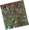
DE2_OPER_HRA_PM4_1C_20210626T111458_N37-732_W007-783_0001
Download Product | Product Info | Browse
Platform Short Name | GEOSAT |
Platform Serial Identifier | 2 |
Product Type | HRA_PM4_1C |
Start Date | 2021-06-26T11:14:58Z |
Stop Date | 2021-06-26T11:15:01Z |
Original Name | DE2_PM4_L1C_000000_20210626T111458_20210626T111501_DE2_38039_02F5.zip |
Footprint | 37.6743491862 -7.67456807677 37.8152067297 -7.70766902675 37.7898080597 -7.89177820112 37.6489361746 -7.85844031916 37.6743491862 -7.67456807677 |
Orbit Direction | ASCENDING |
Scene Centre Longitude | W007 |
Scene Centre Latitude | N37 |
Cloud Cover Percentage | -1 |
DE2_OPER_HRA_PSH_1C_20210613T110625_N37-917_W007-684_0001
Download Product | Product Info | Browse
Platform Short Name | GEOSAT |
Platform Serial Identifier | 2 |
Product Type | HRA_PSH_1C |
Start Date | 2021-06-13T11:06:25Z |
Stop Date | 2021-06-13T11:06:27Z |
Original Name | DE2_PSH_L1C_000000_20210613T110625_20210613T110627_DE2_37846_2E34.zip |
Footprint | 37.8658371358 -7.59347063734 37.9926649618 -7.62697506864 37.9684105392 -7.77486462384 37.8415999464 -7.74114089514 37.8658371358 -7.59347063734 |
Orbit Direction | ASCENDING |
Scene Centre Longitude | W007 |
Scene Centre Latitude | N37 |
Cloud Cover Percentage | -1 |
DE2_OPER_HRA_PM4_1C_20210613T110625_N37-917_W007-684_0001
Download Product | Product Info | Browse
Platform Short Name | GEOSAT |
Platform Serial Identifier | 2 |
Product Type | HRA_PM4_1C |
Start Date | 2021-06-13T11:06:25Z |
Stop Date | 2021-06-13T11:06:27Z |
Original Name | DE2_PM4_L1C_000000_20210613T110625_20210613T110627_DE2_37846_2E34.zip |
Footprint | 37.8658371358 -7.59347063734 37.9926649618 -7.62697506864 37.9684105392 -7.77486462384 37.8415999464 -7.74114089514 37.8658371358 -7.59347063734 |
Orbit Direction | ASCENDING |
Scene Centre Longitude | W007 |
Scene Centre Latitude | N37 |
Cloud Cover Percentage | -1 |
DE2_OPER_HRA_PSH_1C_20210613T110623_N37-802_W007-653_0001
Download Product | Product Info | Browse
Platform Short Name | GEOSAT |
Platform Serial Identifier | 2 |
Product Type | HRA_PSH_1C |
Start Date | 2021-06-13T11:06:23Z |
Stop Date | 2021-06-13T11:06:25Z |
Original Name | DE2_PSH_L1C_000000_20210613T110623_20210613T110625_DE2_37846_8BD7.zip |
Footprint | 37.7507754739 -7.56348970083 37.8775559992 -7.59671851921 37.8533476145 -7.74428290842 37.7265884532 -7.71064894591 37.7507754739 -7.56348970083 |
Orbit Direction | ASCENDING |
Scene Centre Longitude | W007 |
Scene Centre Latitude | N37 |
Cloud Cover Percentage | -1 |
DE2_OPER_HRA_PM4_1C_20210613T110623_N37-802_W007-653_0001
Download Product | Product Info | Browse
Platform Short Name | GEOSAT |
Platform Serial Identifier | 2 |
Product Type | HRA_PM4_1C |
Start Date | 2021-06-13T11:06:23Z |
Stop Date | 2021-06-13T11:06:25Z |
Original Name | DE2_PM4_L1C_000000_20210613T110623_20210613T110625_DE2_37846_8BD7.zip |
Footprint | 37.7507754739 -7.56348970083 37.8775559992 -7.59671851921 37.8533476145 -7.74428290842 37.7265884532 -7.71064894591 37.7507754739 -7.56348970083 |
Orbit Direction | ASCENDING |
Scene Centre Longitude | W007 |
Scene Centre Latitude | N37 |
Cloud Cover Percentage | -1 |