ESA TPM Map Catalogue - Product List
back to previous node |
list of download URLs

Collection G2_Portugal_2021
GEOSAT-2 Portugal Coverage 2021 collection. More details here.
List of available products (latitude from 37.7959 to 37.8744 dg, longitude from -8.39938 to -8.255 dg)..
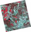
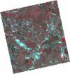
DE2_OPER_HRA_PSH_1C_20210708T110805_N37-918_W008-281_0001
Download Product | Product Info | Browse
Platform Short Name | GEOSAT |
Platform Serial Identifier | 2 |
Product Type | HRA_PSH_1C |
Start Date | 2021-07-08T11:08:05Z |
Stop Date | 2021-07-08T11:08:08Z |
Original Name | DE2_PSH_L1C_000000_20210708T110805_20210708T110808_DE2_38217_7A0E.zip |
Footprint | 37.8674111352 -8.19106615092 37.9941940992 -8.22419198324 37.9699716417 -8.37209925677 37.8431929938 -8.33861028056 37.8674111352 -8.19106615092 |
Orbit Direction | ASCENDING |
Scene Centre Longitude | W008 |
Scene Centre Latitude | N37 |
Cloud Cover Percentage | -1 |
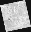
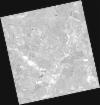
DE2_OPER_HRA_PM4_1C_20210708T110805_N37-918_W008-281_0001
Download Product | Product Info | Browse
Platform Short Name | GEOSAT |
Platform Serial Identifier | 2 |
Product Type | HRA_PM4_1C |
Start Date | 2021-07-08T11:08:05Z |
Stop Date | 2021-07-08T11:08:08Z |
Original Name | DE2_PM4_L1C_000000_20210708T110805_20210708T110808_DE2_38217_7A0E.zip |
Footprint | 37.8674111352 -8.19106615092 37.9941940992 -8.22419198324 37.9699716417 -8.37209925677 37.8431929938 -8.33861028056 37.8674111352 -8.19106615092 |
Orbit Direction | ASCENDING |
Scene Centre Longitude | W008 |
Scene Centre Latitude | N37 |
Cloud Cover Percentage | -1 |
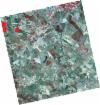
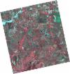
DE2_OPER_HRA_PSH_1C_20210708T110804_N37-803_W008-251_0001
Download Product | Product Info | Browse
Platform Short Name | GEOSAT |
Platform Serial Identifier | 2 |
Product Type | HRA_PSH_1C |
Start Date | 2021-07-08T11:08:04Z |
Stop Date | 2021-07-08T11:08:06Z |
Original Name | DE2_PSH_L1C_000000_20210708T110804_20210708T110806_DE2_38217_B3B0.zip |
Footprint | 37.7523344347 -8.16121189972 37.8791659533 -8.19399070022 37.854951697 -8.34165114283 37.7281640182 -8.30845060788 37.7523344347 -8.16121189972 |
Orbit Direction | ASCENDING |
Scene Centre Longitude | W008 |
Scene Centre Latitude | N37 |
Cloud Cover Percentage | -1 |
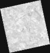
DE2_OPER_HRA_PM4_1C_20210708T110804_N37-803_W008-251_0001
Download Product | Product Info | Browse
Platform Short Name | GEOSAT |
Platform Serial Identifier | 2 |
Product Type | HRA_PM4_1C |
Start Date | 2021-07-08T11:08:04Z |
Stop Date | 2021-07-08T11:08:06Z |
Original Name | DE2_PM4_L1C_000000_20210708T110804_20210708T110806_DE2_38217_B3B0.zip |
Footprint | 37.7523344347 -8.16121189972 37.8791659533 -8.19399070022 37.854951697 -8.34165114283 37.7281640182 -8.30845060788 37.7523344347 -8.16121189972 |
Orbit Direction | ASCENDING |
Scene Centre Longitude | W008 |
Scene Centre Latitude | N37 |
Cloud Cover Percentage | -1 |
DE2_OPER_HRA_PSH_1C_20210507T111109_N37-920_W008-437_0001
Download Product | Product Info | Browse
Platform Short Name | GEOSAT |
Platform Serial Identifier | 2 |
Product Type | HRA_PSH_1C |
Start Date | 2021-05-07T11:11:09Z |
Stop Date | 2021-05-07T11:11:11Z |
Original Name | DE2_PSH_L1C_000000_20210507T111109_20210507T111111_DE2_37297_5E68.zip |
Footprint | 37.8688610912 -8.34612350314 37.9957920099 -8.37949846699 37.9715417364 -8.52875955268 37.8446765674 -8.49483969837 37.8688610912 -8.34612350314 |
Orbit Direction | ASCENDING |
Scene Centre Longitude | W008 |
Scene Centre Latitude | N37 |
Cloud Cover Percentage | -1 |
DE2_OPER_HRA_PM4_1C_20210507T111109_N37-920_W008-437_0001
Download Product | Product Info | Browse
Platform Short Name | GEOSAT |
Platform Serial Identifier | 2 |
Product Type | HRA_PM4_1C |
Start Date | 2021-05-07T11:11:09Z |
Stop Date | 2021-05-07T11:11:11Z |
Original Name | DE2_PM4_L1C_000000_20210507T111109_20210507T111111_DE2_37297_5E68.zip |
Footprint | 37.8688610912 -8.34612350314 37.9957920099 -8.37949846699 37.9715417364 -8.52875955268 37.8446765674 -8.49483969837 37.8688610912 -8.34612350314 |
Orbit Direction | ASCENDING |
Scene Centre Longitude | W008 |
Scene Centre Latitude | N37 |
Cloud Cover Percentage | -1 |
DE2_OPER_HRA_PSH_1C_20210507T111107_N37-805_W008-406_0001
Download Product | Product Info | Browse
Platform Short Name | GEOSAT |
Platform Serial Identifier | 2 |
Product Type | HRA_PSH_1C |
Start Date | 2021-05-07T11:11:07Z |
Stop Date | 2021-05-07T11:11:09Z |
Original Name | DE2_PSH_L1C_000000_20210507T111107_20210507T111109_DE2_37297_EF97.zip |
Footprint | 37.7537468478 -8.31601124434 37.8806195701 -8.34916655725 37.8564115418 -8.49799939971 37.7295380545 -8.46467633539 37.7537468478 -8.31601124434 |
Orbit Direction | ASCENDING |
Scene Centre Longitude | W008 |
Scene Centre Latitude | N37 |
Cloud Cover Percentage | -1 |
DE2_OPER_HRA_PM4_1C_20210507T111107_N37-805_W008-406_0001
Download Product | Product Info | Browse
Platform Short Name | GEOSAT |
Platform Serial Identifier | 2 |
Product Type | HRA_PM4_1C |
Start Date | 2021-05-07T11:11:07Z |
Stop Date | 2021-05-07T11:11:09Z |
Original Name | DE2_PM4_L1C_000000_20210507T111107_20210507T111109_DE2_37297_EF97.zip |
Footprint | 37.7537468478 -8.31601124434 37.8806195701 -8.34916655725 37.8564115418 -8.49799939971 37.7295380545 -8.46467633539 37.7537468478 -8.31601124434 |
Orbit Direction | ASCENDING |
Scene Centre Longitude | W008 |
Scene Centre Latitude | N37 |
Cloud Cover Percentage | -1 |