ESA TPM Map Catalogue - Product List
back to previous node |
list of download URLs
Collection G2_Portugal_2021
GEOSAT-2 Portugal Coverage 2021 collection. More details here.
List of available products (latitude from 37.7175 to 37.7959 dg, longitude from -25.2913 to -25.14 dg)..
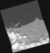
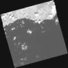
DE2_OPER_HRA_PM4_1C_20210811T115248_N37-830_W025-379_0001
Download Product | Product Info | Browse
Platform Short Name | GEOSAT |
Platform Serial Identifier | 2 |
Product Type | HRA_PM4_1C |
Start Date | 2021-08-11T11:52:48Z |
Stop Date | 2021-08-11T11:52:51Z |
Original Name | DE2_PM4_L1C_000000_20210811T115248_20210811T115251_DE2_38722_DE51.zip |
Footprint | 37.7652139227 -25.2537511771 37.935129788 -25.3139643536 37.8962078824 -25.5047467585 37.7264401681 -25.4441115629 37.7652139227 -25.2537511771 |
Orbit Direction | ASCENDING |
Scene Centre Longitude | W025 |
Scene Centre Latitude | N37 |
Cloud Cover Percentage | -1 |
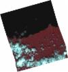
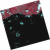
DE2_OPER_HRA_PSH_1C_20210811T115248_N37-830_W025-379_0001
Download Product | Product Info | Browse
Platform Short Name | GEOSAT |
Platform Serial Identifier | 2 |
Product Type | HRA_PSH_1C |
Start Date | 2021-08-11T11:52:48Z |
Stop Date | 2021-08-11T11:52:51Z |
Original Name | DE2_PSH_L1C_000000_20210811T115248_20210811T115251_DE2_38722_DE51.zip |
Footprint | 37.7652139227 -25.2537511771 37.935129788 -25.3139643536 37.8962078824 -25.5047467585 37.7264401681 -25.4441115629 37.7652139227 -25.2537511771 |
Orbit Direction | ASCENDING |
Scene Centre Longitude | W025 |
Scene Centre Latitude | N37 |
Cloud Cover Percentage | -1 |
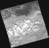
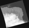
DE2_OPER_HRA_PM4_1C_20210805T115622_N37-828_W025-264_0001
Download Product | Product Info | Browse
Platform Short Name | GEOSAT |
Platform Serial Identifier | 2 |
Product Type | HRA_PM4_1C |
Start Date | 2021-08-05T11:56:22Z |
Stop Date | 2021-08-05T11:56:24Z |
Original Name | DE2_PM4_L1C_000000_20210805T115622_20210805T115624_DE2_38633_37FD.zip |
Footprint | 37.7783481372 -25.1566773779 37.9120493501 -25.2035510616 37.8783417279 -25.3726582643 37.7445526412 -25.3260440857 37.7783481372 -25.1566773779 |
Orbit Direction | ASCENDING |
Scene Centre Longitude | W025 |
Scene Centre Latitude | N37 |
Cloud Cover Percentage | -1 |
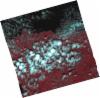
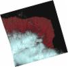
DE2_OPER_HRA_PSH_1C_20210805T115622_N37-828_W025-264_0001
Download Product | Product Info | Browse
Platform Short Name | GEOSAT |
Platform Serial Identifier | 2 |
Product Type | HRA_PSH_1C |
Start Date | 2021-08-05T11:56:22Z |
Stop Date | 2021-08-05T11:56:24Z |
Original Name | DE2_PSH_L1C_000000_20210805T115622_20210805T115624_DE2_38633_37FD.zip |
Footprint | 37.7783481372 -25.1566773779 37.9120493501 -25.2035510616 37.8783417279 -25.3726582643 37.7445526412 -25.3260440857 37.7783481372 -25.1566773779 |
Orbit Direction | ASCENDING |
Scene Centre Longitude | W025 |
Scene Centre Latitude | N37 |
Cloud Cover Percentage | -1 |
DE2_OPER_HRA_PM4_1C_20210805T115620_N37-706_W025-224_0001
Download Product | Product Info | Browse
Platform Short Name | GEOSAT |
Platform Serial Identifier | 2 |
Product Type | HRA_PM4_1C |
Start Date | 2021-08-05T11:56:20Z |
Stop Date | 2021-08-05T11:56:22Z |
Original Name | DE2_PM4_L1C_000000_20210805T115620_20210805T115622_DE2_38633_6122.zip |
Footprint | 37.6563860002 -25.1189659428 37.7906160485 -25.1618831376 37.7568798824 -25.3306955751 37.6227421327 -25.2878192112 37.6563860002 -25.1189659428 |
Orbit Direction | ASCENDING |
Scene Centre Longitude | W025 |
Scene Centre Latitude | N37 |
Cloud Cover Percentage | -1 |
DE2_OPER_HRA_PSH_1C_20210805T115620_N37-706_W025-224_0001
Download Product | Product Info | Browse
Platform Short Name | GEOSAT |
Platform Serial Identifier | 2 |
Product Type | HRA_PSH_1C |
Start Date | 2021-08-05T11:56:20Z |
Stop Date | 2021-08-05T11:56:22Z |
Original Name | DE2_PSH_L1C_000000_20210805T115620_20210805T115622_DE2_38633_6122.zip |
Footprint | 37.6563860002 -25.1189659428 37.7906160485 -25.1618831376 37.7568798824 -25.3306955751 37.6227421327 -25.2878192112 37.6563860002 -25.1189659428 |
Orbit Direction | ASCENDING |
Scene Centre Longitude | W025 |
Scene Centre Latitude | N37 |
Cloud Cover Percentage | -1 |
DE2_OPER_HRA_PM4_1C_20210610T115649_N37-815_W025-202_0001
Download Product | Product Info | Browse
Platform Short Name | GEOSAT |
Platform Serial Identifier | 2 |
Product Type | HRA_PM4_1C |
Start Date | 2021-06-10T11:56:49Z |
Stop Date | 2021-06-10T11:56:51Z |
Original Name | DE2_PM4_L1C_000000_20210610T115649_20210610T115651_DE2_37802_65C4.zip |
Footprint | 37.764995559 -25.0927696905 37.9009203418 -25.1380906018 37.8657166801 -25.3131944145 37.729622866 -25.2667571906 37.764995559 -25.0927696905 |
Orbit Direction | ASCENDING |
Scene Centre Longitude | W025 |
Scene Centre Latitude | N37 |
Cloud Cover Percentage | -1 |
DE2_OPER_HRA_PSH_1C_20210610T115649_N37-815_W025-202_0001
Download Product | Product Info | Browse
Platform Short Name | GEOSAT |
Platform Serial Identifier | 2 |
Product Type | HRA_PSH_1C |
Start Date | 2021-06-10T11:56:49Z |
Stop Date | 2021-06-10T11:56:51Z |
Original Name | DE2_PSH_L1C_000000_20210610T115649_20210610T115651_DE2_37802_65C4.zip |
Footprint | 37.764995559 -25.0927696905 37.9009203418 -25.1380906018 37.8657166801 -25.3131944145 37.729622866 -25.2667571906 37.764995559 -25.0927696905 |
Orbit Direction | ASCENDING |
Scene Centre Longitude | W025 |
Scene Centre Latitude | N37 |
Cloud Cover Percentage | -1 |