ESA TPM Map Catalogue - Product List
back to previous node |
list of download URLs

Collection G2_Portugal_2021
GEOSAT-2 Portugal Coverage 2021 collection. More details here.
List of available products (latitude from 37.7175 to 37.7959 dg, longitude from -8.39938 to -8.255 dg)..
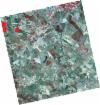
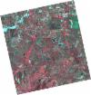
DE2_OPER_HRA_PSH_1C_20210708T110804_N37-803_W008-251_0001
Download Product | Product Info | Browse
Platform Short Name | GEOSAT |
Platform Serial Identifier | 2 |
Product Type | HRA_PSH_1C |
Start Date | 2021-07-08T11:08:04Z |
Stop Date | 2021-07-08T11:08:06Z |
Original Name | DE2_PSH_L1C_000000_20210708T110804_20210708T110806_DE2_38217_B3B0.zip |
Footprint | 37.7523344347 -8.16121189972 37.8791659533 -8.19399070022 37.854951697 -8.34165114283 37.7281640182 -8.30845060788 37.7523344347 -8.16121189972 |
Orbit Direction | ASCENDING |
Scene Centre Longitude | W008 |
Scene Centre Latitude | N37 |
Cloud Cover Percentage | -1 |
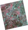
DE2_OPER_HRA_PM4_1C_20210708T110804_N37-803_W008-251_0001
Download Product | Product Info | Browse
Platform Short Name | GEOSAT |
Platform Serial Identifier | 2 |
Product Type | HRA_PM4_1C |
Start Date | 2021-07-08T11:08:04Z |
Stop Date | 2021-07-08T11:08:06Z |
Original Name | DE2_PM4_L1C_000000_20210708T110804_20210708T110806_DE2_38217_B3B0.zip |
Footprint | 37.7523344347 -8.16121189972 37.8791659533 -8.19399070022 37.854951697 -8.34165114283 37.7281640182 -8.30845060788 37.7523344347 -8.16121189972 |
Orbit Direction | ASCENDING |
Scene Centre Longitude | W008 |
Scene Centre Latitude | N37 |
Cloud Cover Percentage | -1 |
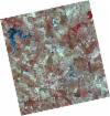
DE2_OPER_HRA_PSH_1C_20210708T110802_N37-688_W008-221_0001
Download Product | Product Info | Browse
Platform Short Name | GEOSAT |
Platform Serial Identifier | 2 |
Product Type | HRA_PSH_1C |
Start Date | 2021-07-08T11:08:02Z |
Stop Date | 2021-07-08T11:08:04Z |
Original Name | DE2_PSH_L1C_000000_20210708T110802_20210708T110804_DE2_38217_87E3.zip |
Footprint | 37.6372526327 -8.13101320728 37.7640640424 -8.16426403703 37.73988303 -8.31147411078 37.6130839154 -8.27812692336 37.6372526327 -8.13101320728 |
Orbit Direction | ASCENDING |
Scene Centre Longitude | W008 |
Scene Centre Latitude | N37 |
Cloud Cover Percentage | -1 |
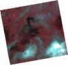
DE2_OPER_HRA_PM4_1C_20210708T110802_N37-688_W008-221_0001
Download Product | Product Info | Browse
Platform Short Name | GEOSAT |
Platform Serial Identifier | 2 |
Product Type | HRA_PM4_1C |
Start Date | 2021-07-08T11:08:02Z |
Stop Date | 2021-07-08T11:08:04Z |
Original Name | DE2_PM4_L1C_000000_20210708T110802_20210708T110804_DE2_38217_87E3.zip |
Footprint | 37.6372526327 -8.13101320728 37.7640640424 -8.16426403703 37.73988303 -8.31147411078 37.6130839154 -8.27812692336 37.6372526327 -8.13101320728 |
Orbit Direction | ASCENDING |
Scene Centre Longitude | W008 |
Scene Centre Latitude | N37 |
Cloud Cover Percentage | -1 |
DE2_OPER_HRA_PSH_1C_20210507T111107_N37-805_W008-406_0001
Download Product | Product Info | Browse
Platform Short Name | GEOSAT |
Platform Serial Identifier | 2 |
Product Type | HRA_PSH_1C |
Start Date | 2021-05-07T11:11:07Z |
Stop Date | 2021-05-07T11:11:09Z |
Original Name | DE2_PSH_L1C_000000_20210507T111107_20210507T111109_DE2_37297_EF97.zip |
Footprint | 37.7537468478 -8.31601124434 37.8806195701 -8.34916655725 37.8564115418 -8.49799939971 37.7295380545 -8.46467633539 37.7537468478 -8.31601124434 |
Orbit Direction | ASCENDING |
Scene Centre Longitude | W008 |
Scene Centre Latitude | N37 |
Cloud Cover Percentage | -1 |
DE2_OPER_HRA_PM4_1C_20210507T111107_N37-805_W008-406_0001
Download Product | Product Info | Browse
Platform Short Name | GEOSAT |
Platform Serial Identifier | 2 |
Product Type | HRA_PM4_1C |
Start Date | 2021-05-07T11:11:07Z |
Stop Date | 2021-05-07T11:11:09Z |
Original Name | DE2_PM4_L1C_000000_20210507T111107_20210507T111109_DE2_37297_EF97.zip |
Footprint | 37.7537468478 -8.31601124434 37.8806195701 -8.34916655725 37.8564115418 -8.49799939971 37.7295380545 -8.46467633539 37.7537468478 -8.31601124434 |
Orbit Direction | ASCENDING |
Scene Centre Longitude | W008 |
Scene Centre Latitude | N37 |
Cloud Cover Percentage | -1 |
DE2_OPER_HRA_PSH_1C_20210507T111105_N37-689_W008-376_0001
Download Product | Product Info | Browse
Platform Short Name | GEOSAT |
Platform Serial Identifier | 2 |
Product Type | HRA_PSH_1C |
Start Date | 2021-05-07T11:11:05Z |
Stop Date | 2021-05-07T11:11:07Z |
Original Name | DE2_PSH_L1C_000000_20210507T111105_20210507T111107_DE2_37297_1A73.zip |
Footprint | 37.6385575481 -8.28624518514 37.7654800904 -8.31919857788 37.7413073702 -8.46773269533 37.6144037503 -8.43458708529 37.6385575481 -8.28624518514 |
Orbit Direction | ASCENDING |
Scene Centre Longitude | W008 |
Scene Centre Latitude | N37 |
Cloud Cover Percentage | -1 |
DE2_OPER_HRA_PM4_1C_20210507T111105_N37-689_W008-376_0001
Download Product | Product Info | Browse
Platform Short Name | GEOSAT |
Platform Serial Identifier | 2 |
Product Type | HRA_PM4_1C |
Start Date | 2021-05-07T11:11:05Z |
Stop Date | 2021-05-07T11:11:07Z |
Original Name | DE2_PM4_L1C_000000_20210507T111105_20210507T111107_DE2_37297_1A73.zip |
Footprint | 37.6385575481 -8.28624518514 37.7654800904 -8.31919857788 37.7413073702 -8.46773269533 37.6144037503 -8.43458708529 37.6385575481 -8.28624518514 |
Orbit Direction | ASCENDING |
Scene Centre Longitude | W008 |
Scene Centre Latitude | N37 |
Cloud Cover Percentage | -1 |
DE2_OPER_HRA_PSH_1C_20210319T112125_N37-686_W008-273_0001
Download Product | Product Info | Browse
Platform Short Name | GEOSAT |
Platform Serial Identifier | 2 |
Product Type | HRA_PSH_1C |
Start Date | 2021-03-19T11:21:25Z |
Stop Date | 2021-03-19T11:21:28Z |
Original Name | DE2_PSH_L1C_000000_20210319T112125_20210319T112128_DE2_36570_FA9D.zip |
Footprint | 37.6273457341 -8.16133518122 37.7716705727 -8.19362621323 37.7459088249 -8.38663891586 37.6015803041 -8.35429011238 37.6273457341 -8.16133518122 |
Orbit Direction | ASCENDING |
Scene Centre Longitude | W008 |
Scene Centre Latitude | N37 |
Cloud Cover Percentage | -1 |
DE2_OPER_HRA_PM4_1C_20210319T112125_N37-686_W008-273_0001
Download Product | Product Info | Browse
Platform Short Name | GEOSAT |
Platform Serial Identifier | 2 |
Product Type | HRA_PM4_1C |
Start Date | 2021-03-19T11:21:25Z |
Stop Date | 2021-03-19T11:21:28Z |
Original Name | DE2_PM4_L1C_000000_20210319T112125_20210319T112128_DE2_36570_FA9D.zip |
Footprint | 37.6273457341 -8.16133518122 37.7716705727 -8.19362621323 37.7459088249 -8.38663891586 37.6015803041 -8.35429011238 37.6273457341 -8.16133518122 |
Orbit Direction | ASCENDING |
Scene Centre Longitude | W008 |
Scene Centre Latitude | N37 |
Cloud Cover Percentage | -1 |