ESA TPM Map Catalogue - Product List
back to previous node |
list of download URLs
Collection G2_Portugal_2021
GEOSAT-2 Portugal Coverage 2021 collection. More details here.
List of available products (latitude from 37.6819 to 37.7603 dg, longitude from -25.5113 to -25.36 dg)..
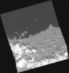
DE2_OPER_HRA_PM4_1C_20210811T115248_N37-830_W025-379_0001
Download Product | Product Info | Browse
Platform Short Name | GEOSAT |
Platform Serial Identifier | 2 |
Product Type | HRA_PM4_1C |
Start Date | 2021-08-11T11:52:48Z |
Stop Date | 2021-08-11T11:52:51Z |
Original Name | DE2_PM4_L1C_000000_20210811T115248_20210811T115251_DE2_38722_DE51.zip |
Footprint | 37.7652139227 -25.2537511771 37.935129788 -25.3139643536 37.8962078824 -25.5047467585 37.7264401681 -25.4441115629 37.7652139227 -25.2537511771 |
Orbit Direction | ASCENDING |
Scene Centre Longitude | W025 |
Scene Centre Latitude | N37 |
Cloud Cover Percentage | -1 |
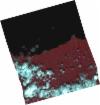
DE2_OPER_HRA_PSH_1C_20210811T115248_N37-830_W025-379_0001
Download Product | Product Info | Browse
Platform Short Name | GEOSAT |
Platform Serial Identifier | 2 |
Product Type | HRA_PSH_1C |
Start Date | 2021-08-11T11:52:48Z |
Stop Date | 2021-08-11T11:52:51Z |
Original Name | DE2_PSH_L1C_000000_20210811T115248_20210811T115251_DE2_38722_DE51.zip |
Footprint | 37.7652139227 -25.2537511771 37.935129788 -25.3139643536 37.8962078824 -25.5047467585 37.7264401681 -25.4441115629 37.7652139227 -25.2537511771 |
Orbit Direction | ASCENDING |
Scene Centre Longitude | W025 |
Scene Centre Latitude | N37 |
Cloud Cover Percentage | -1 |
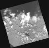
DE2_OPER_HRA_PM4_1C_20210604T120012_N37-799_W025-485_0001
Download Product | Product Info | Browse
Platform Short Name | GEOSAT |
Platform Serial Identifier | 2 |
Product Type | HRA_PM4_1C |
Start Date | 2021-06-04T12:00:12Z |
Stop Date | 2021-06-04T12:00:15Z |
Original Name | DE2_PM4_L1C_000000_20210604T120012_20210604T120015_DE2_37713_AB5A.zip |
Footprint | 37.7493602482 -25.3803399066 37.8815790185 -25.4258095016 37.8487776619 -25.590734601 37.7163107078 -25.5470778992 37.7493602482 -25.3803399066 |
Orbit Direction | ASCENDING |
Scene Centre Longitude | W025 |
Scene Centre Latitude | N37 |
Cloud Cover Percentage | -1 |
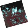
DE2_OPER_HRA_PSH_1C_20210604T120012_N37-799_W025-485_0001
Download Product | Product Info | Browse
Platform Short Name | GEOSAT |
Platform Serial Identifier | 2 |
Product Type | HRA_PSH_1C |
Start Date | 2021-06-04T12:00:12Z |
Stop Date | 2021-06-04T12:00:15Z |
Original Name | DE2_PSH_L1C_000000_20210604T120012_20210604T120015_DE2_37713_AB5A.zip |
Footprint | 37.7493602482 -25.3803399066 37.8815790185 -25.4258095016 37.8487776619 -25.590734601 37.7163107078 -25.5470778992 37.7493602482 -25.3803399066 |
Orbit Direction | ASCENDING |
Scene Centre Longitude | W025 |
Scene Centre Latitude | N37 |
Cloud Cover Percentage | -1 |
DE2_OPER_HRA_PM4_1C_20210604T120011_N37-678_W025-446_0001
Download Product | Product Info | Browse
Platform Short Name | GEOSAT |
Platform Serial Identifier | 2 |
Product Type | HRA_PM4_1C |
Start Date | 2021-06-04T12:00:11Z |
Stop Date | 2021-06-04T12:00:13Z |
Original Name | DE2_PM4_L1C_000000_20210604T120011_20210604T120013_DE2_37713_A948.zip |
Footprint | 37.6289140109 -25.3432427867 37.7617112725 -25.383918914 37.7285678011 -25.5511021423 37.5962278793 -25.507534578 37.6289140109 -25.3432427867 |
Orbit Direction | ASCENDING |
Scene Centre Longitude | W025 |
Scene Centre Latitude | N37 |
Cloud Cover Percentage | -1 |
DE2_OPER_HRA_PSH_1C_20210604T120011_N37-678_W025-446_0001
Download Product | Product Info | Browse
Platform Short Name | GEOSAT |
Platform Serial Identifier | 2 |
Product Type | HRA_PSH_1C |
Start Date | 2021-06-04T12:00:11Z |
Stop Date | 2021-06-04T12:00:13Z |
Original Name | DE2_PSH_L1C_000000_20210604T120011_20210604T120013_DE2_37713_A948.zip |
Footprint | 37.6289140109 -25.3432427867 37.7617112725 -25.383918914 37.7285678011 -25.5511021423 37.5962278793 -25.507534578 37.6289140109 -25.3432427867 |
Orbit Direction | ASCENDING |
Scene Centre Longitude | W025 |
Scene Centre Latitude | N37 |
Cloud Cover Percentage | -1 |