ESA TPM Map Catalogue - Product List
back to previous node |
list of download URLs
Collection G2_Portugal_2021
GEOSAT-2 Portugal Coverage 2021 collection. More details here.
List of available products (latitude from 37.6034 to 37.6819 dg, longitude from -8.68812 to -8.54375 dg)..
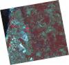
DE2_OPER_HRA_PSH_1C_20210721T111630_N37-713_W008-516_0001
Download Product | Product Info | Browse
Platform Short Name | GEOSAT |
Platform Serial Identifier | 2 |
Product Type | HRA_PSH_1C |
Start Date | 2021-07-21T11:16:30Z |
Stop Date | 2021-07-21T11:16:33Z |
Original Name | DE2_PSH_L1C_000000_20210721T111630_20210721T111633_DE2_38410_BED8.zip |
Footprint | 37.6558342586 -8.41078007971 37.7953303563 -8.44247929697 37.7700878524 -8.62284640821 37.6306823032 -8.59006242171 37.6558342586 -8.41078007971 |
Orbit Direction | ASCENDING |
Scene Centre Longitude | W008 |
Scene Centre Latitude | N37 |
Cloud Cover Percentage | -1 |
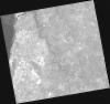
DE2_OPER_HRA_PM4_1C_20210721T111630_N37-713_W008-516_0001
Download Product | Product Info | Browse
Platform Short Name | GEOSAT |
Platform Serial Identifier | 2 |
Product Type | HRA_PM4_1C |
Start Date | 2021-07-21T11:16:30Z |
Stop Date | 2021-07-21T11:16:33Z |
Original Name | DE2_PM4_L1C_000000_20210721T111630_20210721T111633_DE2_38410_BED8.zip |
Footprint | 37.6558342586 -8.41078007971 37.7953303563 -8.44247929697 37.7700878524 -8.62284640821 37.6306823032 -8.59006242171 37.6558342586 -8.41078007971 |
Orbit Direction | ASCENDING |
Scene Centre Longitude | W008 |
Scene Centre Latitude | N37 |
Cloud Cover Percentage | -1 |
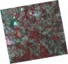
DE2_OPER_HRA_PSH_1C_20210721T111628_N37-586_W008-486_0001
Download Product | Product Info | Browse
Platform Short Name | GEOSAT |
Platform Serial Identifier | 2 |
Product Type | HRA_PSH_1C |
Start Date | 2021-07-21T11:16:28Z |
Stop Date | 2021-07-21T11:16:31Z |
Original Name | DE2_PSH_L1C_000000_20210721T111628_20210721T111631_DE2_38410_F65B.zip |
Footprint | 37.5294360797 -8.38064063489 37.6687725495 -8.41343315613 37.6436241262 -8.59290728084 37.5043004719 -8.55966342834 37.5294360797 -8.38064063489 |
Orbit Direction | ASCENDING |
Scene Centre Longitude | W008 |
Scene Centre Latitude | N37 |
Cloud Cover Percentage | -1 |
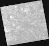
DE2_OPER_HRA_PM4_1C_20210721T111628_N37-586_W008-486_0001
Download Product | Product Info | Browse
Platform Short Name | GEOSAT |
Platform Serial Identifier | 2 |
Product Type | HRA_PM4_1C |
Start Date | 2021-07-21T11:16:28Z |
Stop Date | 2021-07-21T11:16:31Z |
Original Name | DE2_PM4_L1C_000000_20210721T111628_20210721T111631_DE2_38410_F65B.zip |
Footprint | 37.5294360797 -8.38064063489 37.6687725495 -8.41343315613 37.6436241262 -8.59290728084 37.5043004719 -8.55966342834 37.5294360797 -8.38064063489 |
Orbit Direction | ASCENDING |
Scene Centre Longitude | W008 |
Scene Centre Latitude | N37 |
Cloud Cover Percentage | -1 |
DE2_OPER_HRA_PSH_1C_20210715T112000_N37-660_W008-710_0001
Download Product | Product Info | Browse
Platform Short Name | GEOSAT |
Platform Serial Identifier | 2 |
Product Type | HRA_PSH_1C |
Start Date | 2021-07-15T11:20:00Z |
Stop Date | 2021-07-15T11:20:03Z |
Original Name | DE2_PSH_L1C_000000_20210715T112000_20210715T112003_DE2_38321_CE8F.zip |
Footprint | 37.6012096637 -8.59631621376 37.7461872329 -8.63001657635 37.7203895459 -8.82535109578 37.5753656791 -8.7919620806 37.6012096637 -8.59631621376 |
Orbit Direction | ASCENDING |
Scene Centre Longitude | W008 |
Scene Centre Latitude | N37 |
Cloud Cover Percentage | -1 |
DE2_OPER_HRA_PM4_1C_20210715T112000_N37-660_W008-710_0001
Download Product | Product Info | Browse
Platform Short Name | GEOSAT |
Platform Serial Identifier | 2 |
Product Type | HRA_PM4_1C |
Start Date | 2021-07-15T11:20:00Z |
Stop Date | 2021-07-15T11:20:03Z |
Original Name | DE2_PM4_L1C_000000_20210715T112000_20210715T112003_DE2_38321_CE8F.zip |
Footprint | 37.6012096637 -8.59631621376 37.7461872329 -8.63001657635 37.7203895459 -8.82535109578 37.5753656791 -8.7919620806 37.6012096637 -8.59631621376 |
Orbit Direction | ASCENDING |
Scene Centre Longitude | W008 |
Scene Centre Latitude | N37 |
Cloud Cover Percentage | -1 |
DE2_OPER_HRA_PSH_1C_20210715T111958_N37-529_W008-680_0001
Download Product | Product Info | Browse
Platform Short Name | GEOSAT |
Platform Serial Identifier | 2 |
Product Type | HRA_PSH_1C |
Start Date | 2021-07-15T11:19:58Z |
Stop Date | 2021-07-15T11:20:01Z |
Original Name | DE2_PSH_L1C_000000_20210715T111958_20210715T112001_DE2_38321_2F79.zip |
Footprint | 37.4696816167 -8.56703355144 37.6146657628 -8.59933678073 37.5888034158 -8.79500843247 37.4438898256 -8.76175224807 37.4696816167 -8.56703355144 |
Orbit Direction | ASCENDING |
Scene Centre Longitude | W008 |
Scene Centre Latitude | N37 |
Cloud Cover Percentage | -1 |
DE2_OPER_HRA_PM4_1C_20210715T111958_N37-529_W008-680_0001
Download Product | Product Info | Browse
Platform Short Name | GEOSAT |
Platform Serial Identifier | 2 |
Product Type | HRA_PM4_1C |
Start Date | 2021-07-15T11:19:58Z |
Stop Date | 2021-07-15T11:20:01Z |
Original Name | DE2_PM4_L1C_000000_20210715T111958_20210715T112001_DE2_38321_2F79.zip |
Footprint | 37.4696816167 -8.56703355144 37.6146657628 -8.59933678073 37.5888034158 -8.79500843247 37.4438898256 -8.76175224807 37.4696816167 -8.56703355144 |
Orbit Direction | ASCENDING |
Scene Centre Longitude | W008 |
Scene Centre Latitude | N37 |
Cloud Cover Percentage | -1 |
DE2_OPER_HRA_PSH_1C_20210607T110947_N37-655_W008-608_0001
Download Product | Product Info | Browse
Platform Short Name | GEOSAT |
Platform Serial Identifier | 2 |
Product Type | HRA_PSH_1C |
Start Date | 2021-06-07T11:09:47Z |
Stop Date | 2021-06-07T11:09:49Z |
Original Name | DE2_PSH_L1C_000000_20210607T110947_20210607T110949_DE2_37757_A30E.zip |
Footprint | 37.6045110464 -8.519384372 37.7301080851 -8.55279743804 37.7059293093 -8.69796997571 37.5803382917 -8.66446730142 37.6045110464 -8.519384372 |
Orbit Direction | ASCENDING |
Scene Centre Longitude | W008 |
Scene Centre Latitude | N37 |
Cloud Cover Percentage | -1 |
DE2_OPER_HRA_PM4_1C_20210607T110947_N37-655_W008-608_0001
Download Product | Product Info | Browse
Platform Short Name | GEOSAT |
Platform Serial Identifier | 2 |
Product Type | HRA_PM4_1C |
Start Date | 2021-06-07T11:09:47Z |
Stop Date | 2021-06-07T11:09:49Z |
Original Name | DE2_PM4_L1C_000000_20210607T110947_20210607T110949_DE2_37757_A30E.zip |
Footprint | 37.6045110464 -8.519384372 37.7301080851 -8.55279743804 37.7059293093 -8.69796997571 37.5803382917 -8.66446730142 37.6045110464 -8.519384372 |
Orbit Direction | ASCENDING |
Scene Centre Longitude | W008 |
Scene Centre Latitude | N37 |
Cloud Cover Percentage | -1 |
DE2_OPER_HRA_PSH_1C_20210607T110945_N37-541_W008-578_0001
Download Product | Product Info | Browse
Platform Short Name | GEOSAT |
Platform Serial Identifier | 2 |
Product Type | HRA_PSH_1C |
Start Date | 2021-06-07T11:09:45Z |
Stop Date | 2021-06-07T11:09:47Z |
Original Name | DE2_PSH_L1C_000000_20210607T110945_20210607T110947_DE2_37757_C967.zip |
Footprint | 37.4905145761 -8.48870812298 37.6161443987 -8.52253882633 37.5919744229 -8.66754990992 37.4662979214 -8.633961655 37.4905145761 -8.48870812298 |
Orbit Direction | ASCENDING |
Scene Centre Longitude | W008 |
Scene Centre Latitude | N37 |
Cloud Cover Percentage | -1 |
DE2_OPER_HRA_PM4_1C_20210607T110945_N37-541_W008-578_0001
Download Product | Product Info | Browse
Platform Short Name | GEOSAT |
Platform Serial Identifier | 2 |
Product Type | HRA_PM4_1C |
Start Date | 2021-06-07T11:09:45Z |
Stop Date | 2021-06-07T11:09:47Z |
Original Name | DE2_PM4_L1C_000000_20210607T110945_20210607T110947_DE2_37757_C967.zip |
Footprint | 37.4905145761 -8.48870812298 37.6161443987 -8.52253882633 37.5919744229 -8.66754990992 37.4662979214 -8.633961655 37.4905145761 -8.48870812298 |
Orbit Direction | ASCENDING |
Scene Centre Longitude | W008 |
Scene Centre Latitude | N37 |
Cloud Cover Percentage | -1 |