ESA TPM Map Catalogue - Product List
back to previous node |
list of download URLs
Collection G2_Portugal_2021
GEOSAT-2 Portugal Coverage 2021 collection. More details here.
List of available products (latitude from 37.525 to 37.6034 dg, longitude from -8.39938 to -8.255 dg)..
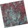
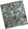
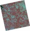
DE2_OPER_HRA_PSH_1C_20210721T111628_N37-586_W008-486_0001
Download Product | Product Info | Browse
Platform Short Name | GEOSAT |
Platform Serial Identifier | 2 |
Product Type | HRA_PSH_1C |
Start Date | 2021-07-21T11:16:28Z |
Stop Date | 2021-07-21T11:16:31Z |
Original Name | DE2_PSH_L1C_000000_20210721T111628_20210721T111631_DE2_38410_F65B.zip |
Footprint | 37.5294360797 -8.38064063489 37.6687725495 -8.41343315613 37.6436241262 -8.59290728084 37.5043004719 -8.55966342834 37.5294360797 -8.38064063489 |
Orbit Direction | ASCENDING |
Scene Centre Longitude | W008 |
Scene Centre Latitude | N37 |
Cloud Cover Percentage | -1 |
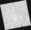
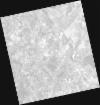
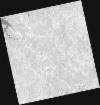
DE2_OPER_HRA_PM4_1C_20210721T111628_N37-586_W008-486_0001
Download Product | Product Info | Browse
Platform Short Name | GEOSAT |
Platform Serial Identifier | 2 |
Product Type | HRA_PM4_1C |
Start Date | 2021-07-21T11:16:28Z |
Stop Date | 2021-07-21T11:16:31Z |
Original Name | DE2_PM4_L1C_000000_20210721T111628_20210721T111631_DE2_38410_F65B.zip |
Footprint | 37.5294360797 -8.38064063489 37.6687725495 -8.41343315613 37.6436241262 -8.59290728084 37.5043004719 -8.55966342834 37.5294360797 -8.38064063489 |
Orbit Direction | ASCENDING |
Scene Centre Longitude | W008 |
Scene Centre Latitude | N37 |
Cloud Cover Percentage | -1 |
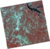
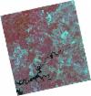
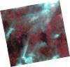
DE2_OPER_HRA_PSH_1C_20210721T111626_N37-460_W008-456_0001
Download Product | Product Info | Browse
Platform Short Name | GEOSAT |
Platform Serial Identifier | 2 |
Product Type | HRA_PSH_1C |
Start Date | 2021-07-21T11:16:26Z |
Stop Date | 2021-07-21T11:16:28Z |
Original Name | DE2_PSH_L1C_000000_20210721T111626_20210721T111628_DE2_38410_4AD6.zip |
Footprint | 37.4031316107 -8.3509209802 37.5423710501 -8.38377674245 37.5172699679 -8.56241340328 37.3778605658 -8.5308390044 37.4031316107 -8.3509209802 |
Orbit Direction | ASCENDING |
Scene Centre Longitude | W008 |
Scene Centre Latitude | N37 |
Cloud Cover Percentage | -1 |
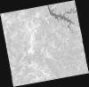
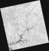
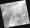
DE2_OPER_HRA_PM4_1C_20210721T111626_N37-460_W008-456_0001
Download Product | Product Info | Browse
Platform Short Name | GEOSAT |
Platform Serial Identifier | 2 |
Product Type | HRA_PM4_1C |
Start Date | 2021-07-21T11:16:26Z |
Stop Date | 2021-07-21T11:16:28Z |
Original Name | DE2_PM4_L1C_000000_20210721T111626_20210721T111628_DE2_38410_4AD6.zip |
Footprint | 37.4031316107 -8.3509209802 37.5423710501 -8.38377674245 37.5172699679 -8.56241340328 37.3778605658 -8.5308390044 37.4031316107 -8.3509209802 |
Orbit Direction | ASCENDING |
Scene Centre Longitude | W008 |
Scene Centre Latitude | N37 |
Cloud Cover Percentage | -1 |
DE2_OPER_HRA_PSH_1C_20210708T110800_N37-573_W008-190_0001
Download Product | Product Info | Browse
Platform Short Name | GEOSAT |
Platform Serial Identifier | 2 |
Product Type | HRA_PSH_1C |
Start Date | 2021-07-08T11:08:00Z |
Stop Date | 2021-07-08T11:08:02Z |
Original Name | DE2_PSH_L1C_000000_20210708T110800_20210708T110802_DE2_38217_E5E8.zip |
Footprint | 37.5223417155 -8.10052860811 37.6490037854 -8.13410697781 37.6248379446 -8.28119193451 37.4981943245 -8.24738271162 37.5223417155 -8.10052860811 |
Orbit Direction | ASCENDING |
Scene Centre Longitude | W008 |
Scene Centre Latitude | N37 |
Cloud Cover Percentage | -1 |
DE2_OPER_HRA_PM4_1C_20210708T110800_N37-573_W008-190_0001
Download Product | Product Info | Browse
Platform Short Name | GEOSAT |
Platform Serial Identifier | 2 |
Product Type | HRA_PM4_1C |
Start Date | 2021-07-08T11:08:00Z |
Stop Date | 2021-07-08T11:08:02Z |
Original Name | DE2_PM4_L1C_000000_20210708T110800_20210708T110802_DE2_38217_E5E8.zip |
Footprint | 37.5223417155 -8.10052860811 37.6490037854 -8.13410697781 37.6248379446 -8.28119193451 37.4981943245 -8.24738271162 37.5223417155 -8.10052860811 |
Orbit Direction | ASCENDING |
Scene Centre Longitude | W008 |
Scene Centre Latitude | N37 |
Cloud Cover Percentage | -1 |
DE2_OPER_HRA_PSH_1C_20210507T111103_N37-574_W008-346_0001
Download Product | Product Info | Browse
Platform Short Name | GEOSAT |
Platform Serial Identifier | 2 |
Product Type | HRA_PSH_1C |
Start Date | 2021-05-07T11:11:03Z |
Stop Date | 2021-05-07T11:11:05Z |
Original Name | DE2_PSH_L1C_000000_20210507T111103_20210507T111105_DE2_37297_2097.zip |
Footprint | 37.5234258281 -8.25637228623 37.6503114421 -8.28932946333 37.6261343727 -8.43782997375 37.4992995396 -8.404324968 37.5234258281 -8.25637228623 |
Orbit Direction | ASCENDING |
Scene Centre Longitude | W008 |
Scene Centre Latitude | N37 |
Cloud Cover Percentage | -1 |
DE2_OPER_HRA_PM4_1C_20210507T111103_N37-574_W008-346_0001
Download Product | Product Info | Browse
Platform Short Name | GEOSAT |
Platform Serial Identifier | 2 |
Product Type | HRA_PM4_1C |
Start Date | 2021-05-07T11:11:03Z |
Stop Date | 2021-05-07T11:11:05Z |
Original Name | DE2_PM4_L1C_000000_20210507T111103_20210507T111105_DE2_37297_2097.zip |
Footprint | 37.5234258281 -8.25637228623 37.6503114421 -8.28932946333 37.6261343727 -8.43782997375 37.4992995396 -8.404324968 37.5234258281 -8.25637228623 |
Orbit Direction | ASCENDING |
Scene Centre Longitude | W008 |
Scene Centre Latitude | N37 |
Cloud Cover Percentage | -1 |
DE2_OPER_HRA_PSH_1C_20210507T111101_N37-459_W008-316_0001
Download Product | Product Info | Browse
Platform Short Name | GEOSAT |
Platform Serial Identifier | 2 |
Product Type | HRA_PSH_1C |
Start Date | 2021-05-07T11:11:01Z |
Stop Date | 2021-05-07T11:11:04Z |
Original Name | DE2_PSH_L1C_000000_20210507T111101_20210507T111104_DE2_37297_05C2.zip |
Footprint | 37.4082643258 -8.22647825825 37.5351875505 -8.25947280586 37.5110969499 -8.40720141154 37.3841913064 -8.37384830381 37.4082643258 -8.22647825825 |
Orbit Direction | ASCENDING |
Scene Centre Longitude | W008 |
Scene Centre Latitude | N37 |
Cloud Cover Percentage | -1 |
DE2_OPER_HRA_PM4_1C_20210507T111101_N37-459_W008-316_0001
Download Product | Product Info | Browse
Platform Short Name | GEOSAT |
Platform Serial Identifier | 2 |
Product Type | HRA_PM4_1C |
Start Date | 2021-05-07T11:11:01Z |
Stop Date | 2021-05-07T11:11:04Z |
Original Name | DE2_PM4_L1C_000000_20210507T111101_20210507T111104_DE2_37297_05C2.zip |
Footprint | 37.4082643258 -8.22647825825 37.5351875505 -8.25947280586 37.5110969499 -8.40720141154 37.3841913064 -8.37384830381 37.4082643258 -8.22647825825 |
Orbit Direction | ASCENDING |
Scene Centre Longitude | W008 |
Scene Centre Latitude | N37 |
Cloud Cover Percentage | -1 |
DE2_OPER_HRA_PSH_1C_20210319T112123_N37-555_W008-244_0001
Download Product | Product Info | Browse
Platform Short Name | GEOSAT |
Platform Serial Identifier | 2 |
Product Type | HRA_PSH_1C |
Start Date | 2021-03-19T11:21:23Z |
Stop Date | 2021-03-19T11:21:26Z |
Original Name | DE2_PSH_L1C_000000_20210319T112123_20210319T112126_DE2_36570_72C0.zip |
Footprint | 37.4964932071 -8.1314845945 37.6407647644 -8.16427865947 37.6149870837 -8.35707202334 37.4707048694 -8.32407791366 37.4964932071 -8.1314845945 |
Orbit Direction | ASCENDING |
Scene Centre Longitude | W008 |
Scene Centre Latitude | N37 |
Cloud Cover Percentage | -1 |
DE2_OPER_HRA_PM4_1C_20210319T112123_N37-555_W008-244_0001
Download Product | Product Info | Browse
Platform Short Name | GEOSAT |
Platform Serial Identifier | 2 |
Product Type | HRA_PM4_1C |
Start Date | 2021-03-19T11:21:23Z |
Stop Date | 2021-03-19T11:21:26Z |
Original Name | DE2_PM4_L1C_000000_20210319T112123_20210319T112126_DE2_36570_72C0.zip |
Footprint | 37.4964932071 -8.1314845945 37.6407647644 -8.16427865947 37.6149870837 -8.35707202334 37.4707048694 -8.32407791366 37.4964932071 -8.1314845945 |
Orbit Direction | ASCENDING |
Scene Centre Longitude | W008 |
Scene Centre Latitude | N37 |
Cloud Cover Percentage | -1 |