ESA TPM Map Catalogue - Product List
back to previous node |
list of download URLs
Collection G2_Portugal_2021
GEOSAT-2 Portugal Coverage 2021 collection. More details here.
List of available products (latitude from 37.525 to 37.6034 dg, longitude from -8.8325 to -8.68812 dg)..
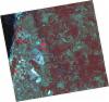
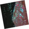
DE2_OPER_HRA_PSH_1C_20210715T112000_N37-660_W008-710_0001
Download Product | Product Info | Browse
Platform Short Name | GEOSAT |
Platform Serial Identifier | 2 |
Product Type | HRA_PSH_1C |
Start Date | 2021-07-15T11:20:00Z |
Stop Date | 2021-07-15T11:20:03Z |
Original Name | DE2_PSH_L1C_000000_20210715T112000_20210715T112003_DE2_38321_CE8F.zip |
Footprint | 37.6012096637 -8.59631621376 37.7461872329 -8.63001657635 37.7203895459 -8.82535109578 37.5753656791 -8.7919620806 37.6012096637 -8.59631621376 |
Orbit Direction | ASCENDING |
Scene Centre Longitude | W008 |
Scene Centre Latitude | N37 |
Cloud Cover Percentage | -1 |
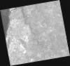
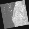
DE2_OPER_HRA_PM4_1C_20210715T112000_N37-660_W008-710_0001
Download Product | Product Info | Browse
Platform Short Name | GEOSAT |
Platform Serial Identifier | 2 |
Product Type | HRA_PM4_1C |
Start Date | 2021-07-15T11:20:00Z |
Stop Date | 2021-07-15T11:20:03Z |
Original Name | DE2_PM4_L1C_000000_20210715T112000_20210715T112003_DE2_38321_CE8F.zip |
Footprint | 37.6012096637 -8.59631621376 37.7461872329 -8.63001657635 37.7203895459 -8.82535109578 37.5753656791 -8.7919620806 37.6012096637 -8.59631621376 |
Orbit Direction | ASCENDING |
Scene Centre Longitude | W008 |
Scene Centre Latitude | N37 |
Cloud Cover Percentage | -1 |
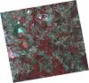
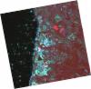
DE2_OPER_HRA_PSH_1C_20210715T111958_N37-529_W008-680_0001
Download Product | Product Info | Browse
Platform Short Name | GEOSAT |
Platform Serial Identifier | 2 |
Product Type | HRA_PSH_1C |
Start Date | 2021-07-15T11:19:58Z |
Stop Date | 2021-07-15T11:20:01Z |
Original Name | DE2_PSH_L1C_000000_20210715T111958_20210715T112001_DE2_38321_2F79.zip |
Footprint | 37.4696816167 -8.56703355144 37.6146657628 -8.59933678073 37.5888034158 -8.79500843247 37.4438898256 -8.76175224807 37.4696816167 -8.56703355144 |
Orbit Direction | ASCENDING |
Scene Centre Longitude | W008 |
Scene Centre Latitude | N37 |
Cloud Cover Percentage | -1 |
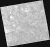
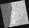
DE2_OPER_HRA_PM4_1C_20210715T111958_N37-529_W008-680_0001
Download Product | Product Info | Browse
Platform Short Name | GEOSAT |
Platform Serial Identifier | 2 |
Product Type | HRA_PM4_1C |
Start Date | 2021-07-15T11:19:58Z |
Stop Date | 2021-07-15T11:20:01Z |
Original Name | DE2_PM4_L1C_000000_20210715T111958_20210715T112001_DE2_38321_2F79.zip |
Footprint | 37.4696816167 -8.56703355144 37.6146657628 -8.59933678073 37.5888034158 -8.79500843247 37.4438898256 -8.76175224807 37.4696816167 -8.56703355144 |
Orbit Direction | ASCENDING |
Scene Centre Longitude | W008 |
Scene Centre Latitude | N37 |
Cloud Cover Percentage | -1 |
DE2_OPER_HRA_PSH_1C_20210419T112056_N37-625_W008-799_0001
Download Product | Product Info | Browse
Platform Short Name | GEOSAT |
Platform Serial Identifier | 2 |
Product Type | HRA_PSH_1C |
Start Date | 2021-04-19T11:20:56Z |
Stop Date | 2021-04-19T11:20:59Z |
Original Name | DE2_PSH_L1C_000000_20210419T112056_20210419T112059_DE2_37030_A990.zip |
Footprint | 37.568349973 -8.69333725213 37.7082886355 -8.72566498704 37.682984035 -8.90651716265 37.5430600944 -8.87415002472 37.568349973 -8.69333725213 |
Orbit Direction | ASCENDING |
Scene Centre Longitude | W008 |
Scene Centre Latitude | N37 |
Cloud Cover Percentage | -1 |
DE2_OPER_HRA_PM4_1C_20210419T112056_N37-625_W008-799_0001
Download Product | Product Info | Browse
Platform Short Name | GEOSAT |
Platform Serial Identifier | 2 |
Product Type | HRA_PM4_1C |
Start Date | 2021-04-19T11:20:56Z |
Stop Date | 2021-04-19T11:20:59Z |
Original Name | DE2_PM4_L1C_000000_20210419T112056_20210419T112059_DE2_37030_A990.zip |
Footprint | 37.568349973 -8.69333725213 37.7082886355 -8.72566498704 37.682984035 -8.90651716265 37.5430600944 -8.87415002472 37.568349973 -8.69333725213 |
Orbit Direction | ASCENDING |
Scene Centre Longitude | W008 |
Scene Centre Latitude | N37 |
Cloud Cover Percentage | -1 |
DE2_OPER_HRA_PSH_1C_20210419T112054_N37-498_W008-770_0001
Download Product | Product Info | Browse
Platform Short Name | GEOSAT |
Platform Serial Identifier | 2 |
Product Type | HRA_PSH_1C |
Start Date | 2021-04-19T11:20:54Z |
Stop Date | 2021-04-19T11:20:57Z |
Original Name | DE2_PSH_L1C_000000_20210419T112054_20210419T112057_DE2_37030_E57B.zip |
Footprint | 37.4415246591 -8.66463027847 37.5813166214 -8.696223104 37.5560224136 -8.87703230771 37.4164448262 -8.84395994873 37.4415246591 -8.66463027847 |
Orbit Direction | ASCENDING |
Scene Centre Longitude | W008 |
Scene Centre Latitude | N37 |
Cloud Cover Percentage | -1 |
DE2_OPER_HRA_PM4_1C_20210419T112054_N37-498_W008-770_0001
Download Product | Product Info | Browse
Platform Short Name | GEOSAT |
Platform Serial Identifier | 2 |
Product Type | HRA_PM4_1C |
Start Date | 2021-04-19T11:20:54Z |
Stop Date | 2021-04-19T11:20:57Z |
Original Name | DE2_PM4_L1C_000000_20210419T112054_20210419T112057_DE2_37030_E57B.zip |
Footprint | 37.4415246591 -8.66463027847 37.5813166214 -8.696223104 37.5560224136 -8.87703230771 37.4164448262 -8.84395994873 37.4415246591 -8.66463027847 |
Orbit Direction | ASCENDING |
Scene Centre Longitude | W008 |
Scene Centre Latitude | N37 |
Cloud Cover Percentage | -1 |