ESA TPM Map Catalogue - Product List
back to previous node |
list of download URLs
Collection G2_Portugal_2021
GEOSAT-2 Portugal Coverage 2021 collection. More details here.
List of available products (latitude from 37.4466 to 37.525 dg, longitude from -8.18938 to -8.045 dg)..
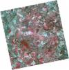
DE2_OPER_HRA_PSH_1C_20211211T110612_N37-580_W008-089_0001
Download Product | Product Info | BrowsePlatform Short Name | GEOSAT |
Platform Serial Identifier | 2 |
Product Type | HRA_PSH_1C |
Start Date | 2021-12-11T11:06:12Z |
Stop Date | 2021-12-11T11:06:15Z |
Original Name | DE2_PSH_L1C_000000_20211211T110612_20211211T110615_DE2_40532_9299.zip |
Footprint | 37.5261280884 -7.99261210686 37.6583855445 -8.02484723129 37.6339127953 -8.18689765447 37.5016881743 -8.15429165239 37.5261280884 -7.99261210686 |
Orbit Direction | ASCENDING |
Scene Centre Longitude | W008 |
Scene Centre Latitude | N37 |
Cloud Cover Percentage | -1 |
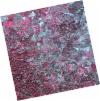
DE2_OPER_HRA_PM4_1C_20211211T110612_N37-580_W008-089_0001
Download Product | Product Info | BrowsePlatform Short Name | GEOSAT |
Platform Serial Identifier | 2 |
Product Type | HRA_PM4_1C |
Start Date | 2021-12-11T11:06:12Z |
Stop Date | 2021-12-11T11:06:15Z |
Original Name | DE2_PM4_L1C_000000_20211211T110612_20211211T110615_DE2_40532_9299.zip |
Footprint | 37.5261280884 -7.99261210686 37.6583855445 -8.02484723129 37.6339127953 -8.18689765447 37.5016881743 -8.15429165239 37.5261280884 -7.99261210686 |
Orbit Direction | ASCENDING |
Scene Centre Longitude | W008 |
Scene Centre Latitude | N37 |
Cloud Cover Percentage | -1 |
DE2_OPER_HRA_PSH_1C_20211211T110610_N37-460_W008-059_0001
Download Product | Product Info | BrowsePlatform Short Name | GEOSAT |
Platform Serial Identifier | 2 |
Product Type | HRA_PSH_1C |
Start Date | 2021-12-11T11:06:10Z |
Stop Date | 2021-12-11T11:06:13Z |
Original Name | DE2_PSH_L1C_000000_20211211T110610_20211211T110613_DE2_40532_D1D7.zip |
Footprint | 37.4061079435 -7.96257888825 37.5383860455 -7.99524861662 37.513897759 -8.15725993003 37.3815564384 -8.1248911356 37.4061079435 -7.96257888825 |
Orbit Direction | ASCENDING |
Scene Centre Longitude | W008 |
Scene Centre Latitude | N37 |
Cloud Cover Percentage | -1 |
DE2_OPER_HRA_PM4_1C_20211211T110610_N37-460_W008-059_0001
Download Product | Product Info | BrowsePlatform Short Name | GEOSAT |
Platform Serial Identifier | 2 |
Product Type | HRA_PM4_1C |
Start Date | 2021-12-11T11:06:10Z |
Stop Date | 2021-12-11T11:06:13Z |
Original Name | DE2_PM4_L1C_000000_20211211T110610_20211211T110613_DE2_40532_D1D7.zip |
Footprint | 37.4061079435 -7.96257888825 37.5383860455 -7.99524861662 37.513897759 -8.15725993003 37.3815564384 -8.1248911356 37.4061079435 -7.96257888825 |
Orbit Direction | ASCENDING |
Scene Centre Longitude | W008 |
Scene Centre Latitude | N37 |
Cloud Cover Percentage | -1 |
DE2_OPER_HRA_PSH_1C_20210708T110800_N37-573_W008-190_0001
Download Product | Product Info | BrowsePlatform Short Name | GEOSAT |
Platform Serial Identifier | 2 |
Product Type | HRA_PSH_1C |
Start Date | 2021-07-08T11:08:00Z |
Stop Date | 2021-07-08T11:08:02Z |
Original Name | DE2_PSH_L1C_000000_20210708T110800_20210708T110802_DE2_38217_E5E8.zip |
Footprint | 37.5223417155 -8.10052860811 37.6490037854 -8.13410697781 37.6248379446 -8.28119193451 37.4981943245 -8.24738271162 37.5223417155 -8.10052860811 |
Orbit Direction | ASCENDING |
Scene Centre Longitude | W008 |
Scene Centre Latitude | N37 |
Cloud Cover Percentage | -1 |
DE2_OPER_HRA_PM4_1C_20210708T110800_N37-573_W008-190_0001
Download Product | Product Info | BrowsePlatform Short Name | GEOSAT |
Platform Serial Identifier | 2 |
Product Type | HRA_PM4_1C |
Start Date | 2021-07-08T11:08:00Z |
Stop Date | 2021-07-08T11:08:02Z |
Original Name | DE2_PM4_L1C_000000_20210708T110800_20210708T110802_DE2_38217_E5E8.zip |
Footprint | 37.5223417155 -8.10052860811 37.6490037854 -8.13410697781 37.6248379446 -8.28119193451 37.4981943245 -8.24738271162 37.5223417155 -8.10052860811 |
Orbit Direction | ASCENDING |
Scene Centre Longitude | W008 |
Scene Centre Latitude | N37 |
Cloud Cover Percentage | -1 |
DE2_OPER_HRA_PM4_1C_20210708T110758_N37-458_W008-160_0001
Download Product | Product Info | BrowsePlatform Short Name | GEOSAT |
Platform Serial Identifier | 2 |
Product Type | HRA_PM4_1C |
Start Date | 2021-07-08T11:07:58Z |
Stop Date | 2021-07-08T11:08:00Z |
Original Name | DE2_PM4_L1C_000000_20210708T110758_20210708T110800_DE2_38217_F101.zip |
Footprint | 37.4072431081 -8.0706022532 37.5340940296 -8.10364713285 37.5099362966 -8.25052346994 37.3831204766 -8.21683318225 37.4072431081 -8.0706022532 |
Orbit Direction | ASCENDING |
Scene Centre Longitude | W008 |
Scene Centre Latitude | N37 |
Cloud Cover Percentage | -1 |
DE2_OPER_HRA_PSH_1C_20210708T110758_N37-458_W008-160_0001
Download Product | Product Info | BrowsePlatform Short Name | GEOSAT |
Platform Serial Identifier | 2 |
Product Type | HRA_PSH_1C |
Start Date | 2021-07-08T11:07:58Z |
Stop Date | 2021-07-08T11:08:00Z |
Original Name | DE2_PSH_L1C_000000_20210708T110758_20210708T110800_DE2_38217_F101.zip |
Footprint | 37.4072431081 -8.0706022532 37.5340940296 -8.10364713285 37.5099362966 -8.25052346994 37.3831204766 -8.21683318225 37.4072431081 -8.0706022532 |
Orbit Direction | ASCENDING |
Scene Centre Longitude | W008 |
Scene Centre Latitude | N37 |
Cloud Cover Percentage | -1 |
DE2_OPER_HRA_PSH_1C_20210331T111501_N37-510_W008-009_0001
Download Product | Product Info | BrowsePlatform Short Name | GEOSAT |
Platform Serial Identifier | 2 |
Product Type | HRA_PSH_1C |
Start Date | 2021-03-31T11:15:01Z |
Stop Date | 2021-03-31T11:15:04Z |
Original Name | DE2_PSH_L1C_000000_20210331T111501_20210331T111504_DE2_36748_786F.zip |
Footprint | 37.455946345 -7.91111404454 37.5895744321 -7.94365078799 37.5649425909 -8.10758316207 37.4313147654 -8.07477211324 37.455946345 -7.91111404454 |
Orbit Direction | ASCENDING |
Scene Centre Longitude | W008 |
Scene Centre Latitude | N37 |
Cloud Cover Percentage | -1 |
DE2_OPER_HRA_PM4_1C_20210331T111501_N37-510_W008-009_0001
Download Product | Product Info | BrowsePlatform Short Name | GEOSAT |
Platform Serial Identifier | 2 |
Product Type | HRA_PM4_1C |
Start Date | 2021-03-31T11:15:01Z |
Stop Date | 2021-03-31T11:15:04Z |
Original Name | DE2_PM4_L1C_000000_20210331T111501_20210331T111504_DE2_36748_786F.zip |
Footprint | 37.455946345 -7.91111404454 37.5895744321 -7.94365078799 37.5649425909 -8.10758316207 37.4313147654 -8.07477211324 37.455946345 -7.91111404454 |
Orbit Direction | ASCENDING |
Scene Centre Longitude | W008 |
Scene Centre Latitude | N37 |
Cloud Cover Percentage | -1 |
DE2_OPER_HRA_PSH_1C_20210319T112123_N37-555_W008-244_0001
Download Product | Product Info | BrowsePlatform Short Name | GEOSAT |
Platform Serial Identifier | 2 |
Product Type | HRA_PSH_1C |
Start Date | 2021-03-19T11:21:23Z |
Stop Date | 2021-03-19T11:21:26Z |
Original Name | DE2_PSH_L1C_000000_20210319T112123_20210319T112126_DE2_36570_72C0.zip |
Footprint | 37.4964932071 -8.1314845945 37.6407647644 -8.16427865947 37.6149870837 -8.35707202334 37.4707048694 -8.32407791366 37.4964932071 -8.1314845945 |
Orbit Direction | ASCENDING |
Scene Centre Longitude | W008 |
Scene Centre Latitude | N37 |
Cloud Cover Percentage | -1 |
DE2_OPER_HRA_PM4_1C_20210319T112123_N37-555_W008-244_0001
Download Product | Product Info | BrowsePlatform Short Name | GEOSAT |
Platform Serial Identifier | 2 |
Product Type | HRA_PM4_1C |
Start Date | 2021-03-19T11:21:23Z |
Stop Date | 2021-03-19T11:21:26Z |
Original Name | DE2_PM4_L1C_000000_20210319T112123_20210319T112126_DE2_36570_72C0.zip |
Footprint | 37.4964932071 -8.1314845945 37.6407647644 -8.16427865947 37.6149870837 -8.35707202334 37.4707048694 -8.32407791366 37.4964932071 -8.1314845945 |
Orbit Direction | ASCENDING |
Scene Centre Longitude | W008 |
Scene Centre Latitude | N37 |
Cloud Cover Percentage | -1 |
DE2_OPER_HRA_PSH_1C_20210319T112121_N37-424_W008-214_0001
Download Product | Product Info | BrowsePlatform Short Name | GEOSAT |
Platform Serial Identifier | 2 |
Product Type | HRA_PSH_1C |
Start Date | 2021-03-19T11:21:21Z |
Stop Date | 2021-03-19T11:21:24Z |
Original Name | DE2_PSH_L1C_000000_20210319T112121_20210319T112124_DE2_36570_9858.zip |
Footprint | 37.3653993166 -8.10230389341 37.5098200688 -8.13463123835 37.4840401814 -8.32719835759 37.3397681096 -8.29322290465 37.3653993166 -8.10230389341 |
Orbit Direction | ASCENDING |
Scene Centre Longitude | W008 |
Scene Centre Latitude | N37 |
Cloud Cover Percentage | -1 |
DE2_OPER_HRA_PM4_1C_20210319T112121_N37-424_W008-214_0001
Download Product | Product Info | BrowsePlatform Short Name | GEOSAT |
Platform Serial Identifier | 2 |
Product Type | HRA_PM4_1C |
Start Date | 2021-03-19T11:21:21Z |
Stop Date | 2021-03-19T11:21:24Z |
Original Name | DE2_PM4_L1C_000000_20210319T112121_20210319T112124_DE2_36570_9858.zip |
Footprint | 37.3653993166 -8.10230389341 37.5098200688 -8.13463123835 37.4840401814 -8.32719835759 37.3397681096 -8.29322290465 37.3653993166 -8.10230389341 |
Orbit Direction | ASCENDING |
Scene Centre Longitude | W008 |
Scene Centre Latitude | N37 |
Cloud Cover Percentage | -1 |
