ESA TPM Map Catalogue - Product List
back to previous node |
list of download URLs
Collection G2_Portugal_2021
GEOSAT-2 Portugal Coverage 2021 collection. More details here.
List of available products (latitude from 37.4466 to 37.525 dg, longitude from -8.68812 to -8.54375 dg)..
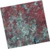
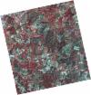
DE2_OPER_HRA_PSH_1C_20210721T111628_N37-586_W008-486_0001
Download Product | Product Info | Browse
Platform Short Name | GEOSAT |
Platform Serial Identifier | 2 |
Product Type | HRA_PSH_1C |
Start Date | 2021-07-21T11:16:28Z |
Stop Date | 2021-07-21T11:16:31Z |
Original Name | DE2_PSH_L1C_000000_20210721T111628_20210721T111631_DE2_38410_F65B.zip |
Footprint | 37.5294360797 -8.38064063489 37.6687725495 -8.41343315613 37.6436241262 -8.59290728084 37.5043004719 -8.55966342834 37.5294360797 -8.38064063489 |
Orbit Direction | ASCENDING |
Scene Centre Longitude | W008 |
Scene Centre Latitude | N37 |
Cloud Cover Percentage | -1 |
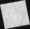
DE2_OPER_HRA_PM4_1C_20210721T111628_N37-586_W008-486_0001
Download Product | Product Info | Browse
Platform Short Name | GEOSAT |
Platform Serial Identifier | 2 |
Product Type | HRA_PM4_1C |
Start Date | 2021-07-21T11:16:28Z |
Stop Date | 2021-07-21T11:16:31Z |
Original Name | DE2_PM4_L1C_000000_20210721T111628_20210721T111631_DE2_38410_F65B.zip |
Footprint | 37.5294360797 -8.38064063489 37.6687725495 -8.41343315613 37.6436241262 -8.59290728084 37.5043004719 -8.55966342834 37.5294360797 -8.38064063489 |
Orbit Direction | ASCENDING |
Scene Centre Longitude | W008 |
Scene Centre Latitude | N37 |
Cloud Cover Percentage | -1 |
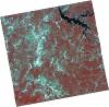
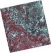
DE2_OPER_HRA_PSH_1C_20210721T111626_N37-460_W008-456_0001
Download Product | Product Info | Browse
Platform Short Name | GEOSAT |
Platform Serial Identifier | 2 |
Product Type | HRA_PSH_1C |
Start Date | 2021-07-21T11:16:26Z |
Stop Date | 2021-07-21T11:16:28Z |
Original Name | DE2_PSH_L1C_000000_20210721T111626_20210721T111628_DE2_38410_4AD6.zip |
Footprint | 37.4031316107 -8.3509209802 37.5423710501 -8.38377674245 37.5172699679 -8.56241340328 37.3778605658 -8.5308390044 37.4031316107 -8.3509209802 |
Orbit Direction | ASCENDING |
Scene Centre Longitude | W008 |
Scene Centre Latitude | N37 |
Cloud Cover Percentage | -1 |
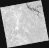
DE2_OPER_HRA_PM4_1C_20210721T111626_N37-460_W008-456_0001
Download Product | Product Info | Browse
Platform Short Name | GEOSAT |
Platform Serial Identifier | 2 |
Product Type | HRA_PM4_1C |
Start Date | 2021-07-21T11:16:26Z |
Stop Date | 2021-07-21T11:16:28Z |
Original Name | DE2_PM4_L1C_000000_20210721T111626_20210721T111628_DE2_38410_4AD6.zip |
Footprint | 37.4031316107 -8.3509209802 37.5423710501 -8.38377674245 37.5172699679 -8.56241340328 37.3778605658 -8.5308390044 37.4031316107 -8.3509209802 |
Orbit Direction | ASCENDING |
Scene Centre Longitude | W008 |
Scene Centre Latitude | N37 |
Cloud Cover Percentage | -1 |
DE2_OPER_HRA_PSH_1C_20210715T111958_N37-529_W008-680_0001
Download Product | Product Info | Browse
Platform Short Name | GEOSAT |
Platform Serial Identifier | 2 |
Product Type | HRA_PSH_1C |
Start Date | 2021-07-15T11:19:58Z |
Stop Date | 2021-07-15T11:20:01Z |
Original Name | DE2_PSH_L1C_000000_20210715T111958_20210715T112001_DE2_38321_2F79.zip |
Footprint | 37.4696816167 -8.56703355144 37.6146657628 -8.59933678073 37.5888034158 -8.79500843247 37.4438898256 -8.76175224807 37.4696816167 -8.56703355144 |
Orbit Direction | ASCENDING |
Scene Centre Longitude | W008 |
Scene Centre Latitude | N37 |
Cloud Cover Percentage | -1 |
DE2_OPER_HRA_PM4_1C_20210715T111958_N37-529_W008-680_0001
Download Product | Product Info | Browse
Platform Short Name | GEOSAT |
Platform Serial Identifier | 2 |
Product Type | HRA_PM4_1C |
Start Date | 2021-07-15T11:19:58Z |
Stop Date | 2021-07-15T11:20:01Z |
Original Name | DE2_PM4_L1C_000000_20210715T111958_20210715T112001_DE2_38321_2F79.zip |
Footprint | 37.4696816167 -8.56703355144 37.6146657628 -8.59933678073 37.5888034158 -8.79500843247 37.4438898256 -8.76175224807 37.4696816167 -8.56703355144 |
Orbit Direction | ASCENDING |
Scene Centre Longitude | W008 |
Scene Centre Latitude | N37 |
Cloud Cover Percentage | -1 |
DE2_OPER_HRA_PSH_1C_20210715T111956_N37-397_W008-651_0001
Download Product | Product Info | Browse
Platform Short Name | GEOSAT |
Platform Serial Identifier | 2 |
Product Type | HRA_PSH_1C |
Start Date | 2021-07-15T11:19:56Z |
Stop Date | 2021-07-15T11:19:59Z |
Original Name | DE2_PSH_L1C_000000_20210715T111956_20210715T111959_DE2_38321_257A.zip |
Footprint | 37.3380165343 -8.53808898427 37.4831175552 -8.56980636686 37.4573286899 -8.76483036262 37.3121025192 -8.73298512284 37.3380165343 -8.53808898427 |
Orbit Direction | ASCENDING |
Scene Centre Longitude | W008 |
Scene Centre Latitude | N37 |
Cloud Cover Percentage | -1 |
DE2_OPER_HRA_PM4_1C_20210715T111956_N37-397_W008-651_0001
Download Product | Product Info | Browse
Platform Short Name | GEOSAT |
Platform Serial Identifier | 2 |
Product Type | HRA_PM4_1C |
Start Date | 2021-07-15T11:19:56Z |
Stop Date | 2021-07-15T11:19:59Z |
Original Name | DE2_PM4_L1C_000000_20210715T111956_20210715T111959_DE2_38321_257A.zip |
Footprint | 37.3380165343 -8.53808898427 37.4831175552 -8.56980636686 37.4573286899 -8.76483036262 37.3121025192 -8.73298512284 37.3380165343 -8.53808898427 |
Orbit Direction | ASCENDING |
Scene Centre Longitude | W008 |
Scene Centre Latitude | N37 |
Cloud Cover Percentage | -1 |
DE2_OPER_HRA_PSH_1C_20210607T110945_N37-541_W008-578_0001
Download Product | Product Info | Browse
Platform Short Name | GEOSAT |
Platform Serial Identifier | 2 |
Product Type | HRA_PSH_1C |
Start Date | 2021-06-07T11:09:45Z |
Stop Date | 2021-06-07T11:09:47Z |
Original Name | DE2_PSH_L1C_000000_20210607T110945_20210607T110947_DE2_37757_C967.zip |
Footprint | 37.4905145761 -8.48870812298 37.6161443987 -8.52253882633 37.5919744229 -8.66754990992 37.4662979214 -8.633961655 37.4905145761 -8.48870812298 |
Orbit Direction | ASCENDING |
Scene Centre Longitude | W008 |
Scene Centre Latitude | N37 |
Cloud Cover Percentage | -1 |
DE2_OPER_HRA_PM4_1C_20210607T110945_N37-541_W008-578_0001
Download Product | Product Info | Browse
Platform Short Name | GEOSAT |
Platform Serial Identifier | 2 |
Product Type | HRA_PM4_1C |
Start Date | 2021-06-07T11:09:45Z |
Stop Date | 2021-06-07T11:09:47Z |
Original Name | DE2_PM4_L1C_000000_20210607T110945_20210607T110947_DE2_37757_C967.zip |
Footprint | 37.4905145761 -8.48870812298 37.6161443987 -8.52253882633 37.5919744229 -8.66754990992 37.4662979214 -8.633961655 37.4905145761 -8.48870812298 |
Orbit Direction | ASCENDING |
Scene Centre Longitude | W008 |
Scene Centre Latitude | N37 |
Cloud Cover Percentage | -1 |
DE2_OPER_HRA_PSH_1C_20210607T110943_N37-427_W008-547_0001
Download Product | Product Info | Browse
Platform Short Name | GEOSAT |
Platform Serial Identifier | 2 |
Product Type | HRA_PSH_1C |
Start Date | 2021-06-07T11:09:43Z |
Stop Date | 2021-06-07T11:09:45Z |
Original Name | DE2_PSH_L1C_000000_20210607T110943_20210607T110945_DE2_37757_4799.zip |
Footprint | 37.3763700288 -8.45885256828 37.5021753225 -8.49170877096 37.4779419156 -8.63707735145 37.3522208896 -8.60353037753 37.3763700288 -8.45885256828 |
Orbit Direction | ASCENDING |
Scene Centre Longitude | W008 |
Scene Centre Latitude | N37 |
Cloud Cover Percentage | -1 |
DE2_OPER_HRA_PM4_1C_20210607T110943_N37-427_W008-547_0001
Download Product | Product Info | Browse
Platform Short Name | GEOSAT |
Platform Serial Identifier | 2 |
Product Type | HRA_PM4_1C |
Start Date | 2021-06-07T11:09:43Z |
Stop Date | 2021-06-07T11:09:45Z |
Original Name | DE2_PM4_L1C_000000_20210607T110943_20210607T110945_DE2_37757_4799.zip |
Footprint | 37.3763700288 -8.45885256828 37.5021753225 -8.49170877096 37.4779419156 -8.63707735145 37.3522208896 -8.60353037753 37.3763700288 -8.45885256828 |
Orbit Direction | ASCENDING |
Scene Centre Longitude | W008 |
Scene Centre Latitude | N37 |
Cloud Cover Percentage | -1 |
DE2_OPER_HRA_PSH_1C_20210419T112054_N37-498_W008-770_0001
Download Product | Product Info | Browse
Platform Short Name | GEOSAT |
Platform Serial Identifier | 2 |
Product Type | HRA_PSH_1C |
Start Date | 2021-04-19T11:20:54Z |
Stop Date | 2021-04-19T11:20:57Z |
Original Name | DE2_PSH_L1C_000000_20210419T112054_20210419T112057_DE2_37030_E57B.zip |
Footprint | 37.4415246591 -8.66463027847 37.5813166214 -8.696223104 37.5560224136 -8.87703230771 37.4164448262 -8.84395994873 37.4415246591 -8.66463027847 |
Orbit Direction | ASCENDING |
Scene Centre Longitude | W008 |
Scene Centre Latitude | N37 |
Cloud Cover Percentage | -1 |
DE2_OPER_HRA_PM4_1C_20210419T112054_N37-498_W008-770_0001
Download Product | Product Info | Browse
Platform Short Name | GEOSAT |
Platform Serial Identifier | 2 |
Product Type | HRA_PM4_1C |
Start Date | 2021-04-19T11:20:54Z |
Stop Date | 2021-04-19T11:20:57Z |
Original Name | DE2_PM4_L1C_000000_20210419T112054_20210419T112057_DE2_37030_E57B.zip |
Footprint | 37.4415246591 -8.66463027847 37.5813166214 -8.696223104 37.5560224136 -8.87703230771 37.4164448262 -8.84395994873 37.4415246591 -8.66463027847 |
Orbit Direction | ASCENDING |
Scene Centre Longitude | W008 |
Scene Centre Latitude | N37 |
Cloud Cover Percentage | -1 |