ESA TPM Map Catalogue - Product List
back to previous node |
list of download URLs


Collection G2_Portugal_2021
GEOSAT-2 Portugal Coverage 2021 collection. More details here.
List of available products (latitude from 37.3681 to 37.4466 dg, longitude from -8.18938 to -8.045 dg)..
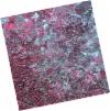
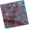
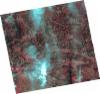
DE2_OPER_HRA_PSH_1C_20211211T110610_N37-460_W008-059_0001
Download Product | Product Info | Browse
Platform Short Name | GEOSAT |
Platform Serial Identifier | 2 |
Product Type | HRA_PSH_1C |
Start Date | 2021-12-11T11:06:10Z |
Stop Date | 2021-12-11T11:06:13Z |
Original Name | DE2_PSH_L1C_000000_20211211T110610_20211211T110613_DE2_40532_D1D7.zip |
Footprint | 37.4061079435 -7.96257888825 37.5383860455 -7.99524861662 37.513897759 -8.15725993003 37.3815564384 -8.1248911356 37.4061079435 -7.96257888825 |
Orbit Direction | ASCENDING |
Scene Centre Longitude | W008 |
Scene Centre Latitude | N37 |
Cloud Cover Percentage | -1 |
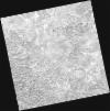
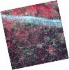
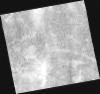
DE2_OPER_HRA_PM4_1C_20211211T110610_N37-460_W008-059_0001
Download Product | Product Info | Browse
Platform Short Name | GEOSAT |
Platform Serial Identifier | 2 |
Product Type | HRA_PM4_1C |
Start Date | 2021-12-11T11:06:10Z |
Stop Date | 2021-12-11T11:06:13Z |
Original Name | DE2_PM4_L1C_000000_20211211T110610_20211211T110613_DE2_40532_D1D7.zip |
Footprint | 37.4061079435 -7.96257888825 37.5383860455 -7.99524861662 37.513897759 -8.15725993003 37.3815564384 -8.1248911356 37.4061079435 -7.96257888825 |
Orbit Direction | ASCENDING |
Scene Centre Longitude | W008 |
Scene Centre Latitude | N37 |
Cloud Cover Percentage | -1 |
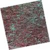
DE2_OPER_HRA_PSH_1C_20211211T110608_N37-340_W008-030_0001
Download Product | Product Info | Browse
Platform Short Name | GEOSAT |
Platform Serial Identifier | 2 |
Product Type | HRA_PSH_1C |
Start Date | 2021-12-11T11:06:08Z |
Stop Date | 2021-12-11T11:06:11Z |
Original Name | DE2_PSH_L1C_000000_20211211T110608_20211211T110611_DE2_40532_D324.zip |
Footprint | 37.2860400211 -7.93428738641 37.4183313912 -7.96580897022 37.3938270995 -8.12776483521 37.2617784026 -8.0943244855 37.2860400211 -7.93428738641 |
Orbit Direction | ASCENDING |
Scene Centre Longitude | W008 |
Scene Centre Latitude | N37 |
Cloud Cover Percentage | -1 |
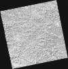
DE2_OPER_HRA_PM4_1C_20211211T110608_N37-340_W008-030_0001
Download Product | Product Info | Browse
Platform Short Name | GEOSAT |
Platform Serial Identifier | 2 |
Product Type | HRA_PM4_1C |
Start Date | 2021-12-11T11:06:08Z |
Stop Date | 2021-12-11T11:06:11Z |
Original Name | DE2_PM4_L1C_000000_20211211T110608_20211211T110611_DE2_40532_D324.zip |
Footprint | 37.2860400211 -7.93428738641 37.4183313912 -7.96580897022 37.3938270995 -8.12776483521 37.2617784026 -8.0943244855 37.2860400211 -7.93428738641 |
Orbit Direction | ASCENDING |
Scene Centre Longitude | W008 |
Scene Centre Latitude | N37 |
Cloud Cover Percentage | -1 |
DE2_OPER_HRA_PM4_1C_20210708T110758_N37-458_W008-160_0001
Download Product | Product Info | Browse
Platform Short Name | GEOSAT |
Platform Serial Identifier | 2 |
Product Type | HRA_PM4_1C |
Start Date | 2021-07-08T11:07:58Z |
Stop Date | 2021-07-08T11:08:00Z |
Original Name | DE2_PM4_L1C_000000_20210708T110758_20210708T110800_DE2_38217_F101.zip |
Footprint | 37.4072431081 -8.0706022532 37.5340940296 -8.10364713285 37.5099362966 -8.25052346994 37.3831204766 -8.21683318225 37.4072431081 -8.0706022532 |
Orbit Direction | ASCENDING |
Scene Centre Longitude | W008 |
Scene Centre Latitude | N37 |
Cloud Cover Percentage | -1 |
DE2_OPER_HRA_PSH_1C_20210708T110758_N37-458_W008-160_0001
Download Product | Product Info | Browse
Platform Short Name | GEOSAT |
Platform Serial Identifier | 2 |
Product Type | HRA_PSH_1C |
Start Date | 2021-07-08T11:07:58Z |
Stop Date | 2021-07-08T11:08:00Z |
Original Name | DE2_PSH_L1C_000000_20210708T110758_20210708T110800_DE2_38217_F101.zip |
Footprint | 37.4072431081 -8.0706022532 37.5340940296 -8.10364713285 37.5099362966 -8.25052346994 37.3831204766 -8.21683318225 37.4072431081 -8.0706022532 |
Orbit Direction | ASCENDING |
Scene Centre Longitude | W008 |
Scene Centre Latitude | N37 |
Cloud Cover Percentage | -1 |
DE2_OPER_HRA_PSH_1C_20210708T110756_N37-343_W008-130_0001
Download Product | Product Info | Browse
Platform Short Name | GEOSAT |
Platform Serial Identifier | 2 |
Product Type | HRA_PSH_1C |
Start Date | 2021-07-08T11:07:56Z |
Stop Date | 2021-07-08T11:07:59Z |
Original Name | DE2_PSH_L1C_000000_20210708T110756_20210708T110759_DE2_38217_6270.zip |
Footprint | 37.2918695989 -8.04042869682 37.4189417722 -8.0736530159 37.3948435482 -8.22003265053 37.2678355582 -8.18648602881 37.2918695989 -8.04042869682 |
Orbit Direction | ASCENDING |
Scene Centre Longitude | W008 |
Scene Centre Latitude | N37 |
Cloud Cover Percentage | -1 |
DE2_OPER_HRA_PM4_1C_20210708T110756_N37-343_W008-130_0001
Download Product | Product Info | Browse
Platform Short Name | GEOSAT |
Platform Serial Identifier | 2 |
Product Type | HRA_PM4_1C |
Start Date | 2021-07-08T11:07:56Z |
Stop Date | 2021-07-08T11:07:59Z |
Original Name | DE2_PM4_L1C_000000_20210708T110756_20210708T110759_DE2_38217_6270.zip |
Footprint | 37.2918695989 -8.04042869682 37.4189417722 -8.0736530159 37.3948435482 -8.22003265053 37.2678355582 -8.18648602881 37.2918695989 -8.04042869682 |
Orbit Direction | ASCENDING |
Scene Centre Longitude | W008 |
Scene Centre Latitude | N37 |
Cloud Cover Percentage | -1 |
DE2_OPER_HRA_PSH_1C_20210331T111501_N37-510_W008-009_0001
Download Product | Product Info | Browse
Platform Short Name | GEOSAT |
Platform Serial Identifier | 2 |
Product Type | HRA_PSH_1C |
Start Date | 2021-03-31T11:15:01Z |
Stop Date | 2021-03-31T11:15:04Z |
Original Name | DE2_PSH_L1C_000000_20210331T111501_20210331T111504_DE2_36748_786F.zip |
Footprint | 37.455946345 -7.91111404454 37.5895744321 -7.94365078799 37.5649425909 -8.10758316207 37.4313147654 -8.07477211324 37.455946345 -7.91111404454 |
Orbit Direction | ASCENDING |
Scene Centre Longitude | W008 |
Scene Centre Latitude | N37 |
Cloud Cover Percentage | -1 |
DE2_OPER_HRA_PM4_1C_20210331T111501_N37-510_W008-009_0001
Download Product | Product Info | Browse
Platform Short Name | GEOSAT |
Platform Serial Identifier | 2 |
Product Type | HRA_PM4_1C |
Start Date | 2021-03-31T11:15:01Z |
Stop Date | 2021-03-31T11:15:04Z |
Original Name | DE2_PM4_L1C_000000_20210331T111501_20210331T111504_DE2_36748_786F.zip |
Footprint | 37.455946345 -7.91111404454 37.5895744321 -7.94365078799 37.5649425909 -8.10758316207 37.4313147654 -8.07477211324 37.455946345 -7.91111404454 |
Orbit Direction | ASCENDING |
Scene Centre Longitude | W008 |
Scene Centre Latitude | N37 |
Cloud Cover Percentage | -1 |
DE2_OPER_HRA_PSH_1C_20210331T111459_N37-389_W007-979_0001
Download Product | Product Info | Browse
Platform Short Name | GEOSAT |
Platform Serial Identifier | 2 |
Product Type | HRA_PSH_1C |
Start Date | 2021-03-31T11:14:59Z |
Stop Date | 2021-03-31T11:15:02Z |
Original Name | DE2_PSH_L1C_000000_20210331T111459_20210331T111502_DE2_36748_25DB.zip |
Footprint | 37.3347526628 -7.882168068 37.4683448661 -7.91413160174 37.443683473 -8.07794337652 37.3101215236 -8.04535944632 37.3347526628 -7.882168068 |
Orbit Direction | ASCENDING |
Scene Centre Longitude | W007 |
Scene Centre Latitude | N37 |
Cloud Cover Percentage | -1 |
DE2_OPER_HRA_PM4_1C_20210331T111459_N37-389_W007-979_0001
Download Product | Product Info | Browse
Platform Short Name | GEOSAT |
Platform Serial Identifier | 2 |
Product Type | HRA_PM4_1C |
Start Date | 2021-03-31T11:14:59Z |
Stop Date | 2021-03-31T11:15:02Z |
Original Name | DE2_PM4_L1C_000000_20210331T111459_20210331T111502_DE2_36748_25DB.zip |
Footprint | 37.3347526628 -7.882168068 37.4683448661 -7.91413160174 37.443683473 -8.07794337652 37.3101215236 -8.04535944632 37.3347526628 -7.882168068 |
Orbit Direction | ASCENDING |
Scene Centre Longitude | W007 |
Scene Centre Latitude | N37 |
Cloud Cover Percentage | -1 |
DE2_OPER_HRA_PSH_1C_20210319T112121_N37-424_W008-214_0001
Download Product | Product Info | Browse
Platform Short Name | GEOSAT |
Platform Serial Identifier | 2 |
Product Type | HRA_PSH_1C |
Start Date | 2021-03-19T11:21:21Z |
Stop Date | 2021-03-19T11:21:24Z |
Original Name | DE2_PSH_L1C_000000_20210319T112121_20210319T112124_DE2_36570_9858.zip |
Footprint | 37.3653993166 -8.10230389341 37.5098200688 -8.13463123835 37.4840401814 -8.32719835759 37.3397681096 -8.29322290465 37.3653993166 -8.10230389341 |
Orbit Direction | ASCENDING |
Scene Centre Longitude | W008 |
Scene Centre Latitude | N37 |
Cloud Cover Percentage | -1 |
DE2_OPER_HRA_PM4_1C_20210319T112121_N37-424_W008-214_0001
Download Product | Product Info | Browse
Platform Short Name | GEOSAT |
Platform Serial Identifier | 2 |
Product Type | HRA_PM4_1C |
Start Date | 2021-03-19T11:21:21Z |
Stop Date | 2021-03-19T11:21:24Z |
Original Name | DE2_PM4_L1C_000000_20210319T112121_20210319T112124_DE2_36570_9858.zip |
Footprint | 37.3653993166 -8.10230389341 37.5098200688 -8.13463123835 37.4840401814 -8.32719835759 37.3397681096 -8.29322290465 37.3653993166 -8.10230389341 |
Orbit Direction | ASCENDING |
Scene Centre Longitude | W008 |
Scene Centre Latitude | N37 |
Cloud Cover Percentage | -1 |
DE2_OPER_HRA_PSH_1C_20210319T112119_N37-294_W008-184_0001
Download Product | Product Info | Browse
Platform Short Name | GEOSAT |
Platform Serial Identifier | 2 |
Product Type | HRA_PSH_1C |
Start Date | 2021-03-19T11:21:19Z |
Stop Date | 2021-03-19T11:21:22Z |
Original Name | DE2_PSH_L1C_000000_20210319T112119_20210319T112122_DE2_36570_5CD2.zip |
Footprint | 37.2355008551 -8.07159883664 37.3786910372 -8.1060337414 37.3530672339 -8.29690053569 37.2089809464 -8.26201334305 37.2355008551 -8.07159883664 |
Orbit Direction | ASCENDING |
Scene Centre Longitude | W008 |
Scene Centre Latitude | N37 |
Cloud Cover Percentage | -1 |
DE2_OPER_HRA_PM4_1C_20210319T112119_N37-294_W008-184_0001
Download Product | Product Info | Browse
Platform Short Name | GEOSAT |
Platform Serial Identifier | 2 |
Product Type | HRA_PM4_1C |
Start Date | 2021-03-19T11:21:19Z |
Stop Date | 2021-03-19T11:21:22Z |
Original Name | DE2_PM4_L1C_000000_20210319T112119_20210319T112122_DE2_36570_5CD2.zip |
Footprint | 37.2355008551 -8.07159883664 37.3786910372 -8.1060337414 37.3530672339 -8.29690053569 37.2089809464 -8.26201334305 37.2355008551 -8.07159883664 |
Orbit Direction | ASCENDING |
Scene Centre Longitude | W008 |
Scene Centre Latitude | N37 |
Cloud Cover Percentage | -1 |