ESA TPM Map Catalogue - Product List
back to previous node |
list of download URLs

Collection G2_Portugal_2021
GEOSAT-2 Portugal Coverage 2021 collection. More details here.
List of available products (latitude from 37.2897 to 37.3681 dg, longitude from -8.255 to -8.11063 dg)..
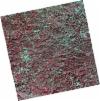
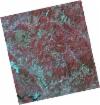
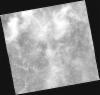
DE2_OPER_HRA_PSH_1C_20211211T110608_N37-340_W008-030_0001
Download Product | Product Info | Browse
Platform Short Name | GEOSAT |
Platform Serial Identifier | 2 |
Product Type | HRA_PSH_1C |
Start Date | 2021-12-11T11:06:08Z |
Stop Date | 2021-12-11T11:06:11Z |
Original Name | DE2_PSH_L1C_000000_20211211T110608_20211211T110611_DE2_40532_D324.zip |
Footprint | 37.2860400211 -7.93428738641 37.4183313912 -7.96580897022 37.3938270995 -8.12776483521 37.2617784026 -8.0943244855 37.2860400211 -7.93428738641 |
Orbit Direction | ASCENDING |
Scene Centre Longitude | W008 |
Scene Centre Latitude | N37 |
Cloud Cover Percentage | -1 |
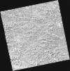
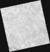
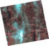
DE2_OPER_HRA_PM4_1C_20211211T110608_N37-340_W008-030_0001
Download Product | Product Info | Browse
Platform Short Name | GEOSAT |
Platform Serial Identifier | 2 |
Product Type | HRA_PM4_1C |
Start Date | 2021-12-11T11:06:08Z |
Stop Date | 2021-12-11T11:06:11Z |
Original Name | DE2_PM4_L1C_000000_20211211T110608_20211211T110611_DE2_40532_D324.zip |
Footprint | 37.2860400211 -7.93428738641 37.4183313912 -7.96580897022 37.3938270995 -8.12776483521 37.2617784026 -8.0943244855 37.2860400211 -7.93428738641 |
Orbit Direction | ASCENDING |
Scene Centre Longitude | W008 |
Scene Centre Latitude | N37 |
Cloud Cover Percentage | -1 |
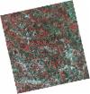
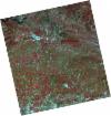
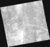
DE2_OPER_HRA_PSH_1C_20210708T110756_N37-343_W008-130_0001
Download Product | Product Info | Browse
Platform Short Name | GEOSAT |
Platform Serial Identifier | 2 |
Product Type | HRA_PSH_1C |
Start Date | 2021-07-08T11:07:56Z |
Stop Date | 2021-07-08T11:07:59Z |
Original Name | DE2_PSH_L1C_000000_20210708T110756_20210708T110759_DE2_38217_6270.zip |
Footprint | 37.2918695989 -8.04042869682 37.4189417722 -8.0736530159 37.3948435482 -8.22003265053 37.2678355582 -8.18648602881 37.2918695989 -8.04042869682 |
Orbit Direction | ASCENDING |
Scene Centre Longitude | W008 |
Scene Centre Latitude | N37 |
Cloud Cover Percentage | -1 |
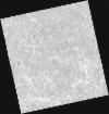
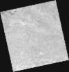
DE2_OPER_HRA_PM4_1C_20210708T110756_N37-343_W008-130_0001
Download Product | Product Info | Browse
Platform Short Name | GEOSAT |
Platform Serial Identifier | 2 |
Product Type | HRA_PM4_1C |
Start Date | 2021-07-08T11:07:56Z |
Stop Date | 2021-07-08T11:07:59Z |
Original Name | DE2_PM4_L1C_000000_20210708T110756_20210708T110759_DE2_38217_6270.zip |
Footprint | 37.2918695989 -8.04042869682 37.4189417722 -8.0736530159 37.3948435482 -8.22003265053 37.2678355582 -8.18648602881 37.2918695989 -8.04042869682 |
Orbit Direction | ASCENDING |
Scene Centre Longitude | W008 |
Scene Centre Latitude | N37 |
Cloud Cover Percentage | -1 |
DE2_OPER_HRA_PSH_1C_20210507T111059_N37-344_W008-286_0001
Download Product | Product Info | Browse
Platform Short Name | GEOSAT |
Platform Serial Identifier | 2 |
Product Type | HRA_PSH_1C |
Start Date | 2021-05-07T11:10:59Z |
Stop Date | 2021-05-07T11:11:02Z |
Original Name | DE2_PSH_L1C_000000_20210507T111059_20210507T111102_DE2_37297_ABBB.zip |
Footprint | 37.2931076617 -8.19668096336 37.4200191467 -8.22940867782 37.3959037796 -8.37710628005 37.2690356406 -8.34388556303 37.2931076617 -8.19668096336 |
Orbit Direction | ASCENDING |
Scene Centre Longitude | W008 |
Scene Centre Latitude | N37 |
Cloud Cover Percentage | -1 |
DE2_OPER_HRA_PM4_1C_20210507T111059_N37-344_W008-286_0001
Download Product | Product Info | Browse
Platform Short Name | GEOSAT |
Platform Serial Identifier | 2 |
Product Type | HRA_PM4_1C |
Start Date | 2021-05-07T11:10:59Z |
Stop Date | 2021-05-07T11:11:02Z |
Original Name | DE2_PM4_L1C_000000_20210507T111059_20210507T111102_DE2_37297_ABBB.zip |
Footprint | 37.2931076617 -8.19668096336 37.4200191467 -8.22940867782 37.3959037796 -8.37710628005 37.2690356406 -8.34388556303 37.2931076617 -8.19668096336 |
Orbit Direction | ASCENDING |
Scene Centre Longitude | W008 |
Scene Centre Latitude | N37 |
Cloud Cover Percentage | -1 |
DE2_OPER_HRA_PSH_1C_20210507T111057_N37-229_W008-256_0001
Download Product | Product Info | Browse
Platform Short Name | GEOSAT |
Platform Serial Identifier | 2 |
Product Type | HRA_PSH_1C |
Start Date | 2021-05-07T11:10:57Z |
Stop Date | 2021-05-07T11:11:00Z |
Original Name | DE2_PSH_L1C_000000_20210507T111057_20210507T111100_DE2_37297_3B10.zip |
Footprint | 37.1781607418 -8.1663014427 37.3048908398 -8.19966998581 37.2808282823 -8.34678661316 37.1540583381 -8.31366344856 37.1781607418 -8.1663014427 |
Orbit Direction | ASCENDING |
Scene Centre Longitude | W008 |
Scene Centre Latitude | N37 |
Cloud Cover Percentage | -1 |
DE2_OPER_HRA_PM4_1C_20210507T111057_N37-229_W008-256_0001
Download Product | Product Info | Browse
Platform Short Name | GEOSAT |
Platform Serial Identifier | 2 |
Product Type | HRA_PM4_1C |
Start Date | 2021-05-07T11:10:57Z |
Stop Date | 2021-05-07T11:11:00Z |
Original Name | DE2_PM4_L1C_000000_20210507T111057_20210507T111100_DE2_37297_3B10.zip |
Footprint | 37.1781607418 -8.1663014427 37.3048908398 -8.19966998581 37.2808282823 -8.34678661316 37.1540583381 -8.31366344856 37.1781607418 -8.1663014427 |
Orbit Direction | ASCENDING |
Scene Centre Longitude | W008 |
Scene Centre Latitude | N37 |
Cloud Cover Percentage | -1 |
DE2_OPER_HRA_PSH_1C_20210319T112121_N37-424_W008-214_0001
Download Product | Product Info | Browse
Platform Short Name | GEOSAT |
Platform Serial Identifier | 2 |
Product Type | HRA_PSH_1C |
Start Date | 2021-03-19T11:21:21Z |
Stop Date | 2021-03-19T11:21:24Z |
Original Name | DE2_PSH_L1C_000000_20210319T112121_20210319T112124_DE2_36570_9858.zip |
Footprint | 37.3653993166 -8.10230389341 37.5098200688 -8.13463123835 37.4840401814 -8.32719835759 37.3397681096 -8.29322290465 37.3653993166 -8.10230389341 |
Orbit Direction | ASCENDING |
Scene Centre Longitude | W008 |
Scene Centre Latitude | N37 |
Cloud Cover Percentage | -1 |
DE2_OPER_HRA_PM4_1C_20210319T112121_N37-424_W008-214_0001
Download Product | Product Info | Browse
Platform Short Name | GEOSAT |
Platform Serial Identifier | 2 |
Product Type | HRA_PM4_1C |
Start Date | 2021-03-19T11:21:21Z |
Stop Date | 2021-03-19T11:21:24Z |
Original Name | DE2_PM4_L1C_000000_20210319T112121_20210319T112124_DE2_36570_9858.zip |
Footprint | 37.3653993166 -8.10230389341 37.5098200688 -8.13463123835 37.4840401814 -8.32719835759 37.3397681096 -8.29322290465 37.3653993166 -8.10230389341 |
Orbit Direction | ASCENDING |
Scene Centre Longitude | W008 |
Scene Centre Latitude | N37 |
Cloud Cover Percentage | -1 |
DE2_OPER_HRA_PSH_1C_20210319T112119_N37-294_W008-184_0001
Download Product | Product Info | Browse
Platform Short Name | GEOSAT |
Platform Serial Identifier | 2 |
Product Type | HRA_PSH_1C |
Start Date | 2021-03-19T11:21:19Z |
Stop Date | 2021-03-19T11:21:22Z |
Original Name | DE2_PSH_L1C_000000_20210319T112119_20210319T112122_DE2_36570_5CD2.zip |
Footprint | 37.2355008551 -8.07159883664 37.3786910372 -8.1060337414 37.3530672339 -8.29690053569 37.2089809464 -8.26201334305 37.2355008551 -8.07159883664 |
Orbit Direction | ASCENDING |
Scene Centre Longitude | W008 |
Scene Centre Latitude | N37 |
Cloud Cover Percentage | -1 |
DE2_OPER_HRA_PM4_1C_20210319T112119_N37-294_W008-184_0001
Download Product | Product Info | Browse
Platform Short Name | GEOSAT |
Platform Serial Identifier | 2 |
Product Type | HRA_PM4_1C |
Start Date | 2021-03-19T11:21:19Z |
Stop Date | 2021-03-19T11:21:22Z |
Original Name | DE2_PM4_L1C_000000_20210319T112119_20210319T112122_DE2_36570_5CD2.zip |
Footprint | 37.2355008551 -8.07159883664 37.3786910372 -8.1060337414 37.3530672339 -8.29690053569 37.2089809464 -8.26201334305 37.2355008551 -8.07159883664 |
Orbit Direction | ASCENDING |
Scene Centre Longitude | W008 |
Scene Centre Latitude | N37 |
Cloud Cover Percentage | -1 |