ESA TPM Map Catalogue - Product List
back to previous node |
list of download URLs
Collection G2_Portugal_2021
GEOSAT-2 Portugal Coverage 2021 collection. More details here.
List of available products (latitude from 37.2541 to 37.3325 dg, longitude from -7.61188 to -7.4675 dg)..
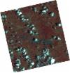
DE2_OPER_HRA_PSH_1C_20210626T111452_N37-348_W007-693_0001
Download Product | Product Info | Browse
Platform Short Name | GEOSAT |
Platform Serial Identifier | 2 |
Product Type | HRA_PSH_1C |
Start Date | 2021-06-26T11:14:52Z |
Stop Date | 2021-06-26T11:14:55Z |
Original Name | DE2_PSH_L1C_000000_20210626T111452_20210626T111455_DE2_38039_4EF9.zip |
Footprint | 37.2909627264 -7.58541123089 37.4316772809 -7.6186659576 37.4063038008 -7.80170367422 37.2653895378 -7.76995529695 37.2909627264 -7.58541123089 |
Orbit Direction | ASCENDING |
Scene Centre Longitude | W007 |
Scene Centre Latitude | N37 |
Cloud Cover Percentage | -1 |
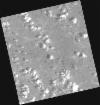
DE2_OPER_HRA_PM4_1C_20210626T111452_N37-348_W007-693_0001
Download Product | Product Info | Browse
Platform Short Name | GEOSAT |
Platform Serial Identifier | 2 |
Product Type | HRA_PM4_1C |
Start Date | 2021-06-26T11:14:52Z |
Stop Date | 2021-06-26T11:14:55Z |
Original Name | DE2_PM4_L1C_000000_20210626T111452_20210626T111455_DE2_38039_4EF9.zip |
Footprint | 37.2909627264 -7.58541123089 37.4316772809 -7.6186659576 37.4063038008 -7.80170367422 37.2653895378 -7.76995529695 37.2909627264 -7.58541123089 |
Orbit Direction | ASCENDING |
Scene Centre Longitude | W007 |
Scene Centre Latitude | N37 |
Cloud Cover Percentage | -1 |
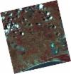
DE2_OPER_HRA_PSH_1C_20210626T111450_N37-220_W007-663_0001
Download Product | Product Info | Browse
Platform Short Name | GEOSAT |
Platform Serial Identifier | 2 |
Product Type | HRA_PSH_1C |
Start Date | 2021-06-26T11:14:50Z |
Stop Date | 2021-06-26T11:14:52Z |
Original Name | DE2_PSH_L1C_000000_20210626T111450_20210626T111452_DE2_38039_453F.zip |
Footprint | 37.1629634147 -7.55527278171 37.303963668 -7.58894190558 37.2786162901 -7.77164349318 37.1375458811 -7.7382442336 37.1629634147 -7.55527278171 |
Orbit Direction | ASCENDING |
Scene Centre Longitude | W007 |
Scene Centre Latitude | N37 |
Cloud Cover Percentage | -1 |
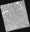
DE2_OPER_HRA_PM4_1C_20210626T111450_N37-220_W007-663_0001
Download Product | Product Info | Browse
Platform Short Name | GEOSAT |
Platform Serial Identifier | 2 |
Product Type | HRA_PM4_1C |
Start Date | 2021-06-26T11:14:50Z |
Stop Date | 2021-06-26T11:14:52Z |
Original Name | DE2_PM4_L1C_000000_20210626T111450_20210626T111452_DE2_38039_453F.zip |
Footprint | 37.1629634147 -7.55527278171 37.303963668 -7.58894190558 37.2786162901 -7.77164349318 37.1375458811 -7.7382442336 37.1629634147 -7.55527278171 |
Orbit Direction | ASCENDING |
Scene Centre Longitude | W007 |
Scene Centre Latitude | N37 |
Cloud Cover Percentage | -1 |
DE2_OPER_HRA_PSH_1C_20210613T110615_N37-341_W007-532_0001
Download Product | Product Info | Browse
Platform Short Name | GEOSAT |
Platform Serial Identifier | 2 |
Product Type | HRA_PSH_1C |
Start Date | 2021-06-13T11:06:15Z |
Stop Date | 2021-06-13T11:06:18Z |
Original Name | DE2_PSH_L1C_000000_20210613T110615_20210613T110618_DE2_37846_141C.zip |
Footprint | 37.2907096025 -7.44200556596 37.4174471516 -7.47562239178 37.3932756656 -7.62222628353 37.2664518033 -7.58886412768 37.2907096025 -7.44200556596 |
Orbit Direction | ASCENDING |
Scene Centre Longitude | W007 |
Scene Centre Latitude | N37 |
Cloud Cover Percentage | -1 |
DE2_OPER_HRA_PM4_1C_20210613T110615_N37-341_W007-532_0001
Download Product | Product Info | Browse
Platform Short Name | GEOSAT |
Platform Serial Identifier | 2 |
Product Type | HRA_PM4_1C |
Start Date | 2021-06-13T11:06:15Z |
Stop Date | 2021-06-13T11:06:18Z |
Original Name | DE2_PM4_L1C_000000_20210613T110615_20210613T110618_DE2_37846_141C.zip |
Footprint | 37.2907096025 -7.44200556596 37.4174471516 -7.47562239178 37.3932756656 -7.62222628353 37.2664518033 -7.58886412768 37.2907096025 -7.44200556596 |
Orbit Direction | ASCENDING |
Scene Centre Longitude | W007 |
Scene Centre Latitude | N37 |
Cloud Cover Percentage | -1 |
DE2_OPER_HRA_PSH_1C_20210613T110613_N37-226_W007-501_0001
Download Product | Product Info | Browse
Platform Short Name | GEOSAT |
Platform Serial Identifier | 2 |
Product Type | HRA_PSH_1C |
Start Date | 2021-06-13T11:06:13Z |
Stop Date | 2021-06-13T11:06:16Z |
Original Name | DE2_PSH_L1C_000000_20210613T110613_20210613T110616_DE2_37846_48DC.zip |
Footprint | 37.1757233066 -7.41191378206 37.3024117392 -7.44515741258 37.2782096476 -7.59189305537 37.1515593146 -7.55805718219 37.1757233066 -7.41191378206 |
Orbit Direction | ASCENDING |
Scene Centre Longitude | W007 |
Scene Centre Latitude | N37 |
Cloud Cover Percentage | -1 |
DE2_OPER_HRA_PM4_1C_20210613T110613_N37-226_W007-501_0001
Download Product | Product Info | Browse
Platform Short Name | GEOSAT |
Platform Serial Identifier | 2 |
Product Type | HRA_PM4_1C |
Start Date | 2021-06-13T11:06:13Z |
Stop Date | 2021-06-13T11:06:16Z |
Original Name | DE2_PM4_L1C_000000_20210613T110613_20210613T110616_DE2_37846_48DC.zip |
Footprint | 37.1757233066 -7.41191378206 37.3024117392 -7.44515741258 37.2782096476 -7.59189305537 37.1515593146 -7.55805718219 37.1757233066 -7.41191378206 |
Orbit Direction | ASCENDING |
Scene Centre Longitude | W007 |
Scene Centre Latitude | N37 |
Cloud Cover Percentage | -1 |