ESA TPM Map Catalogue - Product List
back to previous node |
list of download URLs

Collection G2_Portugal_2021
GEOSAT-2 Portugal Coverage 2021 collection. More details here.
List of available products (latitude from 37.2541 to 37.3325 dg, longitude from -8.045 to -7.90062 dg)..
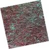
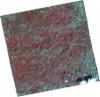
DE2_OPER_HRA_PSH_1C_20211211T110608_N37-340_W008-030_0001
Download Product | Product Info | Browse
Platform Short Name | GEOSAT |
Platform Serial Identifier | 2 |
Product Type | HRA_PSH_1C |
Start Date | 2021-12-11T11:06:08Z |
Stop Date | 2021-12-11T11:06:11Z |
Original Name | DE2_PSH_L1C_000000_20211211T110608_20211211T110611_DE2_40532_D324.zip |
Footprint | 37.2860400211 -7.93428738641 37.4183313912 -7.96580897022 37.3938270995 -8.12776483521 37.2617784026 -8.0943244855 37.2860400211 -7.93428738641 |
Orbit Direction | ASCENDING |
Scene Centre Longitude | W008 |
Scene Centre Latitude | N37 |
Cloud Cover Percentage | -1 |
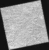
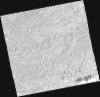
DE2_OPER_HRA_PM4_1C_20211211T110608_N37-340_W008-030_0001
Download Product | Product Info | Browse
Platform Short Name | GEOSAT |
Platform Serial Identifier | 2 |
Product Type | HRA_PM4_1C |
Start Date | 2021-12-11T11:06:08Z |
Stop Date | 2021-12-11T11:06:11Z |
Original Name | DE2_PM4_L1C_000000_20211211T110608_20211211T110611_DE2_40532_D324.zip |
Footprint | 37.2860400211 -7.93428738641 37.4183313912 -7.96580897022 37.3938270995 -8.12776483521 37.2617784026 -8.0943244855 37.2860400211 -7.93428738641 |
Orbit Direction | ASCENDING |
Scene Centre Longitude | W008 |
Scene Centre Latitude | N37 |
Cloud Cover Percentage | -1 |
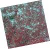
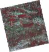
DE2_OPER_HRA_PSH_1C_20210921T111109_N37-375_W007-847_0001
Download Product | Product Info | Browse
Platform Short Name | GEOSAT |
Platform Serial Identifier | 2 |
Product Type | HRA_PSH_1C |
Start Date | 2021-09-21T11:11:09Z |
Stop Date | 2021-09-21T11:11:11Z |
Original Name | DE2_PSH_L1C_000000_20210921T111109_20210921T111111_DE2_39330_4C52.zip |
Footprint | 37.31928422 -7.74262671494 37.4571029531 -7.77646329249 37.4321007198 -7.95189515657 37.2941449766 -7.91932304608 37.31928422 -7.74262671494 |
Orbit Direction | ASCENDING |
Scene Centre Longitude | W007 |
Scene Centre Latitude | N37 |
Cloud Cover Percentage | -1 |
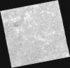
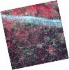
DE2_OPER_HRA_PM4_1C_20210921T111109_N37-375_W007-847_0001
Download Product | Product Info | Browse
Platform Short Name | GEOSAT |
Platform Serial Identifier | 2 |
Product Type | HRA_PM4_1C |
Start Date | 2021-09-21T11:11:09Z |
Stop Date | 2021-09-21T11:11:11Z |
Original Name | DE2_PM4_L1C_000000_20210921T111109_20210921T111111_DE2_39330_4C52.zip |
Footprint | 37.31928422 -7.74262671494 37.4571029531 -7.77646329249 37.4321007198 -7.95189515657 37.2941449766 -7.91932304608 37.31928422 -7.74262671494 |
Orbit Direction | ASCENDING |
Scene Centre Longitude | W007 |
Scene Centre Latitude | N37 |
Cloud Cover Percentage | -1 |
DE2_OPER_HRA_PSH_1C_20210921T111107_N37-250_W007-817_0001
Download Product | Product Info | Browse
Platform Short Name | GEOSAT |
Platform Serial Identifier | 2 |
Product Type | HRA_PSH_1C |
Start Date | 2021-09-21T11:11:07Z |
Stop Date | 2021-09-21T11:11:09Z |
Original Name | DE2_PSH_L1C_000000_20210921T111107_20210921T111109_DE2_39330_5188.zip |
Footprint | 37.1941616778 -7.71241672814 37.332060444 -7.74579157375 37.3069280494 -7.92224602146 37.1691152734 -7.88799178227 37.1941616778 -7.71241672814 |
Orbit Direction | ASCENDING |
Scene Centre Longitude | W007 |
Scene Centre Latitude | N37 |
Cloud Cover Percentage | -1 |
DE2_OPER_HRA_PM4_1C_20210921T111107_N37-250_W007-817_0001
Download Product | Product Info | Browse
Platform Short Name | GEOSAT |
Platform Serial Identifier | 2 |
Product Type | HRA_PM4_1C |
Start Date | 2021-09-21T11:11:07Z |
Stop Date | 2021-09-21T11:11:09Z |
Original Name | DE2_PM4_L1C_000000_20210921T111107_20210921T111109_DE2_39330_5188.zip |
Footprint | 37.1941616778 -7.71241672814 37.332060444 -7.74579157375 37.3069280494 -7.92224602146 37.1691152734 -7.88799178227 37.1941616778 -7.71241672814 |
Orbit Direction | ASCENDING |
Scene Centre Longitude | W007 |
Scene Centre Latitude | N37 |
Cloud Cover Percentage | -1 |
DE2_OPER_HRA_PSH_1C_20210708T110754_N37-228_W008-099_0001
Download Product | Product Info | Browse
Platform Short Name | GEOSAT |
Platform Serial Identifier | 2 |
Product Type | HRA_PSH_1C |
Start Date | 2021-07-08T11:07:54Z |
Stop Date | 2021-07-08T11:07:57Z |
Original Name | DE2_PSH_L1C_000000_20210708T110754_20210708T110757_DE2_38217_13E2.zip |
Footprint | 37.1768479894 -8.00979806456 37.3036912879 -8.0435281727 37.2796201714 -8.18964171934 37.1527350271 -8.15583749011 37.1768479894 -8.00979806456 |
Orbit Direction | ASCENDING |
Scene Centre Longitude | W008 |
Scene Centre Latitude | N37 |
Cloud Cover Percentage | -1 |
DE2_OPER_HRA_PM4_1C_20210708T110754_N37-228_W008-099_0001
Download Product | Product Info | Browse
Platform Short Name | GEOSAT |
Platform Serial Identifier | 2 |
Product Type | HRA_PM4_1C |
Start Date | 2021-07-08T11:07:54Z |
Stop Date | 2021-07-08T11:07:57Z |
Original Name | DE2_PM4_L1C_000000_20210708T110754_20210708T110757_DE2_38217_13E2.zip |
Footprint | 37.1768479894 -8.00979806456 37.3036912879 -8.0435281727 37.2796201714 -8.18964171934 37.1527350271 -8.15583749011 37.1768479894 -8.00979806456 |
Orbit Direction | ASCENDING |
Scene Centre Longitude | W008 |
Scene Centre Latitude | N37 |
Cloud Cover Percentage | -1 |
DE2_OPER_HRA_PSH_1C_20210331T111459_N37-389_W007-979_0001
Download Product | Product Info | Browse
Platform Short Name | GEOSAT |
Platform Serial Identifier | 2 |
Product Type | HRA_PSH_1C |
Start Date | 2021-03-31T11:14:59Z |
Stop Date | 2021-03-31T11:15:02Z |
Original Name | DE2_PSH_L1C_000000_20210331T111459_20210331T111502_DE2_36748_25DB.zip |
Footprint | 37.3347526628 -7.882168068 37.4683448661 -7.91413160174 37.443683473 -8.07794337652 37.3101215236 -8.04535944632 37.3347526628 -7.882168068 |
Orbit Direction | ASCENDING |
Scene Centre Longitude | W007 |
Scene Centre Latitude | N37 |
Cloud Cover Percentage | -1 |
DE2_OPER_HRA_PM4_1C_20210331T111459_N37-389_W007-979_0001
Download Product | Product Info | Browse
Platform Short Name | GEOSAT |
Platform Serial Identifier | 2 |
Product Type | HRA_PM4_1C |
Start Date | 2021-03-31T11:14:59Z |
Stop Date | 2021-03-31T11:15:02Z |
Original Name | DE2_PM4_L1C_000000_20210331T111459_20210331T111502_DE2_36748_25DB.zip |
Footprint | 37.3347526628 -7.882168068 37.4683448661 -7.91413160174 37.443683473 -8.07794337652 37.3101215236 -8.04535944632 37.3347526628 -7.882168068 |
Orbit Direction | ASCENDING |
Scene Centre Longitude | W007 |
Scene Centre Latitude | N37 |
Cloud Cover Percentage | -1 |
DE2_OPER_HRA_PSH_1C_20210331T111457_N37-268_W007-950_0001
Download Product | Product Info | Browse
Platform Short Name | GEOSAT |
Platform Serial Identifier | 2 |
Product Type | HRA_PSH_1C |
Start Date | 2021-03-31T11:14:57Z |
Stop Date | 2021-03-31T11:15:00Z |
Original Name | DE2_PSH_L1C_000000_20210331T111457_20210331T111500_DE2_36748_8968.zip |
Footprint | 37.2136609063 -7.85279291737 37.3471245823 -7.88513455282 37.3224838301 -8.04845356555 37.1892028784 -8.01430108481 37.2136609063 -7.85279291737 |
Orbit Direction | ASCENDING |
Scene Centre Longitude | W007 |
Scene Centre Latitude | N37 |
Cloud Cover Percentage | -1 |
DE2_OPER_HRA_PM4_1C_20210331T111457_N37-268_W007-950_0001
Download Product | Product Info | Browse
Platform Short Name | GEOSAT |
Platform Serial Identifier | 2 |
Product Type | HRA_PM4_1C |
Start Date | 2021-03-31T11:14:57Z |
Stop Date | 2021-03-31T11:15:00Z |
Original Name | DE2_PM4_L1C_000000_20210331T111457_20210331T111500_DE2_36748_8968.zip |
Footprint | 37.2136609063 -7.85279291737 37.3471245823 -7.88513455282 37.3224838301 -8.04845356555 37.1892028784 -8.01430108481 37.2136609063 -7.85279291737 |
Orbit Direction | ASCENDING |
Scene Centre Longitude | W007 |
Scene Centre Latitude | N37 |
Cloud Cover Percentage | -1 |