ESA TPM Map Catalogue - Product List
back to previous node |
list of download URLs
Collection G2_Portugal_2021
GEOSAT-2 Portugal Coverage 2021 collection. More details here.
List of available products (latitude from 37.2541 to 37.3325 dg, longitude from -8.39938 to -8.255 dg)..
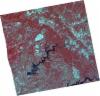
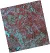
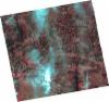
DE2_OPER_HRA_PSH_1C_20210721T111624_N37-333_W008-427_0001
Download Product | Product Info | Browse
Platform Short Name | GEOSAT |
Platform Serial Identifier | 2 |
Product Type | HRA_PSH_1C |
Start Date | 2021-07-21T11:16:24Z |
Stop Date | 2021-07-21T11:16:26Z |
Original Name | DE2_PSH_L1C_000000_20210721T111624_20210721T111626_DE2_38410_39B8.zip |
Footprint | 37.2770708974 -8.32061039092 37.4160080527 -8.35429329805 37.3906596544 -8.53471600375 37.2519263984 -8.499137166 37.2770708974 -8.32061039092 |
Orbit Direction | ASCENDING |
Scene Centre Longitude | W008 |
Scene Centre Latitude | N37 |
Cloud Cover Percentage | -1 |
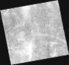
DE2_OPER_HRA_PM4_1C_20210721T111624_N37-333_W008-427_0001
Download Product | Product Info | Browse
Platform Short Name | GEOSAT |
Platform Serial Identifier | 2 |
Product Type | HRA_PM4_1C |
Start Date | 2021-07-21T11:16:24Z |
Stop Date | 2021-07-21T11:16:26Z |
Original Name | DE2_PM4_L1C_000000_20210721T111624_20210721T111626_DE2_38410_39B8.zip |
Footprint | 37.2770708974 -8.32061039092 37.4160080527 -8.35429329805 37.3906596544 -8.53471600375 37.2519263984 -8.499137166 37.2770708974 -8.32061039092 |
Orbit Direction | ASCENDING |
Scene Centre Longitude | W008 |
Scene Centre Latitude | N37 |
Cloud Cover Percentage | -1 |
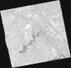
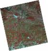
DE2_OPER_HRA_PSH_1C_20210721T111622_N37-207_W008-396_0001
Download Product | Product Info | Browse
Platform Short Name | GEOSAT |
Platform Serial Identifier | 2 |
Product Type | HRA_PSH_1C |
Start Date | 2021-07-21T11:16:22Z |
Stop Date | 2021-07-21T11:16:24Z |
Original Name | DE2_PSH_L1C_000000_20210721T111622_20210721T111624_DE2_38410_FD41.zip |
Footprint | 37.1508382833 -8.29035687715 37.2899326275 -8.3235831355 37.2646919172 -8.50276594186 37.1256773673 -8.4689842759 37.1508382833 -8.29035687715 |
Orbit Direction | ASCENDING |
Scene Centre Longitude | W008 |
Scene Centre Latitude | N37 |
Cloud Cover Percentage | -1 |
DE2_OPER_HRA_PM4_1C_20210721T111622_N37-207_W008-396_0001
Download Product | Product Info | Browse
Platform Short Name | GEOSAT |
Platform Serial Identifier | 2 |
Product Type | HRA_PM4_1C |
Start Date | 2021-07-21T11:16:22Z |
Stop Date | 2021-07-21T11:16:24Z |
Original Name | DE2_PM4_L1C_000000_20210721T111622_20210721T111624_DE2_38410_FD41.zip |
Footprint | 37.1508382833 -8.29035687715 37.2899326275 -8.3235831355 37.2646919172 -8.50276594186 37.1256773673 -8.4689842759 37.1508382833 -8.29035687715 |
Orbit Direction | ASCENDING |
Scene Centre Longitude | W008 |
Scene Centre Latitude | N37 |
Cloud Cover Percentage | -1 |
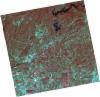
DE2_OPER_HRA_PSH_1C_20210507T111059_N37-344_W008-286_0001
Download Product | Product Info | Browse
Platform Short Name | GEOSAT |
Platform Serial Identifier | 2 |
Product Type | HRA_PSH_1C |
Start Date | 2021-05-07T11:10:59Z |
Stop Date | 2021-05-07T11:11:02Z |
Original Name | DE2_PSH_L1C_000000_20210507T111059_20210507T111102_DE2_37297_ABBB.zip |
Footprint | 37.2931076617 -8.19668096336 37.4200191467 -8.22940867782 37.3959037796 -8.37710628005 37.2690356406 -8.34388556303 37.2931076617 -8.19668096336 |
Orbit Direction | ASCENDING |
Scene Centre Longitude | W008 |
Scene Centre Latitude | N37 |
Cloud Cover Percentage | -1 |
DE2_OPER_HRA_PM4_1C_20210507T111059_N37-344_W008-286_0001
Download Product | Product Info | Browse
Platform Short Name | GEOSAT |
Platform Serial Identifier | 2 |
Product Type | HRA_PM4_1C |
Start Date | 2021-05-07T11:10:59Z |
Stop Date | 2021-05-07T11:11:02Z |
Original Name | DE2_PM4_L1C_000000_20210507T111059_20210507T111102_DE2_37297_ABBB.zip |
Footprint | 37.2931076617 -8.19668096336 37.4200191467 -8.22940867782 37.3959037796 -8.37710628005 37.2690356406 -8.34388556303 37.2931076617 -8.19668096336 |
Orbit Direction | ASCENDING |
Scene Centre Longitude | W008 |
Scene Centre Latitude | N37 |
Cloud Cover Percentage | -1 |
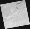
DE2_OPER_HRA_PSH_1C_20210507T111057_N37-229_W008-256_0001
Download Product | Product Info | Browse
Platform Short Name | GEOSAT |
Platform Serial Identifier | 2 |
Product Type | HRA_PSH_1C |
Start Date | 2021-05-07T11:10:57Z |
Stop Date | 2021-05-07T11:11:00Z |
Original Name | DE2_PSH_L1C_000000_20210507T111057_20210507T111100_DE2_37297_3B10.zip |
Footprint | 37.1781607418 -8.1663014427 37.3048908398 -8.19966998581 37.2808282823 -8.34678661316 37.1540583381 -8.31366344856 37.1781607418 -8.1663014427 |
Orbit Direction | ASCENDING |
Scene Centre Longitude | W008 |
Scene Centre Latitude | N37 |
Cloud Cover Percentage | -1 |
DE2_OPER_HRA_PM4_1C_20210507T111057_N37-229_W008-256_0001
Download Product | Product Info | Browse
Platform Short Name | GEOSAT |
Platform Serial Identifier | 2 |
Product Type | HRA_PM4_1C |
Start Date | 2021-05-07T11:10:57Z |
Stop Date | 2021-05-07T11:11:00Z |
Original Name | DE2_PM4_L1C_000000_20210507T111057_20210507T111100_DE2_37297_3B10.zip |
Footprint | 37.1781607418 -8.1663014427 37.3048908398 -8.19966998581 37.2808282823 -8.34678661316 37.1540583381 -8.31366344856 37.1781607418 -8.1663014427 |
Orbit Direction | ASCENDING |
Scene Centre Longitude | W008 |
Scene Centre Latitude | N37 |
Cloud Cover Percentage | -1 |
DE2_OPER_HRA_PSH_1C_20210319T112119_N37-294_W008-184_0001
Download Product | Product Info | Browse
Platform Short Name | GEOSAT |
Platform Serial Identifier | 2 |
Product Type | HRA_PSH_1C |
Start Date | 2021-03-19T11:21:19Z |
Stop Date | 2021-03-19T11:21:22Z |
Original Name | DE2_PSH_L1C_000000_20210319T112119_20210319T112122_DE2_36570_5CD2.zip |
Footprint | 37.2355008551 -8.07159883664 37.3786910372 -8.1060337414 37.3530672339 -8.29690053569 37.2089809464 -8.26201334305 37.2355008551 -8.07159883664 |
Orbit Direction | ASCENDING |
Scene Centre Longitude | W008 |
Scene Centre Latitude | N37 |
Cloud Cover Percentage | -1 |
DE2_OPER_HRA_PM4_1C_20210319T112119_N37-294_W008-184_0001
Download Product | Product Info | Browse
Platform Short Name | GEOSAT |
Platform Serial Identifier | 2 |
Product Type | HRA_PM4_1C |
Start Date | 2021-03-19T11:21:19Z |
Stop Date | 2021-03-19T11:21:22Z |
Original Name | DE2_PM4_L1C_000000_20210319T112119_20210319T112122_DE2_36570_5CD2.zip |
Footprint | 37.2355008551 -8.07159883664 37.3786910372 -8.1060337414 37.3530672339 -8.29690053569 37.2089809464 -8.26201334305 37.2355008551 -8.07159883664 |
Orbit Direction | ASCENDING |
Scene Centre Longitude | W008 |
Scene Centre Latitude | N37 |
Cloud Cover Percentage | -1 |