ESA TPM Map Catalogue - Product List
back to previous node |
list of download URLs
Collection G2_Portugal_2021
GEOSAT-2 Portugal Coverage 2021 collection. More details here.
List of available products (latitude from 37.2541 to 37.3325 dg, longitude from -8.54375 to -8.39938 dg)..
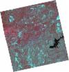
DE2_OPER_HRA_PSH_1C_20210721T111624_N37-333_W008-427_0001
Download Product | Product Info | BrowsePlatform Short Name | GEOSAT |
Platform Serial Identifier | 2 |
Product Type | HRA_PSH_1C |
Start Date | 2021-07-21T11:16:24Z |
Stop Date | 2021-07-21T11:16:26Z |
Original Name | DE2_PSH_L1C_000000_20210721T111624_20210721T111626_DE2_38410_39B8.zip |
Footprint | 37.2770708974 -8.32061039092 37.4160080527 -8.35429329805 37.3906596544 -8.53471600375 37.2519263984 -8.499137166 37.2770708974 -8.32061039092 |
Orbit Direction | ASCENDING |
Scene Centre Longitude | W008 |
Scene Centre Latitude | N37 |
Cloud Cover Percentage | -1 |
DE2_OPER_HRA_PM4_1C_20210721T111624_N37-333_W008-427_0001
Download Product | Product Info | BrowsePlatform Short Name | GEOSAT |
Platform Serial Identifier | 2 |
Product Type | HRA_PM4_1C |
Start Date | 2021-07-21T11:16:24Z |
Stop Date | 2021-07-21T11:16:26Z |
Original Name | DE2_PM4_L1C_000000_20210721T111624_20210721T111626_DE2_38410_39B8.zip |
Footprint | 37.2770708974 -8.32061039092 37.4160080527 -8.35429329805 37.3906596544 -8.53471600375 37.2519263984 -8.499137166 37.2770708974 -8.32061039092 |
Orbit Direction | ASCENDING |
Scene Centre Longitude | W008 |
Scene Centre Latitude | N37 |
Cloud Cover Percentage | -1 |
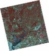
DE2_OPER_HRA_PSH_1C_20210721T111622_N37-207_W008-396_0001
Download Product | Product Info | BrowsePlatform Short Name | GEOSAT |
Platform Serial Identifier | 2 |
Product Type | HRA_PSH_1C |
Start Date | 2021-07-21T11:16:22Z |
Stop Date | 2021-07-21T11:16:24Z |
Original Name | DE2_PSH_L1C_000000_20210721T111622_20210721T111624_DE2_38410_FD41.zip |
Footprint | 37.1508382833 -8.29035687715 37.2899326275 -8.3235831355 37.2646919172 -8.50276594186 37.1256773673 -8.4689842759 37.1508382833 -8.29035687715 |
Orbit Direction | ASCENDING |
Scene Centre Longitude | W008 |
Scene Centre Latitude | N37 |
Cloud Cover Percentage | -1 |
DE2_OPER_HRA_PM4_1C_20210721T111622_N37-207_W008-396_0001
Download Product | Product Info | BrowsePlatform Short Name | GEOSAT |
Platform Serial Identifier | 2 |
Product Type | HRA_PM4_1C |
Start Date | 2021-07-21T11:16:22Z |
Stop Date | 2021-07-21T11:16:24Z |
Original Name | DE2_PM4_L1C_000000_20210721T111622_20210721T111624_DE2_38410_FD41.zip |
Footprint | 37.1508382833 -8.29035687715 37.2899326275 -8.3235831355 37.2646919172 -8.50276594186 37.1256773673 -8.4689842759 37.1508382833 -8.29035687715 |
Orbit Direction | ASCENDING |
Scene Centre Longitude | W008 |
Scene Centre Latitude | N37 |
Cloud Cover Percentage | -1 |
DE2_OPER_HRA_PSH_1C_20210715T111954_N37-266_W008-621_0001
Download Product | Product Info | BrowsePlatform Short Name | GEOSAT |
Platform Serial Identifier | 2 |
Product Type | HRA_PSH_1C |
Start Date | 2021-07-15T11:19:54Z |
Stop Date | 2021-07-15T11:19:57Z |
Original Name | DE2_PSH_L1C_000000_20210715T111954_20210715T111957_DE2_38321_E554.zip |
Footprint | 37.2065666066 -8.50631707937 37.3512428992 -8.54236065134 37.3255948684 -8.7353331085 37.1806567788 -8.70143433781 37.2065666066 -8.50631707937 |
Orbit Direction | ASCENDING |
Scene Centre Longitude | W008 |
Scene Centre Latitude | N37 |
Cloud Cover Percentage | -1 |
DE2_OPER_HRA_PM4_1C_20210715T111954_N37-266_W008-621_0001
Download Product | Product Info | BrowsePlatform Short Name | GEOSAT |
Platform Serial Identifier | 2 |
Product Type | HRA_PM4_1C |
Start Date | 2021-07-15T11:19:54Z |
Stop Date | 2021-07-15T11:19:57Z |
Original Name | DE2_PM4_L1C_000000_20210715T111954_20210715T111957_DE2_38321_E554.zip |
Footprint | 37.2065666066 -8.50631707937 37.3512428992 -8.54236065134 37.3255948684 -8.7353331085 37.1806567788 -8.70143433781 37.2065666066 -8.50631707937 |
Orbit Direction | ASCENDING |
Scene Centre Longitude | W008 |
Scene Centre Latitude | N37 |
Cloud Cover Percentage | -1 |
DE2_OPER_HRA_PSH_1C_20210607T110941_N37-313_W008-517_0001
Download Product | Product Info | BrowsePlatform Short Name | GEOSAT |
Platform Serial Identifier | 2 |
Product Type | HRA_PSH_1C |
Start Date | 2021-06-07T11:09:41Z |
Stop Date | 2021-06-07T11:09:44Z |
Original Name | DE2_PSH_L1C_000000_20210607T110941_20210607T110944_DE2_37757_B267.zip |
Footprint | 37.2624491267 -8.42826311961 37.3880847651 -8.46162357299 37.3639323329 -8.60629765394 37.2383483668 -8.57253728088 37.2624491267 -8.42826311961 |
Orbit Direction | ASCENDING |
Scene Centre Longitude | W008 |
Scene Centre Latitude | N37 |
Cloud Cover Percentage | -1 |
DE2_OPER_HRA_PM4_1C_20210607T110941_N37-313_W008-517_0001
Download Product | Product Info | BrowsePlatform Short Name | GEOSAT |
Platform Serial Identifier | 2 |
Product Type | HRA_PM4_1C |
Start Date | 2021-06-07T11:09:41Z |
Stop Date | 2021-06-07T11:09:44Z |
Original Name | DE2_PM4_L1C_000000_20210607T110941_20210607T110944_DE2_37757_B267.zip |
Footprint | 37.2624491267 -8.42826311961 37.3880847651 -8.46162357299 37.3639323329 -8.60629765394 37.2383483668 -8.57253728088 37.2624491267 -8.42826311961 |
Orbit Direction | ASCENDING |
Scene Centre Longitude | W008 |
Scene Centre Latitude | N37 |
Cloud Cover Percentage | -1 |
DE2_OPER_HRA_PSH_1C_20210607T110939_N37-199_W008-486_0001
Download Product | Product Info | BrowsePlatform Short Name | GEOSAT |
Platform Serial Identifier | 2 |
Product Type | HRA_PSH_1C |
Start Date | 2021-06-07T11:09:39Z |
Stop Date | 2021-06-07T11:09:42Z |
Original Name | DE2_PSH_L1C_000000_20210607T110939_20210607T110942_DE2_37757_CCB8.zip |
Footprint | 37.1484301007 -8.39757844697 37.2741052309 -8.43130502738 37.2499613005 -8.57585445979 37.1242778049 -8.54188167378 37.1484301007 -8.39757844697 |
Orbit Direction | ASCENDING |
Scene Centre Longitude | W008 |
Scene Centre Latitude | N37 |
Cloud Cover Percentage | -1 |
DE2_OPER_HRA_PM4_1C_20210607T110939_N37-199_W008-486_0001
Download Product | Product Info | BrowsePlatform Short Name | GEOSAT |
Platform Serial Identifier | 2 |
Product Type | HRA_PM4_1C |
Start Date | 2021-06-07T11:09:39Z |
Stop Date | 2021-06-07T11:09:42Z |
Original Name | DE2_PM4_L1C_000000_20210607T110939_20210607T110942_DE2_37757_CCB8.zip |
Footprint | 37.1484301007 -8.39757844697 37.2741052309 -8.43130502738 37.2499613005 -8.57585445979 37.1242778049 -8.54188167378 37.1484301007 -8.39757844697 |
Orbit Direction | ASCENDING |
Scene Centre Longitude | W008 |
Scene Centre Latitude | N37 |
Cloud Cover Percentage | -1 |


