ESA TPM Map Catalogue - Product List
back to previous node |
list of download URLs
Collection G2_Portugal_2021
GEOSAT-2 Portugal Coverage 2021 collection. More details here.
List of available products (latitude from 37.2541 to 37.3325 dg, longitude from -8.8325 to -8.68812 dg)..
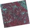
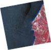
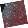
DE2_OPER_HRA_PSH_1C_20210715T111956_N37-397_W008-651_0001
Download Product | Product Info | Browse
Platform Short Name | GEOSAT |
Platform Serial Identifier | 2 |
Product Type | HRA_PSH_1C |
Start Date | 2021-07-15T11:19:56Z |
Stop Date | 2021-07-15T11:19:59Z |
Original Name | DE2_PSH_L1C_000000_20210715T111956_20210715T111959_DE2_38321_257A.zip |
Footprint | 37.3380165343 -8.53808898427 37.4831175552 -8.56980636686 37.4573286899 -8.76483036262 37.3121025192 -8.73298512284 37.3380165343 -8.53808898427 |
Orbit Direction | ASCENDING |
Scene Centre Longitude | W008 |
Scene Centre Latitude | N37 |
Cloud Cover Percentage | -1 |
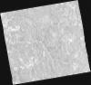
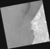
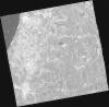
DE2_OPER_HRA_PM4_1C_20210715T111956_N37-397_W008-651_0001
Download Product | Product Info | Browse
Platform Short Name | GEOSAT |
Platform Serial Identifier | 2 |
Product Type | HRA_PM4_1C |
Start Date | 2021-07-15T11:19:56Z |
Stop Date | 2021-07-15T11:19:59Z |
Original Name | DE2_PM4_L1C_000000_20210715T111956_20210715T111959_DE2_38321_257A.zip |
Footprint | 37.3380165343 -8.53808898427 37.4831175552 -8.56980636686 37.4573286899 -8.76483036262 37.3121025192 -8.73298512284 37.3380165343 -8.53808898427 |
Orbit Direction | ASCENDING |
Scene Centre Longitude | W008 |
Scene Centre Latitude | N37 |
Cloud Cover Percentage | -1 |
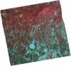
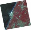
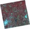
DE2_OPER_HRA_PSH_1C_20210715T111954_N37-266_W008-621_0001
Download Product | Product Info | Browse
Platform Short Name | GEOSAT |
Platform Serial Identifier | 2 |
Product Type | HRA_PSH_1C |
Start Date | 2021-07-15T11:19:54Z |
Stop Date | 2021-07-15T11:19:57Z |
Original Name | DE2_PSH_L1C_000000_20210715T111954_20210715T111957_DE2_38321_E554.zip |
Footprint | 37.2065666066 -8.50631707937 37.3512428992 -8.54236065134 37.3255948684 -8.7353331085 37.1806567788 -8.70143433781 37.2065666066 -8.50631707937 |
Orbit Direction | ASCENDING |
Scene Centre Longitude | W008 |
Scene Centre Latitude | N37 |
Cloud Cover Percentage | -1 |
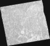
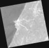
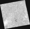
DE2_OPER_HRA_PM4_1C_20210715T111954_N37-266_W008-621_0001
Download Product | Product Info | Browse
Platform Short Name | GEOSAT |
Platform Serial Identifier | 2 |
Product Type | HRA_PM4_1C |
Start Date | 2021-07-15T11:19:54Z |
Stop Date | 2021-07-15T11:19:57Z |
Original Name | DE2_PM4_L1C_000000_20210715T111954_20210715T111957_DE2_38321_E554.zip |
Footprint | 37.2065666066 -8.50631707937 37.3512428992 -8.54236065134 37.3255948684 -8.7353331085 37.1806567788 -8.70143433781 37.2065666066 -8.50631707937 |
Orbit Direction | ASCENDING |
Scene Centre Longitude | W008 |
Scene Centre Latitude | N37 |
Cloud Cover Percentage | -1 |
DE2_OPER_HRA_PSH_1C_20210520T111950_N37-312_W008-901_0001
Download Product | Product Info | Browse
Platform Short Name | GEOSAT |
Platform Serial Identifier | 2 |
Product Type | HRA_PSH_1C |
Start Date | 2021-05-20T11:19:50Z |
Stop Date | 2021-05-20T11:19:52Z |
Original Name | DE2_PSH_L1C_000000_20210520T111950_20210520T111952_DE2_37490_3CE1.zip |
Footprint | 37.255983335 -8.7975460461 37.3941558336 -8.82920355236 37.3682853662 -9.00554519683 37.230787794 -8.97306001372 37.255983335 -8.7975460461 |
Orbit Direction | ASCENDING |
Scene Centre Longitude | W008 |
Scene Centre Latitude | N37 |
Cloud Cover Percentage | -1 |
DE2_OPER_HRA_PM4_1C_20210520T111950_N37-312_W008-901_0001
Download Product | Product Info | Browse
Platform Short Name | GEOSAT |
Platform Serial Identifier | 2 |
Product Type | HRA_PM4_1C |
Start Date | 2021-05-20T11:19:50Z |
Stop Date | 2021-05-20T11:19:52Z |
Original Name | DE2_PM4_L1C_000000_20210520T111950_20210520T111952_DE2_37490_3CE1.zip |
Footprint | 37.255983335 -8.7975460461 37.3941558336 -8.82920355236 37.3682853662 -9.00554519683 37.230787794 -8.97306001372 37.255983335 -8.7975460461 |
Orbit Direction | ASCENDING |
Scene Centre Longitude | W008 |
Scene Centre Latitude | N37 |
Cloud Cover Percentage | -1 |
DE2_OPER_HRA_PSH_1C_20210520T111948_N37-187_W008-871_0001
Download Product | Product Info | Browse
Platform Short Name | GEOSAT |
Platform Serial Identifier | 2 |
Product Type | HRA_PSH_1C |
Start Date | 2021-05-20T11:19:48Z |
Stop Date | 2021-05-20T11:19:50Z |
Original Name | DE2_PSH_L1C_000000_20210520T111948_20210520T111950_DE2_37490_C1B2.zip |
Footprint | 37.1308161593 -8.76720399376 37.2687788905 -8.80029483274 37.2437551126 -8.97575295953 37.1058067885 -8.94274227046 37.1308161593 -8.76720399376 |
Orbit Direction | ASCENDING |
Scene Centre Longitude | W008 |
Scene Centre Latitude | N37 |
Cloud Cover Percentage | -1 |
DE2_OPER_HRA_PM4_1C_20210520T111948_N37-187_W008-871_0001
Download Product | Product Info | Browse
Platform Short Name | GEOSAT |
Platform Serial Identifier | 2 |
Product Type | HRA_PM4_1C |
Start Date | 2021-05-20T11:19:48Z |
Stop Date | 2021-05-20T11:19:50Z |
Original Name | DE2_PM4_L1C_000000_20210520T111948_20210520T111950_DE2_37490_C1B2.zip |
Footprint | 37.1308161593 -8.76720399376 37.2687788905 -8.80029483274 37.2437551126 -8.97575295953 37.1058067885 -8.94274227046 37.1308161593 -8.76720399376 |
Orbit Direction | ASCENDING |
Scene Centre Longitude | W008 |
Scene Centre Latitude | N37 |
Cloud Cover Percentage | -1 |
DE2_OPER_HRA_PSH_1C_20210419T112052_N37-372_W008-741_0001
Download Product | Product Info | Browse
Platform Short Name | GEOSAT |
Platform Serial Identifier | 2 |
Product Type | HRA_PSH_1C |
Start Date | 2021-04-19T11:20:52Z |
Stop Date | 2021-04-19T11:20:54Z |
Original Name | DE2_PSH_L1C_000000_20210419T112052_20210419T112054_DE2_37030_88AE.zip |
Footprint | 37.3159124327 -8.63558089182 37.4545116625 -8.66720107897 37.4293744801 -8.84694249696 37.2895835013 -8.81433657987 37.3159124327 -8.63558089182 |
Orbit Direction | ASCENDING |
Scene Centre Longitude | W008 |
Scene Centre Latitude | N37 |
Cloud Cover Percentage | -1 |
DE2_OPER_HRA_PM4_1C_20210419T112052_N37-372_W008-741_0001
Download Product | Product Info | Browse
Platform Short Name | GEOSAT |
Platform Serial Identifier | 2 |
Product Type | HRA_PM4_1C |
Start Date | 2021-04-19T11:20:52Z |
Stop Date | 2021-04-19T11:20:54Z |
Original Name | DE2_PM4_L1C_000000_20210419T112052_20210419T112054_DE2_37030_88AE.zip |
Footprint | 37.3159124327 -8.63558089182 37.4545116625 -8.66720107897 37.4293744801 -8.84694249696 37.2895835013 -8.81433657987 37.3159124327 -8.63558089182 |
Orbit Direction | ASCENDING |
Scene Centre Longitude | W008 |
Scene Centre Latitude | N37 |
Cloud Cover Percentage | -1 |
DE2_OPER_HRA_PSH_1C_20210419T112050_N37-245_W008-711_0001
Download Product | Product Info | Browse
Platform Short Name | GEOSAT |
Platform Serial Identifier | 2 |
Product Type | HRA_PSH_1C |
Start Date | 2021-04-19T11:20:50Z |
Stop Date | 2021-04-19T11:20:52Z |
Original Name | DE2_PSH_L1C_000000_20210419T112050_20210419T112052_DE2_37030_A6C7.zip |
Footprint | 37.1881509541 -8.60350247814 37.3275366525 -8.63878402998 37.3025278577 -8.81742756169 37.1628002815 -8.78484518634 37.1881509541 -8.60350247814 |
Orbit Direction | ASCENDING |
Scene Centre Longitude | W008 |
Scene Centre Latitude | N37 |
Cloud Cover Percentage | -1 |
DE2_OPER_HRA_PM4_1C_20210419T112050_N37-245_W008-711_0001
Download Product | Product Info | Browse
Platform Short Name | GEOSAT |
Platform Serial Identifier | 2 |
Product Type | HRA_PM4_1C |
Start Date | 2021-04-19T11:20:50Z |
Stop Date | 2021-04-19T11:20:52Z |
Original Name | DE2_PM4_L1C_000000_20210419T112050_20210419T112052_DE2_37030_A6C7.zip |
Footprint | 37.1881509541 -8.60350247814 37.3275366525 -8.63878402998 37.3025278577 -8.81742756169 37.1628002815 -8.78484518634 37.1881509541 -8.60350247814 |
Orbit Direction | ASCENDING |
Scene Centre Longitude | W008 |
Scene Centre Latitude | N37 |
Cloud Cover Percentage | -1 |