ESA TPM Map Catalogue - Product List
back to previous node |
list of download URLs

Collection G2_Portugal_2021
GEOSAT-2 Portugal Coverage 2021 collection. More details here.
List of available products (latitude from 37.1756 to 37.2541 dg, longitude from -8.18938 to -8.045 dg)..
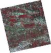
DE2_OPER_HRA_PSH_1C_20210708T110754_N37-228_W008-099_0001
Download Product | Product Info | Browse
Platform Short Name | GEOSAT |
Platform Serial Identifier | 2 |
Product Type | HRA_PSH_1C |
Start Date | 2021-07-08T11:07:54Z |
Stop Date | 2021-07-08T11:07:57Z |
Original Name | DE2_PSH_L1C_000000_20210708T110754_20210708T110757_DE2_38217_13E2.zip |
Footprint | 37.1768479894 -8.00979806456 37.3036912879 -8.0435281727 37.2796201714 -8.18964171934 37.1527350271 -8.15583749011 37.1768479894 -8.00979806456 |
Orbit Direction | ASCENDING |
Scene Centre Longitude | W008 |
Scene Centre Latitude | N37 |
Cloud Cover Percentage | -1 |
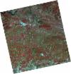
DE2_OPER_HRA_PM4_1C_20210708T110754_N37-228_W008-099_0001
Download Product | Product Info | Browse
Platform Short Name | GEOSAT |
Platform Serial Identifier | 2 |
Product Type | HRA_PM4_1C |
Start Date | 2021-07-08T11:07:54Z |
Stop Date | 2021-07-08T11:07:57Z |
Original Name | DE2_PM4_L1C_000000_20210708T110754_20210708T110757_DE2_38217_13E2.zip |
Footprint | 37.1768479894 -8.00979806456 37.3036912879 -8.0435281727 37.2796201714 -8.18964171934 37.1527350271 -8.15583749011 37.1768479894 -8.00979806456 |
Orbit Direction | ASCENDING |
Scene Centre Longitude | W008 |
Scene Centre Latitude | N37 |
Cloud Cover Percentage | -1 |
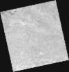
DE2_OPER_HRA_PSH_1C_20210507T111057_N37-229_W008-256_0001
Download Product | Product Info | Browse
Platform Short Name | GEOSAT |
Platform Serial Identifier | 2 |
Product Type | HRA_PSH_1C |
Start Date | 2021-05-07T11:10:57Z |
Stop Date | 2021-05-07T11:11:00Z |
Original Name | DE2_PSH_L1C_000000_20210507T111057_20210507T111100_DE2_37297_3B10.zip |
Footprint | 37.1781607418 -8.1663014427 37.3048908398 -8.19966998581 37.2808282823 -8.34678661316 37.1540583381 -8.31366344856 37.1781607418 -8.1663014427 |
Orbit Direction | ASCENDING |
Scene Centre Longitude | W008 |
Scene Centre Latitude | N37 |
Cloud Cover Percentage | -1 |
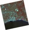
DE2_OPER_HRA_PM4_1C_20210507T111057_N37-229_W008-256_0001
Download Product | Product Info | Browse
Platform Short Name | GEOSAT |
Platform Serial Identifier | 2 |
Product Type | HRA_PM4_1C |
Start Date | 2021-05-07T11:10:57Z |
Stop Date | 2021-05-07T11:11:00Z |
Original Name | DE2_PM4_L1C_000000_20210507T111057_20210507T111100_DE2_37297_3B10.zip |
Footprint | 37.1781607418 -8.1663014427 37.3048908398 -8.19966998581 37.2808282823 -8.34678661316 37.1540583381 -8.31366344856 37.1781607418 -8.1663014427 |
Orbit Direction | ASCENDING |
Scene Centre Longitude | W008 |
Scene Centre Latitude | N37 |
Cloud Cover Percentage | -1 |
DE2_OPER_HRA_PSH_1C_20210507T111055_N37-114_W008-226_0001
Download Product | Product Info | Browse
Platform Short Name | GEOSAT |
Platform Serial Identifier | 2 |
Product Type | HRA_PSH_1C |
Start Date | 2021-05-07T11:10:55Z |
Stop Date | 2021-05-07T11:10:58Z |
Original Name | DE2_PSH_L1C_000000_20210507T111055_20210507T111058_DE2_37297_C14C.zip |
Footprint | 37.0630507213 -8.13618113572 37.189911713 -8.16938328598 37.165818836 -8.31669111717 37.0389828491 -8.28331167511 37.0630507213 -8.13618113572 |
Orbit Direction | ASCENDING |
Scene Centre Longitude | W008 |
Scene Centre Latitude | N37 |
Cloud Cover Percentage | -1 |
DE2_OPER_HRA_PM4_1C_20210507T111055_N37-114_W008-226_0001
Download Product | Product Info | Browse
Platform Short Name | GEOSAT |
Platform Serial Identifier | 2 |
Product Type | HRA_PM4_1C |
Start Date | 2021-05-07T11:10:55Z |
Stop Date | 2021-05-07T11:10:58Z |
Original Name | DE2_PM4_L1C_000000_20210507T111055_20210507T111058_DE2_37297_C14C.zip |
Footprint | 37.0630507213 -8.13618113572 37.189911713 -8.16938328598 37.165818836 -8.31669111717 37.0389828491 -8.28331167511 37.0630507213 -8.13618113572 |
Orbit Direction | ASCENDING |
Scene Centre Longitude | W008 |
Scene Centre Latitude | N37 |
Cloud Cover Percentage | -1 |
DE2_OPER_HRA_PSH_1C_20210319T112119_N37-294_W008-184_0001
Download Product | Product Info | Browse
Platform Short Name | GEOSAT |
Platform Serial Identifier | 2 |
Product Type | HRA_PSH_1C |
Start Date | 2021-03-19T11:21:19Z |
Stop Date | 2021-03-19T11:21:22Z |
Original Name | DE2_PSH_L1C_000000_20210319T112119_20210319T112122_DE2_36570_5CD2.zip |
Footprint | 37.2355008551 -8.07159883664 37.3786910372 -8.1060337414 37.3530672339 -8.29690053569 37.2089809464 -8.26201334305 37.2355008551 -8.07159883664 |
Orbit Direction | ASCENDING |
Scene Centre Longitude | W008 |
Scene Centre Latitude | N37 |
Cloud Cover Percentage | -1 |
DE2_OPER_HRA_PM4_1C_20210319T112119_N37-294_W008-184_0001
Download Product | Product Info | Browse
Platform Short Name | GEOSAT |
Platform Serial Identifier | 2 |
Product Type | HRA_PM4_1C |
Start Date | 2021-03-19T11:21:19Z |
Stop Date | 2021-03-19T11:21:22Z |
Original Name | DE2_PM4_L1C_000000_20210319T112119_20210319T112122_DE2_36570_5CD2.zip |
Footprint | 37.2355008551 -8.07159883664 37.3786910372 -8.1060337414 37.3530672339 -8.29690053569 37.2089809464 -8.26201334305 37.2355008551 -8.07159883664 |
Orbit Direction | ASCENDING |
Scene Centre Longitude | W008 |
Scene Centre Latitude | N37 |
Cloud Cover Percentage | -1 |
DE2_OPER_HRA_PSH_1C_20210319T112117_N37-163_W008-153_0001
Download Product | Product Info | Browse
Platform Short Name | GEOSAT |
Platform Serial Identifier | 2 |
Product Type | HRA_PSH_1C |
Start Date | 2021-03-19T11:21:17Z |
Stop Date | 2021-03-19T11:21:20Z |
Original Name | DE2_PSH_L1C_000000_20210319T112117_20210319T112120_DE2_36570_0ABA.zip |
Footprint | 37.1038588883 -8.04056049317 37.2479975092 -8.07465053846 37.2223798802 -8.26523894031 37.0781480801 -8.2316420908 37.1038588883 -8.04056049317 |
Orbit Direction | ASCENDING |
Scene Centre Longitude | W008 |
Scene Centre Latitude | N37 |
Cloud Cover Percentage | -1 |
DE2_OPER_HRA_PM4_1C_20210319T112117_N37-163_W008-153_0001
Download Product | Product Info | Browse
Platform Short Name | GEOSAT |
Platform Serial Identifier | 2 |
Product Type | HRA_PM4_1C |
Start Date | 2021-03-19T11:21:17Z |
Stop Date | 2021-03-19T11:21:20Z |
Original Name | DE2_PM4_L1C_000000_20210319T112117_20210319T112120_DE2_36570_0ABA.zip |
Footprint | 37.1038588883 -8.04056049317 37.2479975092 -8.07465053846 37.2223798802 -8.26523894031 37.0781480801 -8.2316420908 37.1038588883 -8.04056049317 |
Orbit Direction | ASCENDING |
Scene Centre Longitude | W008 |
Scene Centre Latitude | N37 |
Cloud Cover Percentage | -1 |