ESA TPM Map Catalogue - Product List
back to previous node |
list of download URLs
Collection G2_Portugal_2021
GEOSAT-2 Portugal Coverage 2021 collection. More details here.
List of available products (latitude from 37.1756 to 37.2541 dg, longitude from -8.68812 to -8.54375 dg)..
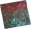
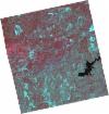
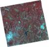
DE2_OPER_HRA_PSH_1C_20210715T111954_N37-266_W008-621_0001
Download Product | Product Info | Browse
Platform Short Name | GEOSAT |
Platform Serial Identifier | 2 |
Product Type | HRA_PSH_1C |
Start Date | 2021-07-15T11:19:54Z |
Stop Date | 2021-07-15T11:19:57Z |
Original Name | DE2_PSH_L1C_000000_20210715T111954_20210715T111957_DE2_38321_E554.zip |
Footprint | 37.2065666066 -8.50631707937 37.3512428992 -8.54236065134 37.3255948684 -8.7353331085 37.1806567788 -8.70143433781 37.2065666066 -8.50631707937 |
Orbit Direction | ASCENDING |
Scene Centre Longitude | W008 |
Scene Centre Latitude | N37 |
Cloud Cover Percentage | -1 |
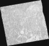
DE2_OPER_HRA_PM4_1C_20210715T111954_N37-266_W008-621_0001
Download Product | Product Info | Browse
Platform Short Name | GEOSAT |
Platform Serial Identifier | 2 |
Product Type | HRA_PM4_1C |
Start Date | 2021-07-15T11:19:54Z |
Stop Date | 2021-07-15T11:19:57Z |
Original Name | DE2_PM4_L1C_000000_20210715T111954_20210715T111957_DE2_38321_E554.zip |
Footprint | 37.2065666066 -8.50631707937 37.3512428992 -8.54236065134 37.3255948684 -8.7353331085 37.1806567788 -8.70143433781 37.2065666066 -8.50631707937 |
Orbit Direction | ASCENDING |
Scene Centre Longitude | W008 |
Scene Centre Latitude | N37 |
Cloud Cover Percentage | -1 |
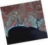
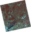
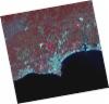
DE2_OPER_HRA_PSH_1C_20210715T111952_N37-134_W008-590_0001
Download Product | Product Info | Browse
Platform Short Name | GEOSAT |
Platform Serial Identifier | 2 |
Product Type | HRA_PSH_1C |
Start Date | 2021-07-15T11:19:52Z |
Stop Date | 2021-07-15T11:19:54Z |
Original Name | DE2_PSH_L1C_000000_20210715T111952_20210715T111954_DE2_38321_956B.zip |
Footprint | 37.0749239426 -8.47627395946 37.2199596915 -8.50969576733 37.1940383305 -8.70507462052 37.0490805736 -8.67072553334 37.0749239426 -8.47627395946 |
Orbit Direction | ASCENDING |
Scene Centre Longitude | W008 |
Scene Centre Latitude | N37 |
Cloud Cover Percentage | -1 |
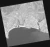
DE2_OPER_HRA_PM4_1C_20210715T111952_N37-134_W008-590_0001
Download Product | Product Info | Browse
Platform Short Name | GEOSAT |
Platform Serial Identifier | 2 |
Product Type | HRA_PM4_1C |
Start Date | 2021-07-15T11:19:52Z |
Stop Date | 2021-07-15T11:19:54Z |
Original Name | DE2_PM4_L1C_000000_20210715T111952_20210715T111954_DE2_38321_956B.zip |
Footprint | 37.0749239426 -8.47627395946 37.2199596915 -8.50969576733 37.1940383305 -8.70507462052 37.0490805736 -8.67072553334 37.0749239426 -8.47627395946 |
Orbit Direction | ASCENDING |
Scene Centre Longitude | W008 |
Scene Centre Latitude | N37 |
Cloud Cover Percentage | -1 |
DE2_OPER_HRA_PSH_1C_20210607T110941_N37-313_W008-517_0001
Download Product | Product Info | Browse
Platform Short Name | GEOSAT |
Platform Serial Identifier | 2 |
Product Type | HRA_PSH_1C |
Start Date | 2021-06-07T11:09:41Z |
Stop Date | 2021-06-07T11:09:44Z |
Original Name | DE2_PSH_L1C_000000_20210607T110941_20210607T110944_DE2_37757_B267.zip |
Footprint | 37.2624491267 -8.42826311961 37.3880847651 -8.46162357299 37.3639323329 -8.60629765394 37.2383483668 -8.57253728088 37.2624491267 -8.42826311961 |
Orbit Direction | ASCENDING |
Scene Centre Longitude | W008 |
Scene Centre Latitude | N37 |
Cloud Cover Percentage | -1 |
DE2_OPER_HRA_PM4_1C_20210607T110941_N37-313_W008-517_0001
Download Product | Product Info | Browse
Platform Short Name | GEOSAT |
Platform Serial Identifier | 2 |
Product Type | HRA_PM4_1C |
Start Date | 2021-06-07T11:09:41Z |
Stop Date | 2021-06-07T11:09:44Z |
Original Name | DE2_PM4_L1C_000000_20210607T110941_20210607T110944_DE2_37757_B267.zip |
Footprint | 37.2624491267 -8.42826311961 37.3880847651 -8.46162357299 37.3639323329 -8.60629765394 37.2383483668 -8.57253728088 37.2624491267 -8.42826311961 |
Orbit Direction | ASCENDING |
Scene Centre Longitude | W008 |
Scene Centre Latitude | N37 |
Cloud Cover Percentage | -1 |
DE2_OPER_HRA_PSH_1C_20210607T110939_N37-199_W008-486_0001
Download Product | Product Info | Browse
Platform Short Name | GEOSAT |
Platform Serial Identifier | 2 |
Product Type | HRA_PSH_1C |
Start Date | 2021-06-07T11:09:39Z |
Stop Date | 2021-06-07T11:09:42Z |
Original Name | DE2_PSH_L1C_000000_20210607T110939_20210607T110942_DE2_37757_CCB8.zip |
Footprint | 37.1484301007 -8.39757844697 37.2741052309 -8.43130502738 37.2499613005 -8.57585445979 37.1242778049 -8.54188167378 37.1484301007 -8.39757844697 |
Orbit Direction | ASCENDING |
Scene Centre Longitude | W008 |
Scene Centre Latitude | N37 |
Cloud Cover Percentage | -1 |
DE2_OPER_HRA_PM4_1C_20210607T110939_N37-199_W008-486_0001
Download Product | Product Info | Browse
Platform Short Name | GEOSAT |
Platform Serial Identifier | 2 |
Product Type | HRA_PM4_1C |
Start Date | 2021-06-07T11:09:39Z |
Stop Date | 2021-06-07T11:09:42Z |
Original Name | DE2_PM4_L1C_000000_20210607T110939_20210607T110942_DE2_37757_CCB8.zip |
Footprint | 37.1484301007 -8.39757844697 37.2741052309 -8.43130502738 37.2499613005 -8.57585445979 37.1242778049 -8.54188167378 37.1484301007 -8.39757844697 |
Orbit Direction | ASCENDING |
Scene Centre Longitude | W008 |
Scene Centre Latitude | N37 |
Cloud Cover Percentage | -1 |
DE2_OPER_HRA_PSH_1C_20210419T112050_N37-245_W008-711_0001
Download Product | Product Info | Browse
Platform Short Name | GEOSAT |
Platform Serial Identifier | 2 |
Product Type | HRA_PSH_1C |
Start Date | 2021-04-19T11:20:50Z |
Stop Date | 2021-04-19T11:20:52Z |
Original Name | DE2_PSH_L1C_000000_20210419T112050_20210419T112052_DE2_37030_A6C7.zip |
Footprint | 37.1881509541 -8.60350247814 37.3275366525 -8.63878402998 37.3025278577 -8.81742756169 37.1628002815 -8.78484518634 37.1881509541 -8.60350247814 |
Orbit Direction | ASCENDING |
Scene Centre Longitude | W008 |
Scene Centre Latitude | N37 |
Cloud Cover Percentage | -1 |
DE2_OPER_HRA_PM4_1C_20210419T112050_N37-245_W008-711_0001
Download Product | Product Info | Browse
Platform Short Name | GEOSAT |
Platform Serial Identifier | 2 |
Product Type | HRA_PM4_1C |
Start Date | 2021-04-19T11:20:50Z |
Stop Date | 2021-04-19T11:20:52Z |
Original Name | DE2_PM4_L1C_000000_20210419T112050_20210419T112052_DE2_37030_A6C7.zip |
Footprint | 37.1881509541 -8.60350247814 37.3275366525 -8.63878402998 37.3025278577 -8.81742756169 37.1628002815 -8.78484518634 37.1881509541 -8.60350247814 |
Orbit Direction | ASCENDING |
Scene Centre Longitude | W008 |
Scene Centre Latitude | N37 |
Cloud Cover Percentage | -1 |
DE2_OPER_HRA_PSH_1C_20210419T112048_N37-118_W008-680_0001
Download Product | Product Info | Browse
Platform Short Name | GEOSAT |
Platform Serial Identifier | 2 |
Product Type | HRA_PSH_1C |
Start Date | 2021-04-19T11:20:48Z |
Stop Date | 2021-04-19T11:20:50Z |
Original Name | DE2_PSH_L1C_000000_20210419T112048_20210419T112050_DE2_37030_EC93.zip |
Footprint | 37.0613056681 -8.57361699114 37.2010873091 -8.60655342154 37.175765694 -8.78779081832 37.0360579743 -8.75378119919 37.0613056681 -8.57361699114 |
Orbit Direction | ASCENDING |
Scene Centre Longitude | W008 |
Scene Centre Latitude | N37 |
Cloud Cover Percentage | -1 |
DE2_OPER_HRA_PM4_1C_20210419T112048_N37-118_W008-680_0001
Download Product | Product Info | Browse
Platform Short Name | GEOSAT |
Platform Serial Identifier | 2 |
Product Type | HRA_PM4_1C |
Start Date | 2021-04-19T11:20:48Z |
Stop Date | 2021-04-19T11:20:50Z |
Original Name | DE2_PM4_L1C_000000_20210419T112048_20210419T112050_DE2_37030_EC93.zip |
Footprint | 37.0613056681 -8.57361699114 37.2010873091 -8.60655342154 37.175765694 -8.78779081832 37.0360579743 -8.75378119919 37.0613056681 -8.57361699114 |
Orbit Direction | ASCENDING |
Scene Centre Longitude | W008 |
Scene Centre Latitude | N37 |
Cloud Cover Percentage | -1 |