ESA TPM Map Catalogue - Product List
back to previous node |
list of download URLs


Collection G2_Portugal_2021
GEOSAT-2 Portugal Coverage 2021 collection. More details here.
List of available products (latitude from 37.0972 to 37.1756 dg, longitude from -7.90062 to -7.75625 dg)..
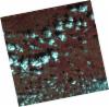
DE2_OPER_HRA_PSH_1C_20210921T111105_N37-125_W007-786_0001
Download Product | Product Info | Browse
Platform Short Name | GEOSAT |
Platform Serial Identifier | 2 |
Product Type | HRA_PSH_1C |
Start Date | 2021-09-21T11:11:05Z |
Stop Date | 2021-09-21T11:11:07Z |
Original Name | DE2_PSH_L1C_000000_20210921T111105_20210921T111107_DE2_39330_CC2A.zip |
Footprint | 37.0689966822 -7.6822757204 37.2069815325 -7.7157739589 37.1819261009 -7.89088786448 37.0440079172 -7.8566668155 37.0689966822 -7.6822757204 |
Orbit Direction | ASCENDING |
Scene Centre Longitude | W007 |
Scene Centre Latitude | N37 |
Cloud Cover Percentage | -1 |
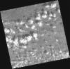
DE2_OPER_HRA_PM4_1C_20210921T111105_N37-125_W007-786_0001
Download Product | Product Info | Browse
Platform Short Name | GEOSAT |
Platform Serial Identifier | 2 |
Product Type | HRA_PM4_1C |
Start Date | 2021-09-21T11:11:05Z |
Stop Date | 2021-09-21T11:11:07Z |
Original Name | DE2_PM4_L1C_000000_20210921T111105_20210921T111107_DE2_39330_CC2A.zip |
Footprint | 37.0689966822 -7.6822757204 37.2069815325 -7.7157739589 37.1819261009 -7.89088786448 37.0440079172 -7.8566668155 37.0689966822 -7.6822757204 |
Orbit Direction | ASCENDING |
Scene Centre Longitude | W007 |
Scene Centre Latitude | N37 |
Cloud Cover Percentage | -1 |
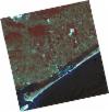
DE2_OPER_HRA_PSH_1C_20210802T110913_N37-075_W007-751_0001
Download Product | Product Info | Browse
Platform Short Name | GEOSAT |
Platform Serial Identifier | 2 |
Product Type | HRA_PSH_1C |
Start Date | 2021-08-02T11:09:13Z |
Stop Date | 2021-08-02T11:09:16Z |
Original Name | DE2_PSH_L1C_000000_20210802T110913_20210802T110916_DE2_38588_D69A.zip |
Footprint | 37.0221589492 -7.65613114957 37.153099408 -7.68889143756 37.1287031337 -7.8470521179 36.9978080985 -7.81337058995 37.0221589492 -7.65613114957 |
Orbit Direction | ASCENDING |
Scene Centre Longitude | W007 |
Scene Centre Latitude | N37 |
Cloud Cover Percentage | -1 |
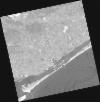
DE2_OPER_HRA_PM4_1C_20210802T110913_N37-075_W007-751_0001
Download Product | Product Info | Browse
Platform Short Name | GEOSAT |
Platform Serial Identifier | 2 |
Product Type | HRA_PM4_1C |
Start Date | 2021-08-02T11:09:13Z |
Stop Date | 2021-08-02T11:09:16Z |
Original Name | DE2_PM4_L1C_000000_20210802T110913_20210802T110916_DE2_38588_D69A.zip |
Footprint | 37.0221589492 -7.65613114957 37.153099408 -7.68889143756 37.1287031337 -7.8470521179 36.9978080985 -7.81337058995 37.0221589492 -7.65613114957 |
Orbit Direction | ASCENDING |
Scene Centre Longitude | W007 |
Scene Centre Latitude | N37 |
Cloud Cover Percentage | -1 |
DE2_OPER_HRA_PSH_1C_20210331T111455_N37-147_W007-919_0001
Download Product | Product Info | Browse
Platform Short Name | GEOSAT |
Platform Serial Identifier | 2 |
Product Type | HRA_PSH_1C |
Start Date | 2021-03-31T11:14:55Z |
Stop Date | 2021-03-31T11:14:58Z |
Original Name | DE2_PSH_L1C_000000_20210331T111455_20210331T111458_DE2_36748_7B9E.zip |
Footprint | 37.0926622042 -7.82212107387 37.2260395941 -7.85566571205 37.201541167 -8.01763947045 37.068134422 -7.98427576803 37.0926622042 -7.82212107387 |
Orbit Direction | ASCENDING |
Scene Centre Longitude | W007 |
Scene Centre Latitude | N37 |
Cloud Cover Percentage | -1 |
DE2_OPER_HRA_PM4_1C_20210331T111455_N37-147_W007-919_0001
Download Product | Product Info | Browse
Platform Short Name | GEOSAT |
Platform Serial Identifier | 2 |
Product Type | HRA_PM4_1C |
Start Date | 2021-03-31T11:14:55Z |
Stop Date | 2021-03-31T11:14:58Z |
Original Name | DE2_PM4_L1C_000000_20210331T111455_20210331T111458_DE2_36748_7B9E.zip |
Footprint | 37.0926622042 -7.82212107387 37.2260395941 -7.85566571205 37.201541167 -8.01763947045 37.068134422 -7.98427576803 37.0926622042 -7.82212107387 |
Orbit Direction | ASCENDING |
Scene Centre Longitude | W007 |
Scene Centre Latitude | N37 |
Cloud Cover Percentage | -1 |
DE2_OPER_HRA_PSH_1C_20210325T111808_N37-245_W007-754_0001
Download Product | Product Info | Browse
Platform Short Name | GEOSAT |
Platform Serial Identifier | 2 |
Product Type | HRA_PSH_1C |
Start Date | 2021-03-25T11:18:08Z |
Stop Date | 2021-03-25T11:18:10Z |
Original Name | DE2_PSH_L1C_000000_20210325T111808_20210325T111810_DE2_36659_0048.zip |
Footprint | 37.1882903219 -7.64601038526 37.3290491582 -7.67905056302 37.3034633036 -7.86404766616 37.1628013094 -7.8297421113 37.1882903219 -7.64601038526 |
Orbit Direction | ASCENDING |
Scene Centre Longitude | W007 |
Scene Centre Latitude | N37 |
Cloud Cover Percentage | -1 |
DE2_OPER_HRA_PM4_1C_20210325T111808_N37-245_W007-754_0001
Download Product | Product Info | Browse
Platform Short Name | GEOSAT |
Platform Serial Identifier | 2 |
Product Type | HRA_PM4_1C |
Start Date | 2021-03-25T11:18:08Z |
Stop Date | 2021-03-25T11:18:10Z |
Original Name | DE2_PM4_L1C_000000_20210325T111808_20210325T111810_DE2_36659_0048.zip |
Footprint | 37.1882903219 -7.64601038526 37.3290491582 -7.67905056302 37.3034633036 -7.86404766616 37.1628013094 -7.8297421113 37.1882903219 -7.64601038526 |
Orbit Direction | ASCENDING |
Scene Centre Longitude | W007 |
Scene Centre Latitude | N37 |
Cloud Cover Percentage | -1 |
DE2_OPER_HRA_PSH_1C_20210325T111806_N37-118_W007-723_0001
Download Product | Product Info | Browse
Platform Short Name | GEOSAT |
Platform Serial Identifier | 2 |
Product Type | HRA_PSH_1C |
Start Date | 2021-03-25T11:18:06Z |
Stop Date | 2021-03-25T11:18:08Z |
Original Name | DE2_PSH_L1C_000000_20210325T111806_20210325T111808_DE2_36659_292D.zip |
Footprint | 37.0605051888 -7.61575021107 37.2013746767 -7.64869223802 37.1758695871 -7.83255657775 37.0351053739 -7.79860678695 37.0605051888 -7.61575021107 |
Orbit Direction | ASCENDING |
Scene Centre Longitude | W007 |
Scene Centre Latitude | N37 |
Cloud Cover Percentage | -1 |
DE2_OPER_HRA_PM4_1C_20210325T111806_N37-118_W007-723_0001
Download Product | Product Info | Browse
Platform Short Name | GEOSAT |
Platform Serial Identifier | 2 |
Product Type | HRA_PM4_1C |
Start Date | 2021-03-25T11:18:06Z |
Stop Date | 2021-03-25T11:18:08Z |
Original Name | DE2_PM4_L1C_000000_20210325T111806_20210325T111808_DE2_36659_292D.zip |
Footprint | 37.0605051888 -7.61575021107 37.2013746767 -7.64869223802 37.1758695871 -7.83255657775 37.0351053739 -7.79860678695 37.0605051888 -7.61575021107 |
Orbit Direction | ASCENDING |
Scene Centre Longitude | W007 |
Scene Centre Latitude | N37 |
Cloud Cover Percentage | -1 |