ESA TPM Map Catalogue - Product List
back to previous node |
list of download URLs

Collection G2_Portugal_2021
GEOSAT-2 Portugal Coverage 2021 collection. More details here.
List of available products (latitude from 37.0972 to 37.1756 dg, longitude from -8.39938 to -8.255 dg)..
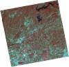
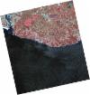
DE2_OPER_HRA_PSH_1C_20210721T111622_N37-207_W008-396_0001
Download Product | Product Info | Browse
Platform Short Name | GEOSAT |
Platform Serial Identifier | 2 |
Product Type | HRA_PSH_1C |
Start Date | 2021-07-21T11:16:22Z |
Stop Date | 2021-07-21T11:16:24Z |
Original Name | DE2_PSH_L1C_000000_20210721T111622_20210721T111624_DE2_38410_FD41.zip |
Footprint | 37.1508382833 -8.29035687715 37.2899326275 -8.3235831355 37.2646919172 -8.50276594186 37.1256773673 -8.4689842759 37.1508382833 -8.29035687715 |
Orbit Direction | ASCENDING |
Scene Centre Longitude | W008 |
Scene Centre Latitude | N37 |
Cloud Cover Percentage | -1 |
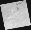
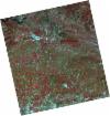
DE2_OPER_HRA_PM4_1C_20210721T111622_N37-207_W008-396_0001
Download Product | Product Info | Browse
Platform Short Name | GEOSAT |
Platform Serial Identifier | 2 |
Product Type | HRA_PM4_1C |
Start Date | 2021-07-21T11:16:22Z |
Stop Date | 2021-07-21T11:16:24Z |
Original Name | DE2_PM4_L1C_000000_20210721T111622_20210721T111624_DE2_38410_FD41.zip |
Footprint | 37.1508382833 -8.29035687715 37.2899326275 -8.3235831355 37.2646919172 -8.50276594186 37.1256773673 -8.4689842759 37.1508382833 -8.29035687715 |
Orbit Direction | ASCENDING |
Scene Centre Longitude | W008 |
Scene Centre Latitude | N37 |
Cloud Cover Percentage | -1 |
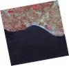
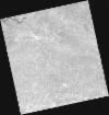
DE2_OPER_HRA_PSH_1C_20210721T111620_N37-081_W008-366_0001
Download Product | Product Info | Browse
Platform Short Name | GEOSAT |
Platform Serial Identifier | 2 |
Product Type | HRA_PSH_1C |
Start Date | 2021-07-21T11:16:20Z |
Stop Date | 2021-07-21T11:16:22Z |
Original Name | DE2_PSH_L1C_000000_20210721T111620_20210721T111622_DE2_38410_42BB.zip |
Footprint | 37.024651954 -8.26044446838 37.1637488166 -8.29341234013 37.1385633146 -8.47206934985 36.9994651996 -8.43873471203 37.024651954 -8.26044446838 |
Orbit Direction | ASCENDING |
Scene Centre Longitude | W008 |
Scene Centre Latitude | N37 |
Cloud Cover Percentage | -1 |
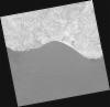
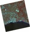
DE2_OPER_HRA_PM4_1C_20210721T111620_N37-081_W008-366_0001
Download Product | Product Info | Browse
Platform Short Name | GEOSAT |
Platform Serial Identifier | 2 |
Product Type | HRA_PM4_1C |
Start Date | 2021-07-21T11:16:20Z |
Stop Date | 2021-07-21T11:16:22Z |
Original Name | DE2_PM4_L1C_000000_20210721T111620_20210721T111622_DE2_38410_42BB.zip |
Footprint | 37.024651954 -8.26044446838 37.1637488166 -8.29341234013 37.1385633146 -8.47206934985 36.9994651996 -8.43873471203 37.024651954 -8.26044446838 |
Orbit Direction | ASCENDING |
Scene Centre Longitude | W008 |
Scene Centre Latitude | N37 |
Cloud Cover Percentage | -1 |
DE2_OPER_HRA_PSH_1C_20210607T110937_N37-085_W008-456_0001
Download Product | Product Info | Browse
Platform Short Name | GEOSAT |
Platform Serial Identifier | 2 |
Product Type | HRA_PSH_1C |
Start Date | 2021-06-07T11:09:37Z |
Stop Date | 2021-06-07T11:09:40Z |
Original Name | DE2_PSH_L1C_000000_20210607T110937_20210607T110940_DE2_37757_CEF4.zip |
Footprint | 37.0343030776 -8.36749030703 37.160074085 -8.40070430678 37.135924943 -8.54502870527 37.0102870085 -8.51164442819 37.0343030776 -8.36749030703 |
Orbit Direction | ASCENDING |
Scene Centre Longitude | W008 |
Scene Centre Latitude | N37 |
Cloud Cover Percentage | -1 |
DE2_OPER_HRA_PM4_1C_20210607T110937_N37-085_W008-456_0001
Download Product | Product Info | Browse
Platform Short Name | GEOSAT |
Platform Serial Identifier | 2 |
Product Type | HRA_PM4_1C |
Start Date | 2021-06-07T11:09:37Z |
Stop Date | 2021-06-07T11:09:40Z |
Original Name | DE2_PM4_L1C_000000_20210607T110937_20210607T110940_DE2_37757_CEF4.zip |
Footprint | 37.0343030776 -8.36749030703 37.160074085 -8.40070430678 37.135924943 -8.54502870527 37.0102870085 -8.51164442819 37.0343030776 -8.36749030703 |
Orbit Direction | ASCENDING |
Scene Centre Longitude | W008 |
Scene Centre Latitude | N37 |
Cloud Cover Percentage | -1 |
DE2_OPER_HRA_PSH_1C_20210507T111057_N37-229_W008-256_0001
Download Product | Product Info | Browse
Platform Short Name | GEOSAT |
Platform Serial Identifier | 2 |
Product Type | HRA_PSH_1C |
Start Date | 2021-05-07T11:10:57Z |
Stop Date | 2021-05-07T11:11:00Z |
Original Name | DE2_PSH_L1C_000000_20210507T111057_20210507T111100_DE2_37297_3B10.zip |
Footprint | 37.1781607418 -8.1663014427 37.3048908398 -8.19966998581 37.2808282823 -8.34678661316 37.1540583381 -8.31366344856 37.1781607418 -8.1663014427 |
Orbit Direction | ASCENDING |
Scene Centre Longitude | W008 |
Scene Centre Latitude | N37 |
Cloud Cover Percentage | -1 |
DE2_OPER_HRA_PM4_1C_20210507T111057_N37-229_W008-256_0001
Download Product | Product Info | Browse
Platform Short Name | GEOSAT |
Platform Serial Identifier | 2 |
Product Type | HRA_PM4_1C |
Start Date | 2021-05-07T11:10:57Z |
Stop Date | 2021-05-07T11:11:00Z |
Original Name | DE2_PM4_L1C_000000_20210507T111057_20210507T111100_DE2_37297_3B10.zip |
Footprint | 37.1781607418 -8.1663014427 37.3048908398 -8.19966998581 37.2808282823 -8.34678661316 37.1540583381 -8.31366344856 37.1781607418 -8.1663014427 |
Orbit Direction | ASCENDING |
Scene Centre Longitude | W008 |
Scene Centre Latitude | N37 |
Cloud Cover Percentage | -1 |
DE2_OPER_HRA_PSH_1C_20210507T111055_N37-114_W008-226_0001
Download Product | Product Info | Browse
Platform Short Name | GEOSAT |
Platform Serial Identifier | 2 |
Product Type | HRA_PSH_1C |
Start Date | 2021-05-07T11:10:55Z |
Stop Date | 2021-05-07T11:10:58Z |
Original Name | DE2_PSH_L1C_000000_20210507T111055_20210507T111058_DE2_37297_C14C.zip |
Footprint | 37.0630507213 -8.13618113572 37.189911713 -8.16938328598 37.165818836 -8.31669111717 37.0389828491 -8.28331167511 37.0630507213 -8.13618113572 |
Orbit Direction | ASCENDING |
Scene Centre Longitude | W008 |
Scene Centre Latitude | N37 |
Cloud Cover Percentage | -1 |
DE2_OPER_HRA_PM4_1C_20210507T111055_N37-114_W008-226_0001
Download Product | Product Info | Browse
Platform Short Name | GEOSAT |
Platform Serial Identifier | 2 |
Product Type | HRA_PM4_1C |
Start Date | 2021-05-07T11:10:55Z |
Stop Date | 2021-05-07T11:10:58Z |
Original Name | DE2_PM4_L1C_000000_20210507T111055_20210507T111058_DE2_37297_C14C.zip |
Footprint | 37.0630507213 -8.13618113572 37.189911713 -8.16938328598 37.165818836 -8.31669111717 37.0389828491 -8.28331167511 37.0630507213 -8.13618113572 |
Orbit Direction | ASCENDING |
Scene Centre Longitude | W008 |
Scene Centre Latitude | N37 |
Cloud Cover Percentage | -1 |