ESA TPM Map Catalogue - Product List
back to previous node |
list of download URLs
Collection G2_Portugal_2021
GEOSAT-2 Portugal Coverage 2021 collection. More details here.
List of available products (latitude from 37.0972 to 37.1756 dg, longitude from -8.8325 to -8.68812 dg)..
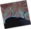
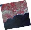
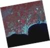
DE2_OPER_HRA_PSH_1C_20210715T111952_N37-134_W008-590_0001
Download Product | Product Info | Browse
Platform Short Name | GEOSAT |
Platform Serial Identifier | 2 |
Product Type | HRA_PSH_1C |
Start Date | 2021-07-15T11:19:52Z |
Stop Date | 2021-07-15T11:19:54Z |
Original Name | DE2_PSH_L1C_000000_20210715T111952_20210715T111954_DE2_38321_956B.zip |
Footprint | 37.0749239426 -8.47627395946 37.2199596915 -8.50969576733 37.1940383305 -8.70507462052 37.0490805736 -8.67072553334 37.0749239426 -8.47627395946 |
Orbit Direction | ASCENDING |
Scene Centre Longitude | W008 |
Scene Centre Latitude | N37 |
Cloud Cover Percentage | -1 |
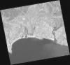
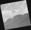
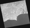
DE2_OPER_HRA_PM4_1C_20210715T111952_N37-134_W008-590_0001
Download Product | Product Info | Browse
Platform Short Name | GEOSAT |
Platform Serial Identifier | 2 |
Product Type | HRA_PM4_1C |
Start Date | 2021-07-15T11:19:52Z |
Stop Date | 2021-07-15T11:19:54Z |
Original Name | DE2_PM4_L1C_000000_20210715T111952_20210715T111954_DE2_38321_956B.zip |
Footprint | 37.0749239426 -8.47627395946 37.2199596915 -8.50969576733 37.1940383305 -8.70507462052 37.0490805736 -8.67072553334 37.0749239426 -8.47627395946 |
Orbit Direction | ASCENDING |
Scene Centre Longitude | W008 |
Scene Centre Latitude | N37 |
Cloud Cover Percentage | -1 |
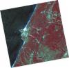
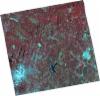
DE2_OPER_HRA_PSH_1C_20210520T111948_N37-187_W008-871_0001
Download Product | Product Info | Browse
Platform Short Name | GEOSAT |
Platform Serial Identifier | 2 |
Product Type | HRA_PSH_1C |
Start Date | 2021-05-20T11:19:48Z |
Stop Date | 2021-05-20T11:19:50Z |
Original Name | DE2_PSH_L1C_000000_20210520T111948_20210520T111950_DE2_37490_C1B2.zip |
Footprint | 37.1308161593 -8.76720399376 37.2687788905 -8.80029483274 37.2437551126 -8.97575295953 37.1058067885 -8.94274227046 37.1308161593 -8.76720399376 |
Orbit Direction | ASCENDING |
Scene Centre Longitude | W008 |
Scene Centre Latitude | N37 |
Cloud Cover Percentage | -1 |
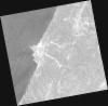
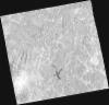
DE2_OPER_HRA_PM4_1C_20210520T111948_N37-187_W008-871_0001
Download Product | Product Info | Browse
Platform Short Name | GEOSAT |
Platform Serial Identifier | 2 |
Product Type | HRA_PM4_1C |
Start Date | 2021-05-20T11:19:48Z |
Stop Date | 2021-05-20T11:19:50Z |
Original Name | DE2_PM4_L1C_000000_20210520T111948_20210520T111950_DE2_37490_C1B2.zip |
Footprint | 37.1308161593 -8.76720399376 37.2687788905 -8.80029483274 37.2437551126 -8.97575295953 37.1058067885 -8.94274227046 37.1308161593 -8.76720399376 |
Orbit Direction | ASCENDING |
Scene Centre Longitude | W008 |
Scene Centre Latitude | N37 |
Cloud Cover Percentage | -1 |
DE2_OPER_HRA_PSH_1C_20210520T111946_N37-062_W008-841_0001
Download Product | Product Info | Browse
Platform Short Name | GEOSAT |
Platform Serial Identifier | 2 |
Product Type | HRA_PSH_1C |
Start Date | 2021-05-20T11:19:46Z |
Stop Date | 2021-05-20T11:19:48Z |
Original Name | DE2_PSH_L1C_000000_20210520T111946_20210520T111948_DE2_37490_75CA.zip |
Footprint | 37.0056329995 -8.73733159755 37.1435862215 -8.77025577834 37.1185588533 -8.94571282091 36.9806130527 -8.91303801774 37.0056329995 -8.73733159755 |
Orbit Direction | ASCENDING |
Scene Centre Longitude | W008 |
Scene Centre Latitude | N37 |
Cloud Cover Percentage | -1 |
DE2_OPER_HRA_PM4_1C_20210520T111946_N37-062_W008-841_0001
Download Product | Product Info | Browse
Platform Short Name | GEOSAT |
Platform Serial Identifier | 2 |
Product Type | HRA_PM4_1C |
Start Date | 2021-05-20T11:19:46Z |
Stop Date | 2021-05-20T11:19:48Z |
Original Name | DE2_PM4_L1C_000000_20210520T111946_20210520T111948_DE2_37490_75CA.zip |
Footprint | 37.0056329995 -8.73733159755 37.1435862215 -8.77025577834 37.1185588533 -8.94571282091 36.9806130527 -8.91303801774 37.0056329995 -8.73733159755 |
Orbit Direction | ASCENDING |
Scene Centre Longitude | W008 |
Scene Centre Latitude | N37 |
Cloud Cover Percentage | -1 |
DE2_OPER_HRA_PSH_1C_20210419T112050_N37-245_W008-711_0001
Download Product | Product Info | Browse
Platform Short Name | GEOSAT |
Platform Serial Identifier | 2 |
Product Type | HRA_PSH_1C |
Start Date | 2021-04-19T11:20:50Z |
Stop Date | 2021-04-19T11:20:52Z |
Original Name | DE2_PSH_L1C_000000_20210419T112050_20210419T112052_DE2_37030_A6C7.zip |
Footprint | 37.1881509541 -8.60350247814 37.3275366525 -8.63878402998 37.3025278577 -8.81742756169 37.1628002815 -8.78484518634 37.1881509541 -8.60350247814 |
Orbit Direction | ASCENDING |
Scene Centre Longitude | W008 |
Scene Centre Latitude | N37 |
Cloud Cover Percentage | -1 |
DE2_OPER_HRA_PM4_1C_20210419T112050_N37-245_W008-711_0001
Download Product | Product Info | Browse
Platform Short Name | GEOSAT |
Platform Serial Identifier | 2 |
Product Type | HRA_PM4_1C |
Start Date | 2021-04-19T11:20:50Z |
Stop Date | 2021-04-19T11:20:52Z |
Original Name | DE2_PM4_L1C_000000_20210419T112050_20210419T112052_DE2_37030_A6C7.zip |
Footprint | 37.1881509541 -8.60350247814 37.3275366525 -8.63878402998 37.3025278577 -8.81742756169 37.1628002815 -8.78484518634 37.1881509541 -8.60350247814 |
Orbit Direction | ASCENDING |
Scene Centre Longitude | W008 |
Scene Centre Latitude | N37 |
Cloud Cover Percentage | -1 |
DE2_OPER_HRA_PSH_1C_20210419T112048_N37-118_W008-680_0001
Download Product | Product Info | Browse
Platform Short Name | GEOSAT |
Platform Serial Identifier | 2 |
Product Type | HRA_PSH_1C |
Start Date | 2021-04-19T11:20:48Z |
Stop Date | 2021-04-19T11:20:50Z |
Original Name | DE2_PSH_L1C_000000_20210419T112048_20210419T112050_DE2_37030_EC93.zip |
Footprint | 37.0613056681 -8.57361699114 37.2010873091 -8.60655342154 37.175765694 -8.78779081832 37.0360579743 -8.75378119919 37.0613056681 -8.57361699114 |
Orbit Direction | ASCENDING |
Scene Centre Longitude | W008 |
Scene Centre Latitude | N37 |
Cloud Cover Percentage | -1 |
DE2_OPER_HRA_PM4_1C_20210419T112048_N37-118_W008-680_0001
Download Product | Product Info | Browse
Platform Short Name | GEOSAT |
Platform Serial Identifier | 2 |
Product Type | HRA_PM4_1C |
Start Date | 2021-04-19T11:20:48Z |
Stop Date | 2021-04-19T11:20:50Z |
Original Name | DE2_PM4_L1C_000000_20210419T112048_20210419T112050_DE2_37030_EC93.zip |
Footprint | 37.0613056681 -8.57361699114 37.2010873091 -8.60655342154 37.175765694 -8.78779081832 37.0360579743 -8.75378119919 37.0613056681 -8.57361699114 |
Orbit Direction | ASCENDING |
Scene Centre Longitude | W008 |
Scene Centre Latitude | N37 |
Cloud Cover Percentage | -1 |